Ticker for August 4, 2022
MESONET TICKER ... MESONET TICKER ... MESONET TICKER ... MESONET TICKER ...
August 4, 2022 August 4, 2022 August 4, 2022 August 4, 2022
WHOOSH!

Are ya like me (we've talked about this before...I can send you a list of the
proper medications) and you think the DC Comics movies are vastly underrated?
Weren't the Christian Bale "Batman" movies vastly superior to just about anything
Marvel has put out? And the first "Wonder Woman" movie? I know, I know...the
"Green Lantern" debacle draws them down, as does both cuts of "The Justice League"
movie, but have ya seen the new Thor movie?
AHA!
Now that I've weighed your mind down with some of the most troubling issues of
our time--MCU vs DC--I have you softened up to talk about our LEAST favorite
subject this summer...FLASH DROUGHT. Well, that and hairbrushes. Yeah, you know
why.
But you can see from the above graphic with our friend the Flash on it that we
have tried to properly account for the "flashiness" of this drought, or the
rapid speed of its development, in the Drought Monitor process. Again, we can
track the beginning of this flash drought back to the very day it started, which
is unusual for drought which often has no discernible beginning or end. And
that day is June 11, 2022. After all of our wonderful rains of May and the first
10 days of June, we are left with this mess since then.

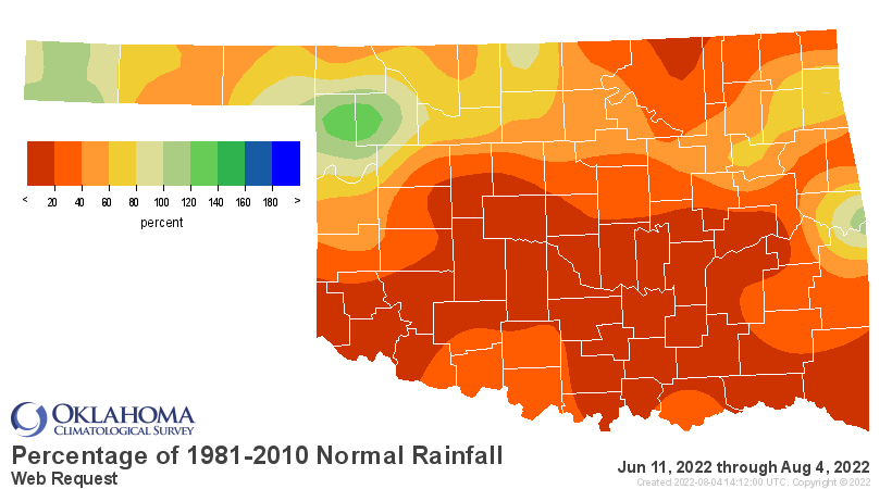
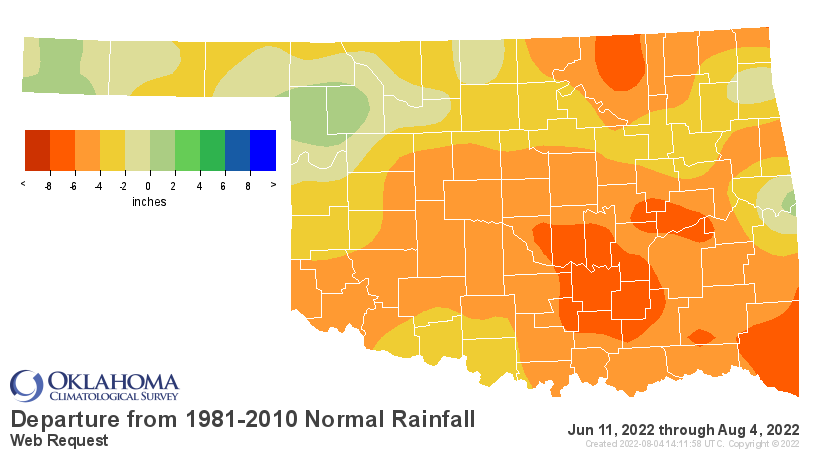
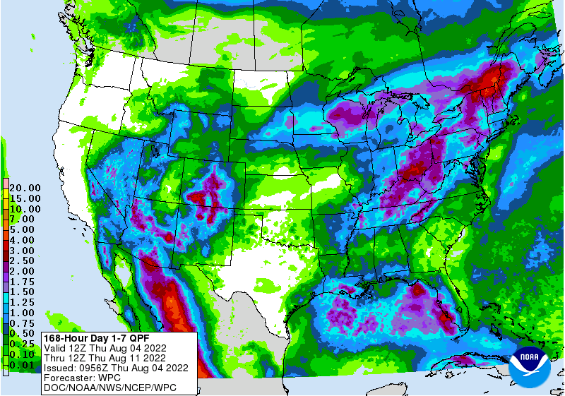
Don't be fooled by all those gorgeous colors in northern OK, either. Remember,
those totals are for 54 days now, so only in those wettest possible areas
are they above normal for that period.
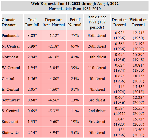
While we're no longer trudging along with that running period since June 11
being the driest in the last 100 years, it still ain't ideal, hanging out with
the likes of the worst year of the Dust Bowl in 1936.
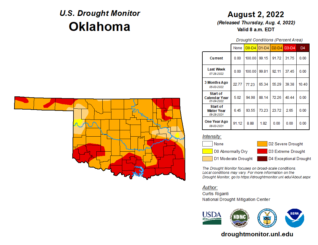
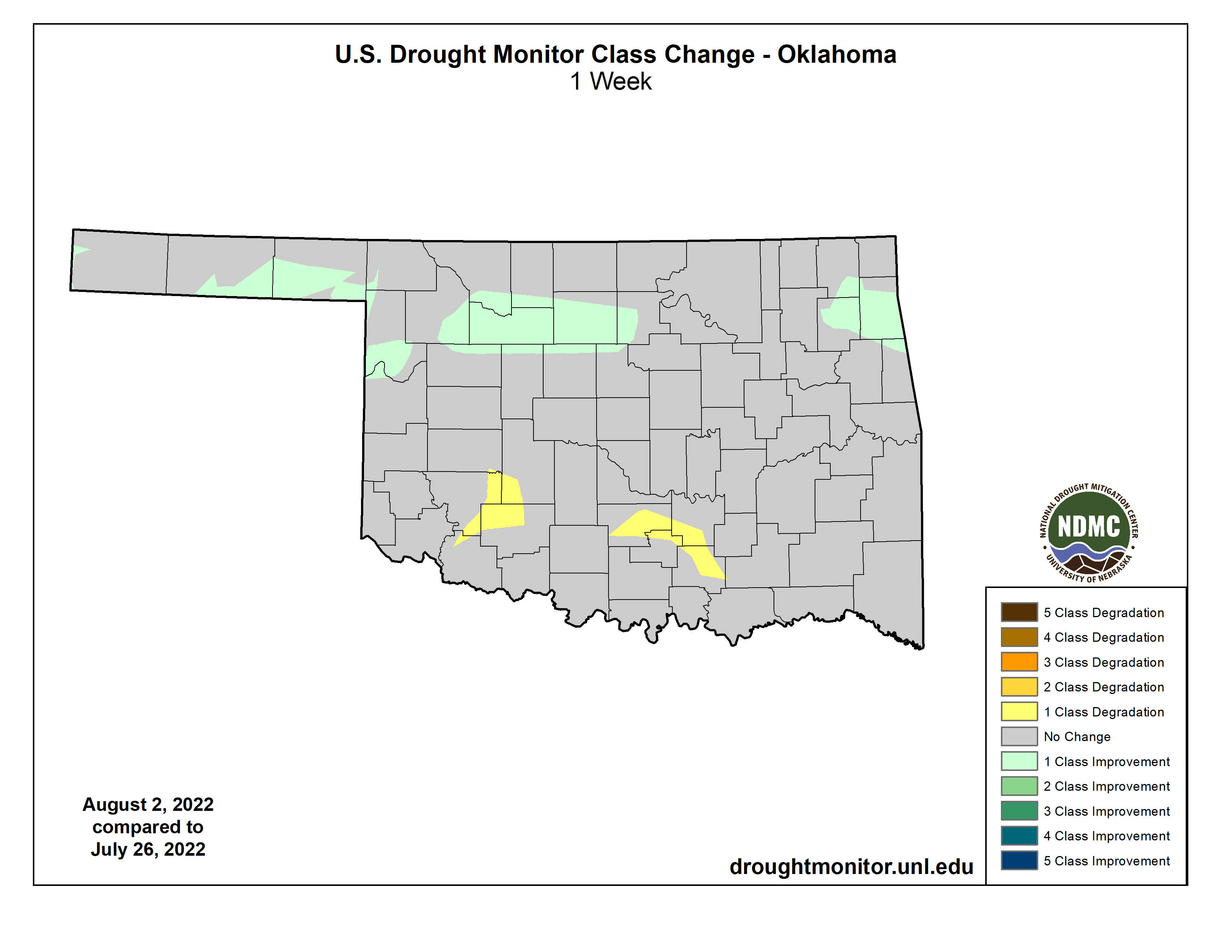
Our rain last week did afford us some improvements this week, but most of the
state is still under the gun of future flash drought development, which is by
now beginning to transform into just plain old drought as we begin the
HOPEFULLY inevitable transition into fall in the next couple of months. If
we don't get saving rains, of course. Those rains in the last week did allow a
few improvements, but those that missed saw a few degradations.

What about our rain chances? Heck, it's raining now in some spots. At least I
*think* this is reaching the ground.
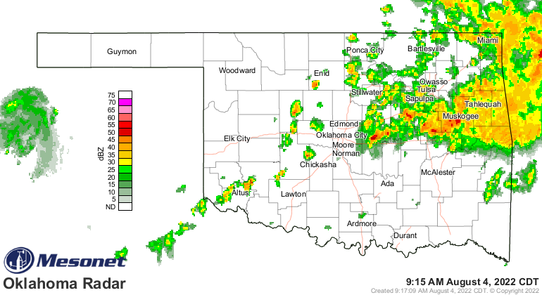
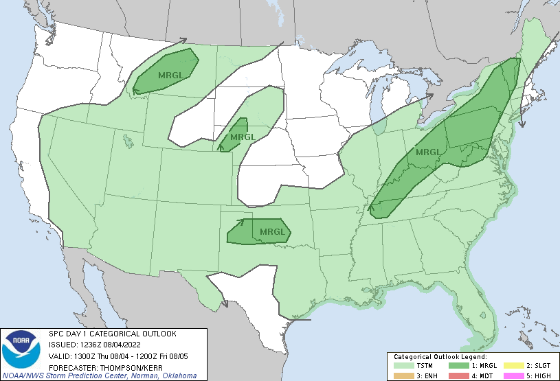
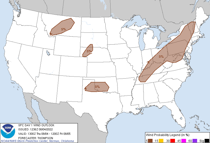
So that's the sort of thing we should continue to see off and on, with even a
few severe storm chances today. As is usually the case, severe winds are the
main (but still improbable) threat for today.
We aren't talking widespread gully-washers (Okie to English translation: "heavy
rains") here, but some very localized areas could see a bit of flooding with
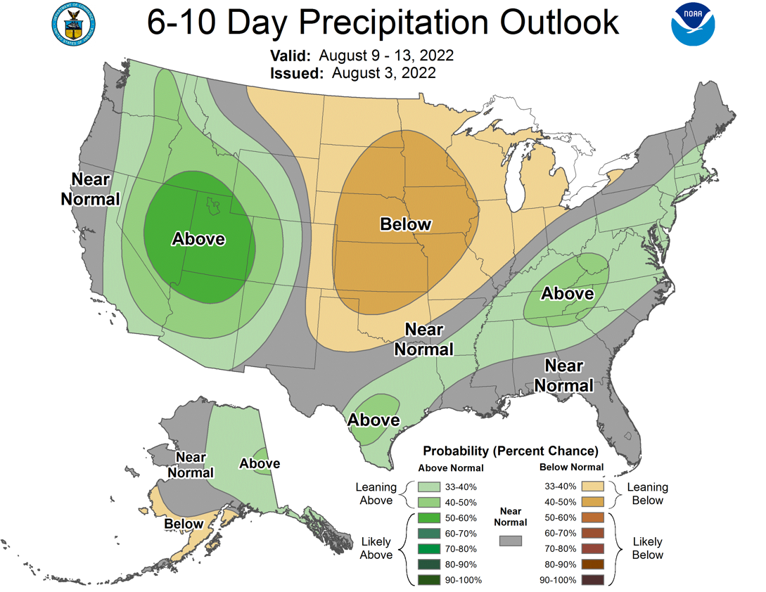
these types of storms. Sadly, no larger-scale drought relief appears immenent...
imenent...coming up anytime soon.
Now what we could see as we go forward is that upper-level ridge of high pressure
(aka "the Death Ridge") scoot a bit farther to the NW over time, which would
allow for something to swing through and give us a bit of temperature relief,
but the rain chances are still a bit on the iffy side.
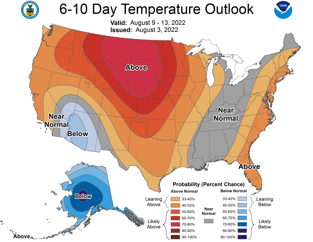
What is NOT iffy is the continued heat, at least for the next few days, until
we see another cold front push through early next week that will take us down
from "scorching hot" to "really hot," but at least something closer to normal.
And remember who you're talking to when I talk about "normal."
I HEARD THAT!
Gary McManus
State Climatologist
Oklahoma Mesonet
Oklahoma Climatological Survey
gmcmanus@mesonet.org
August 4 in Mesonet History
| Record | Value | Station | Year |
|---|---|---|---|
| Maximum Temperature | 112°F | KIN2 | 2012 |
| Minimum Temperature | 54°F | NOWA | 2020 |
| Maximum Rainfall | 2.29 inches | JAYX | 1998 |
Mesonet records begin in 1994.
Search by Date
If you're a bit off, don't worry, because just like horseshoes, “almost” counts on the Ticker website!