Ticker for July 28, 2022
MESONET TICKER ... MESONET TICKER ... MESONET TICKER ... MESONET TICKER ...
July 28, 2022 July 28, 2022 July 28, 2022 July 28, 2022
Mason-Desiccated Line
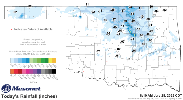
Well the good news is that it's raining right now!

And we already have some "okay" rainfall amounts today.
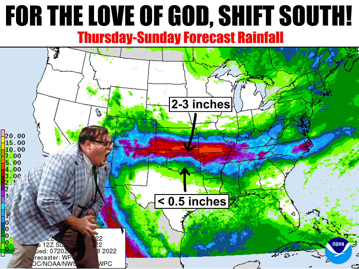
And of course the bad news is we need a LOT more than that. It would be great to
see that front shift a bit more south, but we will take what we can get. Hopefully,
we can disrupt many of these maps with both the forecast rainfall AND temperatures.

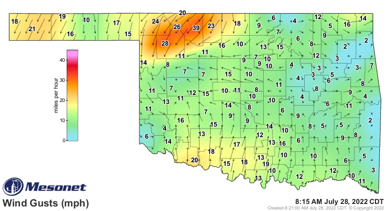
Our "savior," this cold front, is just now through the NW quarter of the state,
moving ever so slowly to the southeast.
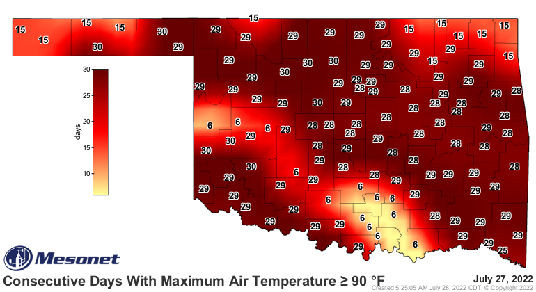
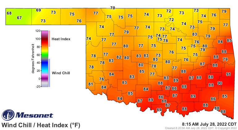
It's tough to tell in the temperature map due to the rain and whatnot. Isn't it
always the whatnot?
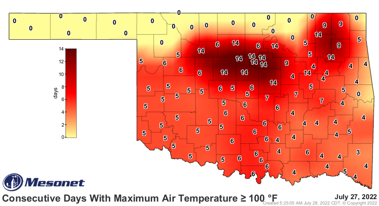
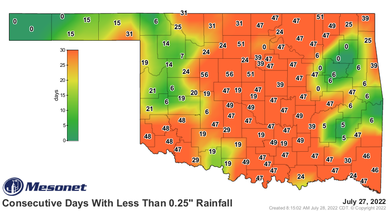
Our goal here is to reduce the heat, and also to put a stop to the progression
of this disastrous flash drought, which ramped up once again at our request
on this week's U.S. Drought Monitor map as we scramble to match the intensities
on the map with the actual impacts being felt on the ground here in Oklahoma.

I'm not gonna show you the forecast maps for Sunday forward, because why end
on that note? The key here is to be grateful for what we're getting THIS
weekend, and maybe hope for more NEXT weekend.
We'll cover that Monday, after our brush with early Fall.
Gary McManus
State Climatologist
Oklahoma Mesonet
Oklahoma Climatological Survey
gmcmanus@mesonet.org
July 28 in Mesonet History
| Record | Value | Station | Year |
|---|---|---|---|
| Maximum Temperature | 109°F | GRA2 | 2008 |
| Minimum Temperature | 47°F | MANG | 2005 |
| Maximum Rainfall | 3.50 inches | ALV2 | 2002 |
Mesonet records begin in 1994.
Search by Date
If you're a bit off, don't worry, because just like horseshoes, “almost” counts on the Ticker website!