Ticker for July 27, 2022
MESONET TICKER ... MESONET TICKER ... MESONET TICKER ... MESONET TICKER ...
July 27, 2022 July 27, 2022 July 27, 2022 July 27, 2022
Change
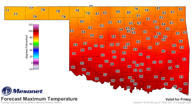
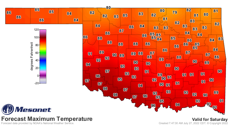
Seems like an easy choice, but dat McRib doe! Oh, let's go with the highs in the
70s and 80s (sorry southern Oklahoma) and rain. We seem to need that, from what
I've been hearing.
Keep those cards, letters, and angry phone calls coming.
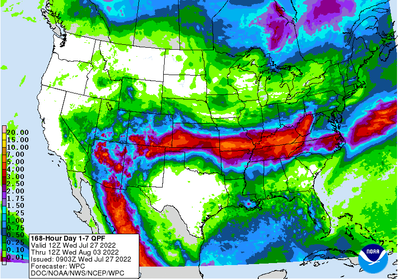
Our rain is pretty much a northern half of the state thing for Thursday night
through Sunday, but never sell a stalled front short. Maybe it will shift to the
south just a bit more.
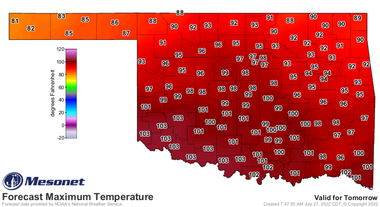
The highs should start to come down with the front later tomorrow, but by Sunday,
well...you'll be wishing for that Vanilla Frosty!
There was a bit of a worry when the forecast models were backing the front's
reach into the state up into about the northern third of the state, but they
appear to show it back into central Oklahoma, at least. The break is enormously
welcomed from a state beleaguered by unending heat and lack of rainfall. But,
all that is coming back. By the time we get back to it on Sunday and even more
so on Monday, we will be on track to break through 2012's triple-digit totals
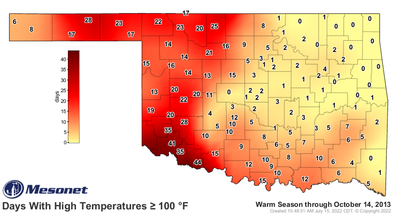
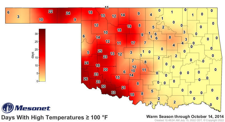
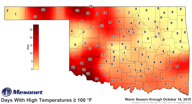
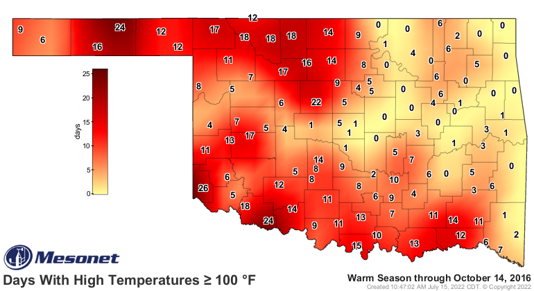
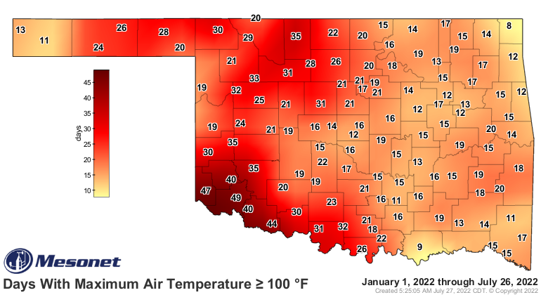
to stand with 2011 as our only master in the last 12 years or so. Take a look
at these 100 totals for the entire warm season for years 2010-2021, then where
we are as of now (but add one to most because we'll be breaking 100 again today).
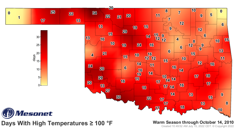

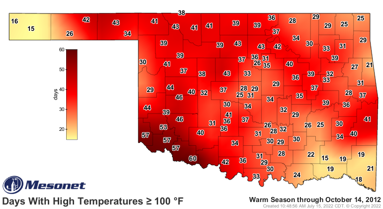
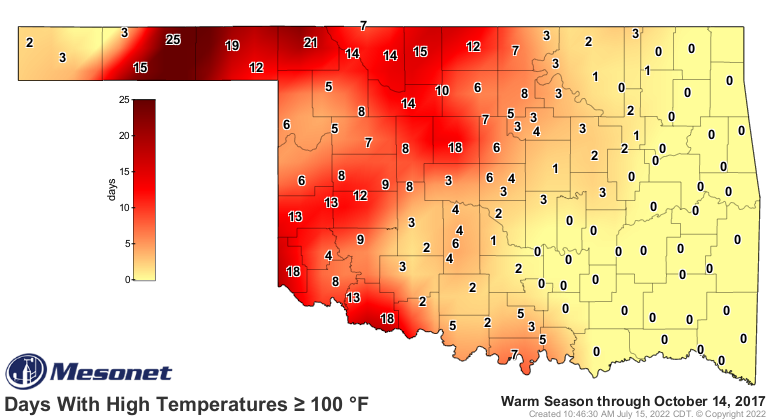
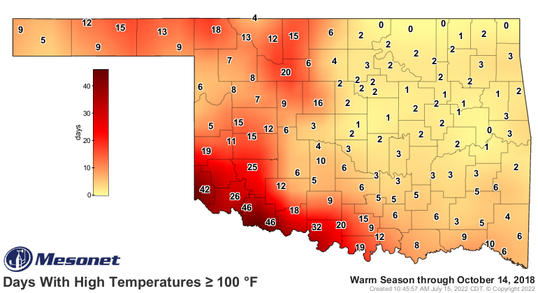
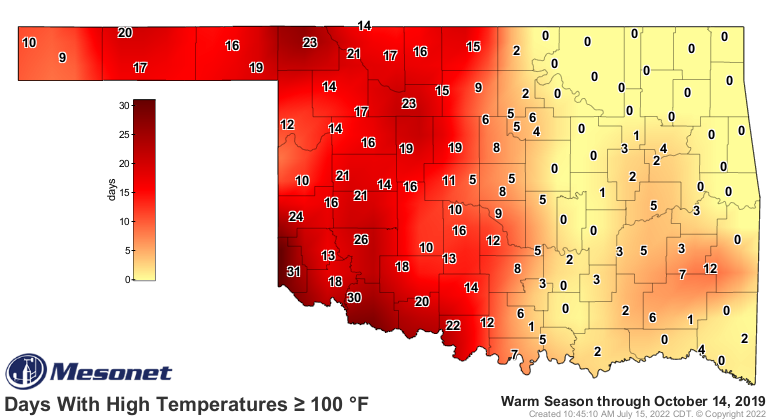

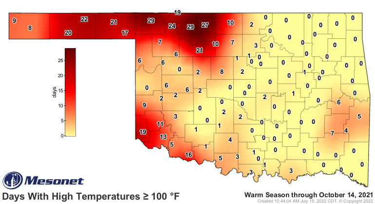
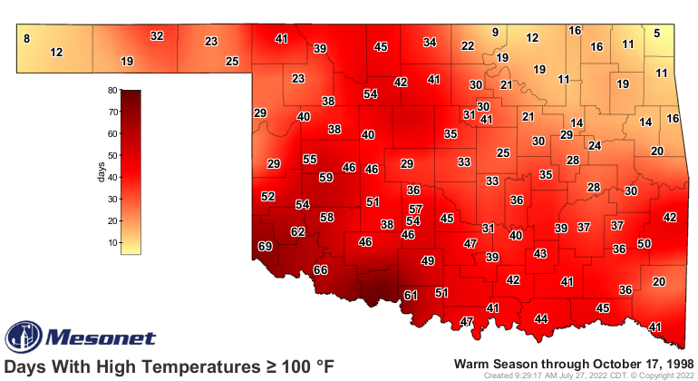
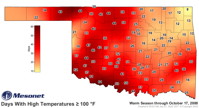
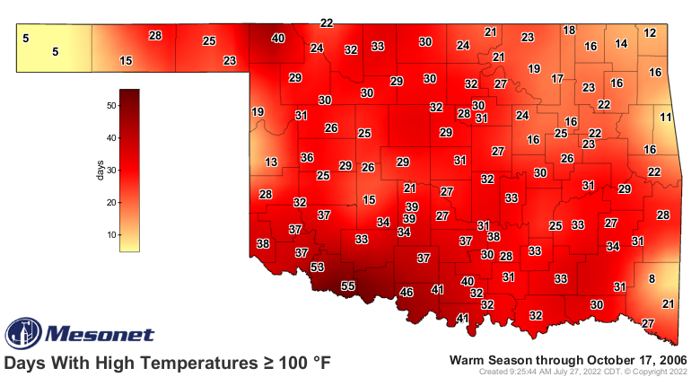
Now when you go back to the beginning of the Mesonet's temperature records,
looking at 1997 forward, you then start to look at 1998, 2000, and 2006, to
try and surpass.
Choosing the number of 100 degree days is a rather random benchmark for heat...
why not 99? Or 101? But it will suffice as an indicator of the extreme we
suffered through each of those warm seasons.
How many we can add this year, that's the question we probably don't want
answered.
Gary McManus
State Climatologist
Oklahoma Mesonet
Oklahoma Climatological Survey
gmcmanus@mesonet.org
July 27 in Mesonet History
| Record | Value | Station | Year |
|---|---|---|---|
| Maximum Temperature | 112°F | ALV2 | 2011 |
| Minimum Temperature | 49°F | KENT | 2005 |
| Maximum Rainfall | 4.96 inches | YUKO | 2020 |
Mesonet records begin in 1994.
Search by Date
If you're a bit off, don't worry, because just like horseshoes, “almost” counts on the Ticker website!