Ticker for July 13, 2022
MESONET TICKER ... MESONET TICKER ... MESONET TICKER ... MESONET TICKER ...
July 13, 2022 July 13, 2022 July 13, 2022 July 13, 2022
MA!
What can I say?
No, seriously, what can I say? I was up all night climatizing and I got nothing
this morning.
BRB...
Okay, I'm back, re-energized! I've had one, maybe two strawberry milks and I'm
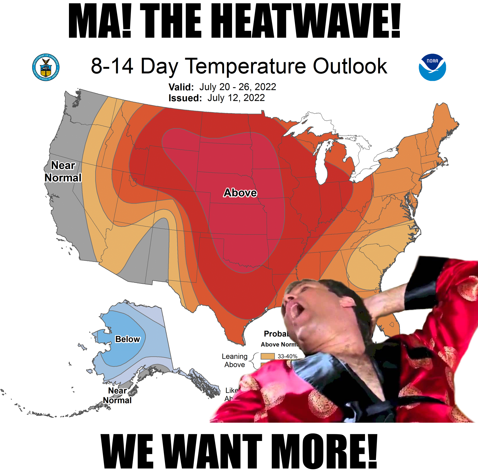
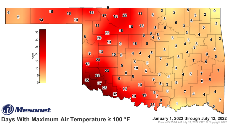
looking for trouble. The startling dryness and associated heatwave (or maybe
it's the other way around...this is kind of a chicken vs. fried-egg-on-the-sidewalk
thing going on here) statistics that came out a couple of days ago continue
unabated, and appear to be here to stay for awhile. I know it was cooler yesterday
for some of us, but for others...unabated.
Have you ever been bated? It's not pleasant.

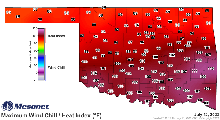
If you were in southern Oklahoma yesterday, THE COLD FRONT WAS BUT A FIGMENT
OF YOUR IMAGINATION! And now we hit another turning point from the somewhat
milder weather of yesterday and today and begin another climb back into our
stretch of dry weather that we've almost NEVER seen over this particular stretch,
and stretch of unending heat that we haven't seen for a decade.
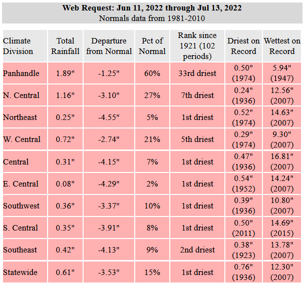
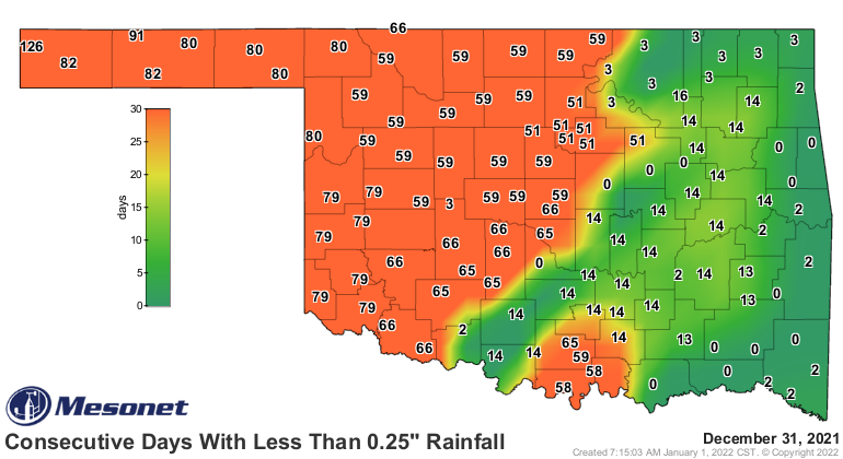
June 11, 2022, is going to be a date to remember if things don't turn around
in a hurry, possibly known hereafter as "the day it stopped raining" during the
drought and heatwave of Summer 2022. Nineteen Mesonet sites have had ZERO
rain since June 11, and 41 have had less than a tenth of an inch. Sixty-two
have had a quarter-inch or less. In the last 33 days. It's not like we haven't
seen this recently, but in another stretch of the calendar. Did you forget Last
November and December already? In 2021? Seven months ago?
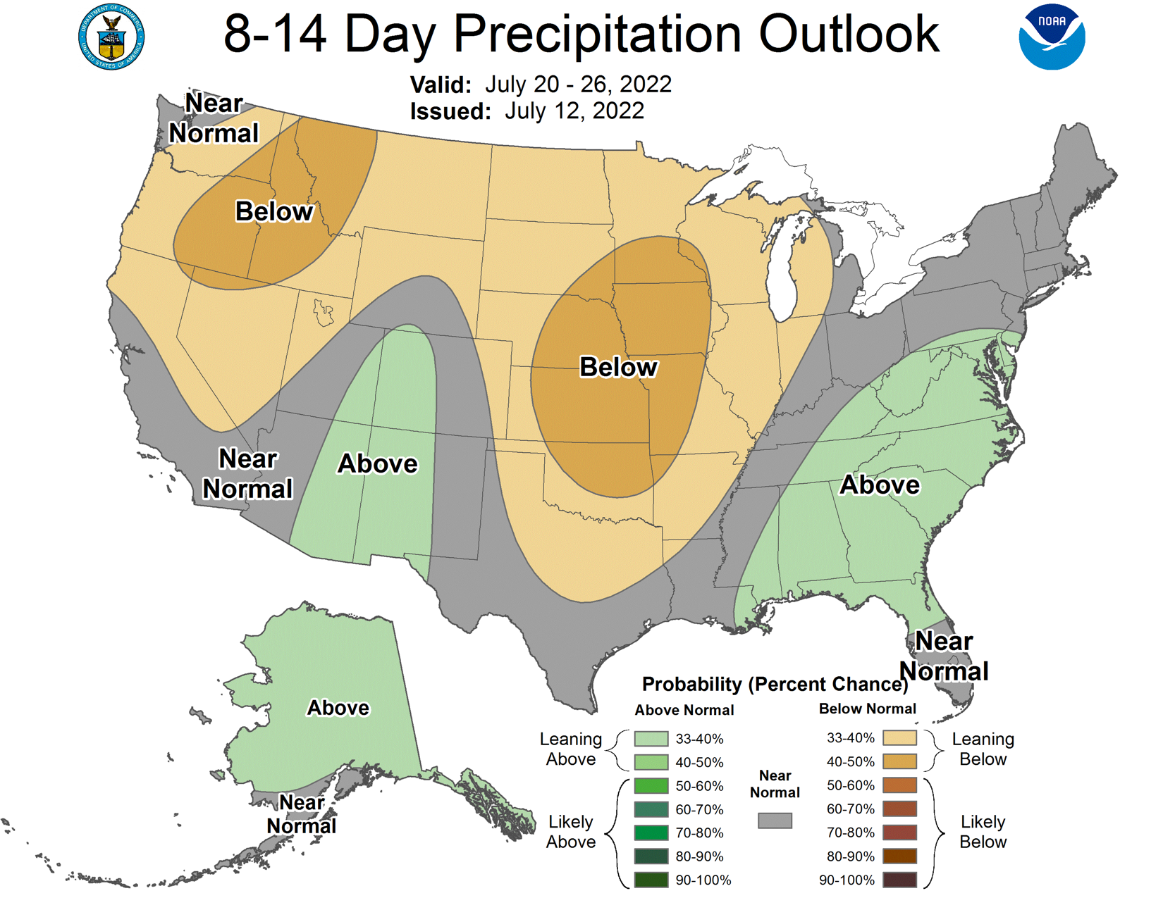
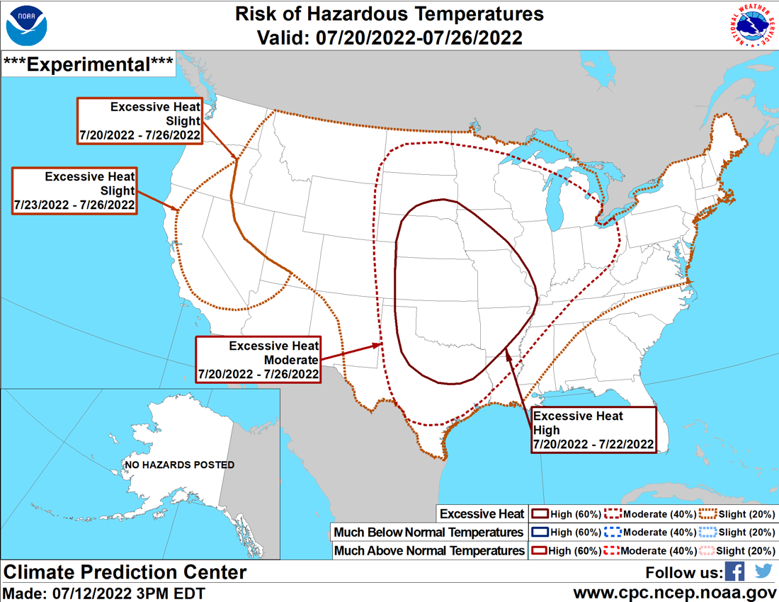
We know what's ahead of us for at least another week, and probably two...lots of
heat. We'll have to see about the precipitation. We could still get lucky and
see that heat dome shift east or west which would give us a chance of showers
along the fringes. North or south too, I guess. But as we get out into next
week, after possibly the hottest weather of the year coming up for this weekend,
it might get even hotter.
Don't compare it to the summer of 2011. That summer is incomparable, with
Oklahoma's ending up as the hottest in the history of the United States, dating
back to 1895 (tied with Texas that year). So far above the previous hottest
summer, any state (except Texas), any year, that it's not even a contest. But
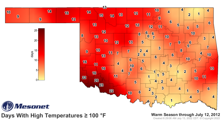
you can compare it to our summer of 2012, which ended up as the 13th warmest
summer on record.
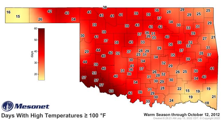
We're somewhat ahead of their triple-digit pace as of yesterday.
At any rate, the stats are skewed this summer by that unusually cool first 10
days of June. Maybe we'll simply end up with a 2016 or 2018 type of summer,
which were tied with quite a few others at 26th warmest? However, this summer
is already well ahead of those in the "brutal" category.
Ugh, back to the strawberry milk. Might have to break out the chocolate.
Gary McManus
State Climatologist
Oklahoma Mesonet
Oklahoma Climatological Survey
gmcmanus@mesonet.org
July 13 in Mesonet History
| Record | Value | Station | Year |
|---|---|---|---|
| Maximum Temperature | 109°F | LAHO | 2003 |
| Minimum Temperature | 52°F | BOIS | 2008 |
| Maximum Rainfall | 4.29 inches | CLAY | 2025 |
Mesonet records begin in 1994.
Search by Date
If you're a bit off, don't worry, because just like horseshoes, “almost” counts on the Ticker website!