Ticker for July 14, 2022
MESONET TICKER ... MESONET TICKER ... MESONET TICKER ... MESONET TICKER ...
July 14, 2022 July 14, 2022 July 14, 2022 July 14, 2022
Sonny and Hot
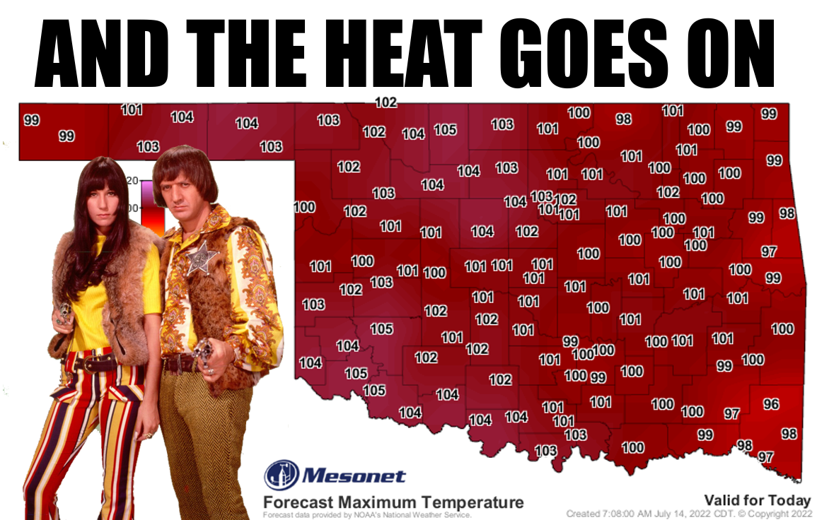
With almost no time to Tick today, I still felt the need to Tock to you for just
a moment about the ongoing heat.
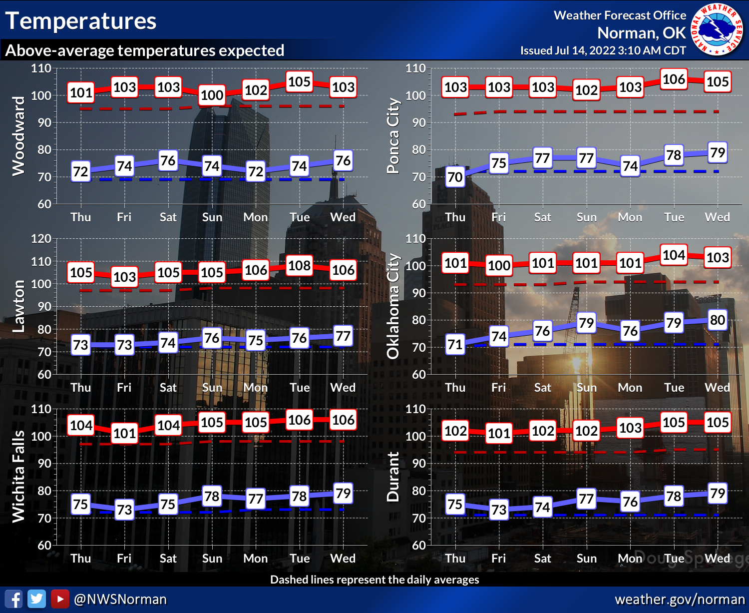
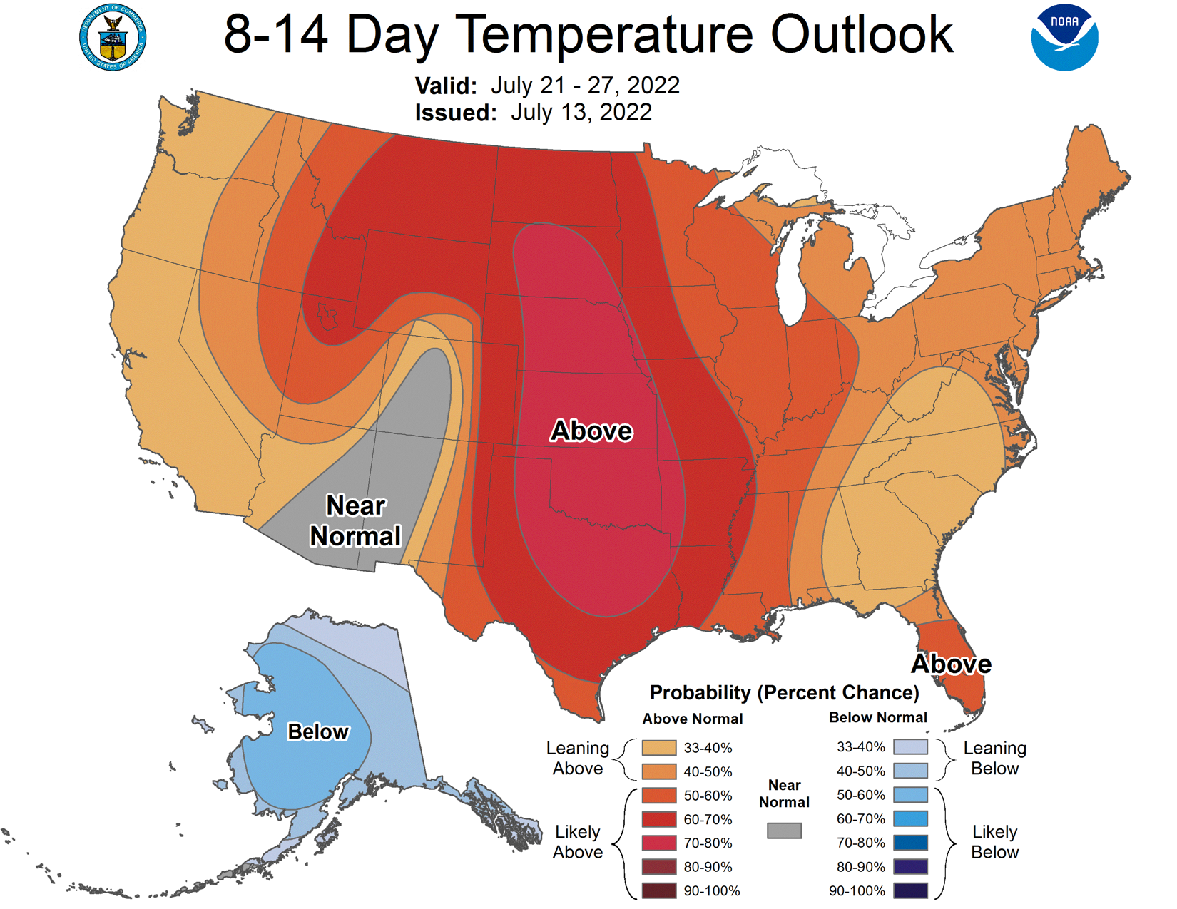
It's going to be hot for a long time.
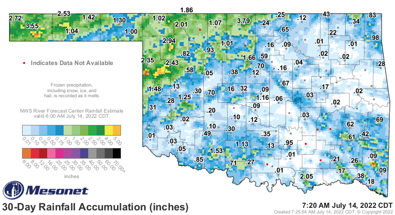
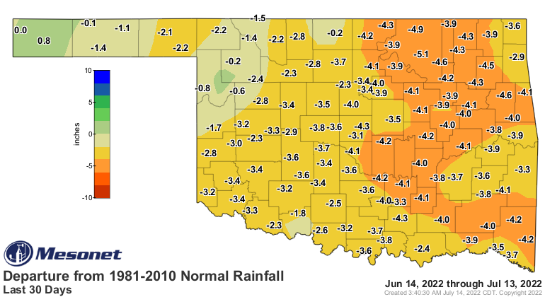
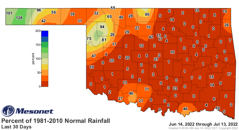
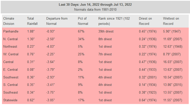
And it's going to stay dry for a long time.


That's only going to exacerbate our rapidly expanding/intensifying flash drought
situation, a little over a month after flooding rains exited the state.
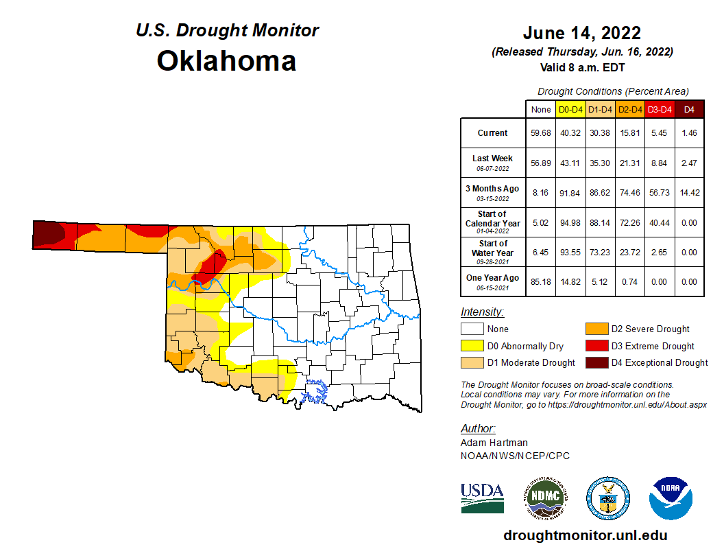
In response to the rapid onset of drought, we asked for and received a large
scale intensification of drought conditions across the state from the U.S.
Drought Monitor, with a bit of improvement in the far western Panhandle.
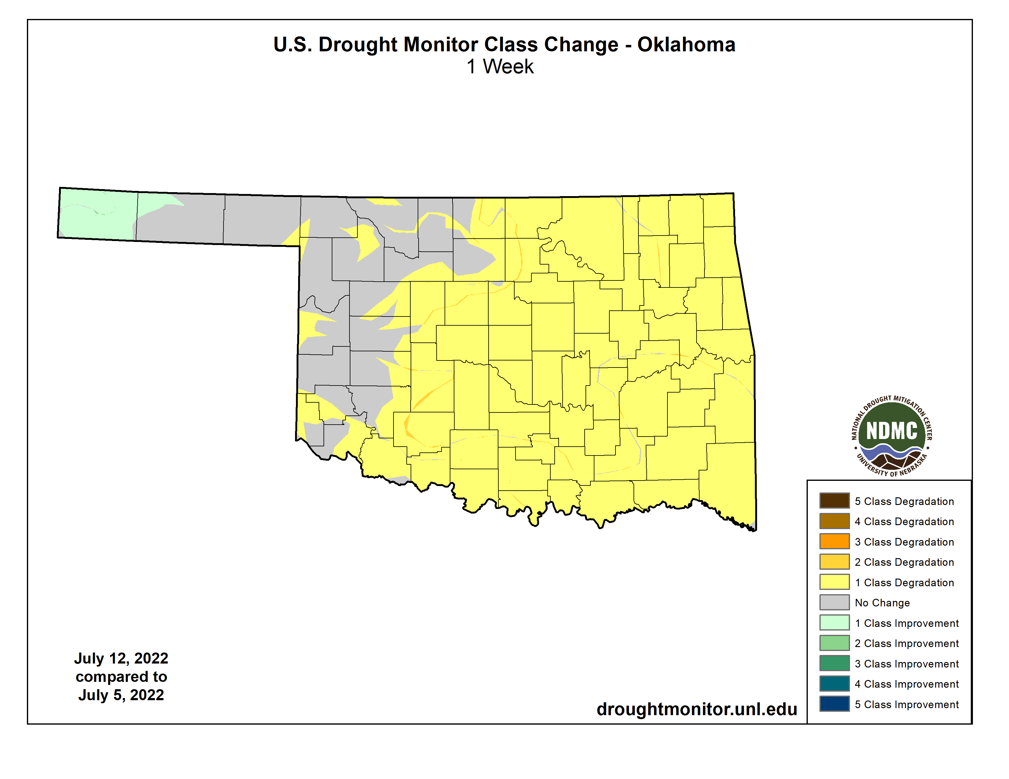
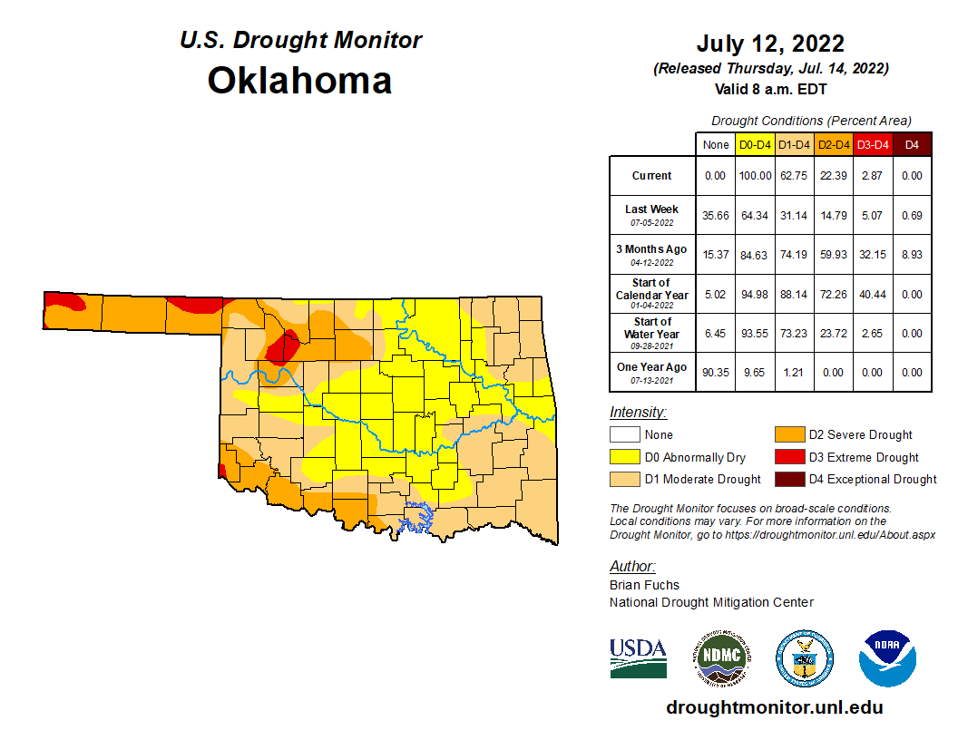
An unfortunate turn of events given where we were just a few short weeks ago
with a rapidly IMPROVING drought map.
To quote my good buddy Dalton, it'll get worse (possibly much worse) before it
gets better. Shoot, we still have three weeks to go before we reach our "normal"
peak heat in early August.

Also plenty of time to move that heat dome out of here and turn this thing
around. Not for awhile, though.
Gary McManus
State Climatologist
Oklahoma Mesonet
Oklahoma Climatological Survey
gmcmanus@mesonet.org
July 14 in Mesonet History
| Record | Value | Station | Year |
|---|---|---|---|
| Maximum Temperature | 113°F | HOLL | 2020 |
| Minimum Temperature | 54°F | EVAX | 2019 |
| Maximum Rainfall | 5.94 inches | ANT2 | 2025 |
Mesonet records begin in 1994.
Search by Date
If you're a bit off, don't worry, because just like horseshoes, “almost” counts on the Ticker website!