Ticker for June 13, 2022
MESONET TICKER ... MESONET TICKER ... MESONET TICKER ... MESONET TICKER ...
June 13, 2022 June 13, 2022 June 13, 2022 June 13, 2022
Uncommon
We warned you more than a week ago that it was gonna get hot. "Careful," we said,
"with all this rain, the heat index is gonna be worse than the temperature
itself." Well, in true Oklahoma fashion, Mother Nature had to go "ALL GAS, NO
BRAKES!" on the heat this weekend.
117 degrees heat index on Saturday, Centrahoma?
Really?
110 degrees actual air temperature on Sunday, Altus?
Seriously?
Yes, really and seriously. In the first half of June.


We haven't seen a heat index that high in the state since August 29, 2020. And
we haven't seen an actual air temperature that high-up in the 110s-since August
28, 2020.
AND FURTHERMORE, we haven't seen a high in the 110s in June since 2013, when
Freedom hit 111 degrees on the 27th of that month. So 9 years, and 2013 isn't a
year you want to be hanging out with!
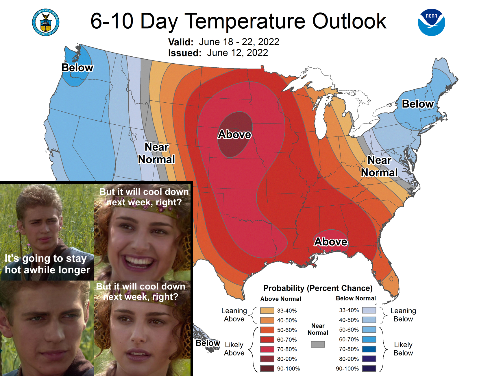
Here's the deal...it's gonna cool off slightly this week, and slightly is okay
because you're dropping down from very dangerous heat levels to just plain old
dangerous heat levels. And remember, it's not just the temperature itself, but
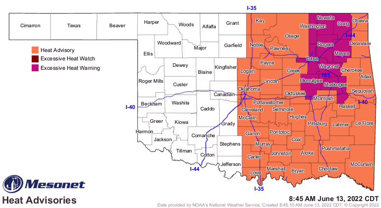
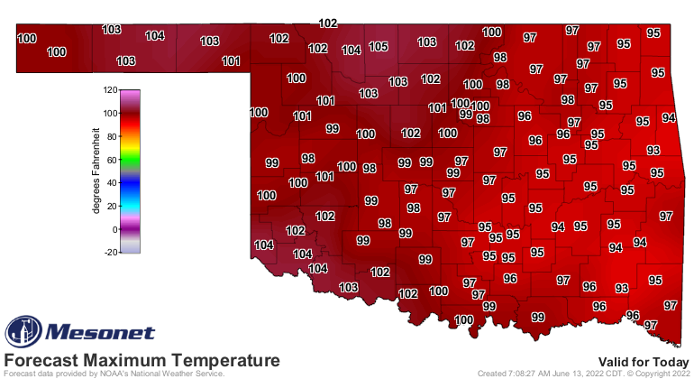
the humidity, sun, and wind all combined. So today will be pretty nasty, but
then we'll just be sort of nasty for the rest of the week. So watch for highs
in the 100s today across western OK, but heat index values from 105-115 for
eastern OK.
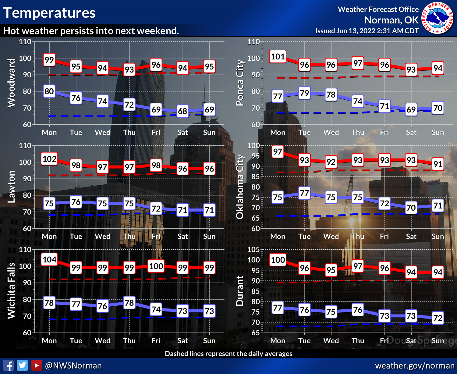
And then more of the same as we extend out even further.

Here's how it works...whenever that heat dome is over you, you're gonna heat
up like we've seen the last few days (and the coming couple of weeks unless
things change). That's the anatomy of a heat wave.
Now, when you can get on the periphery of that heat dome, you can then slip
a cool front through, or get some showers and storms...both of which can help
cool things down. But that's just not showing up right now to the degree (pardon
the pun...a very sweaty pun, but a pun nonetheless) that we need to break the
heat. Maybe a few showers in northern OK Wednesday as a cold front tries to slip
into the state. "Tries" being the key word there.
I guess the good news is that as we get closer to July, this is more "normal"
for that time of year?
Gary McManus
State Climatologist
Oklahoma Mesonet
Oklahoma Climatological Survey
gmcmanus@mesonet.org
June 13 in Mesonet History
| Record | Value | Station | Year |
|---|---|---|---|
| Maximum Temperature | 110°F | BUFF | 2011 |
| Minimum Temperature | 47°F | BOIS | 2005 |
| Maximum Rainfall | 4.15 inches | HOBA | 2007 |
Mesonet records begin in 1994.
Search by Date
If you're a bit off, don't worry, because just like horseshoes, “almost” counts on the Ticker website!