Ticker for June 9, 2022
MESONET TICKER ... MESONET TICKER ... MESONET TICKER ... MESONET TICKER ...
June 9, 2022 June 9, 2022 June 9, 2022 June 9, 2022
A quarter-inch at a time
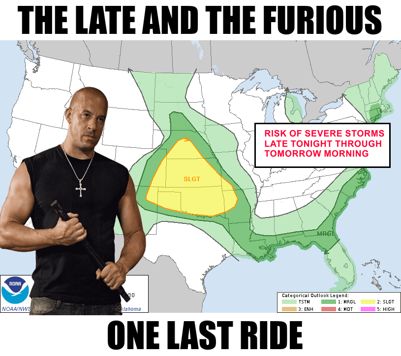
You asked for it (you didn't), you got it (maybe you won't). Yes, another fun
night of trying to sleep as Mother Nature rains sizzling bolts of electrified
destruction upon the earth, followed by ear-splintering crescendos of thunder,
accompanied by frozen projectiles hurtling towards you with the force of a
hellfire missile, propelled even faster by winds that will suck the breath out of
your lungs even as you search frantically for your next breath amidst the flooding
rainfall.
Okay, cut the dramatics, pal! In other words, we have a chance of storms
overnight. "Hellfire missile???" Sorry, it was the only one I could think of and
I refuse to google to see if it's really "a thing." There is a chance of some
severe winds and some large hail, but nothing too bad, hopefully. And yes, in a
minor inconvenience, they may wake you up.
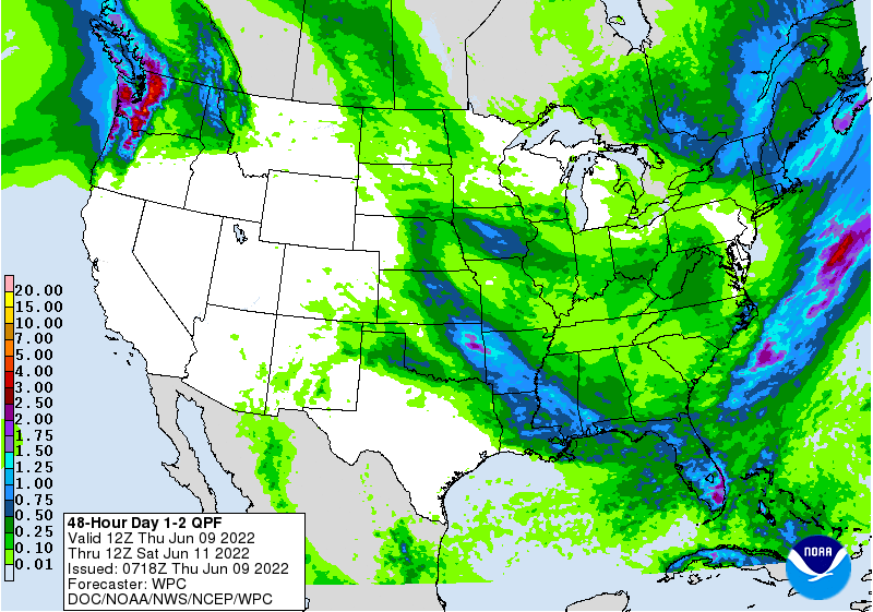
The flooding risk that we've seen with these gargantuan rain totals over the last
few overnight episodes should be confined to eastern OK where the heavier rains
are forecast to fall, but remember much of the western half of the state is
fairly well saturated so any heavy rains with training storms could quickly
cause flash flooding.
There is still a need for rainfall in some areas to alleviate drought, but in
reality we do need this moisture to go away for awhile so those wheat farmers
who both still have wheat AND haven't gotten it into the bins yet can get back
into the fields and resume harvest. However, the rains have diminished drought
coverage in the state back to where we were early last fall.


That 35% drought coverage in the state is the lowest we've seen since we were
at 11% back on Sept. 14, 2021, nine months ago. And we've mostly eliminated
the two worst categories in the state, extreme and exceptional, at only 9%.
That's the lowest we've seen those categories since Dec. 21, 2021, when it
then took off remarkably fast for the winter thanks to our unusually warm (and
dry, not so unusual...thanks Tom Jones) December.
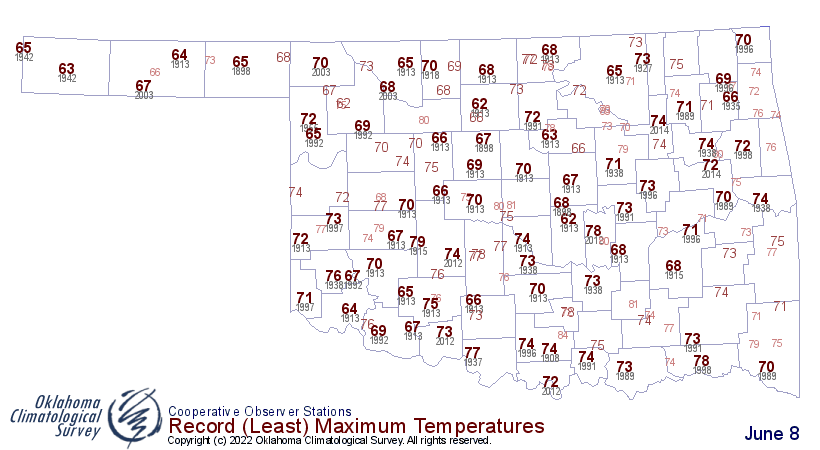
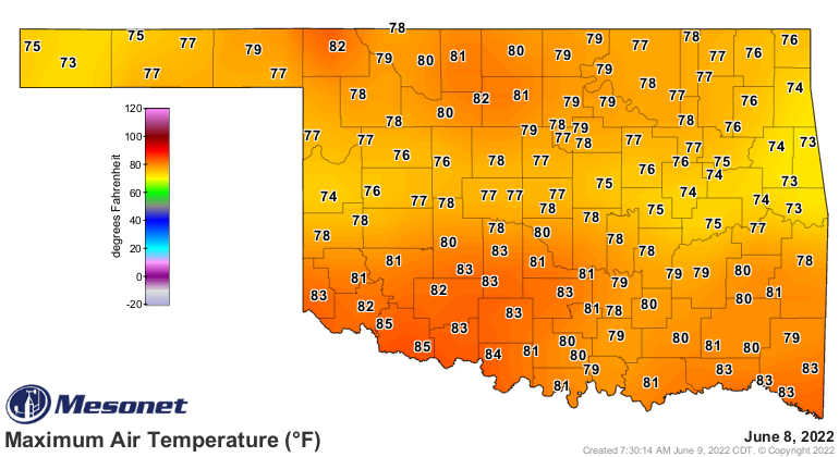
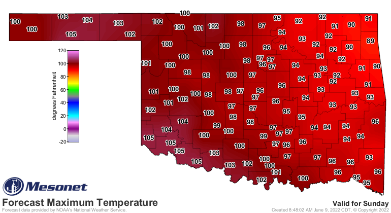
As for now, after a near-record cool day yesterday
we'll see summer return to its rightful place as our seasonal guide.
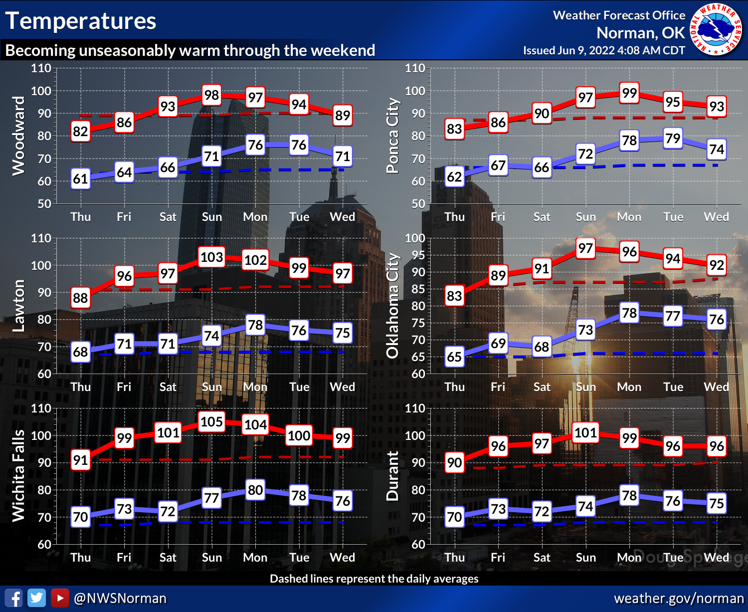
Those pool seekers will have a great weekend to take the plunge as we see
temperatures (and probably heat indexes in the east) soar back to triple-digit
territory.
I live my life a quarter of a degree at a time: I'm never more alive than
when we accelerate from 99.75F to 100F.
Gary McManus
State Climatologist
Oklahoma Mesonet
Oklahoma Climatological Survey
gmcmanus@mesonet.org
June 9 in Mesonet History
| Record | Value | Station | Year |
|---|---|---|---|
| Maximum Temperature | 104°F | ALTU | 2011 |
| Minimum Temperature | 43°F | EVAX | 2020 |
| Maximum Rainfall | 5.12 inches | BOWL | 2008 |
Mesonet records begin in 1994.
Search by Date
If you're a bit off, don't worry, because just like horseshoes, “almost” counts on the Ticker website!