Ticker for June 15, 2022
MESONET TICKER ... MESONET TICKER ... MESONET TICKER ... MESONET TICKER ...
June 15, 2022 June 15, 2022 June 15, 2022 June 15, 2022
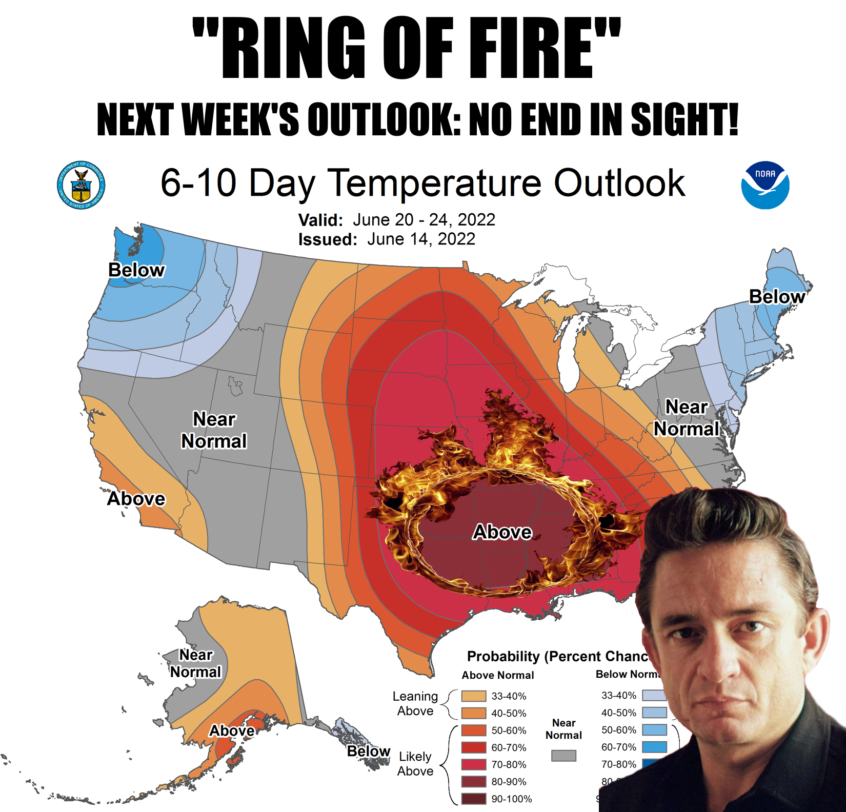
June is a burning thing
Longtime Ticker readers know that I'm a "Boy Named Sue" guy. They also know that
I'm certifiably insane, but that's beside the point. The point is "Boy Named
Sue" is quite possibly the best song ever written in ANY genre! That or anything
from Nickelback.
See? Insanity.
But here's the deal...we're in a heat wave (another great song) and it's not gonna
end anytime soon. We've already dealt with our hottest day since July 2020 on
Sunday, based on statewide average temperatures, and it was also the hottest June
day since June 27, 2012, at 87.7 degrees. But the current heatwave pales in
comparison to what we had back in June 2011 and 2012, and trust me, I KNOW PALE!
I get sunburned by the moon. If we say the current heatwave started on Saturday,
we've had a 4-day statewide average temperature, through Tuesday, of 85.2 degrees.
That's quite a ways (Okie to English translation: "A lot") behind the 4-day
period ending on June 27, 2011, which had a 4-day statewide average of 88.1
degrees. AND, it's a LONG WAY (WAYS?) behind June 16, 1953's 89.3 degrees.
Hey, I type what comes into my head, okay? And I'm QUITE A WAYS from sane, so
cut me some slack.
At any rate, we're in for a long-haul heat wave that's only bound to get worse.
At least through the next two weeks, it would appear. And the hottest days are
yet to come since we are headed towards the heart of summer.
Ahhhh, "Heart of Summer," a song I wrote for Nickelback back in 2008. Strange,
I never heard back from them.
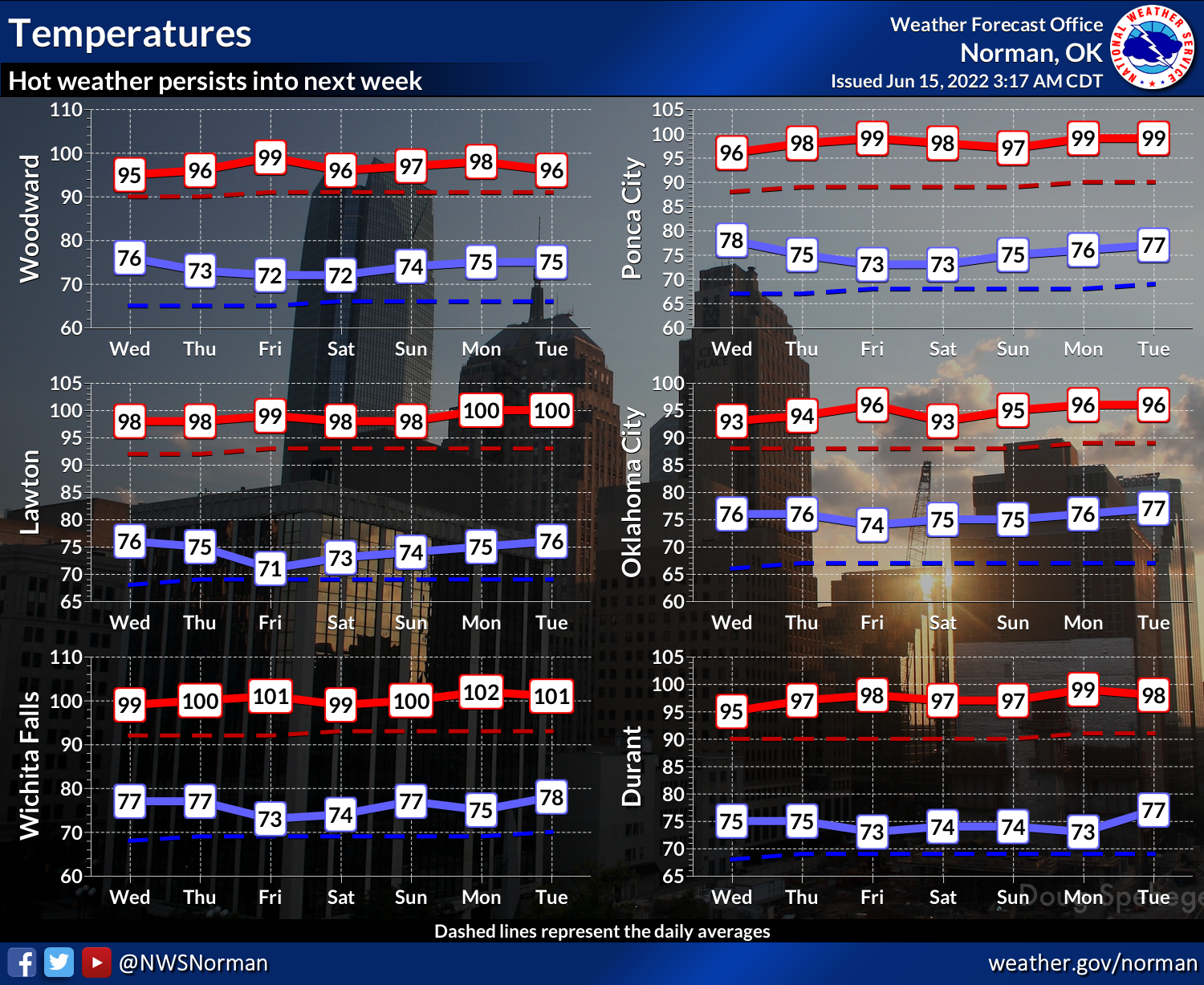
Anyway, check out these temps from our friends at the NWS Norman office. They're
for their forecast area, but they're good for a generalized look at the state's
future temps over the next week.
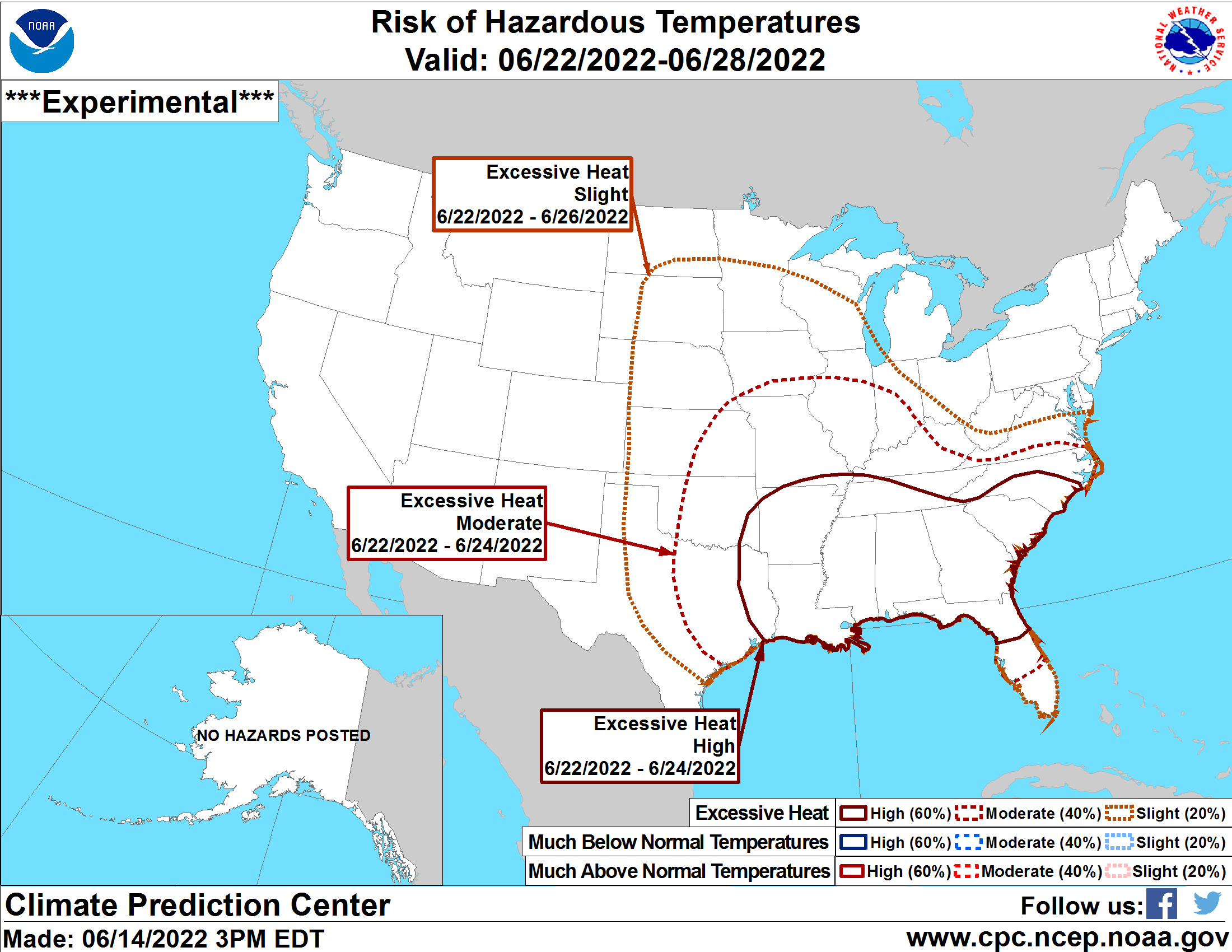
Check out the heat risk hazards for the 8-14 day period from CPC, so this is for
June 22-28.
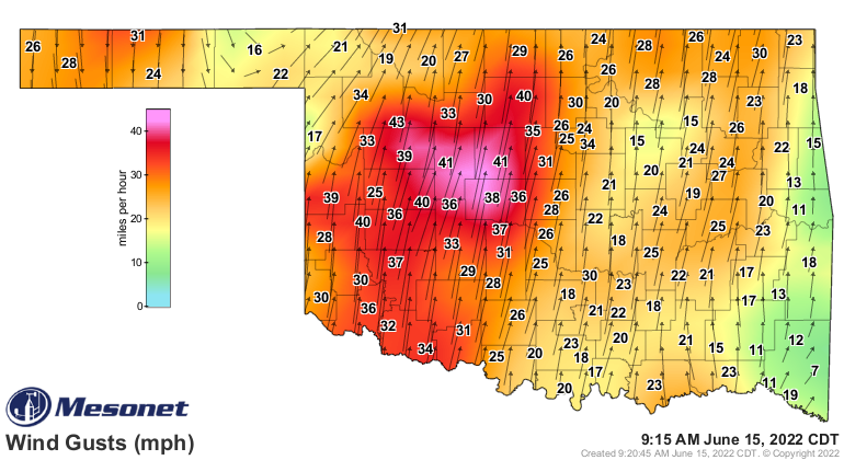
But hey, at least we have the wind, right? Because there's nothing that goes
with triple-digit temperatures like 40 mph winds. That's how a guy from
Elk City thought up the modern day hair drier. No, he didn't invent it, he just
thought about it one day, then forgot about it.
ARGH! I had to go and write about hair driers.
Et tu, myself?
Oh well, at least my head cools off faster.
Gary McManus
State Climatologist
Oklahoma Mesonet
Oklahoma Climatological Survey
gmcmanus@mesonet.org
June 15 in Mesonet History
| Record | Value | Station | Year |
|---|---|---|---|
| Maximum Temperature | 104°F | ALTU | 2022 |
| Minimum Temperature | 42°F | KENT | 2001 |
| Maximum Rainfall | 5.22 inches | BYAR | 2007 |
Mesonet records begin in 1994.
Search by Date
If you're a bit off, don't worry, because just like horseshoes, “almost” counts on the Ticker website!