Ticker for June 7, 2022
MESONET TICKER ... MESONET TICKER ... MESONET TICKER ... MESONET TICKER ...
June 7, 2022 June 7, 2022 June 7, 2022 June 7, 2022
Sesame Flooded Street
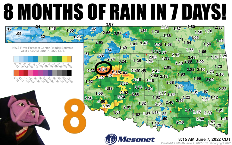
Right, so that's how droughts work...and end. Our Mesonet site at Butler has been
the (un)lucky recipient of 8.04 inches of rain in the last 7 days. Lucky in that
they were in pretty dire drought conditions before last week, and unlucky because
of all the flooding that has gone on in the area. Something tells me most folks
out that way consider it lucky. So rainfall since May 31 about this time in the
morning through, well, this time in the morning today, Butler received 8.04 inches
of rain. Between October 13 and May 30, 8.02 inches of rain, about 8 months (7
months and 17 days, to be exact...sorry, we couldn't find a pic of Count von
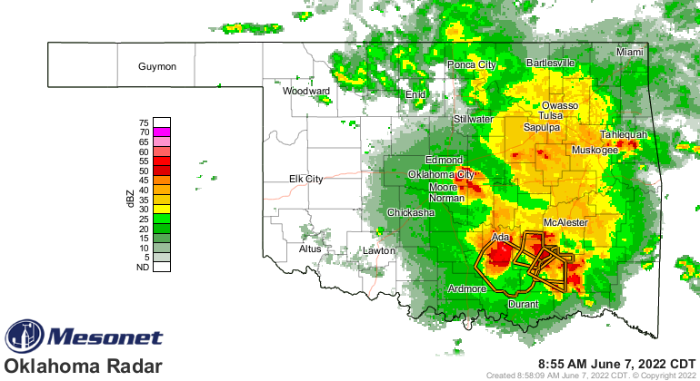
Count saying 7 months and 17 days). This is after the current round of storms
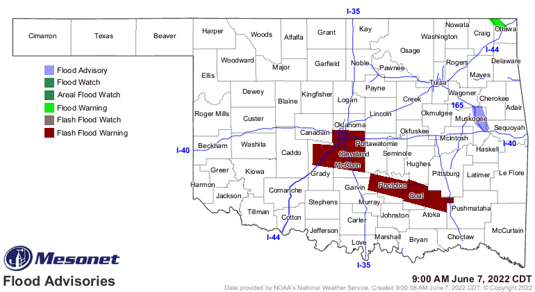
that has just passed through central OK on its way through the eastern half of
the state. Lots of flooding and water rescues were underway across the OKC
metro thanks to the sudden deluges.
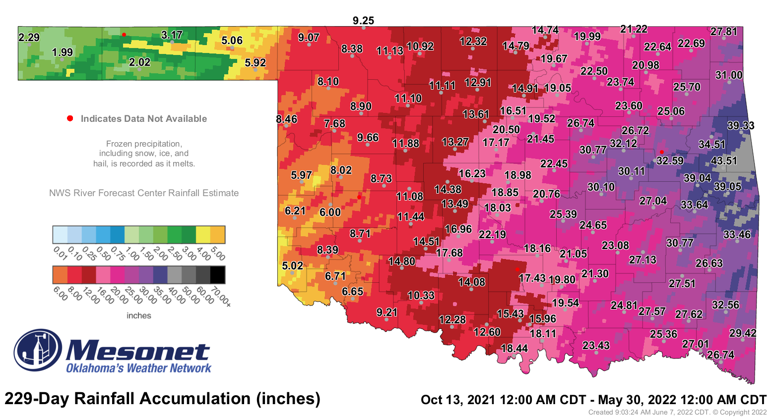
We can take a look at the totals across the state for that Oct. 13-May 30
period and see how Butler's totals now AND through the previous 8 months are
dwarfed across much of the eastern half of the state.
When you combine the two periods, the last week and the previous 7 months and
17 days, you get a much better looking map for parts of western Oklahoma, but
we do have to realize much of that rain has come recently.

We can go back even a bit farther, to Oct. 1, 2021, which is the start of the
current Water Year, and take a look at the deficits that still remain.

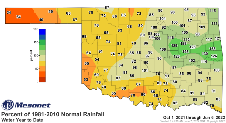
And that's why we still have drought in parts of the western half of the state.
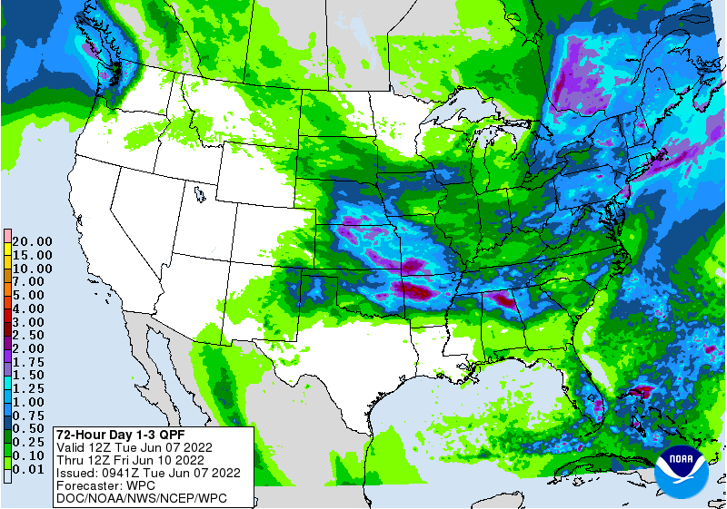
We have a couple more days to go of significant rains in the state then we
start to slow it down again. Some of the rains on this forecast have already
fallen this morning, so keep that in mind.
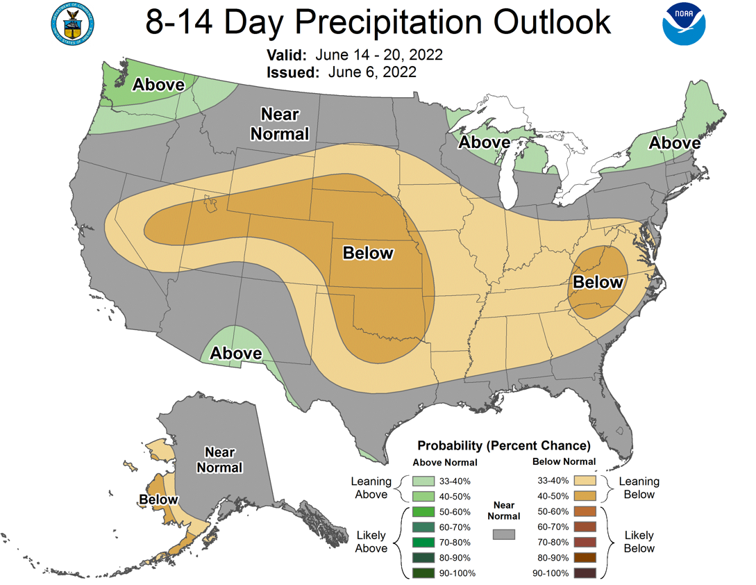
THEN we head back to summer, and dry out a bit. For those folks still in
serious (is there any other kind) drought, it's a bit of a tough break to say
the least.
Now, let's get down to business. You think Grover could take The Cookie Monster?
I'm talking bare knuckles, of course.
Gary McManus
State Climatologist
Oklahoma Mesonet
Oklahoma Climatological Survey
gmcmanus@mesonet.org
June 7 in Mesonet History
| Record | Value | Station | Year |
|---|---|---|---|
| Maximum Temperature | 105°F | ALTU | 2011 |
| Minimum Temperature | 45°F | PRYO | 1998 |
| Maximum Rainfall | 4.27 inches | HINT | 2022 |
Mesonet records begin in 1994.
Search by Date
If you're a bit off, don't worry, because just like horseshoes, “almost” counts on the Ticker website!