Ticker for June 6, 2022
MESONET TICKER ... MESONET TICKER ... MESONET TICKER ... MESONET TICKER ...
June 6, 2022 June 6, 2022 June 6, 2022 June 6, 2022
Sweat fealty
Are ya like me (there are meds for that) and you want to actually sweat again?
Well, other than complain about this crazy spring phase that we're going through,
or simply wait until later this week for summer to actually return, maybe we're
just in the wrong place? It's still getting hot in parts of the state. Look for
the sweat stains, or simply this map of maximum heat index values from yesterday.
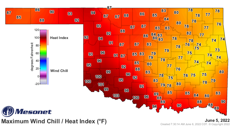
But you can see that sharp cutoff from the SW third of the state vs. the NE
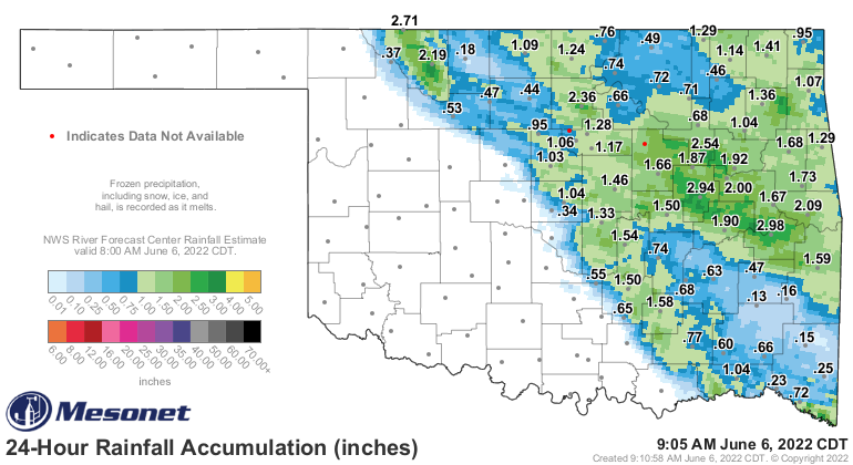
one-half. Yeah, I was never good at fractions. Well, the 24-hour rainfall shows
the culprit as we are stuck in this very June-like upper-level flow pattern from
the NW.
So what we saw last night will continue through the next few days. That means
we'll see storms form up to our NW somewhere in the High Plains of KS and CO and
then move to the southeast as a large complex of storms. There will be a chance
of severe weather each night, so if you like to be interrupted in the middle of
the night by SIS-BOOM-BAH, fire up the band.
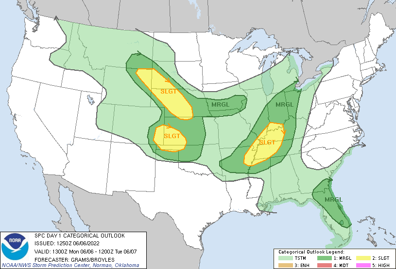
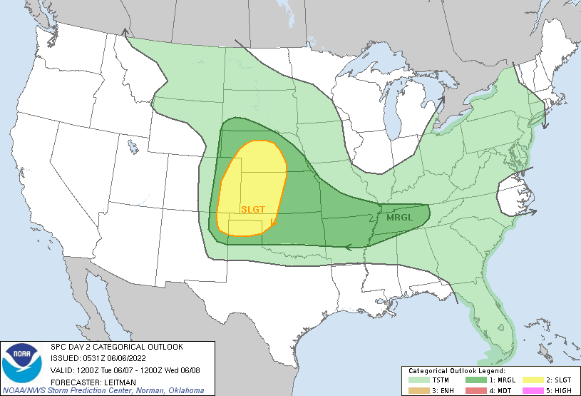


So there will be a chance of severe weather, but also some heavy rainfall here
and there. Obviously, northern OK is probably in the bullseye mostly, but it
would be nice to see the Panhandle get their share.

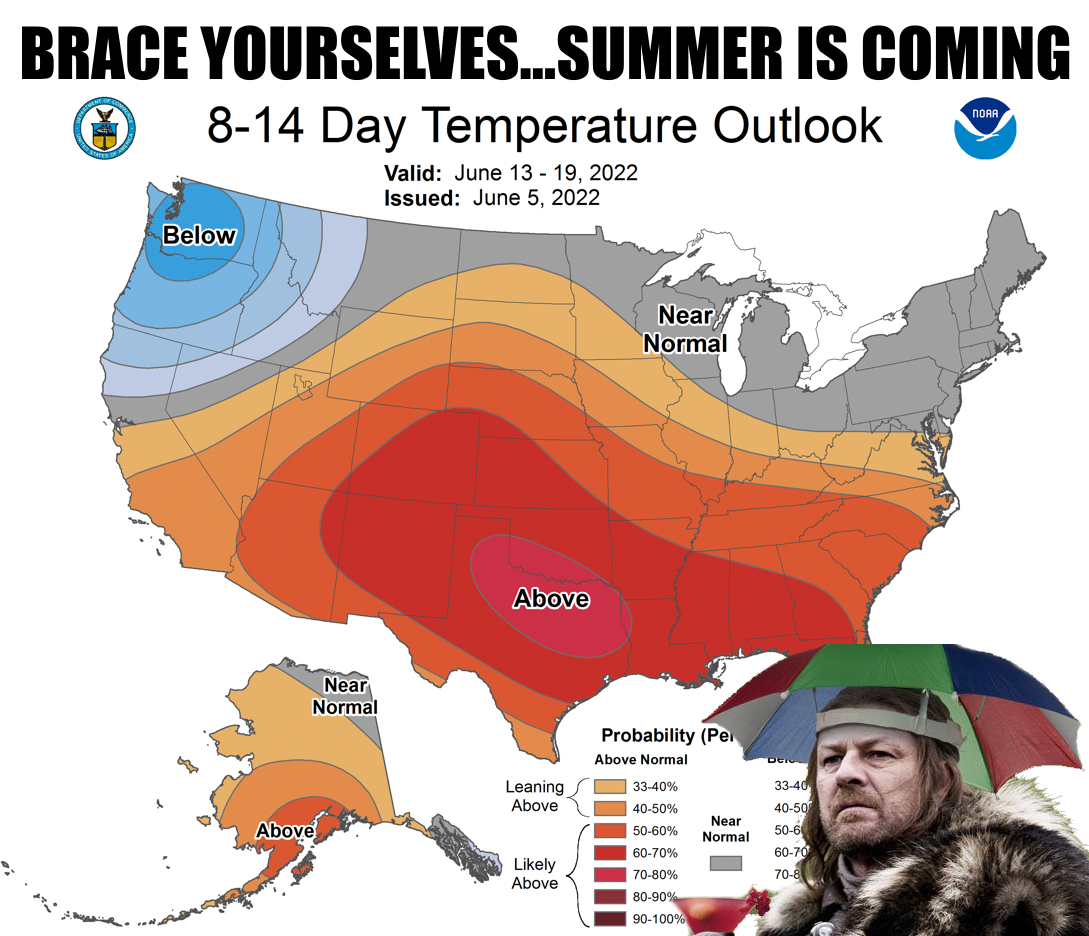
Summer IS coming. I promise. The Death Ridge Heat Dome of Sweat is going to
move this way later on and since we will be in mid-June when it does, we will
get a true dose of summer.
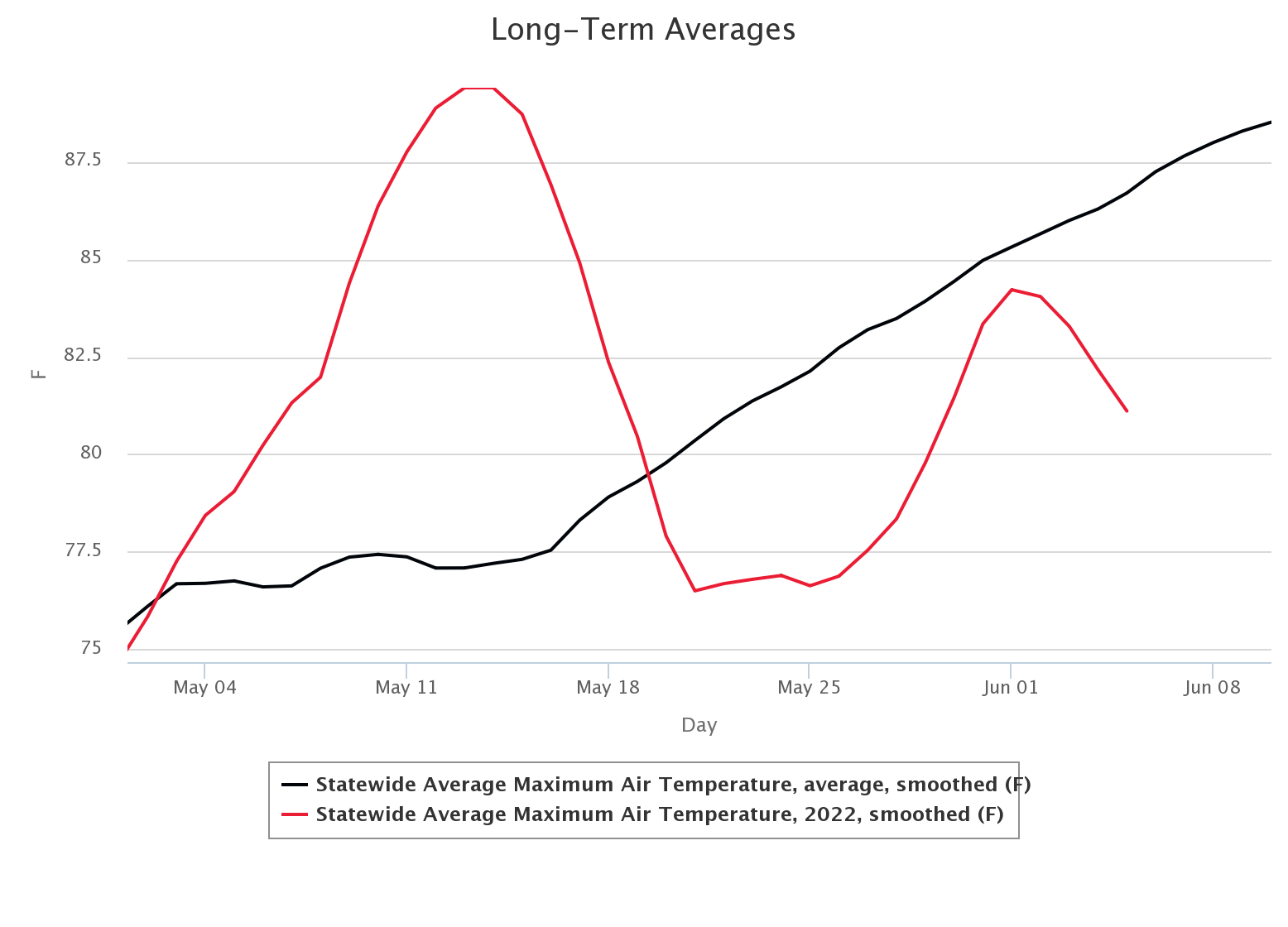
Speaking of this whole spring phase we're in (I still say Fall), our statewide
averaged high temperature as compared to the Mesonet long-term average still
shows us below the curve for the most part. That preview of summer we had in
early- through mid-May will return.
The fun starts Friday.
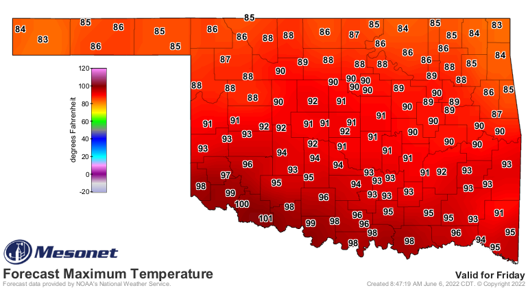
Unfortunately, it's going to be very humid. So read that again, in a very
sarcastic voice.
The. Fun. Starts. Friday.
Gary McManus
State Climatologist
Oklahoma Mesonet
Oklahoma Climatological Survey
gmcmanus@mesonet.org
June 6 in Mesonet History
| Record | Value | Station | Year |
|---|---|---|---|
| Maximum Temperature | 104°F | CHER | 2011 |
| Minimum Temperature | 38°F | BOIS | 1998 |
| Maximum Rainfall | 4.75 inches | TULN | 2019 |
Mesonet records begin in 1994.
Search by Date
If you're a bit off, don't worry, because just like horseshoes, “almost” counts on the Ticker website!