Ticker for June 1, 2022
MESONET TICKER ... MESONET TICKER ... MESONET TICKER ... MESONET TICKER ...
June 1, 2022 June 1, 2022 June 1, 2022 June 1, 2022
As Rain Goes By
Yeah yeah yeah, I know it's not the real quote. But most of the weather info I
post here is fake, too, so there!
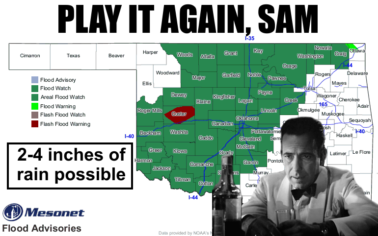
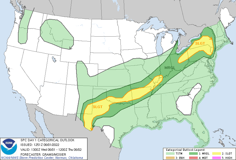
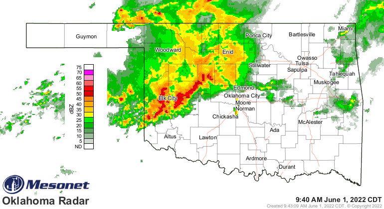
Well last night was no fun, and it looks like we get to do it all over again,
at least with the flooding rainfall. Maybe not the big hail and wind as much,
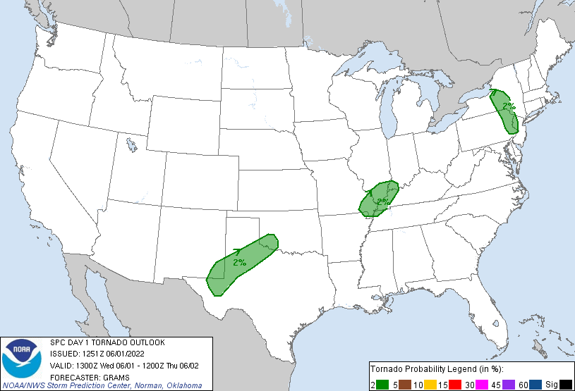
but those threats are there as well. The tornado threat is very low...BUT NOT
ZERO! We learned our lesson on that last night, didn't we?
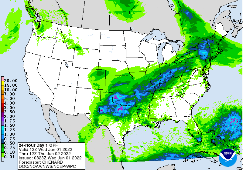
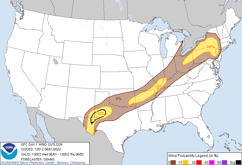
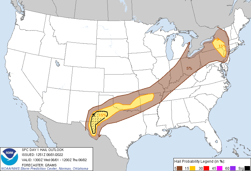
The ground is saturated over a large part of the state, so further rains will
have the chance to cause flooding, hence the flash flood watch above. Heck,
it's raining now! Hard!
I'm gonna leave it there. Stick around below and read about our monumental
May rainfall. Will there be monuments? No, but that's what the Ticker is for.
Enjoy. Or Grimace. Both will work.
----------------------------------------------------------------------------------
May Rains Dent Drought
June 1, 2022
May’s reputation as Oklahoma’s most prolific severe weather month was confirmed
within the first week with as many as 21 tornadoes in the month’s first five
days. While most of that count were weak EF0 or EF1 tornadoes, they were
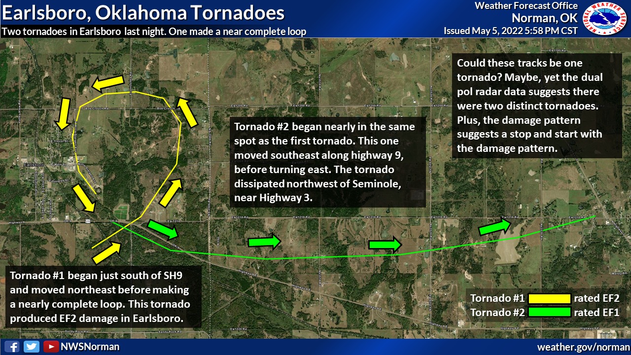
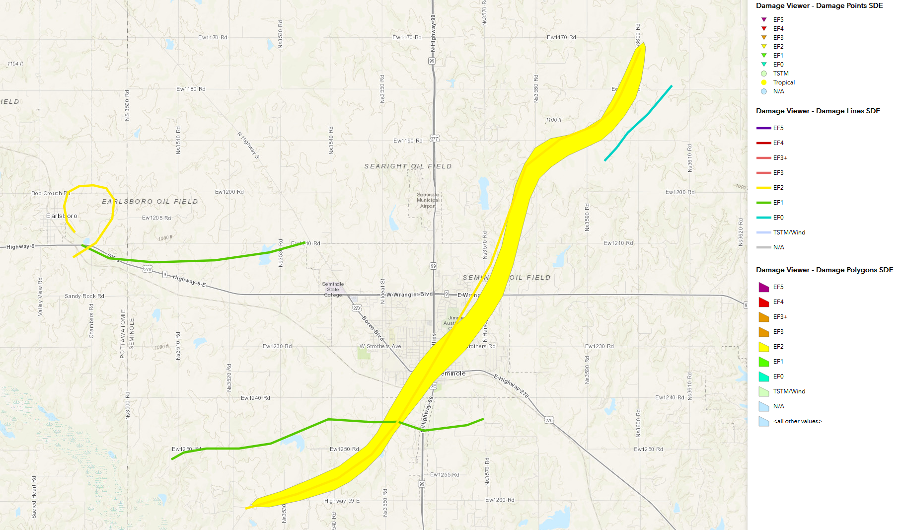
damaging, nonetheless. That total also included two strong EF2 twisters that
struck both Earlsboro and Seminole on May 4. The Earlsboro tornado traveled in
nearly a complete circle, producing damage in the southeast side of the city
first and then the northeast side along its circuitous route. The Seminole
twister grew up to a mile wide with multiple vortices at times and was on the
ground for 12 miles. Unfortunately, part of that path took it through downtown
Seminole where it produced significant damage to homes, businesses, and two
Seminole schools. That same tornadic storm also produced a large damaging EF1
tornado near Cromwell and Okemah. Another large tornado reached nearly a mile
wide and produced EF1 damage in Le Flore County earlier on May 2. Nearly
10,000 electric customers were left without power following the multi-day
severe weather event, and there were at least 21 storm-related injuries.
Reports of large hail were common throughout the month. Hail to the size of
grapefruits was reported near Seminole on May 2 and again at Okemah on May 15.
Prodigious rains not only took a huge bite out of the drought, but also
produced widespread flooding—especially across eastern Oklahoma where more than
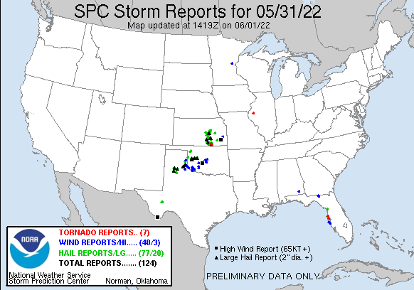
a foot of precipitation fell. The month ended much as it began with severe
storms rolling across the state producing large hail, severe winds, and
flooding rainfall on May 31.
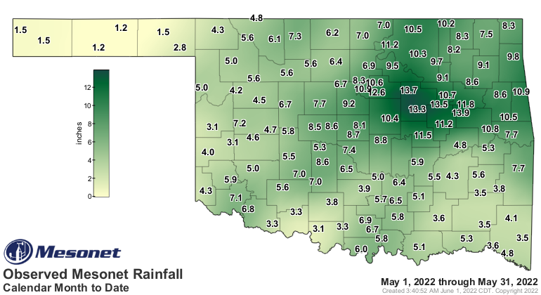
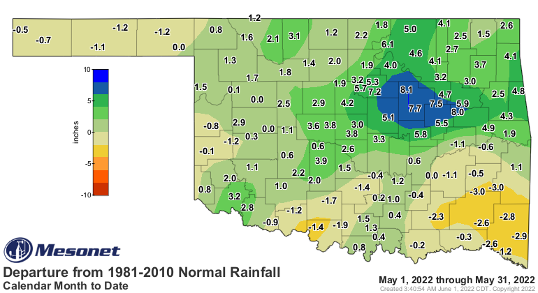
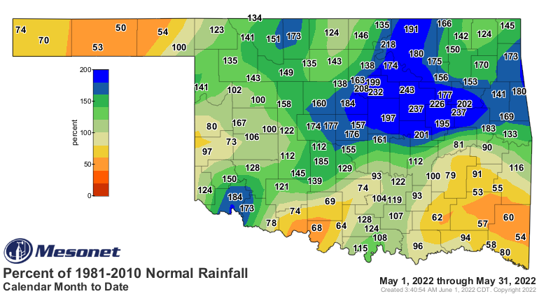
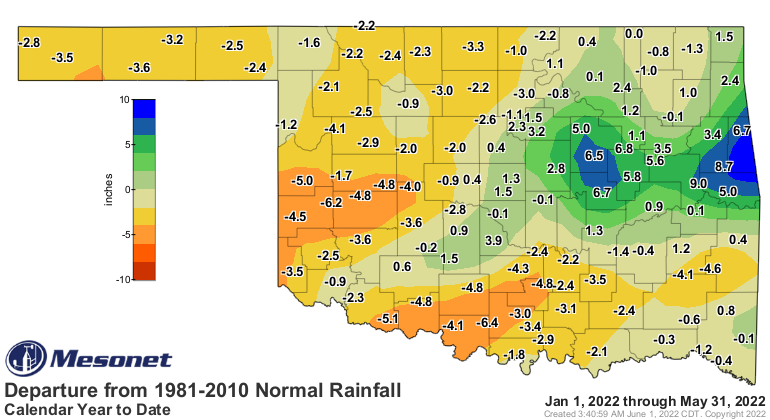
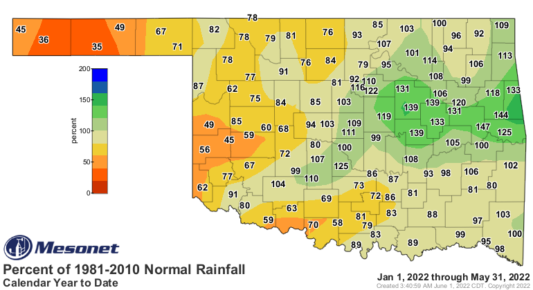
The statewide average rain total was 6.33 inches according to preliminary data
from the Oklahoma Mesonet, 1.4 inches above normal and ranked as the 30th
wettest May since records began in 1895. For the first time since June 2021,
all 120 Oklahoma Mesonet sites received at least an inch of rainfall. Those
totals ranged from 1.04 inches at Eva to 13.9 inches at Haskell. Nineteen
Mesonet sites recorded at least 10 inches of rain for the month, and another 65
reached the 5-inch mark. For some parts of western Oklahoma, it was more
moisture than they had in the previous eight months totaled together, dating
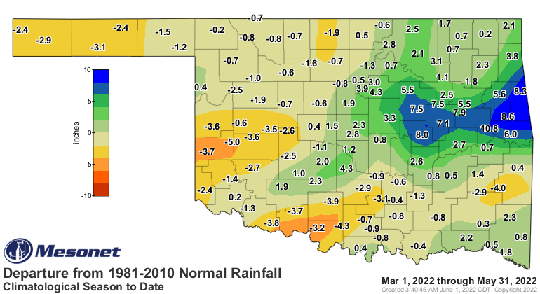
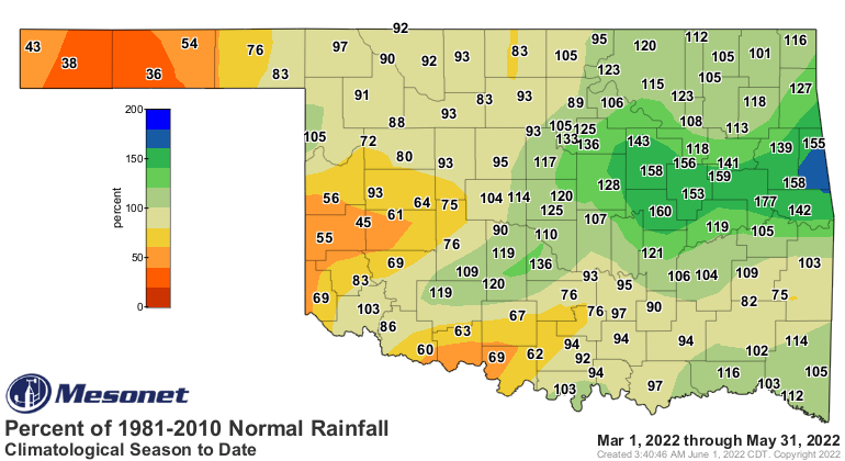
back to September 2021. The climatological spring (March-May) finished with a
statewide average of 11.51 inches, 0.21 inches above normal and ranked as the
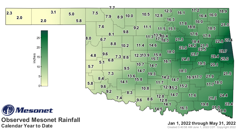
43rd wettest March-May on record. The first five months of the year had a
statewide average of 13.85 inches, 0.71 inches below normal and ranked as the
56th wettest January-May on record.

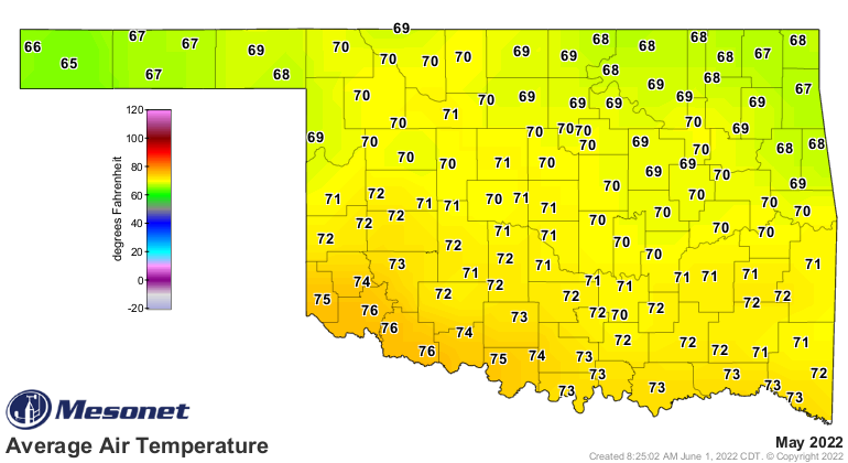
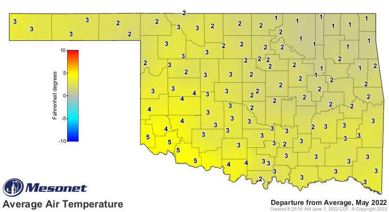
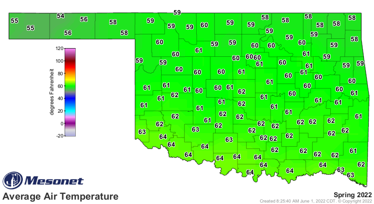
The statewide average temperature finished at 70.3 degrees, 1.9 degrees above
normal to rank as the 29th warmest May on record. Temperatures soared into
summer-like territory for much of the middle of the month, with significantly
cooler weather bookending that burst of summer. The Mesonet’s 120 sites
recorded triple-digit temperatures 82 times on 12 separate days during May.
Altus had 11 days at or above 100 degrees during the month to lead the state,
although Hollis was close behind at 10 days. Temperatures ranged from a high of
108 degrees at Grandfield on May 8 to a low of 32 degrees at Eva on the
22nd—undoubtedly Oklahoma’s last freeze of the spring season. Spring ended as
the 31st warmest on record at 60.6 degrees, 0.9 degrees above normal. The first
five months of the year remained 0.4 degrees below normal with a statewide
average of 51.7 degrees, the 47th warmest January-May on record.

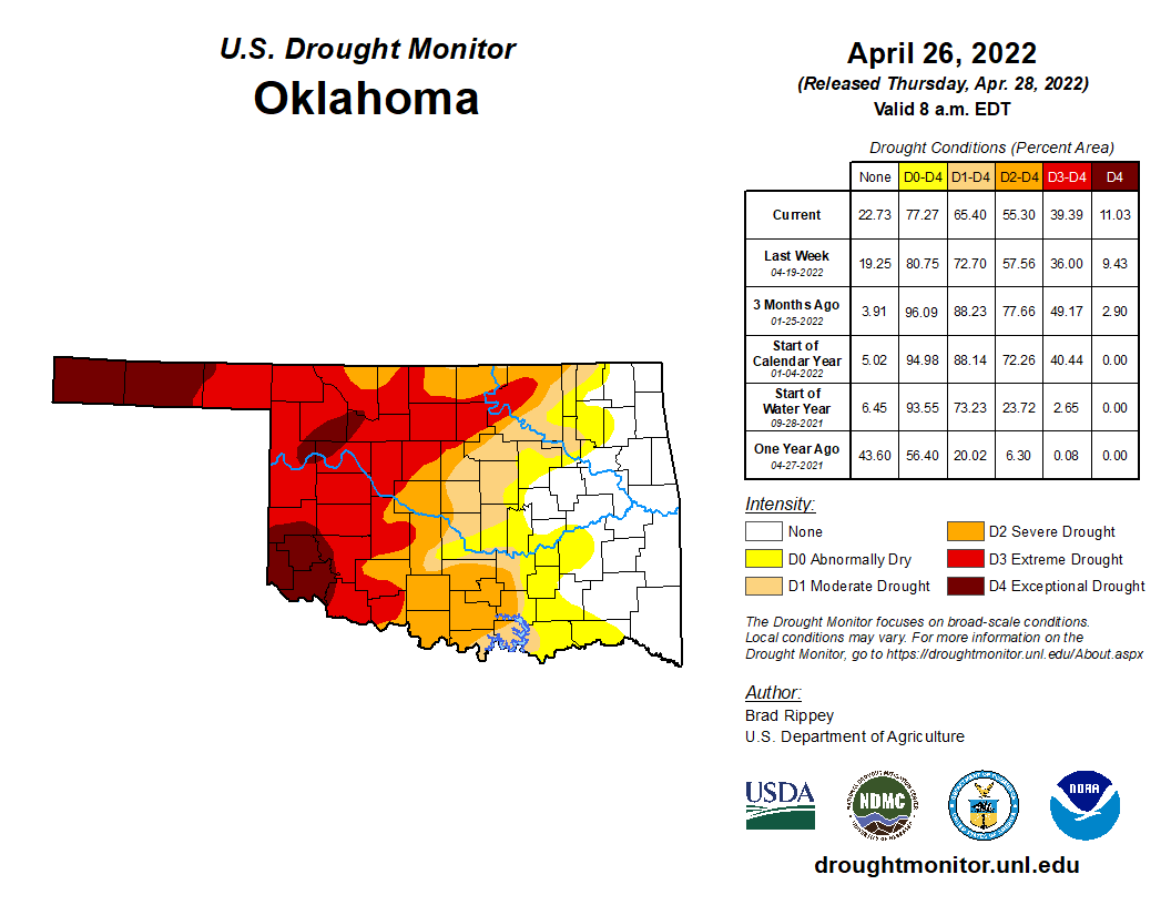
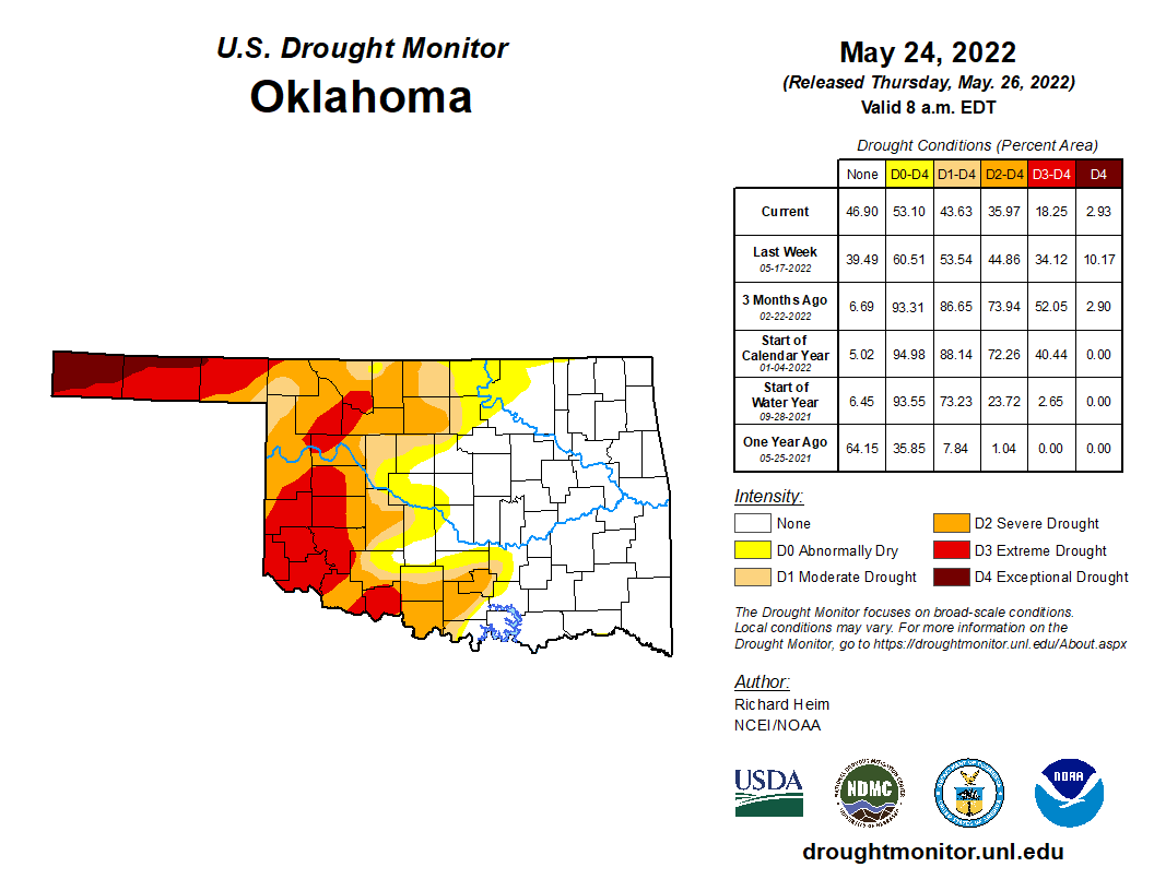
Drought took a major hit during May. According to the U.S. Drought Monitor,
coverage dropped from 65% at the end of April to 44% at the end of May. The two
most intense categories of drought—extreme and exceptional—fell by more than
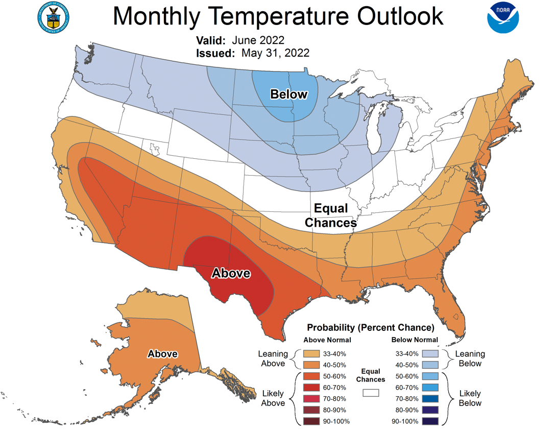
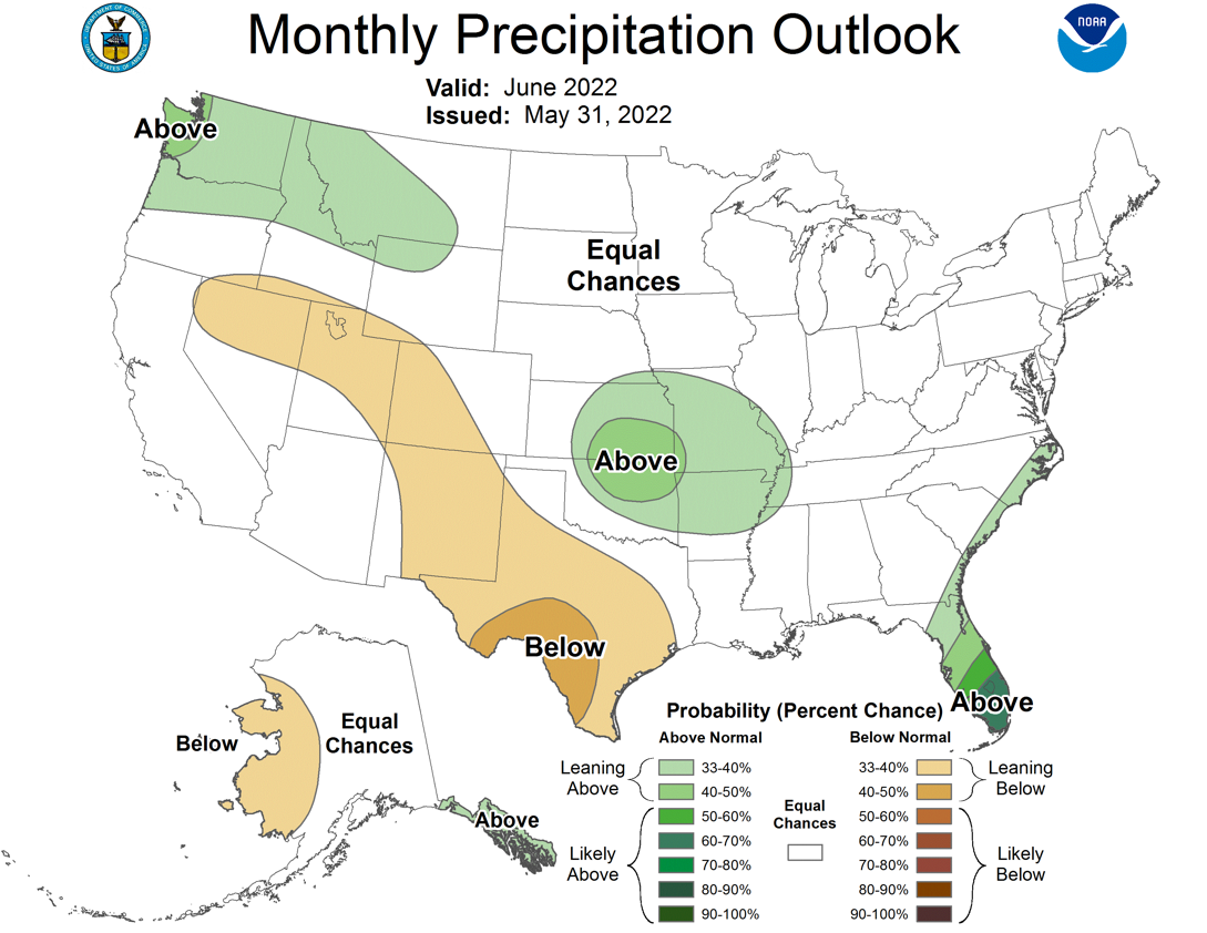
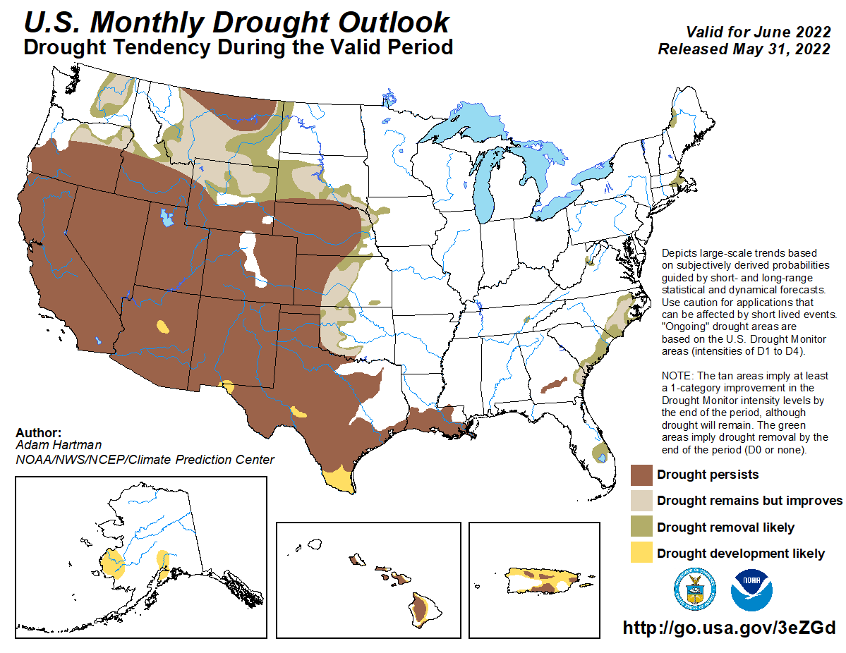
half from 39% to 18%. The June outlooks from the Climate Prediction Center hold
some promise for more drought relief. The rainfall outlook shows increased odds
of above normal moisture across the northeastern half of the state, while
temperatures are expected to be above normal across much of southern and
western Oklahoma. With heavy rains forecast for the first week of June, the
June drought outlook indicates improvements are likely across all of the state
save for the Panhandle and extreme southern Oklahoma where persistence is
favored.
Gary McManus
State Climatologist
Oklahoma Mesonet
Oklahoma Climatological Survey
gmcmanus@mesonet.org
June 1 in Mesonet History
| Record | Value | Station | Year |
|---|---|---|---|
| Maximum Temperature | 110°F | ALTU | 1998 |
| Minimum Temperature | 44°F | OILT | 2012 |
| Maximum Rainfall | 6.51 inches | OKEM | 2013 |
Mesonet records begin in 1994.
Search by Date
If you're a bit off, don't worry, because just like horseshoes, “almost” counts on the Ticker website!