Ticker for May 12, 2022
MESONET TICKER ... MESONET TICKER ... MESONET TICKER ... MESONET TICKER ...
May 12, 2022 May 12, 2022 May 12, 2022 May 12, 2022
Hey Ward
"Nobody puts Baby in a corner, and nobody outshines June Cleaver."--Abraham
Lincoln (okay, it might have been me).
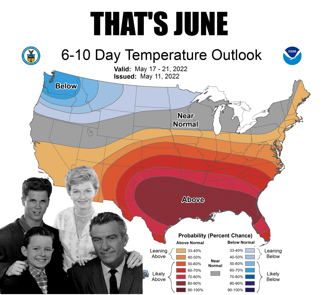
Don't look now, Ward, but we don't need to wait on June...she's already here. And
late June at that. Now see here, I've always despised Ward Cleaver, what with his
good looks and all that wisdom and good advice. There's no room for that in our
world! There's also no room for May, since we seemed to have skipped right to
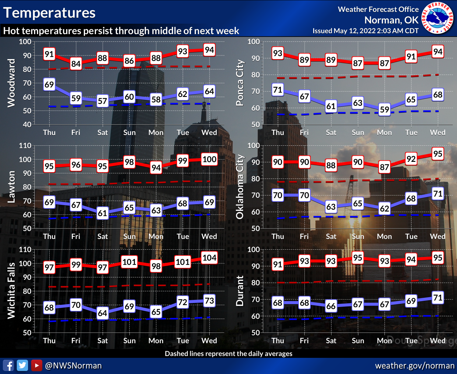
the weather of late next month all of a sudden. Check it out...highs in the 90s
and 100s (in the SW), dewpoints in the 70s, chances for storms because of all the
heat and humidity that give us mostly high winds for severe threats with the
jet stream having retreated way to the North. Oh, that's not to say we can't go
right back into May-mode with a southward plunge of that jet stream and a load of
REAL severe weather (i.e., big rotating supercells, tornadoes, etc.), but for
at least the next week it looks as if we will stay just outside of July. Rain
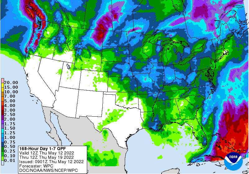
doesn't look good, but you never know with this type of pattern.
The good news is we didn't use a picture of Hazel. Don't get me started. But
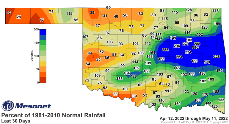
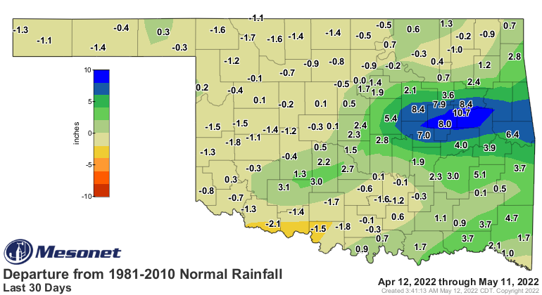
the OTHER good news is that the rain we've had in May has helped delete drought
across much of eastern OK, sans parts of NC and SC areas of the state. We even
have a tongue of no drought extending down into SW OK.

These changes are actually two weeks' worth, so not only did we get some
frowned upon 2-category changes, we even managed to sneak into "reassessment"
territory on the Drought Monitor map with some 3-category changes.
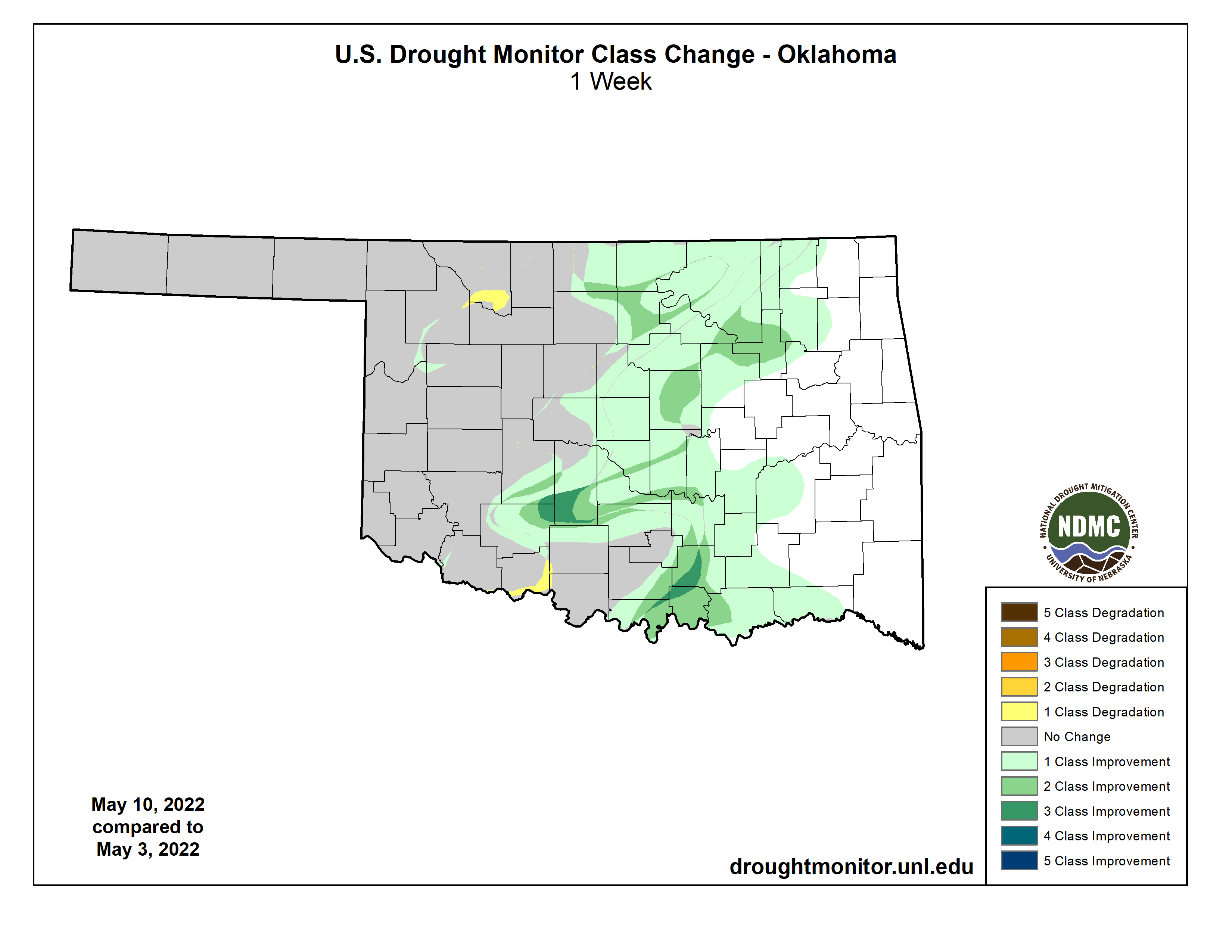
This was done due to some much above normal rainfall amounts across these areas
over the last couple of weeks, with some help before that. Once you start
getting multiple big rain events, the changes really start to occur.
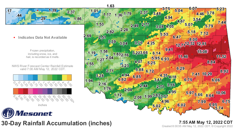
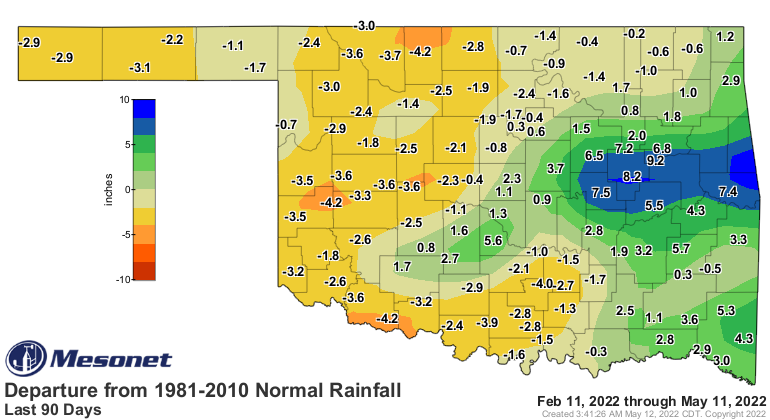
But the reason we still have drought going strong across much of the western
half of the state (and into NC and SC OK), is that once you get out past the
30-day period, those deficits start to magnify once again.
We will have a chance of more storms each day for the next few days, but again,
not too much widespread it looks like right now. And we will continue in
the current mode of temperatures mostly in the 90s, but flirting with triple
digits down in SW OK and not cooling down too much at night.
Why, because it's like June, Ward. Now go put that in your pipe and smoke it.
Gary McManus
State Climatologist
Oklahoma Mesonet
Oklahoma Climatological Survey
gmcmanus@mesonet.org
May 12 in Mesonet History
| Record | Value | Station | Year |
|---|---|---|---|
| Maximum Temperature | 99°F | HOOK | 2022 |
| Minimum Temperature | 36°F | ANTL | 2008 |
| Maximum Rainfall | 5.55 inches | COOK | 2016 |
Mesonet records begin in 1994.
Search by Date
If you're a bit off, don't worry, because just like horseshoes, “almost” counts on the Ticker website!