Ticker for May 10, 2022
MESONET TICKER ... MESONET TICKER ... MESONET TICKER ... MESONET TICKER ...
May 10, 2022 May 10, 2022 May 10, 2022 May 10, 2022
Mune or Muly?
Hey, I know I'm a warminista...give me 100s or give me death! Wait, I'm not really
willing to die for this cause.
GIVE ME 100s OR GIVE ME UPPER 90s!
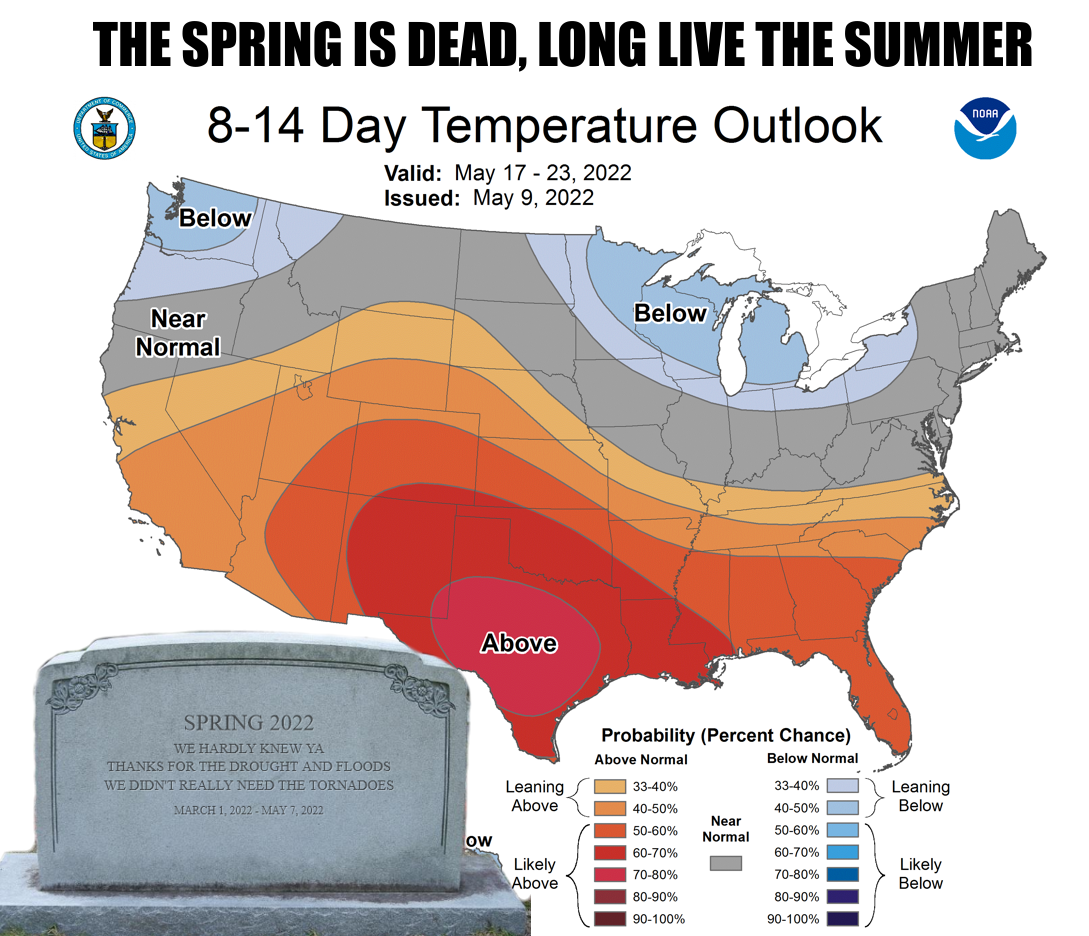
There, that's better. Here's the deal, though...we have gone from about a month
and a half of spring right into summer (although some would say spring started
in December, but then we'd have to deal with our cold February, but then again,
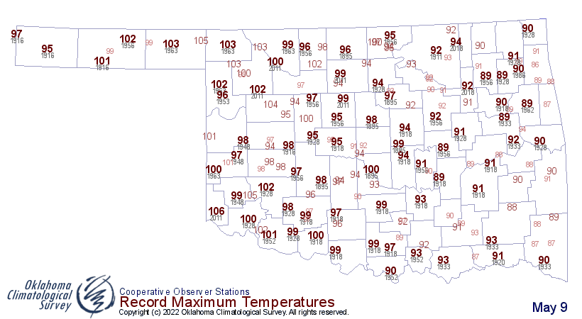
that's Oklahoma!). For the second day in a row, we saw records fall across much
of the state. On top of that, the 107 degrees in Altus was the highest temperature
ever recorded on a May 9 in Oklahoma, topping the 106 from Hollis back in 2011.

To add to the blast furnace of fun, the winds were gusting to over 40 mph in
spots.

That's very un-July like. But we keep hearing these comparisons to 2011. We're
not QUITE that bad. But we're getting there. Check out the number of days at
or above 90s degrees and 100 degrees at this point in time between 2011 and
this year.
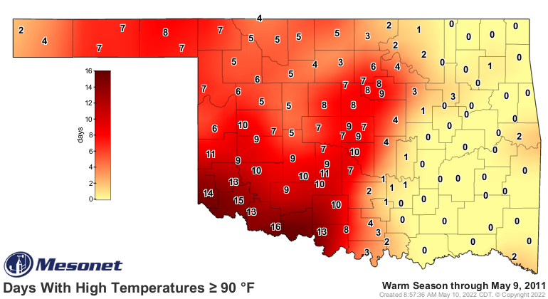
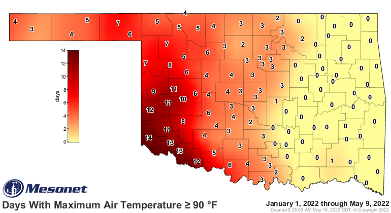
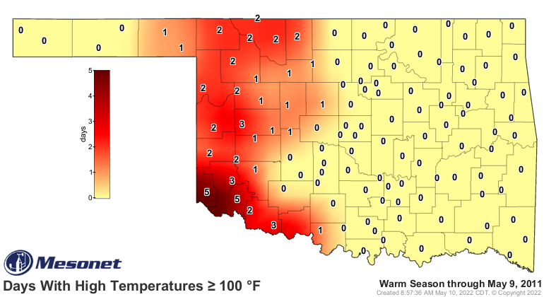
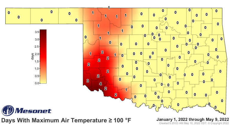
Yeah, wayyyy too similar. The drought picture is pretty similar, too.
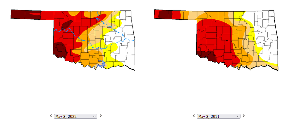
Now this week's Drought Monitor map will look quite different across central and
eastern OK when it comes out on Thursday following two weeks of heavy rains, but
across the western half of the state, still very similar to 2011. At that
time in 2011, we were dealing with storms across eastern OK--April 2011 alone
had 50 tornadoes, all east of I35--while western Oklahoma was mired behind a
semi-permanent dryline with blowing dust, 100s, and 50-60 mph winds. So the
drought improved across eastern Oklahoma in May 2011, but then took off
across western Oklahoma before obliterating all areas of the state through July
and August.
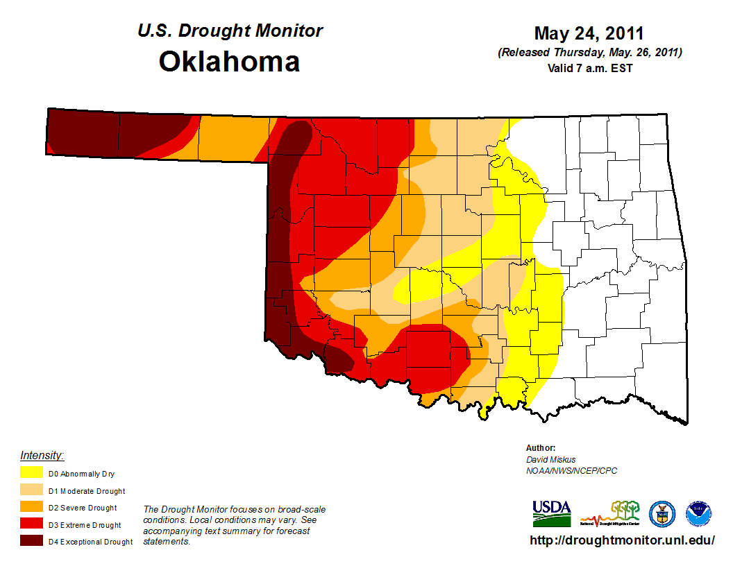
This is where it was on May 24, 2011 (a preview of this week's map, too).
And this is where it was at the beginning of August.

So while I'm not predicting another 2011-style drought, what I am saying is
that the similarities are there. Another cautionary tale would be that any
moisture you can get in May is precious, even if it's too much. Because the
brutal Oklahoma summer can send it backwards in a hurry.
Oh, speaking of rain, there's a chance tonight across far SW OK! There is also
a risk of severe storms with winds being the main hazard.
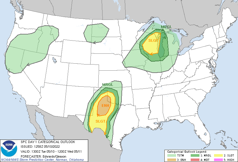

There are some decent rains possible, just depends on where those storms line
up. These aren't drought-busting rains, of course, but every bit is precious
(remember?).
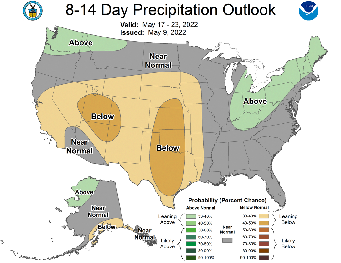
Further out, there aren't a lot of big rains out there for the next week.

Even further out, the dry weather continues through next week.
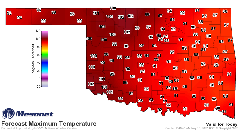
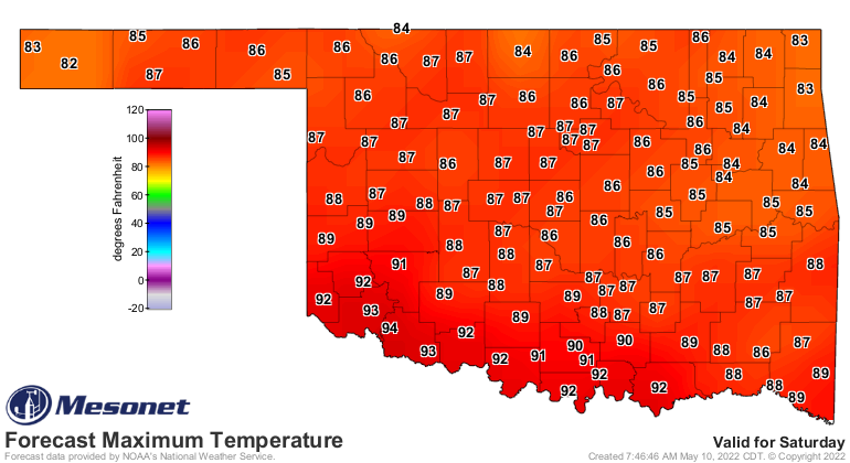
Another blast furnace today, before we "cool down" into the upper 80s and low
90s for the weekend, then start marching upwards again.
Well same to you! I don't make the weather, I just report it.
Gary McManus
State Climatologist
Oklahoma Mesonet
Oklahoma Climatological Survey
gmcmanus@mesonet.org
May 10 in Mesonet History
| Record | Value | Station | Year |
|---|---|---|---|
| Maximum Temperature | 102°F | ERIC | 2022 |
| Minimum Temperature | 31°F | EVAX | 2019 |
| Maximum Rainfall | 5.62 inches | IDAB | 2009 |
Mesonet records begin in 1994.
Search by Date
If you're a bit off, don't worry, because just like horseshoes, “almost” counts on the Ticker website!