Ticker for May 16, 2022
MESONET TICKER ... MESONET TICKER ... MESONET TICKER ... MESONET TICKER ...
May 16, 2022 May 16, 2022 May 16, 2022 May 16, 2022
For reals!
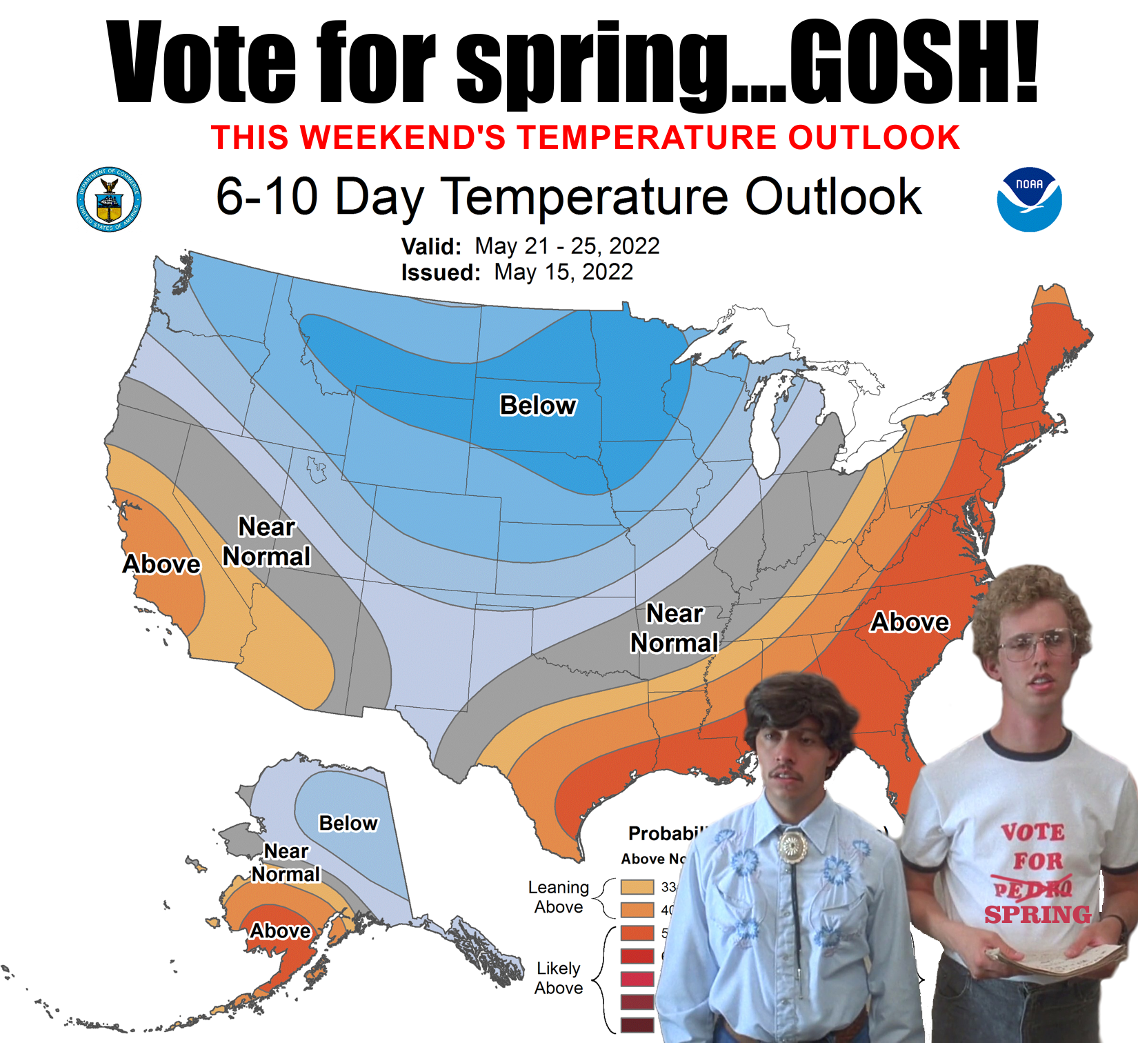
Yeah, last night's cold front dropped us back down to just barely above normal,
instead of the 15-25 degrees above normal we were all trying to get used to (and
failing horribly, mostly, due to the humidity).
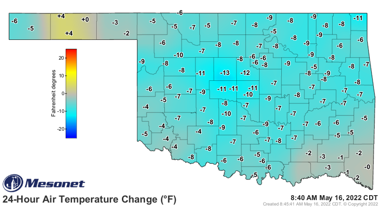
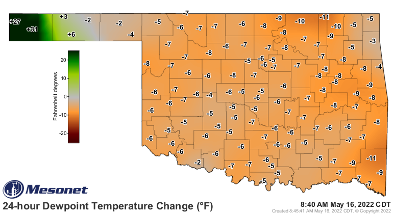
No, I'm not going to show you what the actual temperature and dewpoint values are.
That's EXACTLY what you'd expect me to do. Nice try.
What I can tell you is that today's return to near-spring is temporary, so enjoy
it whilst you can.
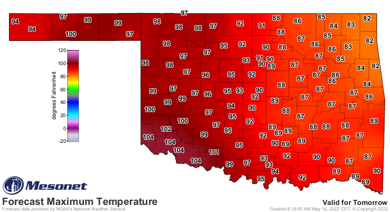
Because tomorrow it's right back to the salt mines. Wait, are salt mines really
hot and humid? Okay, back to the (mine where it is someplace hot...hope you picked
a clever one because I couldn't think of one). And it's gonna stay that way
until Friday when we get a really nice cold front that might actually drop
us down BELOW normal just a tad.
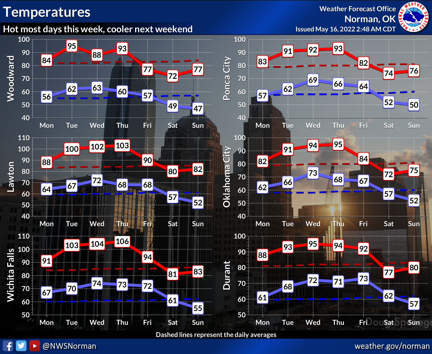
Now the difference between today's and Friday's is 5 days, but that's not
important right now. The REAL difference is that today's lasts a day...Friday's
front should last for several days with highs in the 70s and 80s and lows in
40s and 50s. I think we might even eke out a freeze in the far western Panhandle.
Eva, we're looking at you.
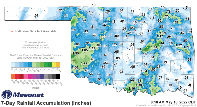
We will also see an enhanced chance for rain with that front, although we've
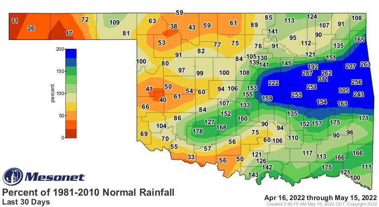
been seeing some rain (AND LOTS OF BIG HAIL!) over the last few days. In the
last week, we've seen real relief across some of the areas hardest hit by
drought. Not everywhere, though.
There are also rain chances out west for the next few days, with more chances
of severe weather, too. This isn't high-end May severe weather Oklahoma is
used to, but bad enough at times to be significant.
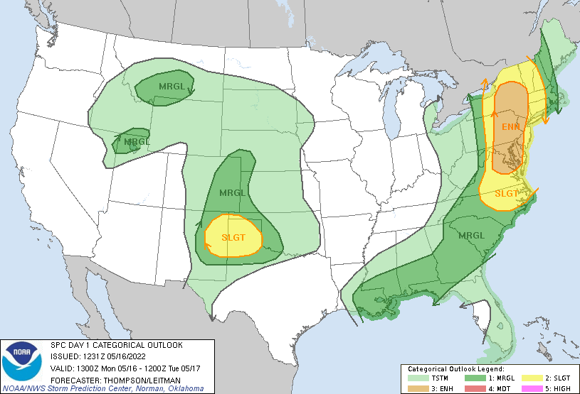

This will be a good chance for the Panhandle to get a bit more moisture.
After that, it does look like it could get hot, and I mean REALLY hot, later
next week, but that's nightmare-cast territory. So 3-4 days of second spring
will soon be sprung. Be ready!
Gary McManus
State Climatologist
Oklahoma Mesonet
Oklahoma Climatological Survey
gmcmanus@mesonet.org
May 16 in Mesonet History
| Record | Value | Station | Year |
|---|---|---|---|
| Maximum Temperature | 101°F | ALTU | 2000 |
| Minimum Temperature | 31°F | BOIS | 2011 |
| Maximum Rainfall | 4.55 inches | WYNO | 2021 |
Mesonet records begin in 1994.
Search by Date
If you're a bit off, don't worry, because just like horseshoes, “almost” counts on the Ticker website!