Ticker for May 2, 2022
MESONET TICKER ... MESONET TICKER ... MESONET TICKER ... MESONET TICKER ...
May 2, 2022 May 2, 2022 May 2, 2022 May 2, 2022
This is our weather now
Why Bonaduce? Why not.
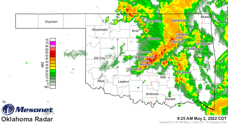
So this is another one of THOSE days in Oklahoma. You know the type, starts out
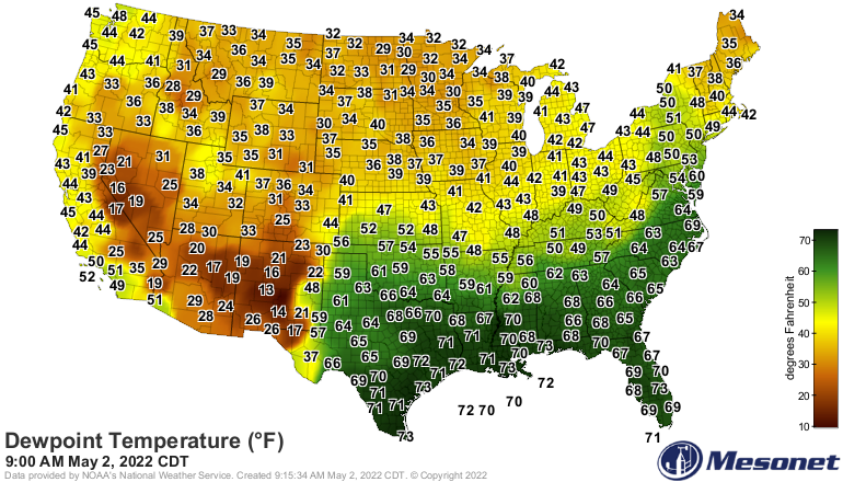
raining, a bit cool, but you know lurking to our south is a blast of warm and
even more moist air headed our way.
A storm system to our west will kick out another disturbance as a surface low
to our NW moves east and drag a cold front through the state later tonight. We
will also see a dryline across western OK. With clearing later today (in case
ya hadn't noticed, it's raining now across the eastern half of the state) in
western OK, we should be able to warm up enough to initiate convection along
the dry line and the warm front that's bringing that moist air north.
Now a bit different than what we've seen over the last few weeks with all these
conditional severe weather chances thanks to that strong capping inversion,
today will see much less resistance to storm's firing and flourishing. If ya
got tired of seeing "if storms form," you might wish for those days back after
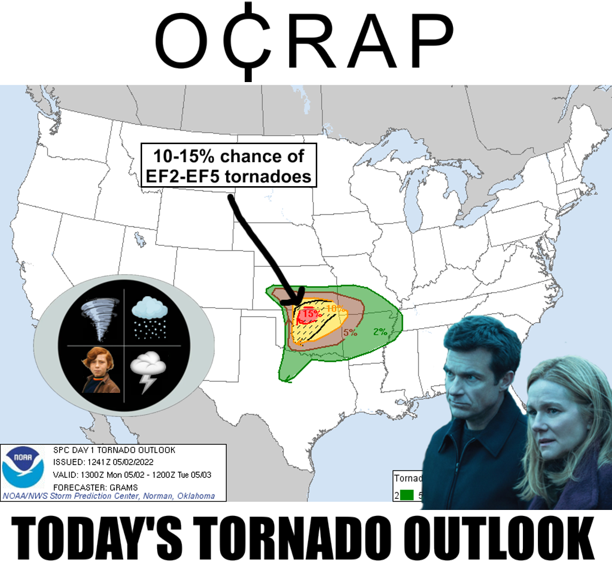
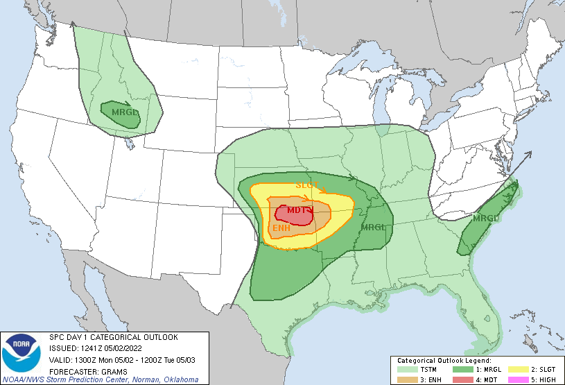
today. Here are the convective outlooks from the Storm Prediction Center here
in Norman, right across the hall. Ain't they lucky?
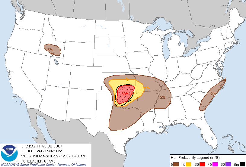
So as storms go up, they should remain separated a bit which will allow them
to rotate unfettered. Those storms will bring a chance of tornadoes, including
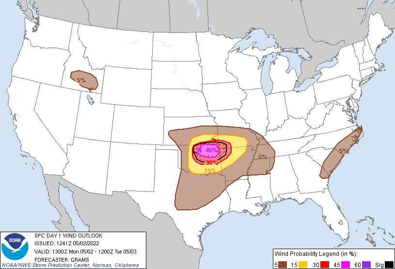
some intense twisters, and a giant hail threat. Later on, the cold front will
sweep through and line the storms out a bit more solid, increasing the wind
threat and storm coverage. The biggest threat area will be up across north
central Oklahoma at the triple-point of the cold front, dryline, and warm
front. That's where the "Moderate risk" area is in red. I'm thinking that might
be the first moderate threat this year for OK?
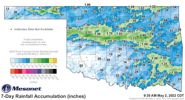
Additionally, with heavy rain already falling in parts of the state, there will
be a flood threat across the eastern half of the state as more rains fall. Heck,
we're seeing flooding rains as I type!
Now are ya like me? No wonder people avoid you. But are you also like me in that
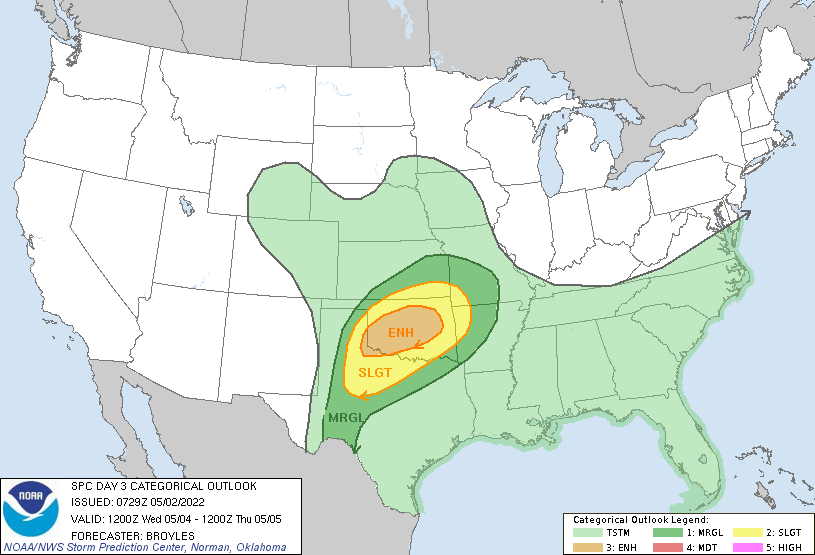
you'd rather have a week or so between storms? Well, too bad, because it looks
like we get to do this all over again Wednesday.
Oh yeah, well same to you! I don't make the weather. Now with these storms, a
goodly bit of rain should fall over the next 5 days or so.
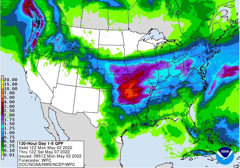
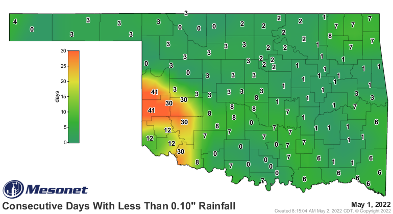
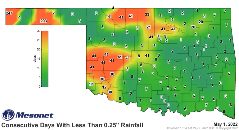
And that's on top of what's fallen today and over the last week that saw some of
those consecutive day maps get reset a bit.
I'm gonna stop there before I bore ya to death.
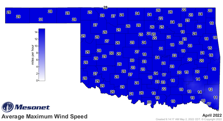
Hello? Anybody still out there? Hey, stick around below and read about how April
was probably the windiest since the Mesonet began in 1994. Many suspected it,
most complained about it, so how about we prove them right.
----------------------------------------------------------------------------------
April Winds Highest in Mesonet Era
May 2, 2022
Opinions on Oklahoma’s weather are often more variable than the weather itself.
Some Oklahomans will look back on April 2022 and remember the seven confirmed
tornadoes that touched down, although that is still below the long-term average
of 11.7 for the month. Many others will remember drought that saw both
intensification in the northwest and improvement across the southeast. There is
one aspect of this April’s weather that would unite most Oklahomans, however—the
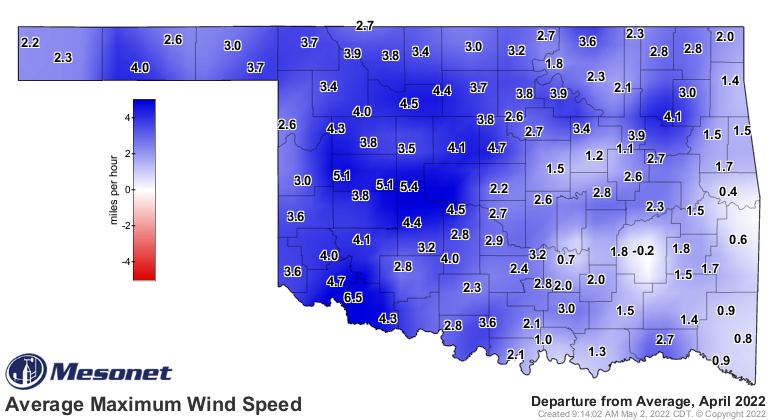
wind. Already Oklahoma’s windiest calendar month climatologically, the seemingly
unceasing gales howling day and night became a common point of exasperation.
Data from the Oklahoma Mesonet lends credence to that frustration. Both the
statewide average wind speed and maximum wind speed for this April were tops
since Mesonet data began in 1994 at 12.2 mph and 22.9 mph, respectively.
Previous top marks were held by 1996’s 12 mph and 2011’s 22.5 mph, again
respectively. Those and other metrics point towards the month as the windiest
April statewide in the Mesonet era. Fourteen of April’s 30 days saw
non-thunderstorm wind gusts of at least 50 mph somewhere in the state, and nine
days with at least 60 mph. Tipton and Slapout shared the highest wind gusts at
74 mph on April 5 and 22, respectively. The seven confirmed tornadoes brought
2022’s total to 12, still a bit below the long-term average of 16.5 for the
first four months of the year.


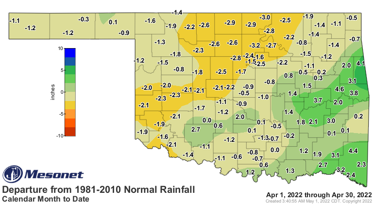
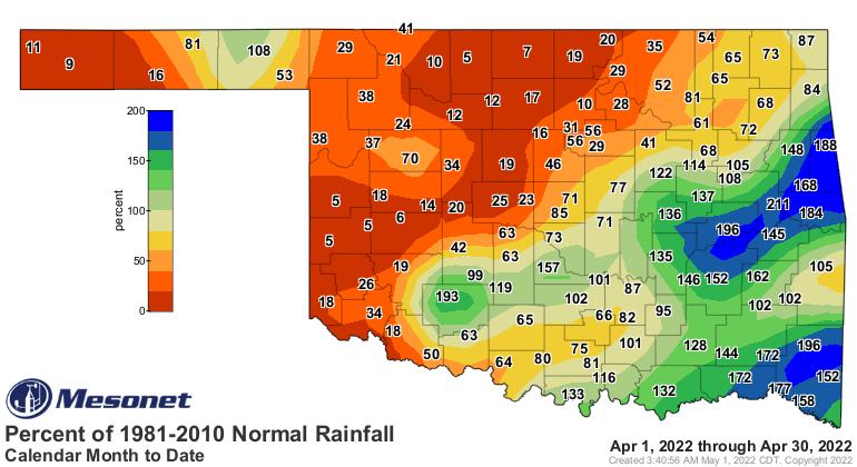
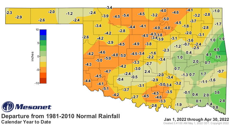
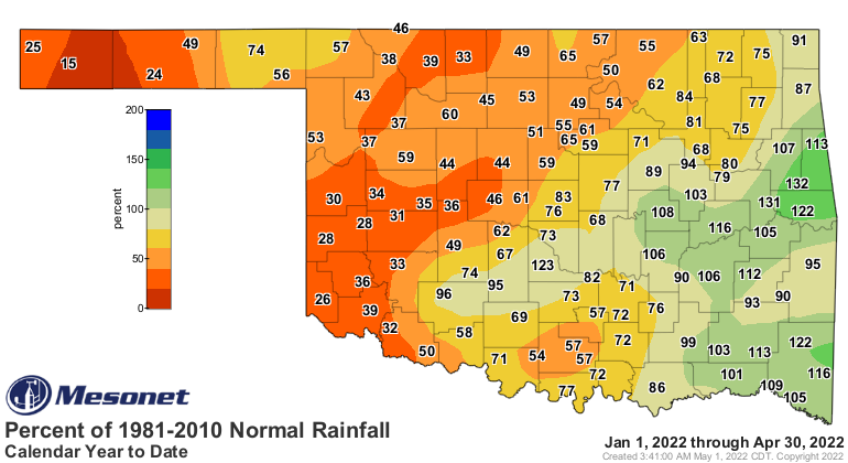
It was largely a state divided on the rainfall maps, with areas to the
southeast of Interstate 44 receiving a surplus of moisture while those to the
northwest continued in prolonged dry conditions. Combined, the statewide
average for the month was 2.7 inches, 0.89 inches below normal and ranked as
the 43rd driest April since records began in 1895. The differing fortunes were
emphasized by north central Oklahoma’s third driest ranking at 2.58 inches
below normal, as opposed to east central Oklahoma’s ranking as 26th wettest
with an average surplus of 1.69 inches. Mt. Herman led the Mesonet’s 120 sites
with 8.98 inches of rain for the month. Erick went nearly the entire month
without appreciable moisture, finishing with a paltry tenth of an inch.
Twenty-seven sites reported more than 5 inches for the month while another 38
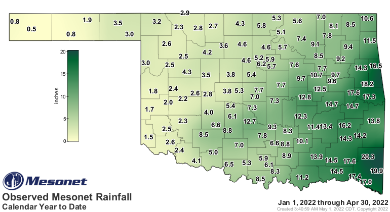
received less than an inch. The first four months of the year finished at 7.69
inches, the 42nd driest January through April on record, 1.94 inches below
normal.

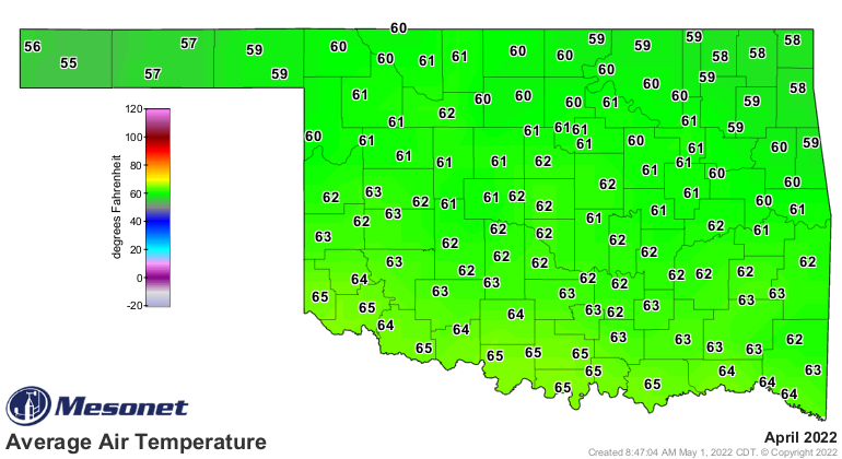
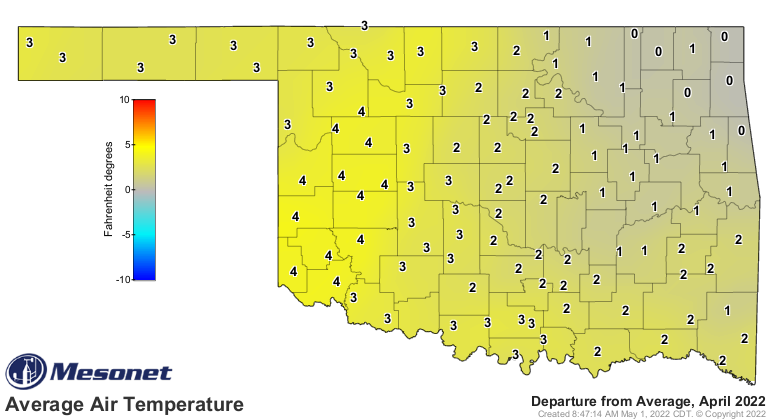
The statewide average temperature finished at 61 degrees, 1.5 degrees above
normal and ranked as the 39th warmest April since records began in 1895.
Temperatures soared at times, with 90s being recorded on 11 of April’s 30 days,
and Oklahoma’s first triple-digit temperature of 2022 was recorded on the 29th
at Altus at exactly 100 degrees. The heat was more concentrated across western
Oklahoma where the drought has flourished with many locations 3-4 degrees above
normal for the month. Eva dropped to 16 degrees on the 14th for the lowest
recorded temperature. The first four months of the year remained below normal
thanks to a frigid February. The statewide average was 46.9 degrees, a degree
below normal and ranked as the 57th warmest such period on record.
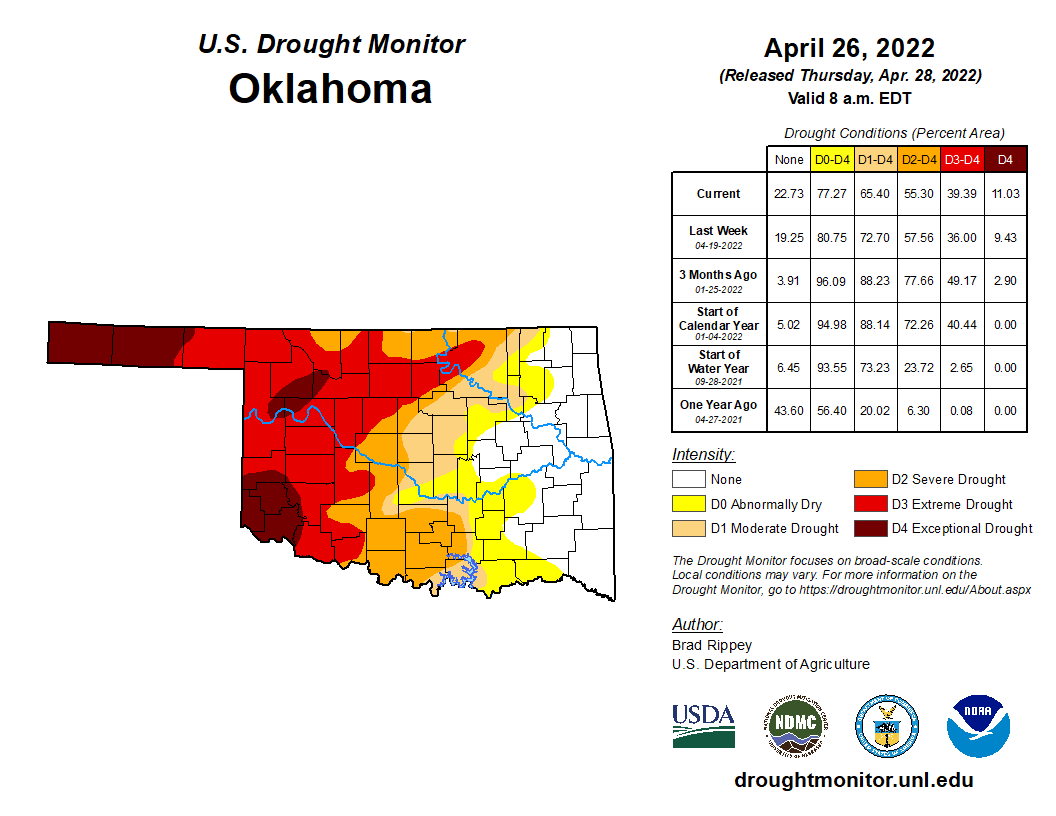
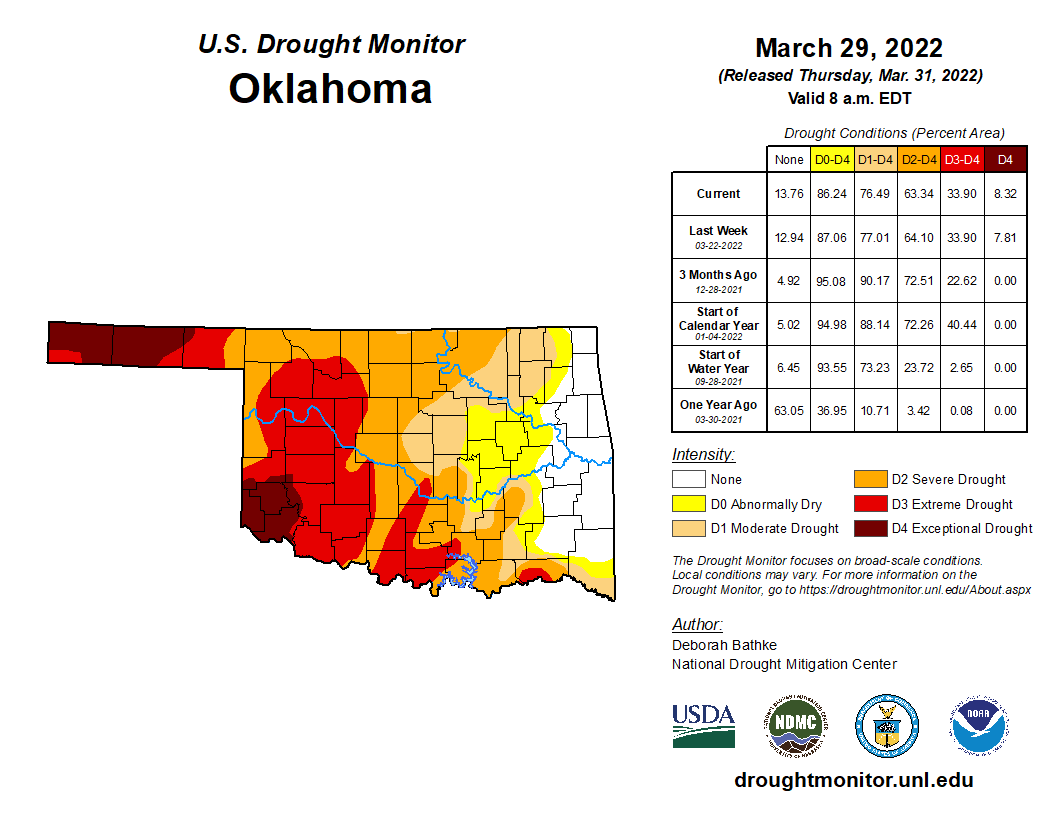
While drought’s coverage decreased from 76% of the state at the end of March
to 65% at the end of April, the two highest levels of drought—extreme and
exceptional—increased from 34% to 39% according to the U.S. Drought Monitor.
The most intense category of drought, exceptional, increased from 8% to 11%
over that same span, all across far western Oklahoma. Heavy rains forecast for
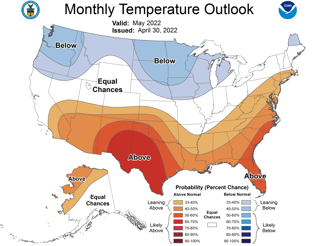
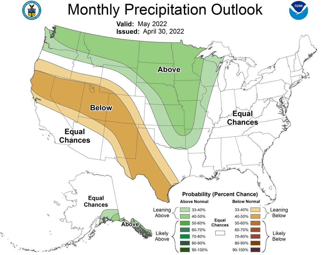
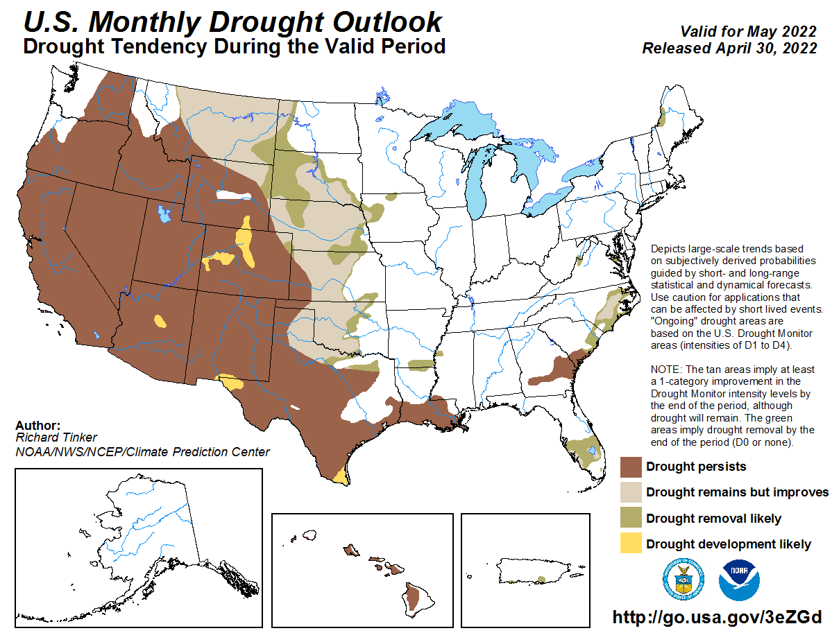
early May could spell relief, however. The Climate Prediction Center’s May
temperature and precipitation outlooks call for increased odds of above normal
temperatures across the entire state and above normal precipitation in the
eastern two-thirds of Oklahoma. CPC believes the expected early moisture,
combined with the onset of the climatological wettest part of the year for most
of the state, will lead to improvements in drought conditions in all but the
western Panhandle through May.
Gary McManus
State Climatologist
Oklahoma Mesonet
Oklahoma Climatological Survey
gmcmanus@mesonet.org
May 2 in Mesonet History
| Record | Value | Station | Year |
|---|---|---|---|
| Maximum Temperature | 105°F | ALTU | 2020 |
| Minimum Temperature | 24°F | BOIS | 2013 |
| Maximum Rainfall | 4.04 inches | HASK | 2022 |
Mesonet records begin in 1994.
Search by Date
If you're a bit off, don't worry, because just like horseshoes, “almost” counts on the Ticker website!