Ticker for April 28, 2022
MESONET TICKER ... MESONET TICKER ... MESONET TICKER ... MESONET TICKER ...
April 28, 2022 April 28, 2022 April 28, 2022 April 28, 2022
ELONGATED HODOGRAPHS!
"Modified forecast soundings for warmer surface
temperatures do result in erosion of the cap. Therefore, while some
capping may limit storm coverage, it is anticipated that at least a
few supercells will develop in a narrow corridor along the dryline
by late afternoon/early evening. Very steep midlevel lapse rates and
elongated hodographs above favorably-curved low-levels indicate
significant hail potential with these storms. Furthermore, steep
low-level lapse rates and moderate 0-3 km MLCAPE values amid
increasing SRH as a low-level jet increases during the evening,
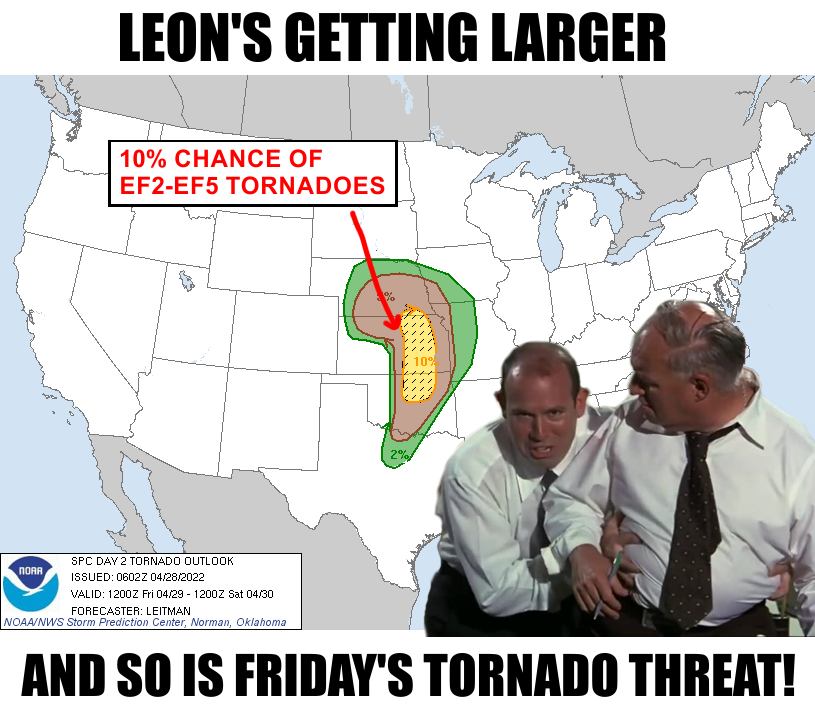
indicate that tornadoes will also be possible, a couple of which may
be significant (EF 2+)."
Folks, I had an elongated hodograph a couple of years ago and not only is it
painful, it's about as tough to diagnose as a shortened medulla oblongata
(obshortgata??). Okay, enough medical jargon. *I* might find it humerus, but I
doubt you do.
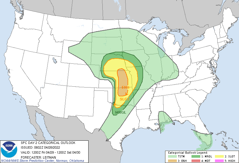
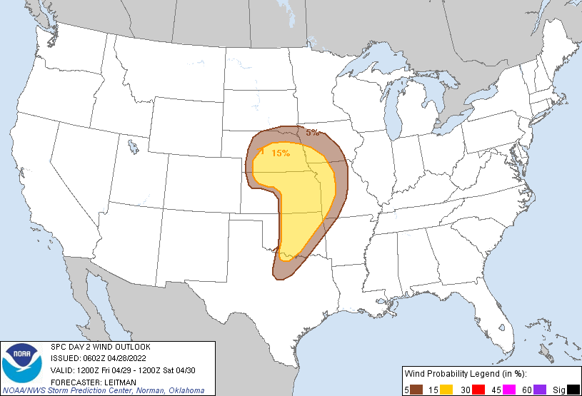
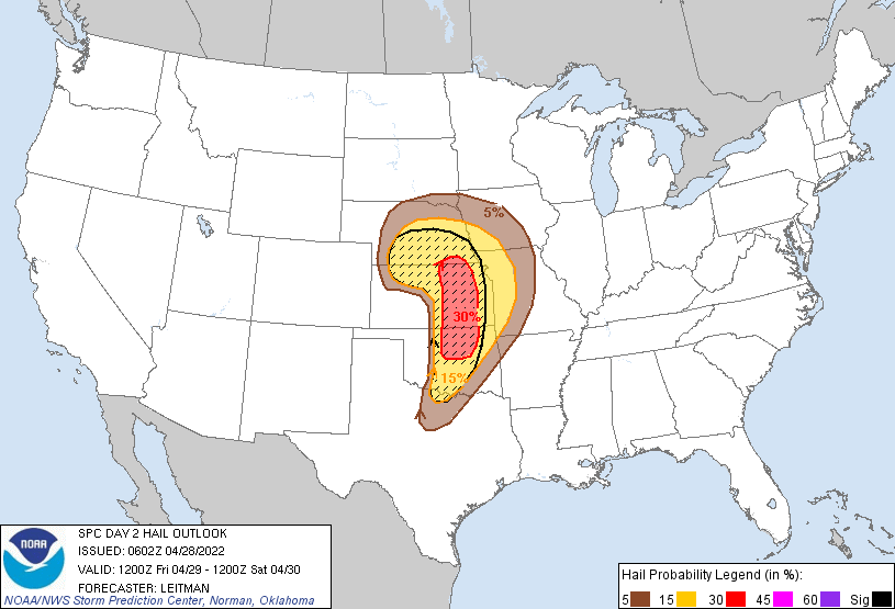
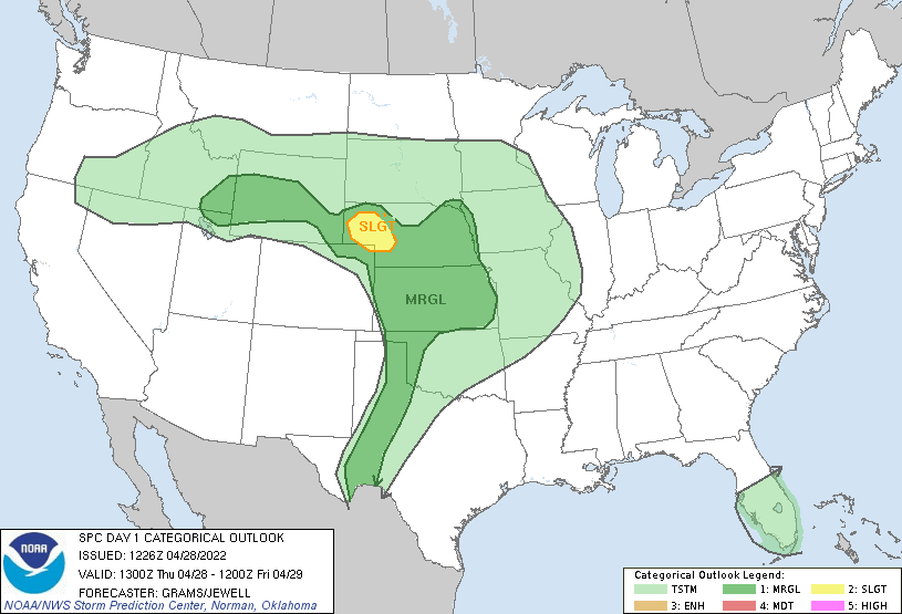
Here are the rest of the outlooks for tomorrow, Friday, April 29, 2022. Big hail
will also be of particular concern now that it appears the cap will break after
all. Of course, that could all change with the next outlook around noon, but
things are trending a bit worse with heightened severe storm chances.
Aaaand, there's a marginal chance for severe weather today out west.
However, the most exciting thing to me--yes, even more exciting than the
possibility of strong tornadoes tomorrow--was the rainfall up in the NW quarter
last night. I might have buried the lede (it's lede, not lead...I swear to ya!)
again by showing this third.
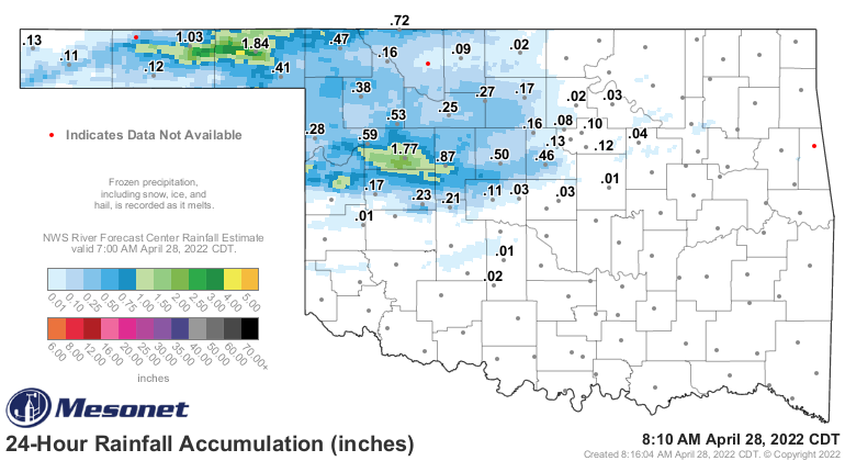
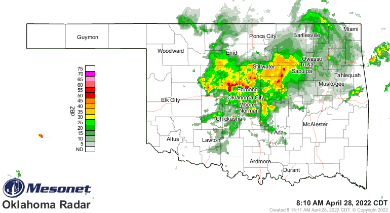
Heck, it's raining right now in central and northern OK!
That 1.84 inches in Beaver last night is more than they've received in the
previous 196 days combined! That dates back to Oct. 13, 2021. Holy mackerel,
I still had hair back then! Okay, maybe not, but it'd be a lot cooler if I did.
What's more...no, really, what's "more"?
more
/môr/
determiner
a greater or additional amount or degree of.
Okay, what's MORE, additional rain chances over the next week or so will give
us the opportunity to really relieve some of these drought areas across parts of
western OK. Maybe not everybody, but increased relief does appear possible as
we go through early next week.
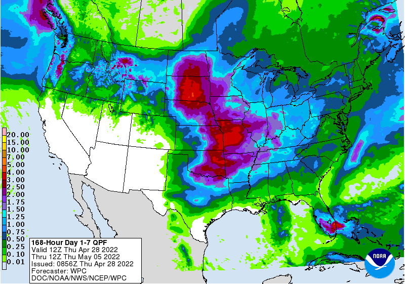
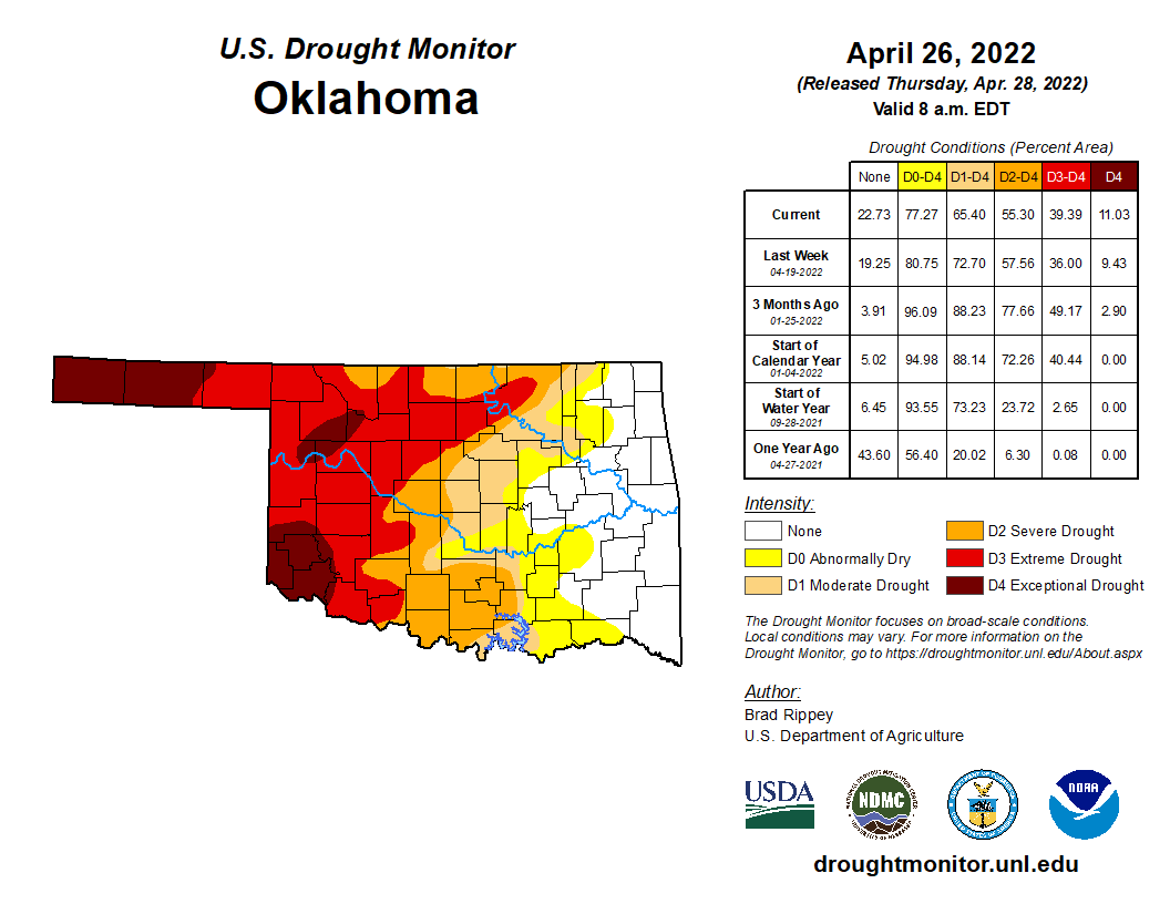
And that's important because while the drought has been getting eradicated
across eastern OK, it was still strengthening across the western half of the
state.
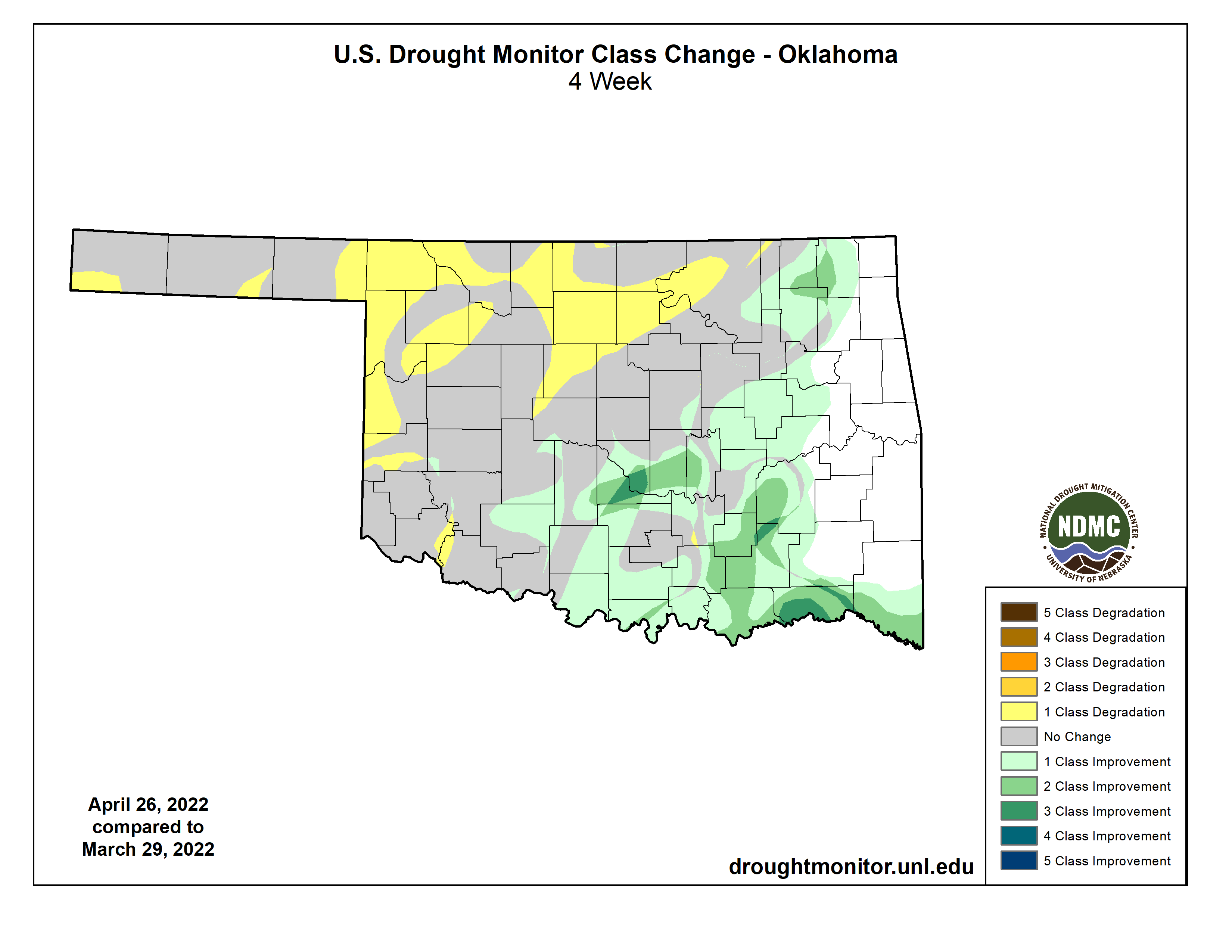
Despite the rain that fell across western OK last night, and possibly again
today, tomorrow's storm system will once again bring a dryline into central
OK. While that might fire off some big storms later tomorrow, it will also place
western OK behind the dryline again with strong SW winds, plummeting humidity
(it's called a DRYline!), summer temps, and that vegetation will not have greened
up in a single day (and most folks missed on the rain anyway). The western
third of the state will be a powder keg.

Ugh. I guess I picked the wrong week to stop sniffing chocolate donuts.
Gary McManus
State Climatologist
Oklahoma Mesonet
Oklahoma Climatological Survey
gmcmanus@mesonet.org
April 28 in Mesonet History
| Record | Value | Station | Year |
|---|---|---|---|
| Maximum Temperature | 98°F | ALTU | 2020 |
| Minimum Temperature | 27°F | BOIS | 2008 |
| Maximum Rainfall | 6.80 inches | MADI | 2006 |
Mesonet records begin in 1994.
Search by Date
If you're a bit off, don't worry, because just like horseshoes, “almost” counts on the Ticker website!