Ticker for April 27, 2022
MESONET TICKER ... MESONET TICKER ... MESONET TICKER ... MESONET TICKER ...
April 27, 2022 April 27, 2022 April 27, 2022 April 27, 2022
Hat weather
That dreaded cap. That layer of warm air above the surface that inhibits
convection (if that happens to you, consider more fiber) has killed a lot of good
storms this year. I don't mean good storms in the sense that they will bring
some amazing severe weather. No, more that they would bring some amazing RAINS!
Let's face it, you can't really get rain in the spring in Oklahoma without
convection most of the time, and given the factors at play due to our geography,
that means severe weather. Sure, our severe weather season thus far has been
pretty benign, but so has our rainfall!
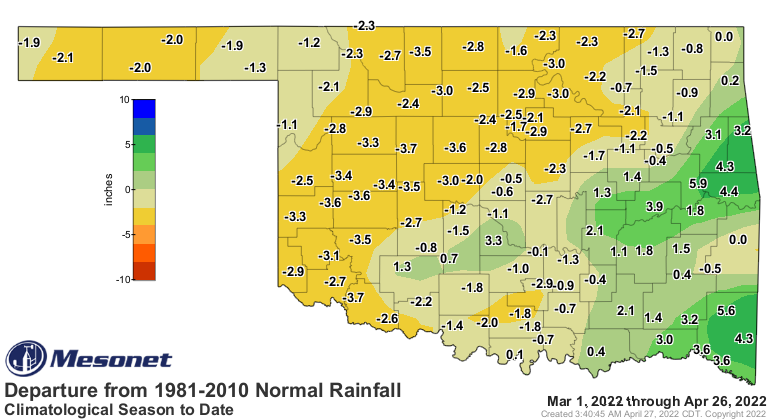
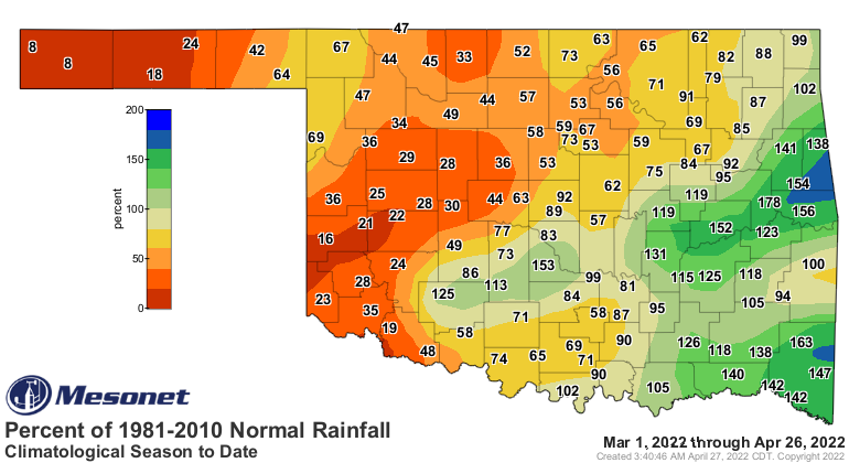
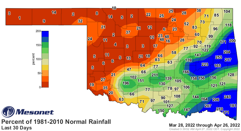
Just the last 30 days alone, the setup for good rains vs. crappy rains becomes
pretty evident as an I-44 phenomenon. I'd say that's probably because of this
persistent capping inversion, it takes more cold front action to generate convection
vs. our classical dryline storms (last Saturday notwithstanding). Imagine those
fronts coming through in their own classic sense oriented from SW to NE.
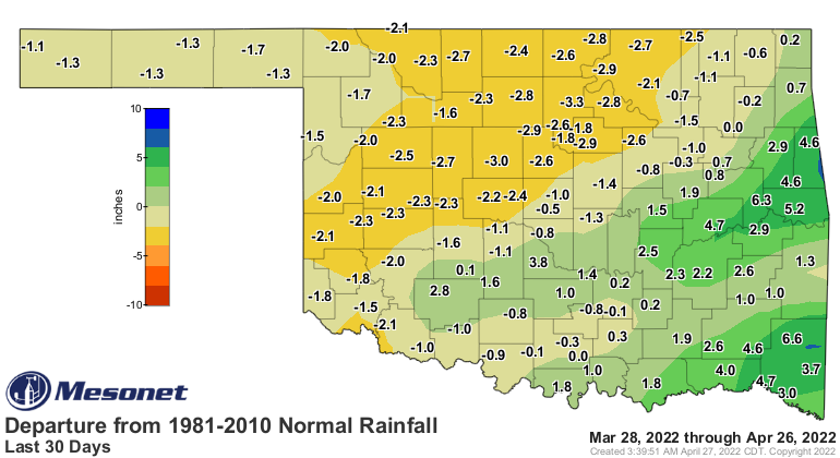
Well, it's a working theory. But that's the same setup we'll have for our next
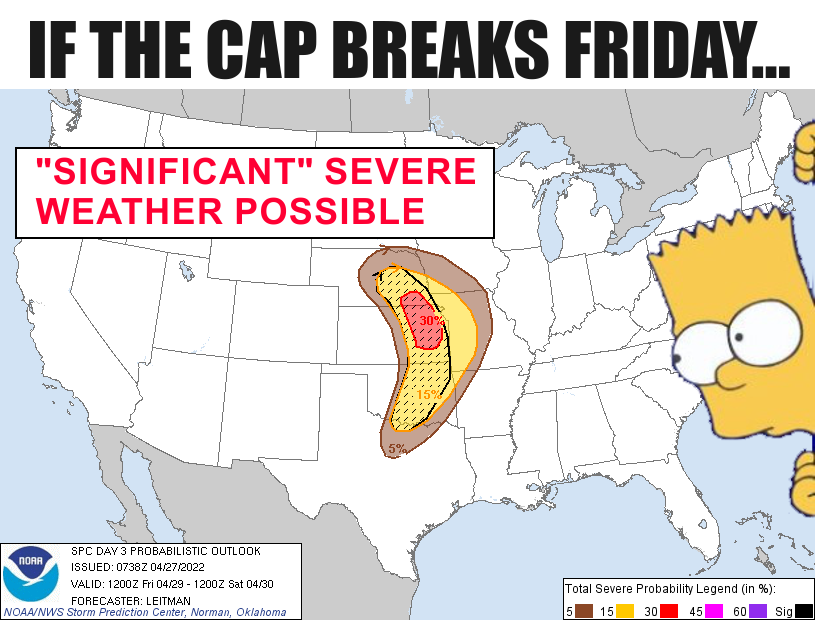
big chance of severe weather on Friday.
"Hey, there's a big capping inversion in place that will limit storms, BUT if
storms do form...well, watch out. All severe modes will be possible then."
The advice that is always best is to prepare for that cap to break. If it does,
then you're ready--as you can be for Oklahoma severe weather, at least. If it
doesn't, consider it practice for May when that cap won't always be there.
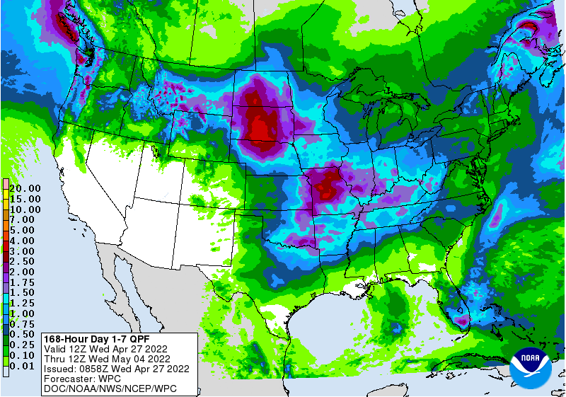
We also have a chance for storms tonight in the Panhandle and western OK, then
tomorrow again a bit farther west, then the central-through-eastern OK bit
on Friday.
Maybe.
Even so, we're not talking drought-busting rains here, but we don't need
drought-busting rains necessarily. Sure, it'd be nice; what we need is just
rain PERIOD out across western OK.

Our next good chance will come on Monday, which could bring us more substantial
rains across western and central OK.
So here's hoping for storms, but not too severe, if not severe at all, but we
need storms so severe is likely also needed, but not needed.
Ugh.
Gary McManus
State Climatologist
Oklahoma Mesonet
Oklahoma Climatological Survey
gmcmanus@mesonet.org
April 27 in Mesonet History
| Record | Value | Station | Year |
|---|---|---|---|
| Maximum Temperature | 96°F | GRA2 | 2012 |
| Minimum Temperature | 24°F | BOIS | 2008 |
| Maximum Rainfall | 5.85 inches | BLAC | 2024 |
Mesonet records begin in 1994.
Search by Date
If you're a bit off, don't worry, because just like horseshoes, “almost” counts on the Ticker website!