Ticker for April 25, 2022
MESONET TICKER ... MESONET TICKER ... MESONET TICKER ... MESONET TICKER ...
April 25, 2022 April 25, 2022 April 25, 2022 April 25, 2022
Which car you in?
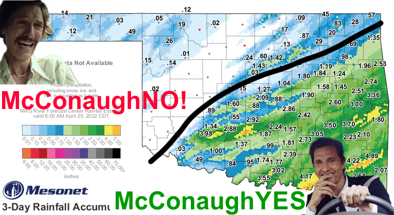
(Here is an uncluttered look at those totals).
Well, last week's (yeah, the stupid thing took a week to get here and clear out)
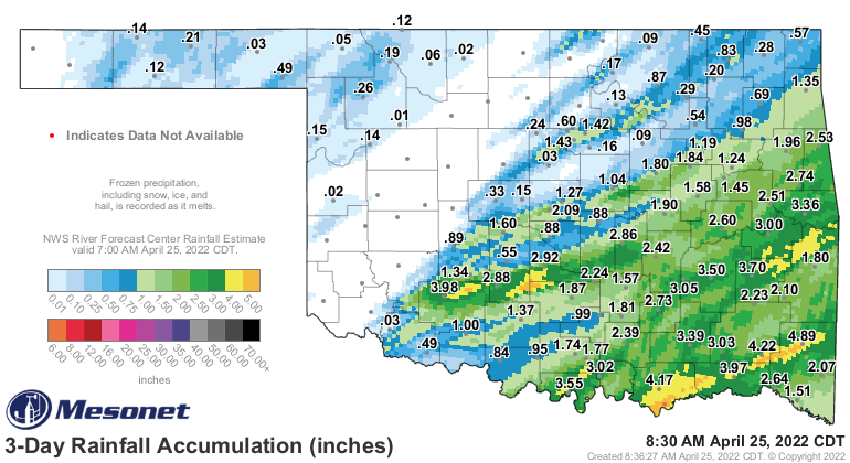
was everything it was promised to be: lots of rain across the SE half of the state,
lots of fire danger and little rainfall NW of there, some severe weather with large
hail and a few tornadoes, AND WIND! Always with the wind. It's like the line
in the morning at a Starbucks...it just keeps going and going. You don't believe
me? Go outside.
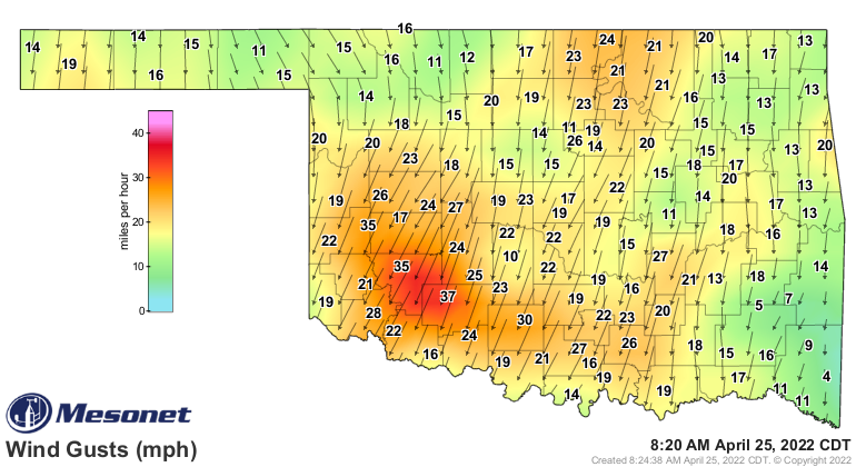
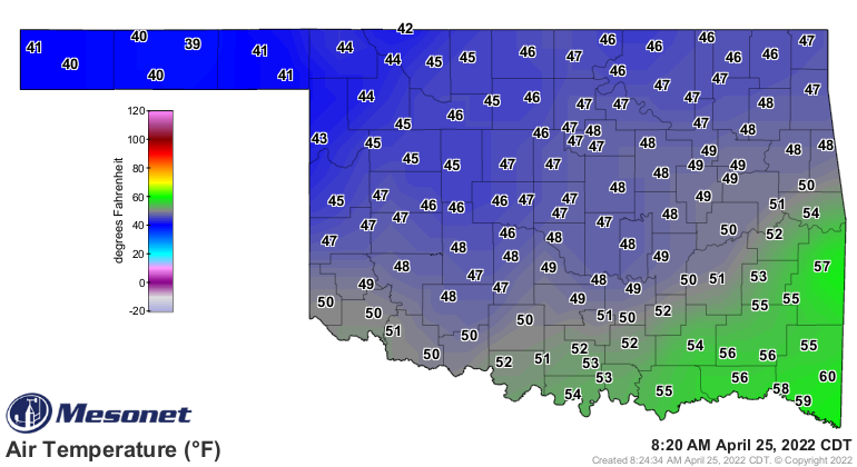
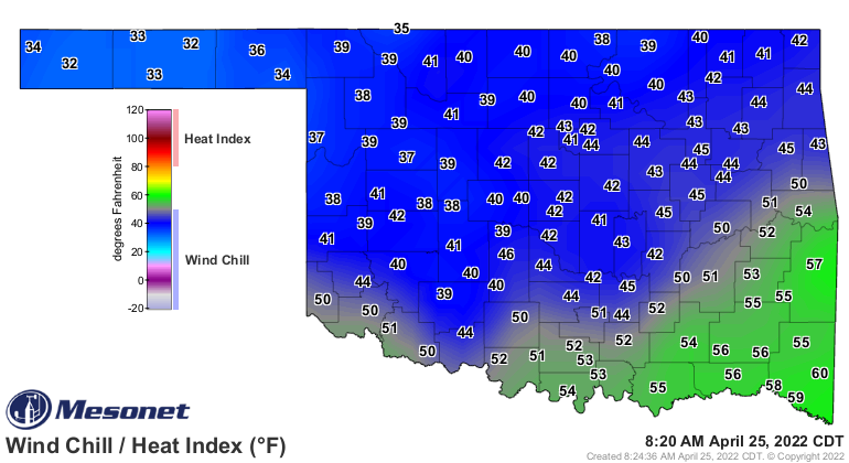
YEAH, IT'S WINDY AGAIN! Certainly nothing like what we saw for the last week.
Errrrr, I mean two months. But windy nevertheless; enough so that we have a rather
nasty wind chill going on.
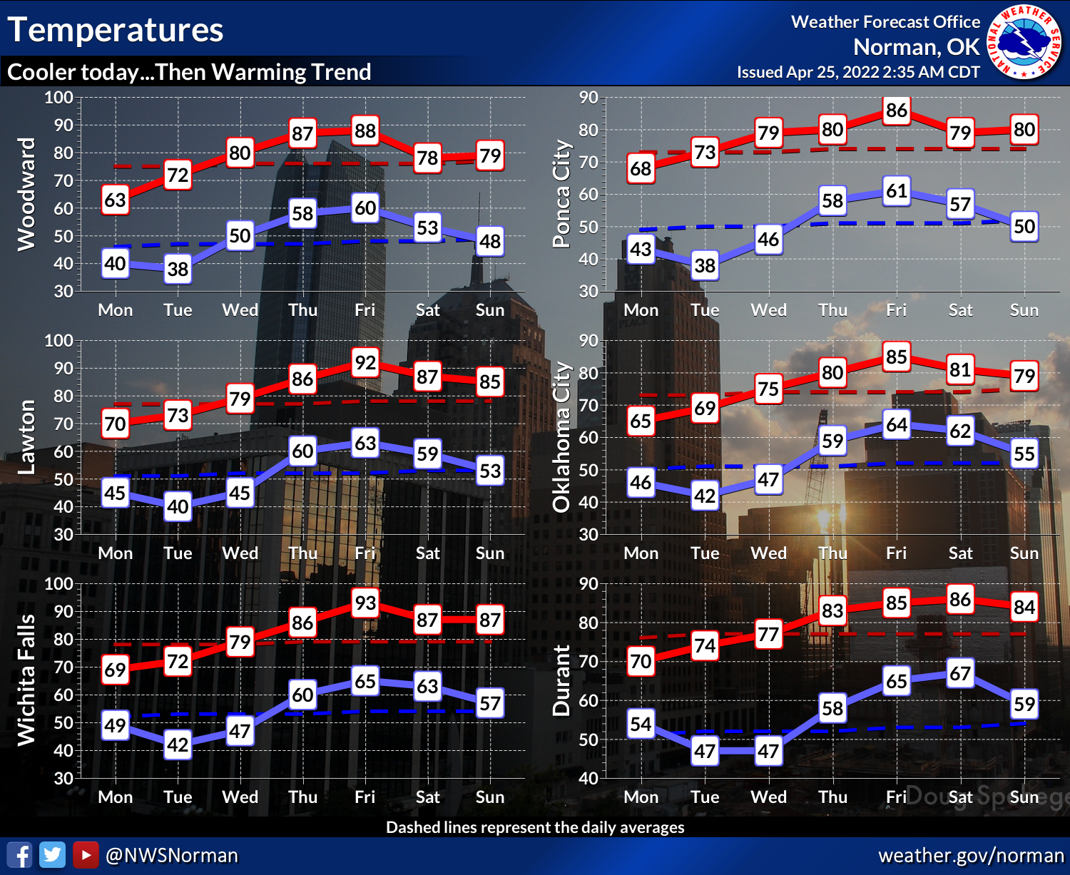
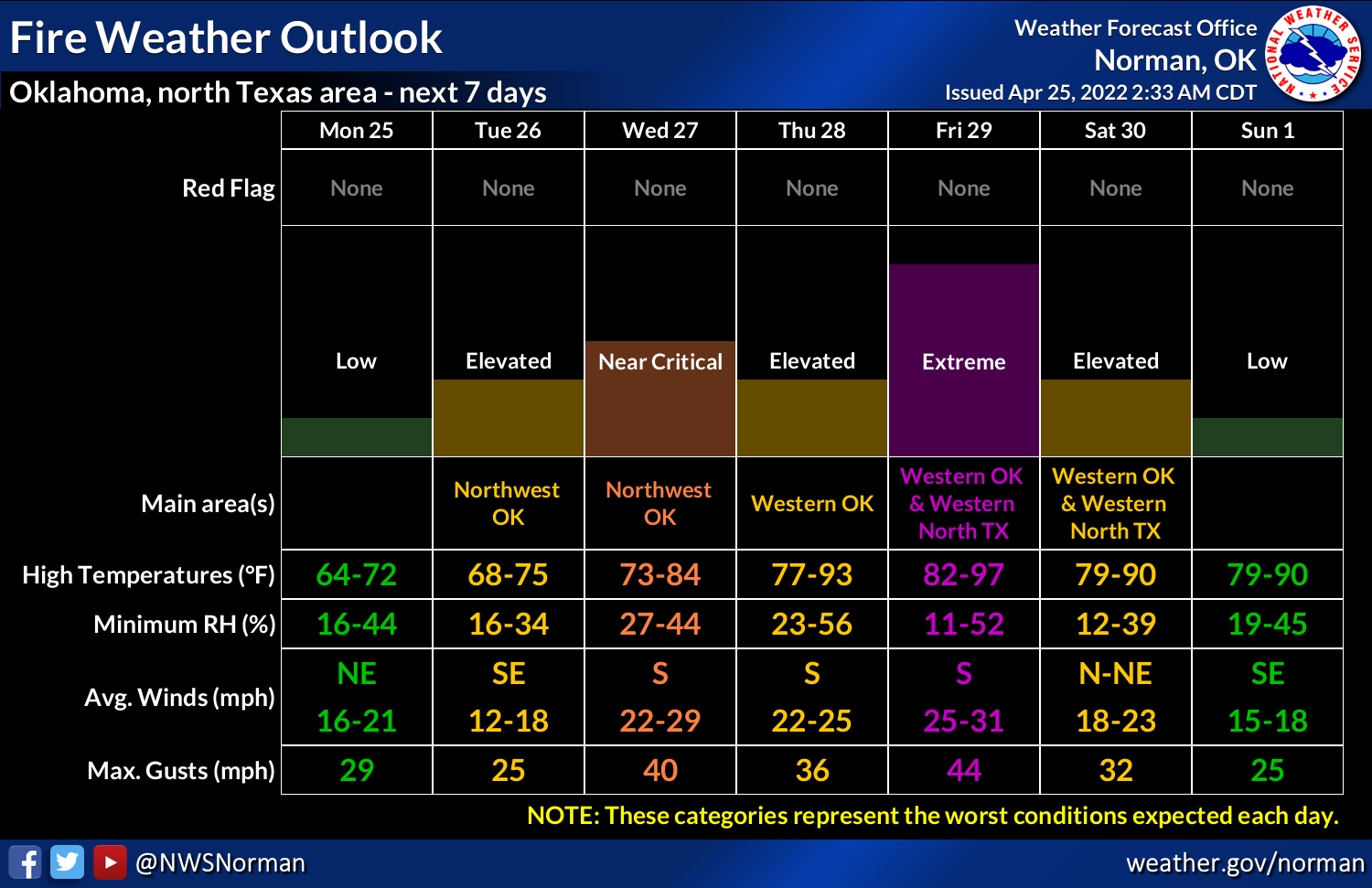
Okay, so here's what we have going this week: another warm up through the
weekend and another approaching storm system with rain/storm chances starting
on Wednesday lasting through the weekend, and more fire danger. These graphics
are for the NWS Norman forecast area, but let's just use them as a guide for
the whole state for the trends, if not the numbers themselves.
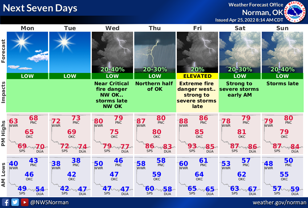
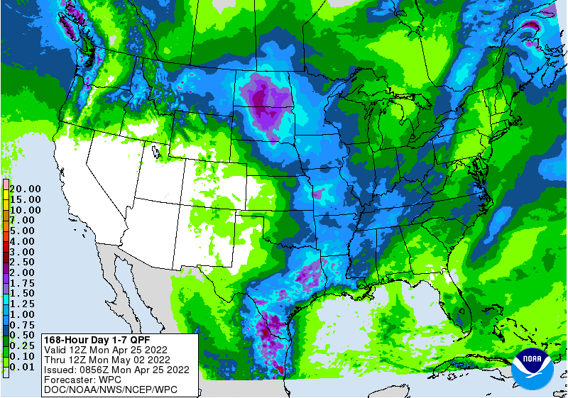
Rain totals with the upcoming storms appear as they usually have over the last
9 months or so, with western OK missing out mostly and eastern OK getting the
bulk of the precip.
The winds will be up over the week...sometimes higher, sometimes lower. How's
THAT for forecast that's almost impossible to be wrong? See...I'm learning!
Watch out for Friday. It would appear that's our next chance for some high-end
severe weather. A ways away as of now, of course, but always a good chance to
prepare. It may seem like we've had a pretty slow severe weather season, and
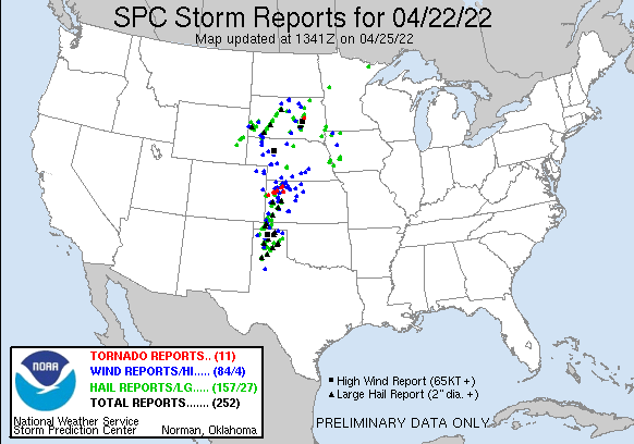
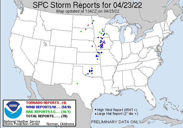
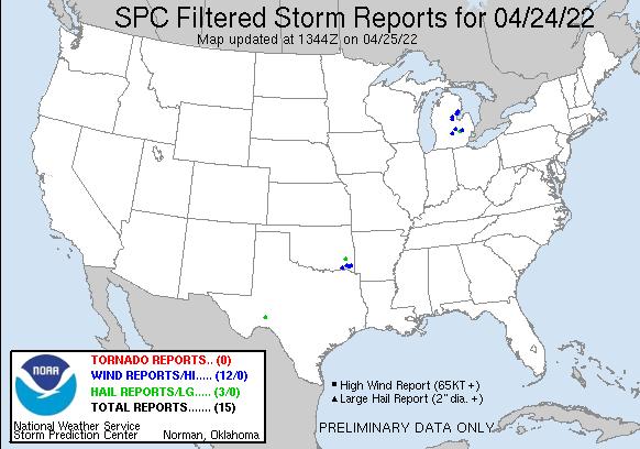
we probably have. The NWS says they've found at least two tornado paths from
this weekend, which would raise our total to 8 for the year thus far. But let
me say this...we were dangerously close to a major severe weather outbreak
on Saturday. We had scads (not oodles, but also not modicums...just scads) of
rotating supercells blasting up and down the I44 corridor and marching southeast.
We could have had a much worse situations had a couple of severe weather
ingredients been just a bit more potent.
As we take a look ahead at the May-July outlooks from the Climate Prediction
Center, well, I hate to do this to ya. Take solace that these things are
sometimes a shot in the dark. Or in this case, a shot to the crotch! BUT, there
is certainly hope that they end up a bit off.
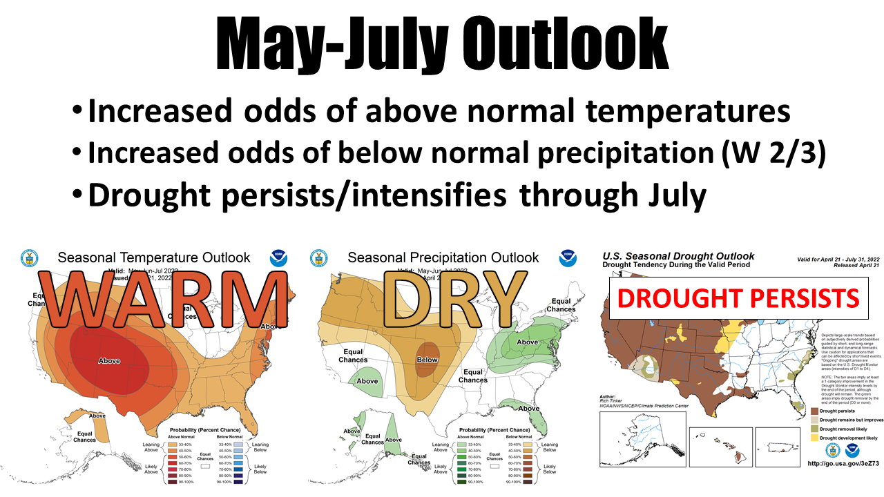
A lot of those outlooks are weighted towards our La Nina episode continuing
for the next few months, unfortunately, and also long-term trends and dynamical
model output.
They ain't good, but they ain't gospel, either. However, if they are even close
to being accurate, we have a long summer ahead for the western half of Oklahoma.
Gary McManus
State Climatologist
Oklahoma Mesonet
Oklahoma Climatological Survey
gmcmanus@mesonet.org
April 25 in Mesonet History
| Record | Value | Station | Year |
|---|---|---|---|
| Maximum Temperature | 105°F | ERIC | 2012 |
| Minimum Temperature | 28°F | BURN | 2013 |
| Maximum Rainfall | 4.84 inches | MEDF | 2009 |
Mesonet records begin in 1994.
Search by Date
If you're a bit off, don't worry, because just like horseshoes, “almost” counts on the Ticker website!