Ticker for April 1, 2022
MESONET TICKER ... MESONET TICKER ... MESONET TICKER ... MESONET TICKER ...
April 1, 2022 April 1, 2022 April 1, 2022 April 1, 2022
I see April
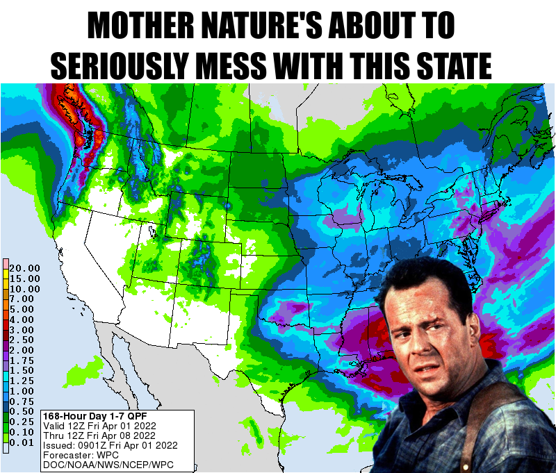
Well rats. Longtime Ticker readers know 2 things:
a) They're tired of reading the Ticker,
2) I don't know how to label lists, nor count,
III) My love of "Die Hard."
Now I don't love Die Hard when it's an arctic blast, like the past two
Februarys. Februaryes. Februaries. There we go. So we're gonna go forward
remembering Bruce Willis in his retirement as we loved him best, Officer John
McClane of the NYPD and LAPD (yes he did, remember Die Hard 2?). Too many great
roles to mention. We will just give him a Multi-pass on that.
Now as for the above graphic, not really THAT bad. We have a chance of rain
today, then again Sunday into Monday...maybe bleeding over into Tuesday. Maybe
some strong storms on Monday as well, but not looking too violent just yet,
which is a good thing. The best news is that it looks like winter is sliding
off once again, at least for 4 or 5 days at least. After a chilly start this
morning with lows once again below freezing or just above, looks like we'll
be up at least into the 60s and 70s for the next week or so.
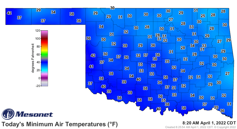
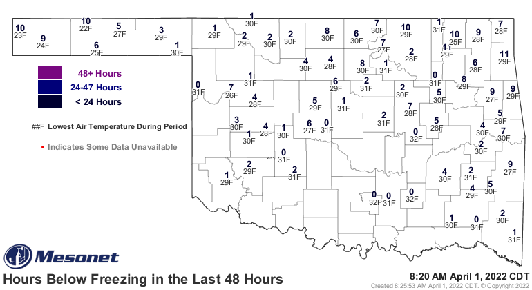
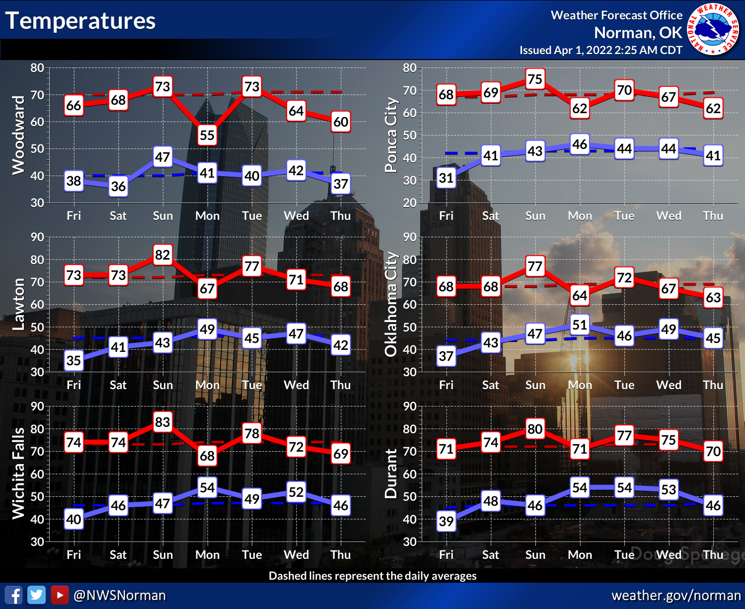
Now we say goodbye to March below in proper John McClane fashion.
Yippie Kay Yay, March!
----------------------------------------------------------------------------------
Variety Describes March Weather
Apr. 1, 2022
March’s weather ran the gamut of nearly all the hazards Oklahoma has to offer,
befitting a seasonal transition month in the Southern Plains. Winter got the
first crack with a blast of arctic air during the month’s second week.
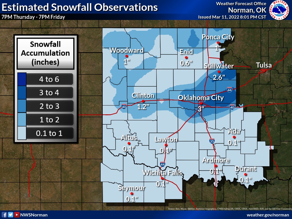
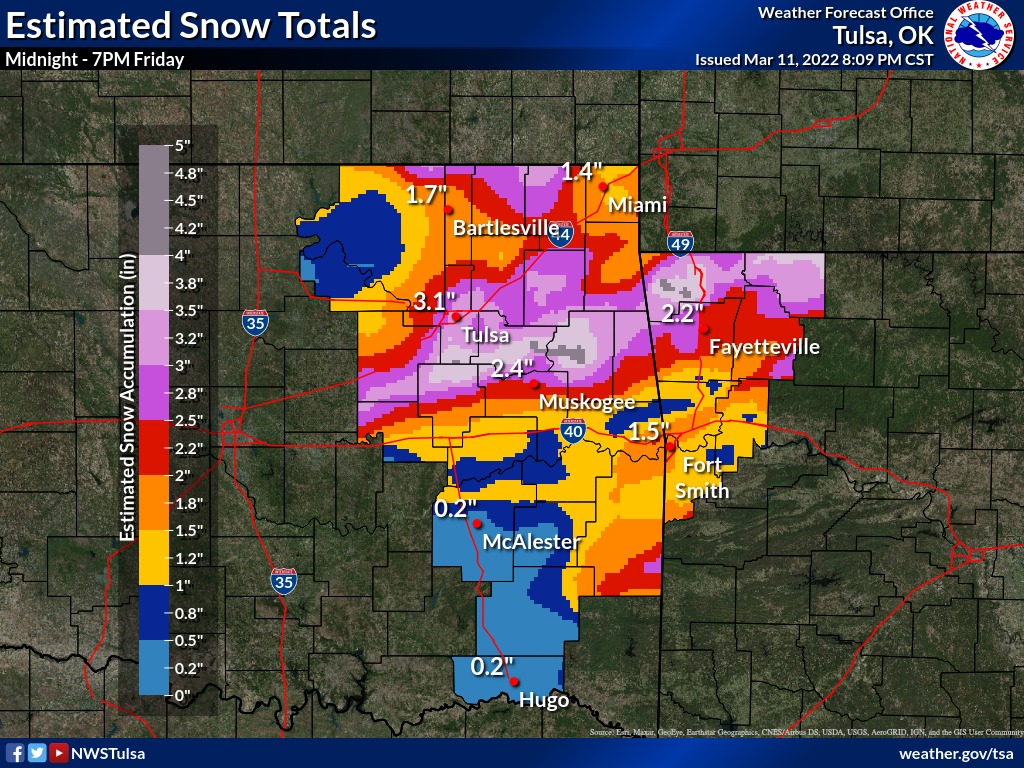
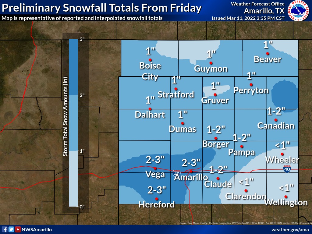
Temperatures plummeted and a storm system blanketed the northern half of the
state with 2-3 inches of snow. The frozen weather resulted in numerous traffic
accidents and closed many businesses and schools.
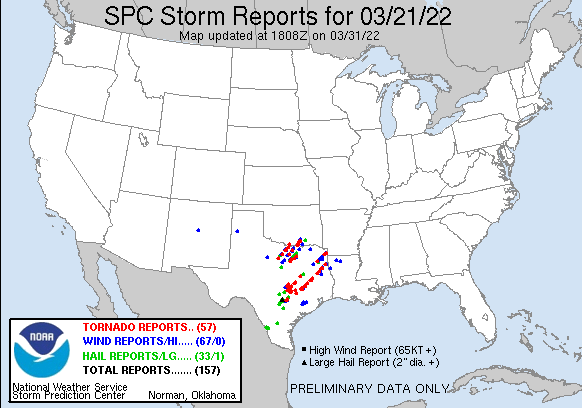
Spring took its turn with at least three tornadoes rumbling out of Texas across
Love, Marshall, and Johnston counties on March 21. The twisters produced
significant damage in and around the Kingston and Lake Texoma area, destroying
homes and knocking out power to nearly 10,000 customers. Several injuries were
reported with the storms, and one fatality occurred across the state line in
Texas. One of the tornadoes was rated as an EF2 by National Weather Service
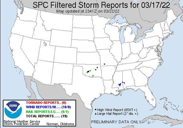
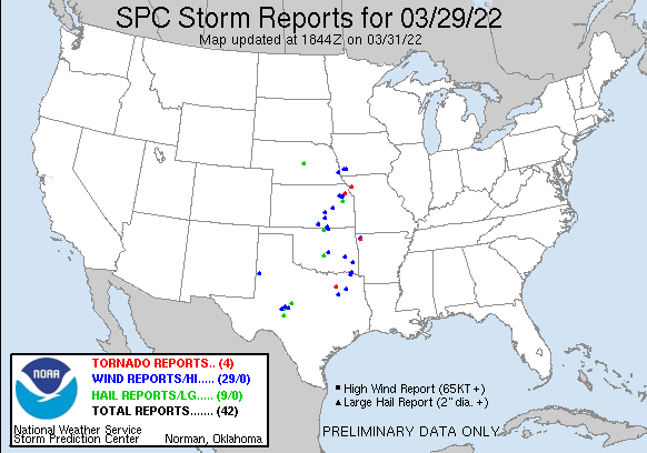
personnel that surveyed the damage. Other severe storms occurred on March 17
and 29 with scattered reports of large hail and high winds.
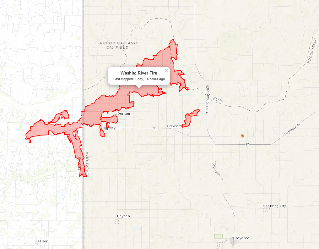
Fire danger was a common occurrence throughout the month, a result of the
continued dry conditions. Several large fires burned out of control during the
last week of March, including the Washita River fire that spread from the Texas
Panhandle into Roger Mills County in Oklahoma. The fire, which was still not
contained at month’s end, burned nearly 40,000 acres and at least eight
structures.
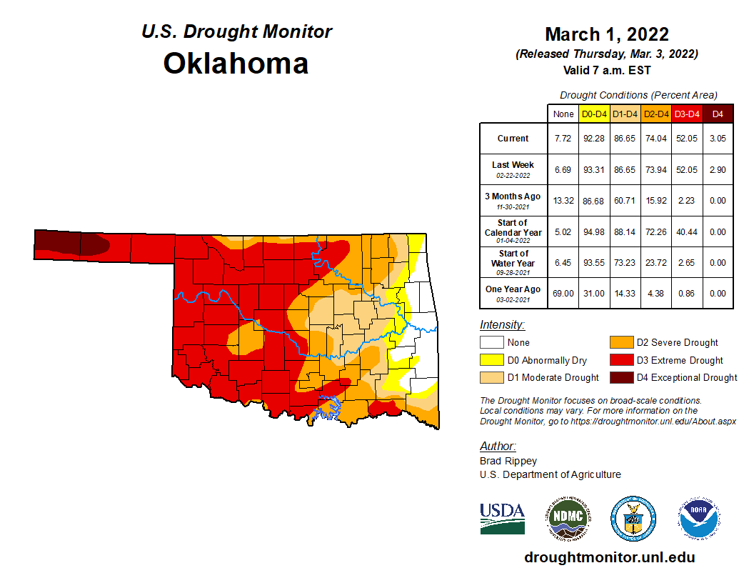
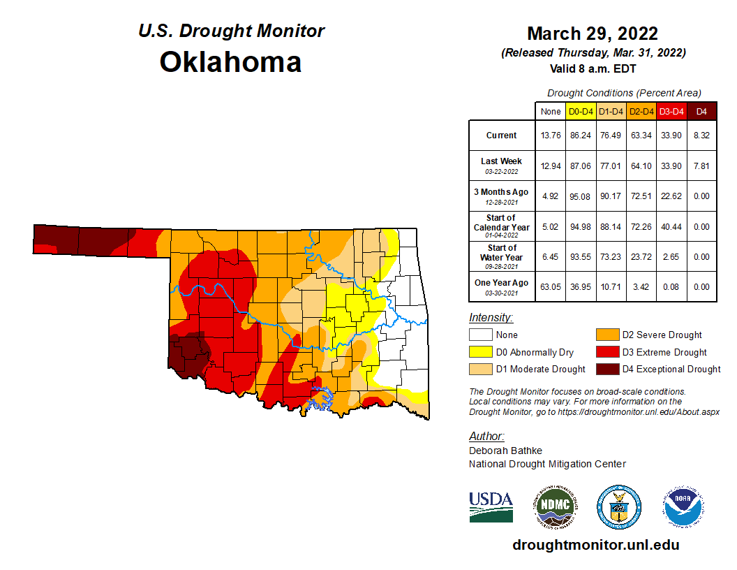
The ongoing drought was a constant backdrop to the other weather hazards. Dry
conditions that began late in the summer of 2021 were somewhat alleviated by
the rain and snow during March. Coverage of the drought dropped through the
month from 87 percent at the end of February to 76 percent at the end of March
according to the U.S. Drought Monitor. The most intense areas of
drought—extreme and exceptional—dropped from 52 to 34 percent over that time.
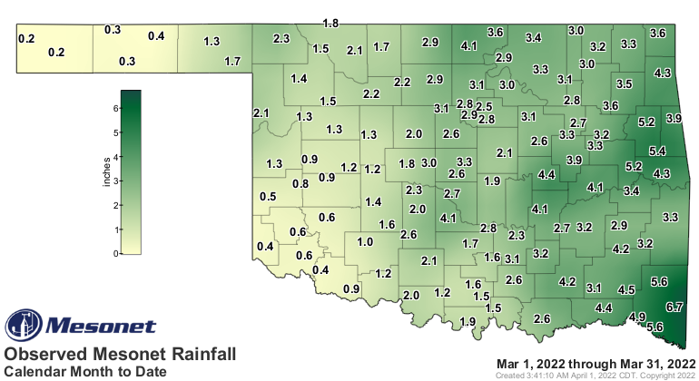
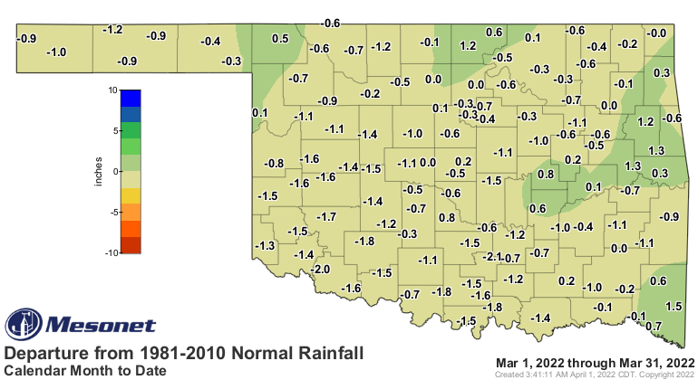
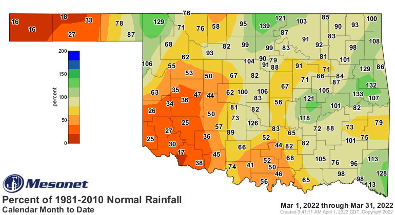
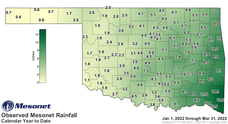
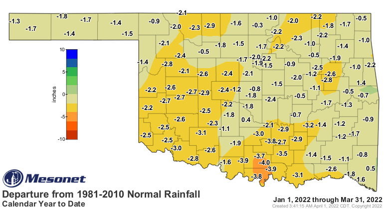
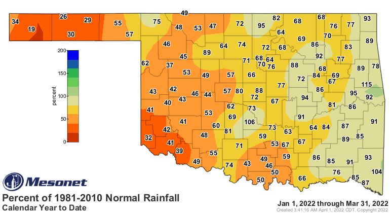
According to preliminary data from the Oklahoma Mesonet, the statewide average
precipitation total finished at 2.45 inches for the month, 0.33 inches below
normal and ranked as the 60th wettest March since records began in 1895. Totals
ranged from 6.73 inches at Broken Bow to 0.17 inches at Kenton. While deficits
were not terribly large, generally ranging from 0.5 to 1.5 inches, they were
still prevalent across much of the state. Conditions were much drier in far
southwestern Oklahoma and the western Panhandle, and wetter in the northern and
eastern sections of the state. Fifteen of the Mesonet’s 120 sites recorded less
than an inch for the month, and another 27 had less than 2 inches. Eighteen
stations reported 4 inches or more. The first three months of the year were
1.42 inches below normal with a statewide average of 4.62 inches—the 45th
driest January through March period on record.
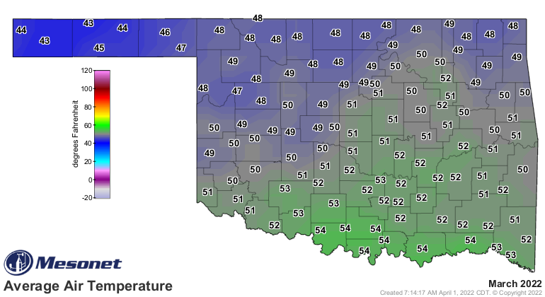
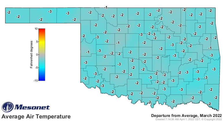
Several winter intrusions inched the month to the cool side of normal. The
statewide average temperature was 50 degrees, 1.2 degrees below normal and
ranked as the 59th warmest March since records began in 1895. Temperatures
across the state ranged from 94 degrees at Hollis on the 29th to 7 degrees at
Eva on the 12th. Wind chill values dropped below zero in the Panhandle on
several days, the lowest of which was Eva’s minus 7 degrees on the 12th. The
first three months of the year were 2.1 degrees below normal with a statewide
average of 41.9 degrees, the 56th coolest such period on record.
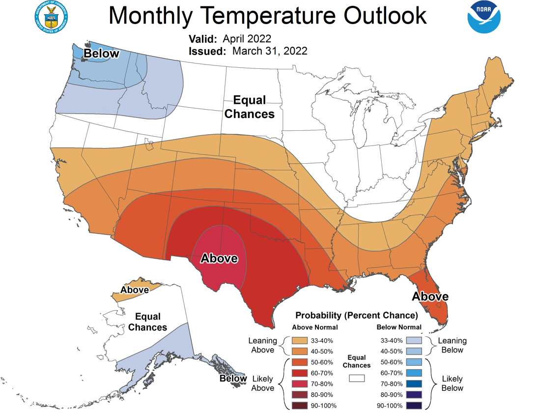
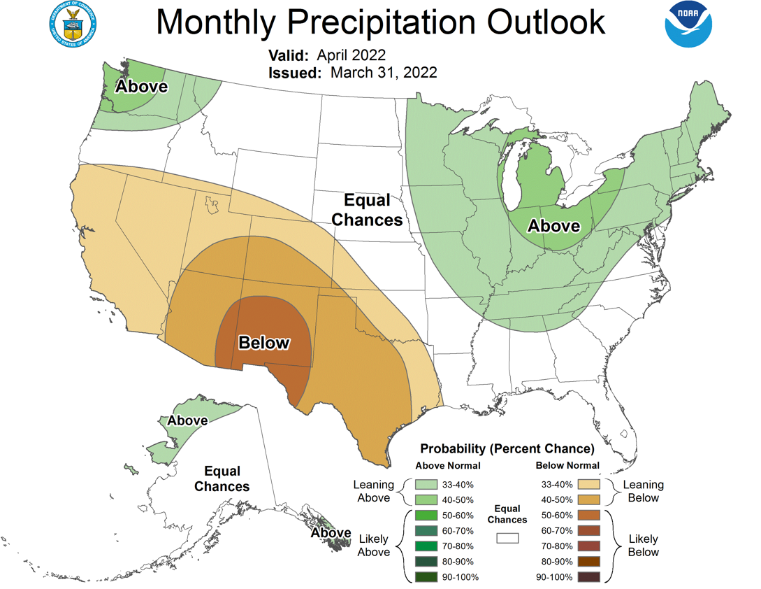
The Climate Prediction Center’s temperature and precipitation outlooks for
April do not give much hope for drought relief through the next month. The
outlooks show increased odds of above normal temperatures for the entire state,
and below normal precipitation for the southwestern two-thirds of Oklahoma.
Those odds are enhanced across far southwestern Oklahoma and the western
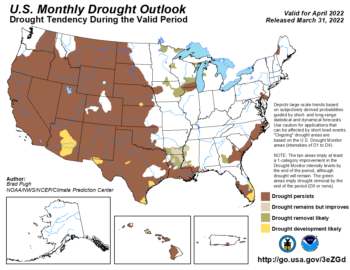
Panhandle for precipitation, and again in the southwest for temperature. CPC’s
April drought outlook shows persistence or intensification during the month
where drought already exists, but no new development is expected. The
possibility of blowing dust across western Oklahoma due to the dry conditions
is also mentioned.
Gary McManus
State Climatologist
Oklahoma Mesonet
Oklahoma Climatological Survey
gmcmanus@mesonet.org
April 1 in Mesonet History
| Record | Value | Station | Year |
|---|---|---|---|
| Maximum Temperature | 98°F | ALTU | 2012 |
| Minimum Temperature | 19°F | EVAX | 2023 |
| Maximum Rainfall | 2.57 inches | TIPT | 2006 |
Mesonet records begin in 1994.
Search by Date
If you're a bit off, don't worry, because just like horseshoes, “almost” counts on the Ticker website!