Ticker for April 4, 2022
MESONET TICKER ... MESONET TICKER ... MESONET TICKER ... MESONET TICKER ...
April 4, 2022 April 4, 2022 April 4, 2022 April 4, 2022
Moolti-fire
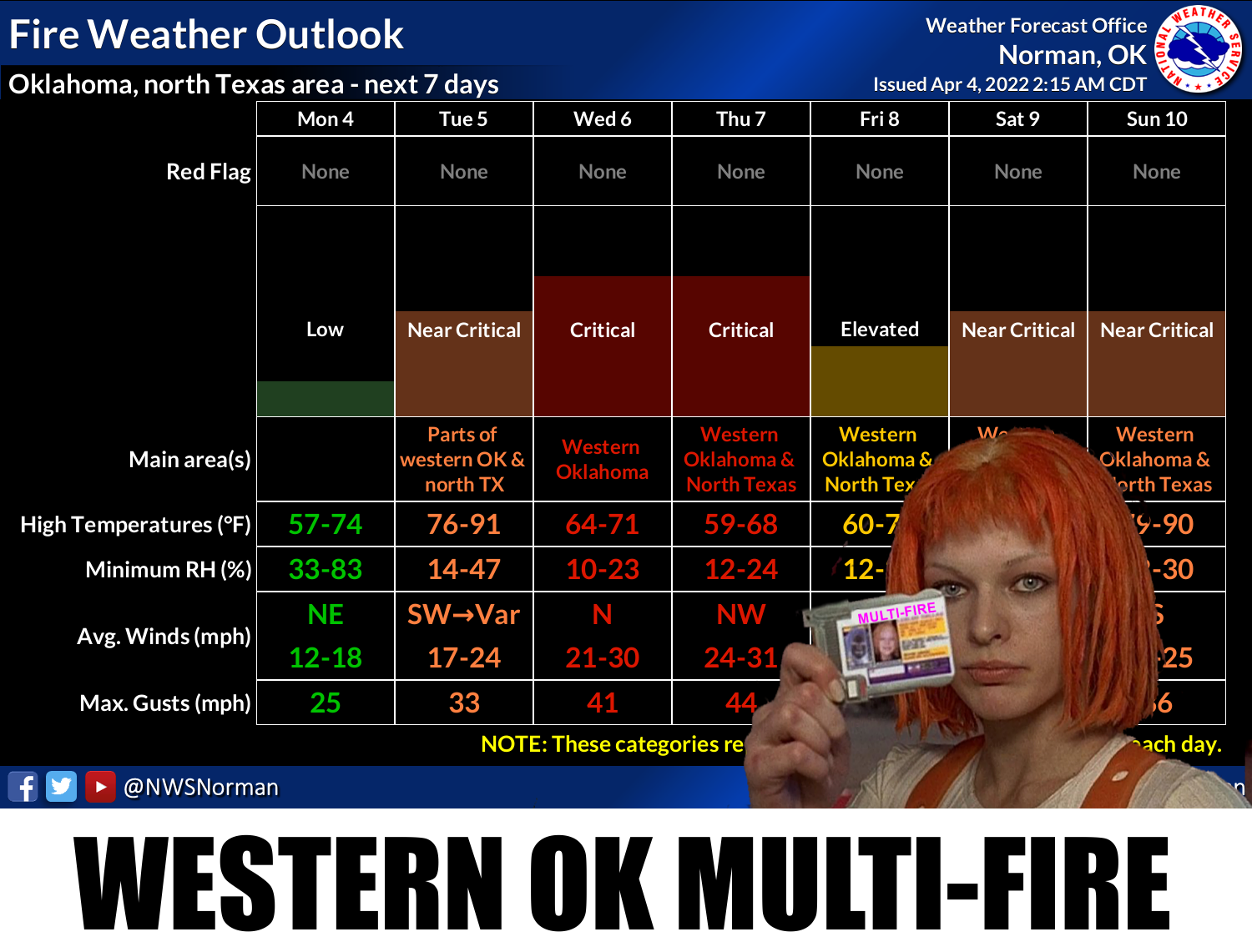
On a side note, which is strange because I haven't even written the MAIN note
yet, but you realize I get paid to write this stuff? I know, right??
So you went into the week with thunder and rain and you thought "Oh, here we go
with a gray, wet week across Oklahoma." Well, enjoy it today because after that
we kick up the Southern Plains wind machine (insert your favorite political joke
here) and dry things out. For much of the eastern two-thirds of the state, we
have had enough wetting and just enough greening up of the vegetation to limit
some of that fire danger. For the western third of the store or so, however, things
are going to be pretty dire. Don't just take it from Leeloo (her friends call her
Leeloo, you folks can call her Leeloominaï Lekatariba Lamina-Tchaï Ekbat De Sebat)
and our NWS Norman friends above (their friends call them NWS Norman, you folks
can call them, uhhh, NWS Norman)...get it straight from the OK Forestry Services'
mouth:
There is strong potential for a very active period of wildfire activity
in western Oklahoma this week. Rain and storms moving over parts of
Oklahoma last night and this morning coupled with additional chances
this evening extending from southwestern Oklahoma into Central and all
of eastern Oklahoma are poised to provide some moisture improving both
live and dead fuel moisture values in central and eastern Oklahoma.
Energy Release Component values across western Oklahoma improved a bit
with a late-week rain although the strength of fire weather over
predominantly dormant fuels in western Oklahoma will drive increasing
ERC values as well as potential for high-severity wildfires in the
Oklahoma Panhandle, northwestern and western Oklahoma.
Yikes! So there will probably be increased fire danger over much of the state,
at least "elevated," but severe to critical values out west through pretty much
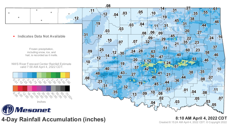
the rest of the week. You can see where that rainfall has helped just the last
few days.
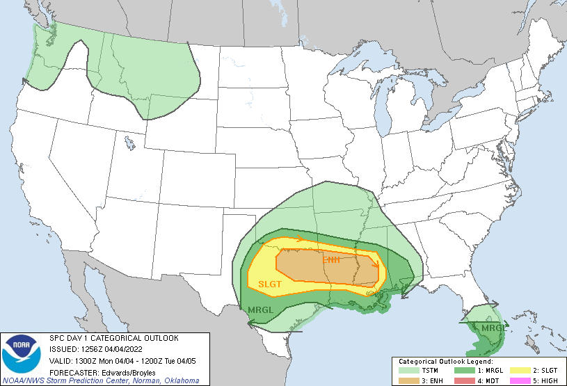
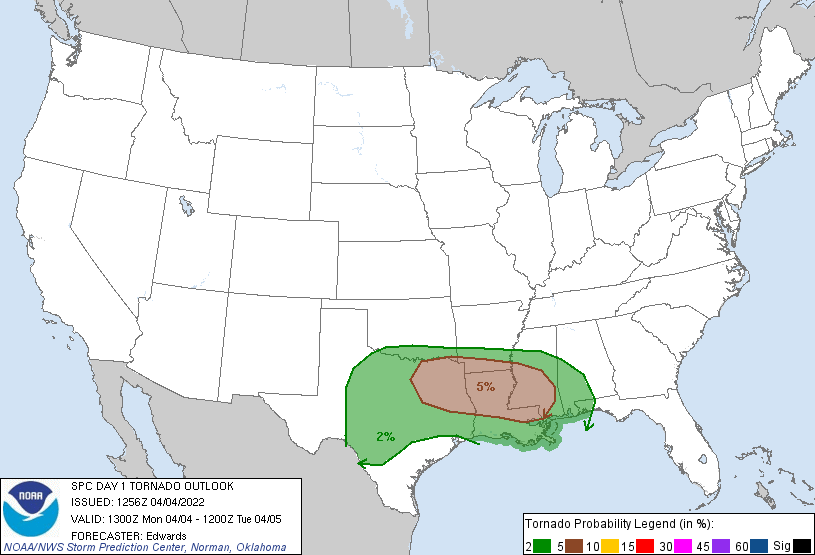
So that's the main weather concern for this week, except for today where we have
a chance of strong storms down in southern OK. Nothing too bad, as it looks now,
but just something to be aware of. The worst of it looks to be down into Texas.
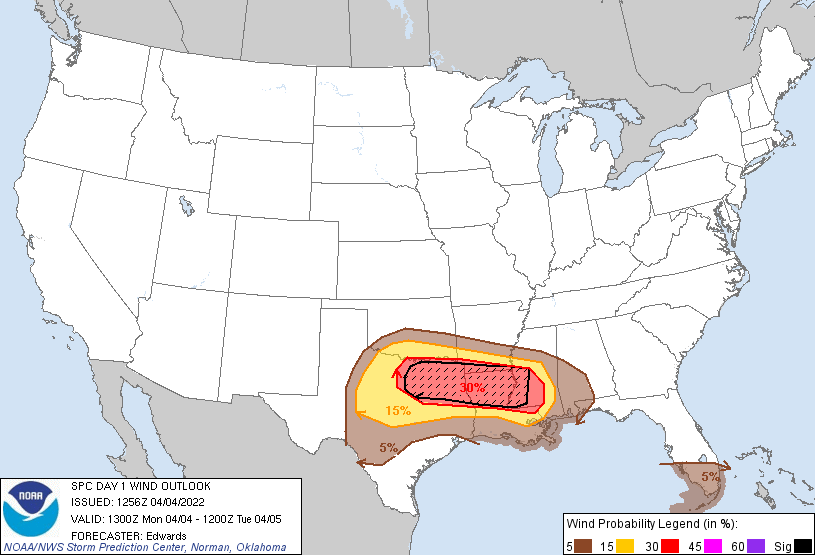
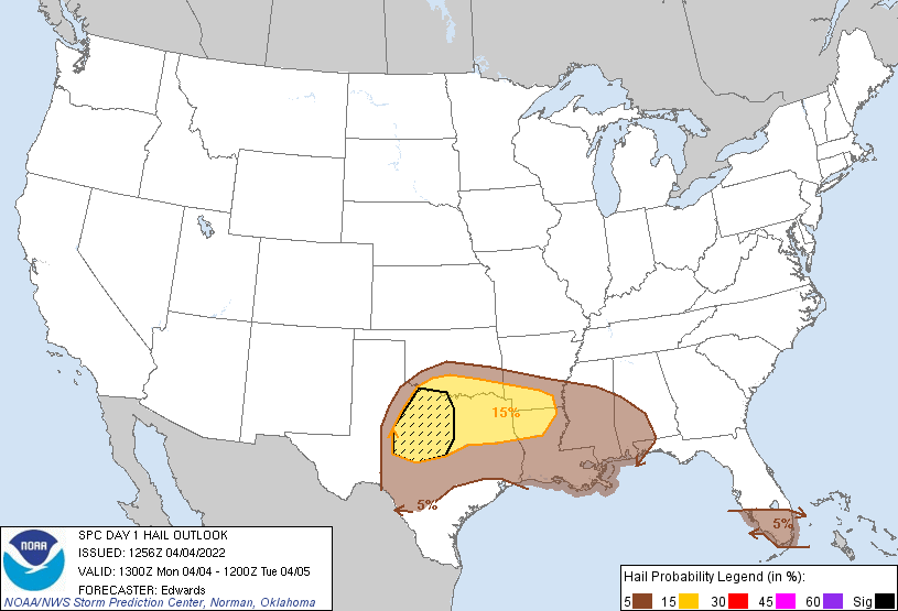
There will also be the risk of some flooding with some of the heavier rain
amounts.
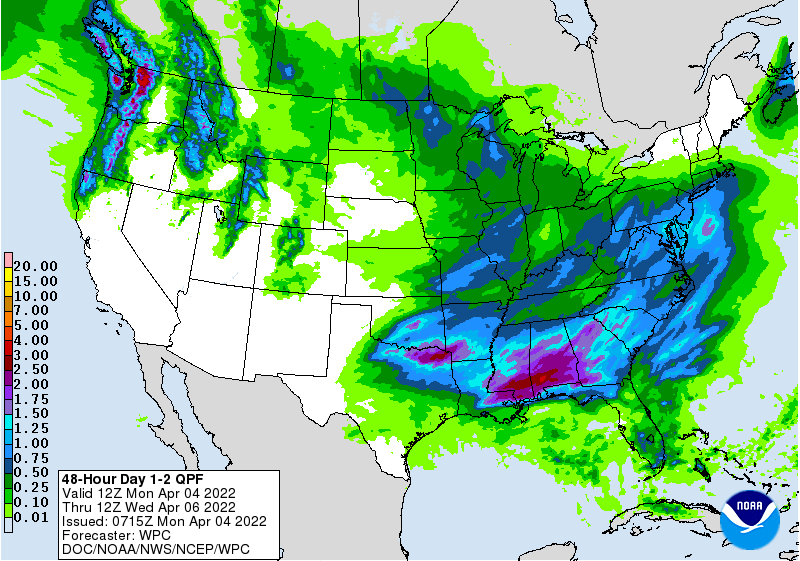
Ugh, still way too dry out across western OK. That will not help either the
drought situation or the wildfire danger.
There may be some "unsettled" weather headed out way later into the month with
a big trough sliding down into the SW US. That's still a long way away, of
course, but you know that bigtime severe weather is coming eventually. BEFORE
that, however, look for temperatures to really kick up this weekend, and also
the moisture return from the Gulf.
We'll have to wait and see with that trough if this means a BIG BADA BOOM!
Gary McManus
State Climatologist
Oklahoma Mesonet
Oklahoma Climatological Survey
gmcmanus@mesonet.org
April 4 in Mesonet History
| Record | Value | Station | Year |
|---|---|---|---|
| Maximum Temperature | 94°F | ALTU | 2023 |
| Minimum Temperature | 16°F | BUFF | 2018 |
| Maximum Rainfall | 4.31 inches | TALI | 2025 |
Mesonet records begin in 1994.
Search by Date
If you're a bit off, don't worry, because just like horseshoes, “almost” counts on the Ticker website!