Ticker for March 29, 2022
MESONET TICKER ... MESONET TICKER ... MESONET TICKER ... MESONET TICKER ...
March 29, 2022 March 29, 2022 March 29, 2022 March 29, 2022
Twister tale
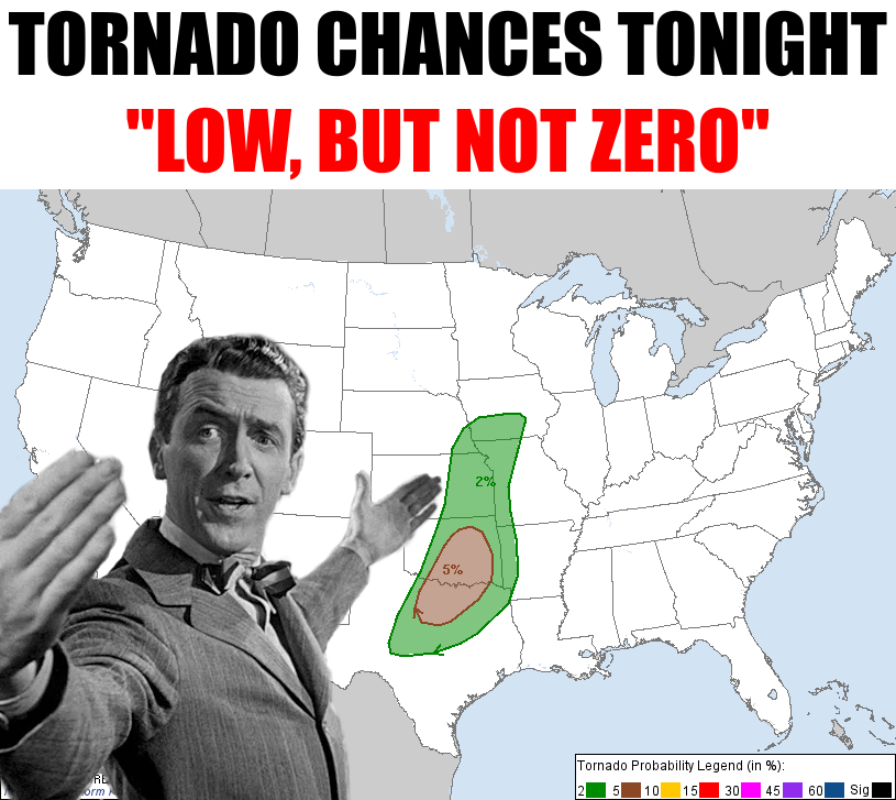
The exaggerated tornado threat old George Bailey is bragging about there on the
map should only serve as a reminder to remain weather aware not only tonight,
when the actual severe storm dangers arise, but throughout the afternoon as well.
The severe threat is probably secondary today, as a matter of fact, although there
is some conditional tornadic threat above and beyond the chance for small QLCS
spin ups as the storms possibly line out tonight. So "if this happens and this
occurs then this might also occur and then we might have some added supercellular
activity..." type of stuff, per the SPC.
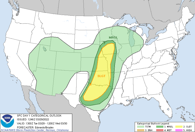
A window of opportunity for embedded supercells and
mesovortices to become tornadic may exist over parts of north TX and
OK this evening as the main convective band impinges on a moistening
boundary-layer plume while:
1. Effective inflow-layer parcels are still surface-based, and
2. A LLJ-enlarged low-level hodograph fosters favorable helicity in
the boundary layer.
How about we NOT foster favorable helicity, mmmkay? Hey, remember back in the late
1990s when that TV show "Helicity" was really popular, but then the star cut her
hair and it plummeted in the ratings and was quickly canceled? Anyone? Well,
that's the way I remember it.
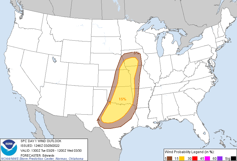
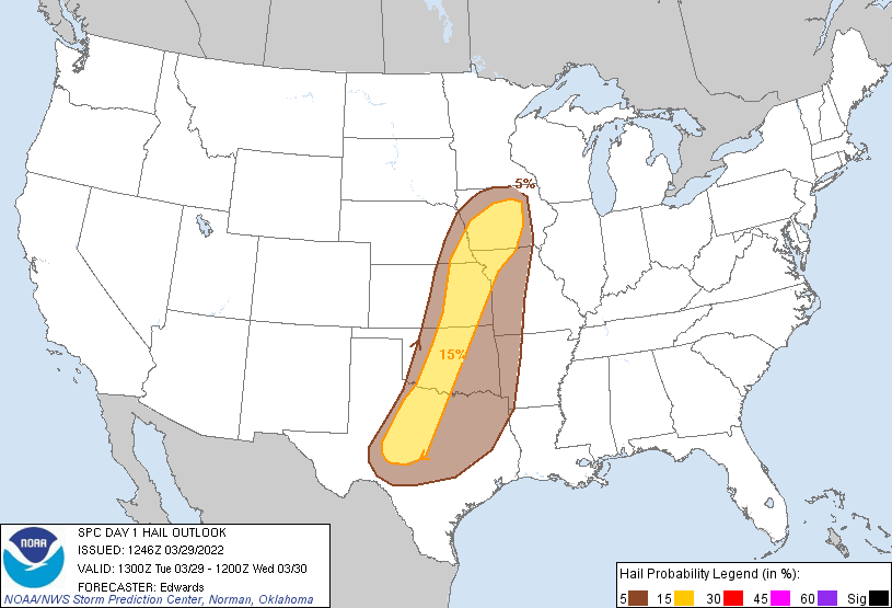
At any rate, there will be a better chance, although still not that great, of
some large hail and high winds with this line of storms as it marches through
the state later tonight into the overnight hours.
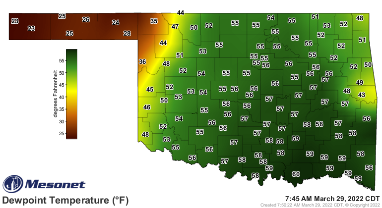
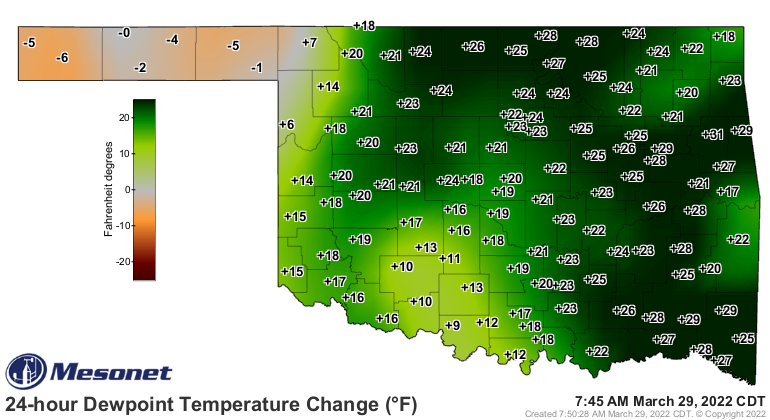
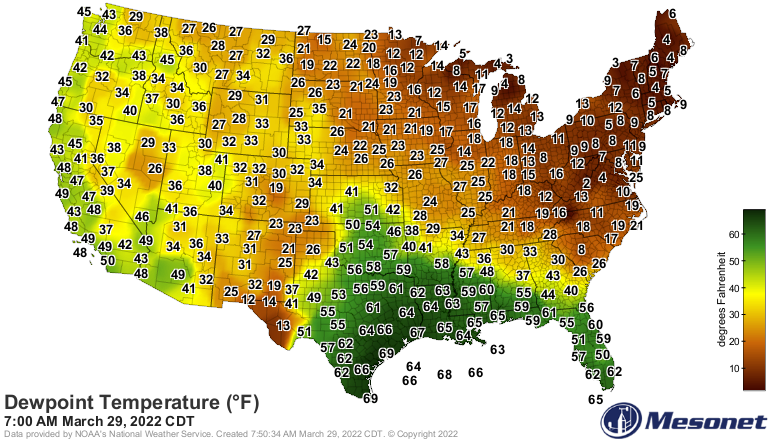
The fuel, as in moisture, needed for these storms tonight is streaming back to
the north from the Gulf of Mexico on strong southerly winds. By tonight, we
should see some 60s dewpoints up into southern OK, at least, and that dryline
will sharpen up throughout the day.
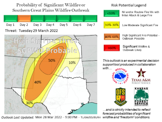
The real danger today could be wildfire danger, with critical levels showing up
on the SPC's fire danger map today.
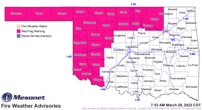
From the OK Forestry Service's Fire Sit-Rep today:
Today: As a dryline moves into western Oklahoma, critical fire weather
will develop over dormant fuels that have exhibited tendency to
transition quickly into problematic fire behavior (torching/spotting)
and occasional periods of extreme fire behavior (rapid rates
if spread, mir-range spotting and short crown runs). Within the Warned
Area, the highest probability of significant fire occurrence will
develop in northwestern Oklahoma and the eastern Oklahoma Panhandle.
Within the domain illustrated in the probability graphic
to the right, a wildfire outbreak is probable. Fire behavior will
prove resistant to control with heightened suppression difficulty.
Emergency Managers and local law enforcement should be prepared to
facilitate evacuations should fire occurrence populated areas.
Winds will be off the charts today across much of the western half of the state,
and that usually extends over into Osage County as well. No, I don't know why.
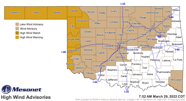
Those winds will be gusting 45-60 mph through much of the day. For those with
hair in central and eastern OK, you'll be getting the double-whammy of high
humidity AND wind. So ha ha, hair havers!
Wait...
Gary McManus
State Climatologist
Oklahoma Mesonet
Oklahoma Climatological Survey
gmcmanus@mesonet.org
March 29 in Mesonet History
| Record | Value | Station | Year |
|---|---|---|---|
| Maximum Temperature | 94°F | HOLL | 2022 |
| Minimum Temperature | 16°F | BOIS | 2009 |
| Maximum Rainfall | 2.93 inches | WATO | 2007 |
Mesonet records begin in 1994.
Search by Date
If you're a bit off, don't worry, because just like horseshoes, “almost” counts on the Ticker website!