Ticker for March 28, 2022
MESONET TICKER ... MESONET TICKER ... MESONET TICKER ... MESONET TICKER ...
March 28, 2022 March 28, 2022 March 28, 2022 March 28, 2022
Say hello
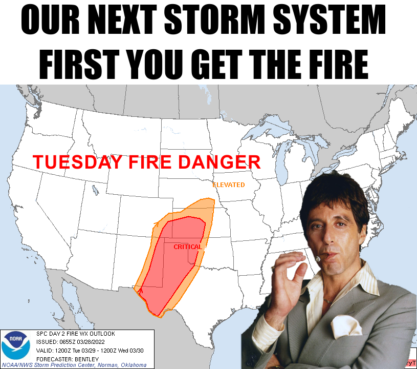
Let's see...first you get the low pressure, then you get the dryline, then you
get the cold front, then you get the fire danger, then you get the storms, then
you get the hail, winds, and tornadoes, then you get the winter.
No wait, let's try that again: low pressure, dryline, fire danger, cold front,
storms...
Low pressure, dryline, fire danger, storms, cold front, MORE storms...
Okay, you get the picture. Maybe I should have just led with this:
SAY HELLO TO MY LITTLE STORM SYSTEM!
Age old story for March around these parts, we'll have big fire danger today and
tomorrow as the winds kick up from the southwest and low humidity settles in
during the heat of the day. Tomorrow looks to be the worst, but today is no
picnic either as temperatures on both days push close to 90 out west.
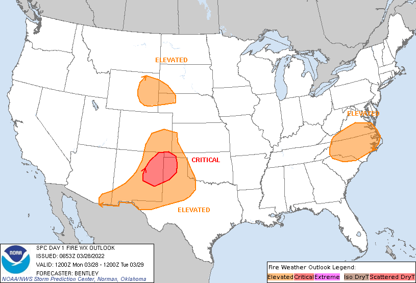
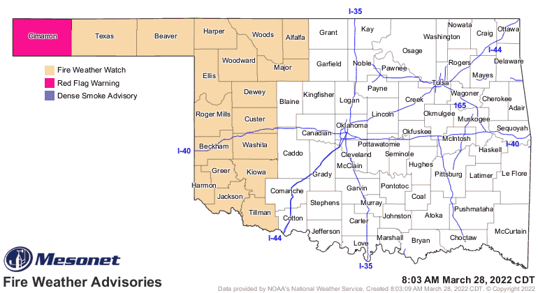
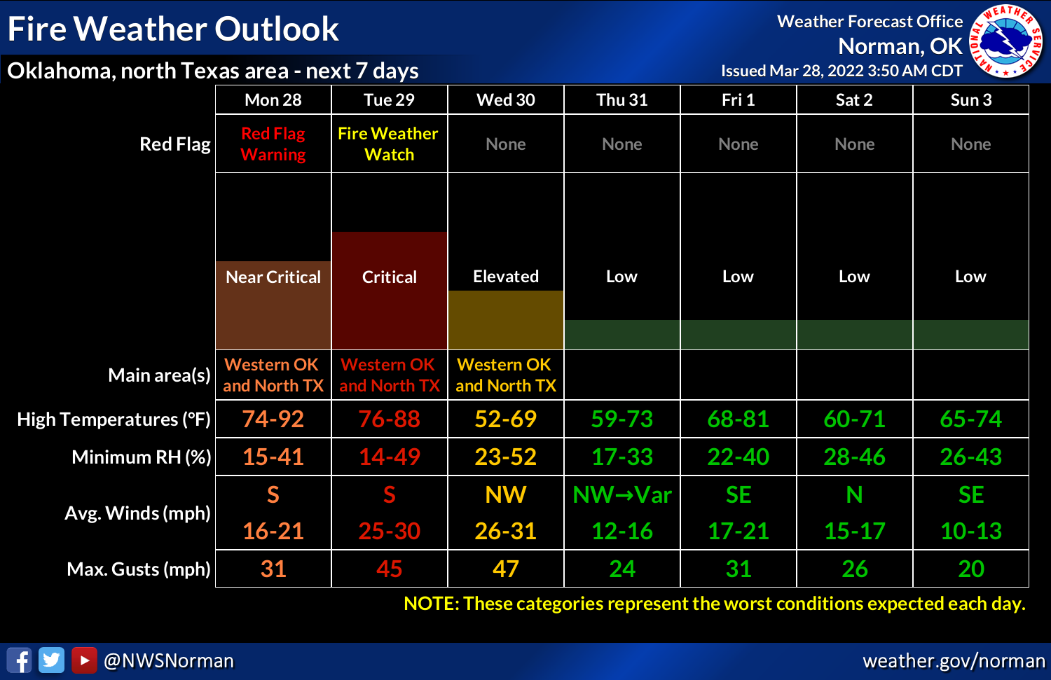
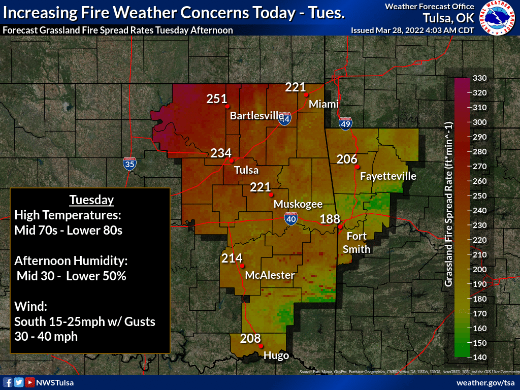
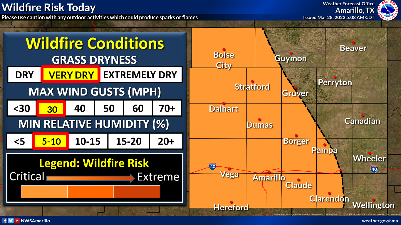
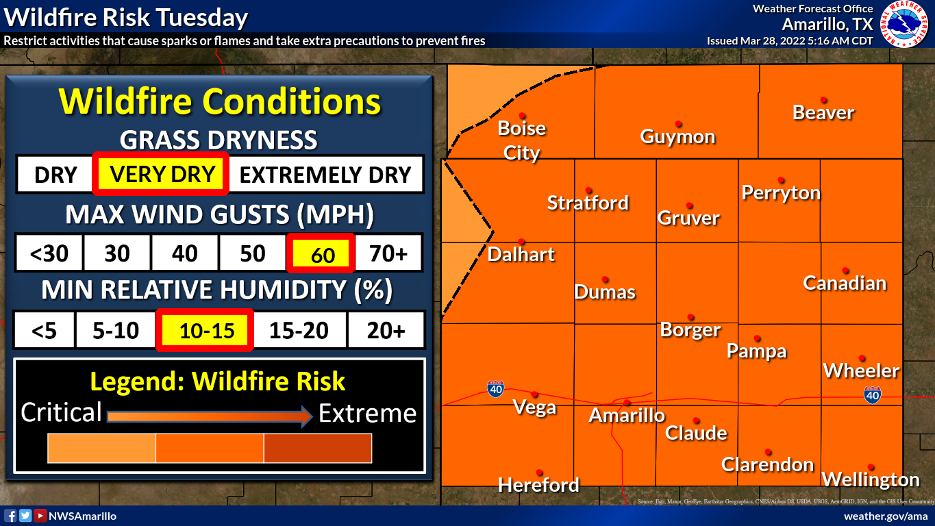
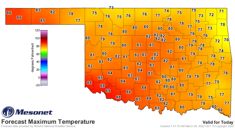
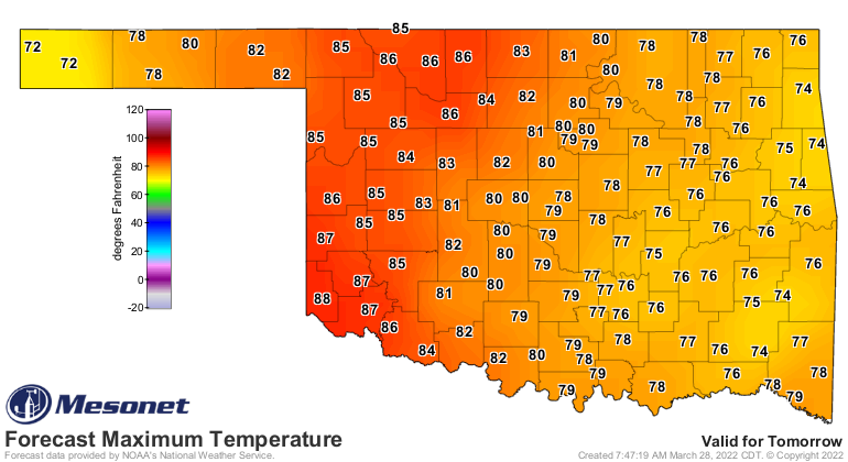
Yeah, that's a whole lotta fire graphics! If the number of graphics is
proportional to how high the fire danger is, the next couple of days could
be pretty bad.
Okay, so we'll see that dryline tomorrow with some storms possibly going up
in the afternoon along it out west, but more likely not much until we see
that cold front push in. Tornado danger at this time looks "low," but NOT
ZERO. So we're talking about maybe a tornado or two when the storms first fire
up and are still discrete (indiscretion is actually a good thing in storms),
but a bit higher as a line forms and we see those quick spin-ups out in the
front part of the line...those QLCS tornadoes that pop up quickly and are
normally short-lived. Not always, though, so they bear watching. That's opposed
to "bare watching" which can get you thrown in jail. Stick to bears.
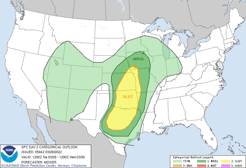
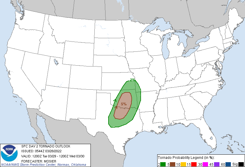
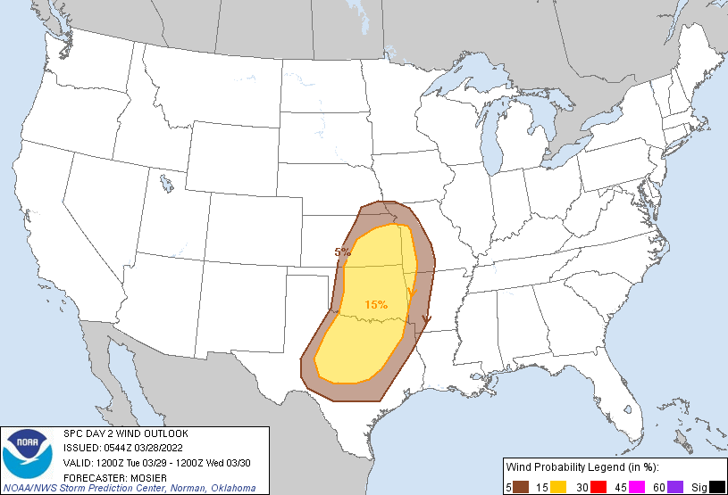
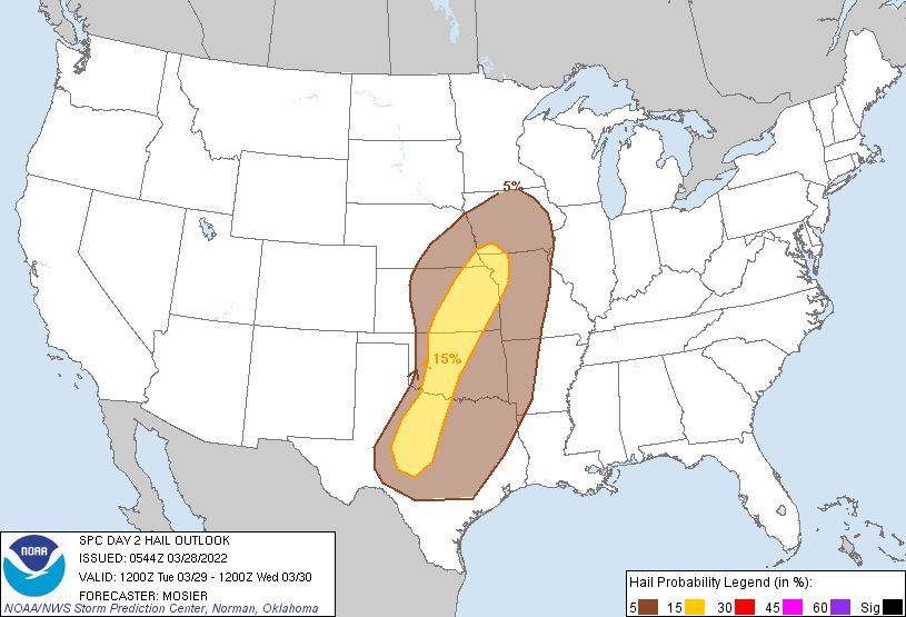
This doesn't look like a high end event just yet, but again best to stay weather
aware because that could definitely change. And if you're the one impacted, it
becomes "infinitely-high end."
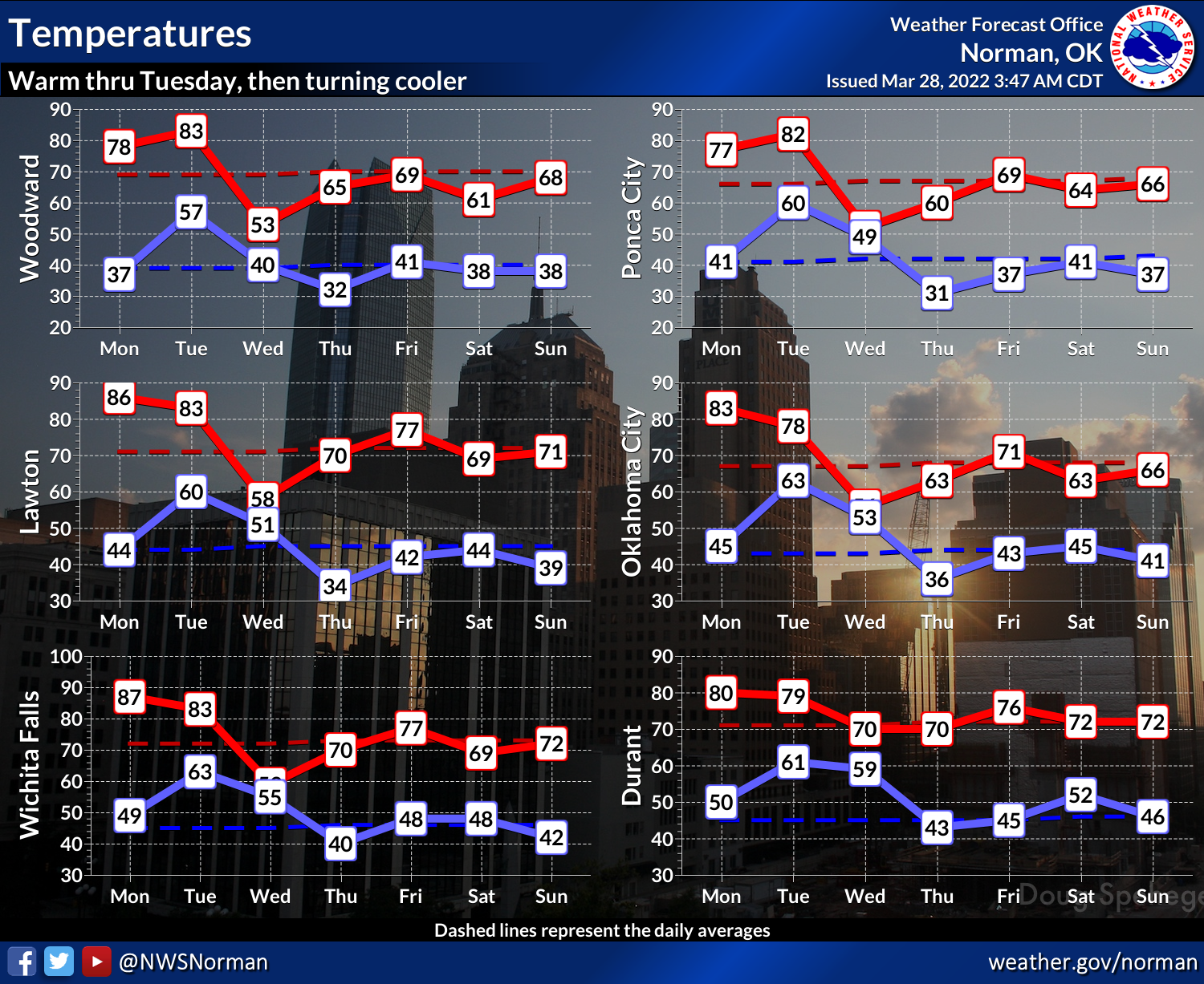
After that, cold air sweeps in after the cold front and kicks us back down to
the reality that it's still March. HOWEVER, part of that reality is that cold
fronts this time of year mean cold mornings and somewhat pleasant afternoons,
so don't fret too much, my fellow cold weather haters.
So remember, uhhhhhhhh, fire pressure, low tornadoes, dry squiggles...and no
bare storm-watching excursions. I think that about sums it up!
Gary McManus
State Climatologist
Oklahoma Mesonet
Oklahoma Climatological Survey
gmcmanus@mesonet.org
March 28 in Mesonet History
| Record | Value | Station | Year |
|---|---|---|---|
| Maximum Temperature | 90°F | TIPT | 2022 |
| Minimum Temperature | 11°F | BOIS | 2009 |
| Maximum Rainfall | 4.20 inches | ACME | 2017 |
Mesonet records begin in 1994.
Search by Date
If you're a bit off, don't worry, because just like horseshoes, “almost” counts on the Ticker website!