Ticker for March 24, 2022
MESONET TICKER ... MESONET TICKER ... MESONET TICKER ... MESONET TICKER ...
March 24, 2022 March 24, 2022 March 24, 2022 March 24, 2022
Summer approacheth!
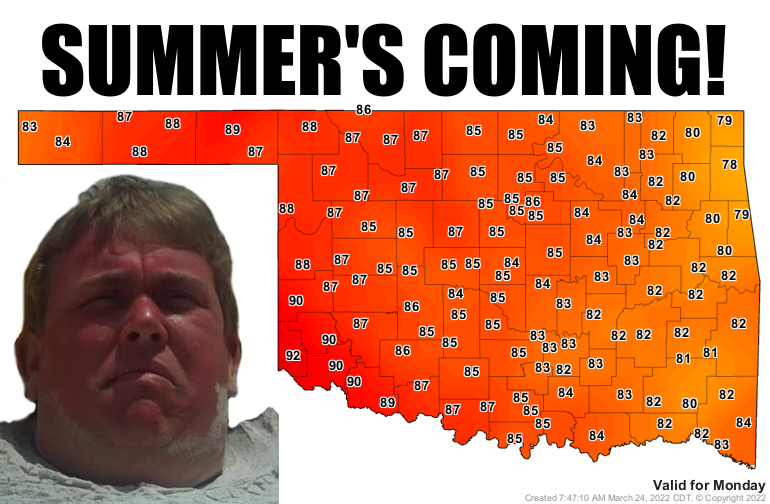
90s! I told ya we'd probably see some 90s come Monday. Now it might just be that
they show up on the forecast but not come to fruition, but nobody REALLY likes
fruit anyway so just seeing it on the forecast is glorious enough. Amember (Okie
to English translation: "Remember") when we had out last 90s in the state? No,
not September or even October. That was in November, part of our gloriously warm
fall and just before our ridiculously warm December. I think these temperatures
are a one-hit wonder, actually. We see these types of temps in early spring in
the advance of a storm system, usually, and that also means a cold front will be
coming close behind. We can see us building to that crescendo on Monday before
we get a cool down. The difference here is that we're not plunging back into the
30s and 40s, but more like 50s and 60s.
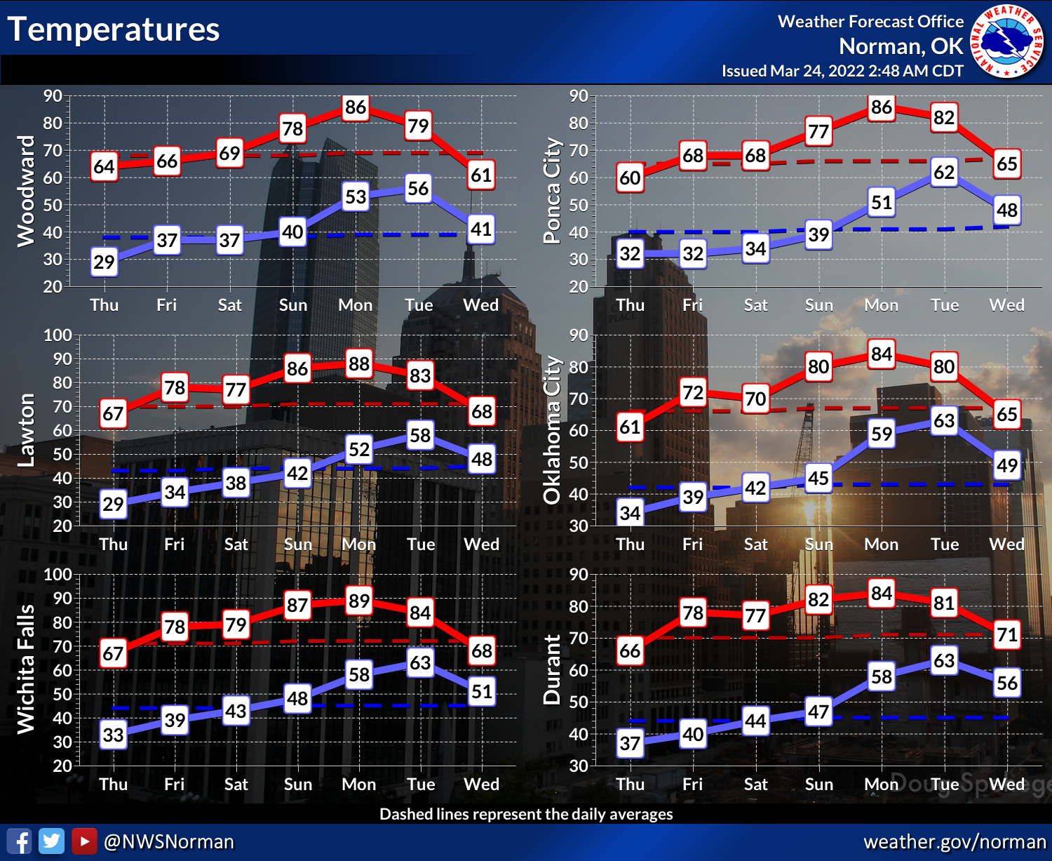
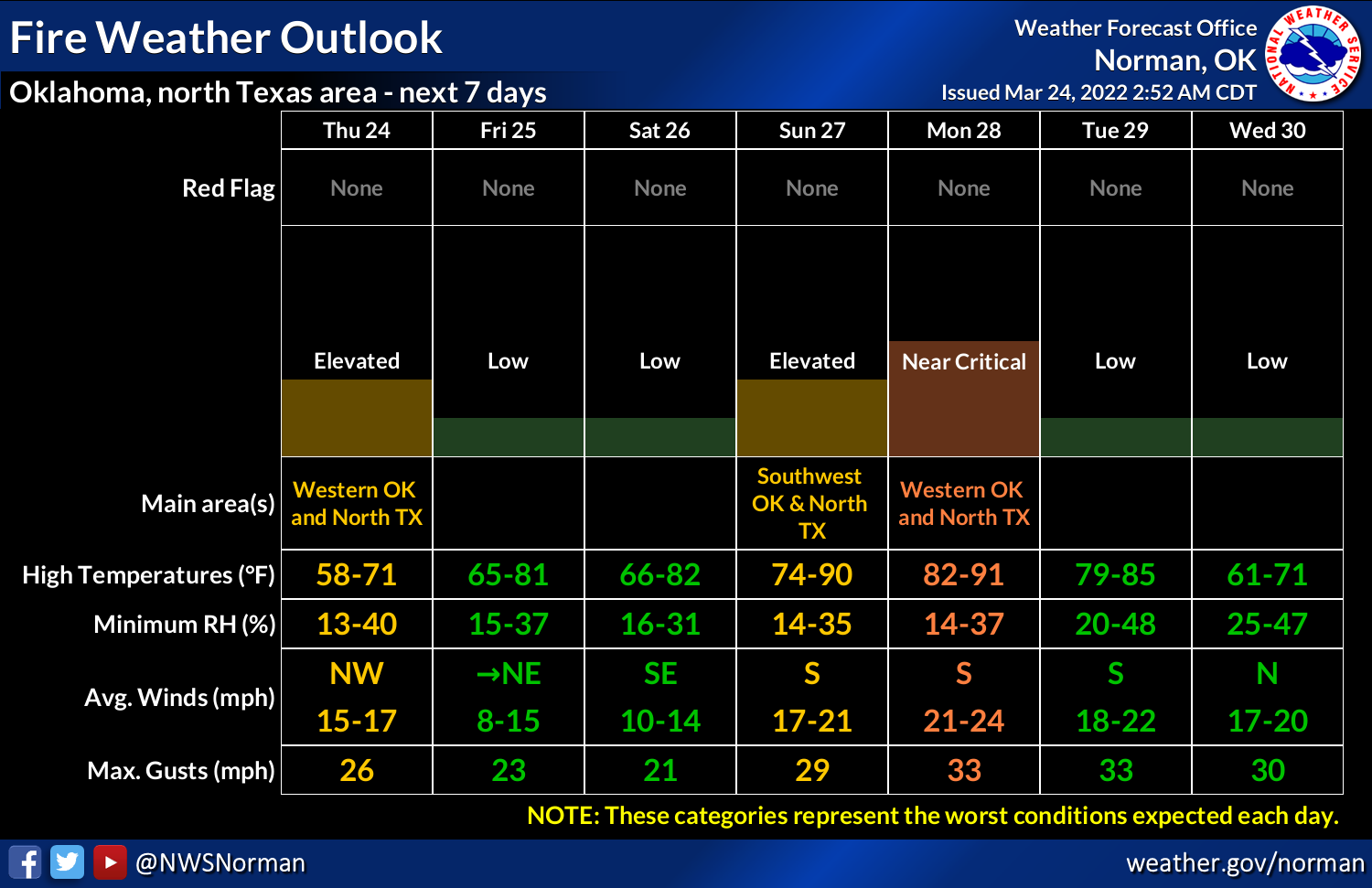
Now that also means a couple of things usually in early spring...high fire danger
leading up to the front, and also a chance of storms. Looks like both of those
possibilities are in order with our next change of rain showing up next Tuesday
and Wednesday, but also a stretch of high fire danger, peaking on Monday.
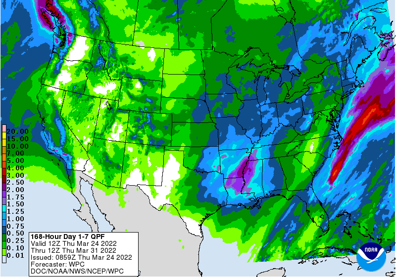
That chance of rain doesn't look like much just yet, but we definitely need it
to build off our last system. In the case of places like far SW OK and the
western Panhandle, there isn't much to build off of. But we did see significant
drought relief last week and early this week, but we still have a long way
to go.
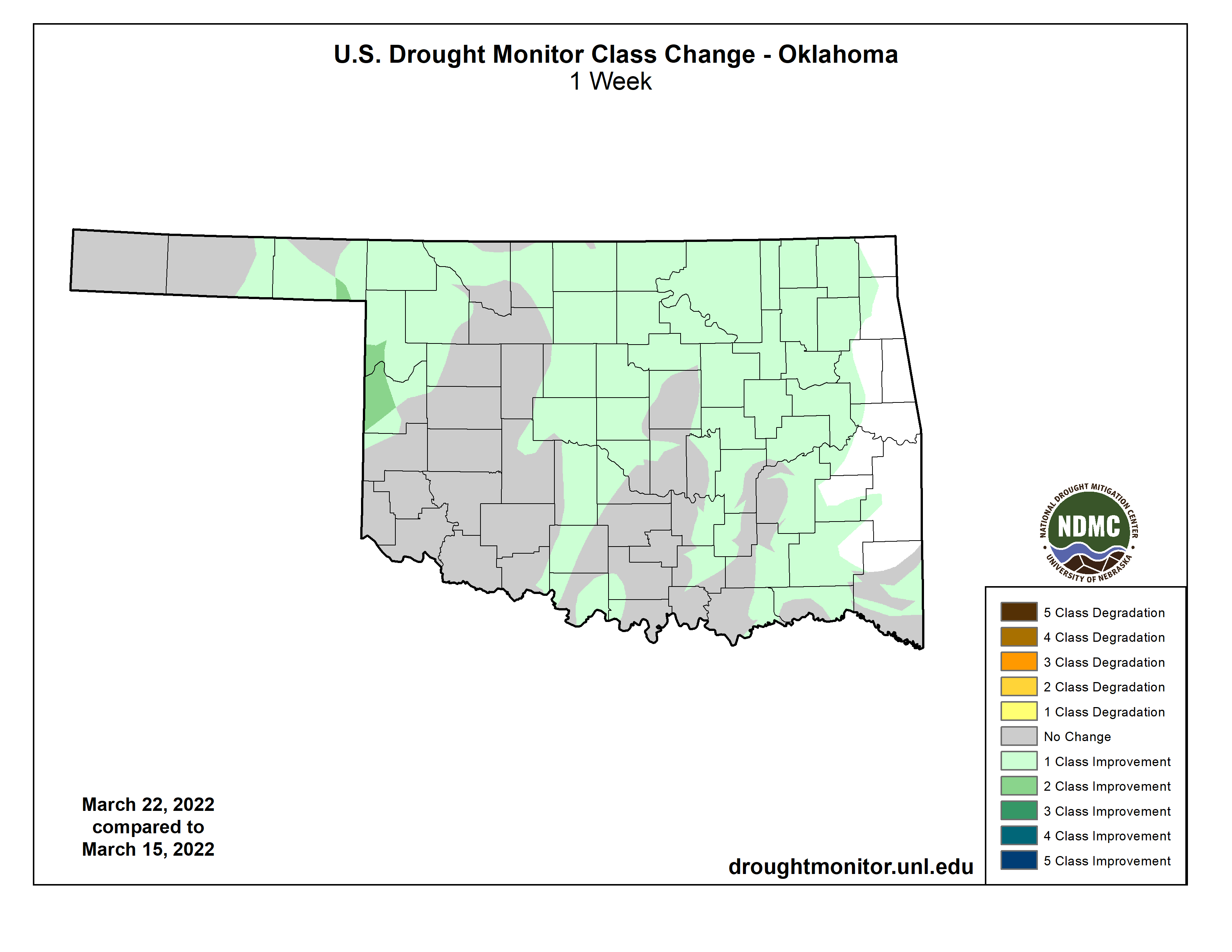
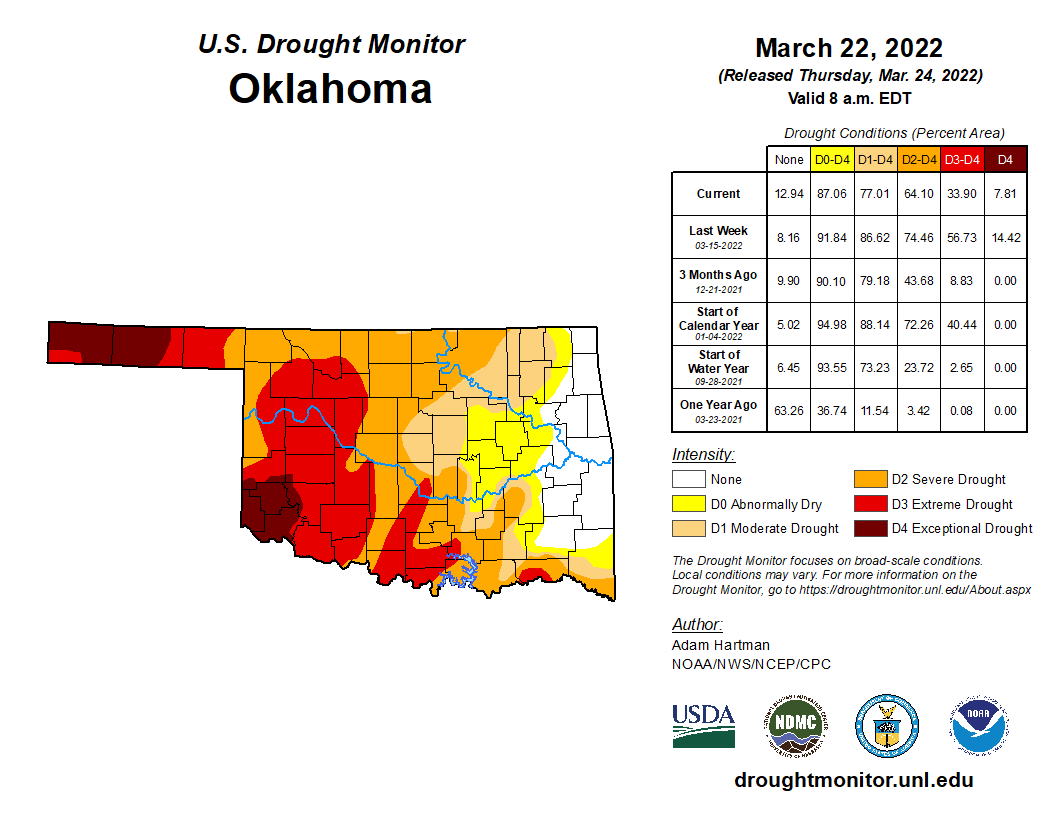
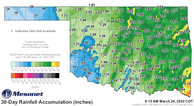
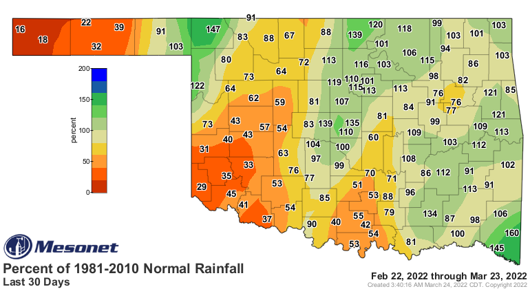
The last 30 days have improved as far as moisture goes for some, and that shows
up pretty well on the maps. Keep in mind that last storm was responsible for
almost all of these better looking numbers.
Each storm system that can manage to eek out some rainfall is an important
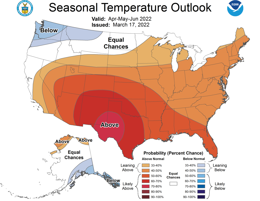
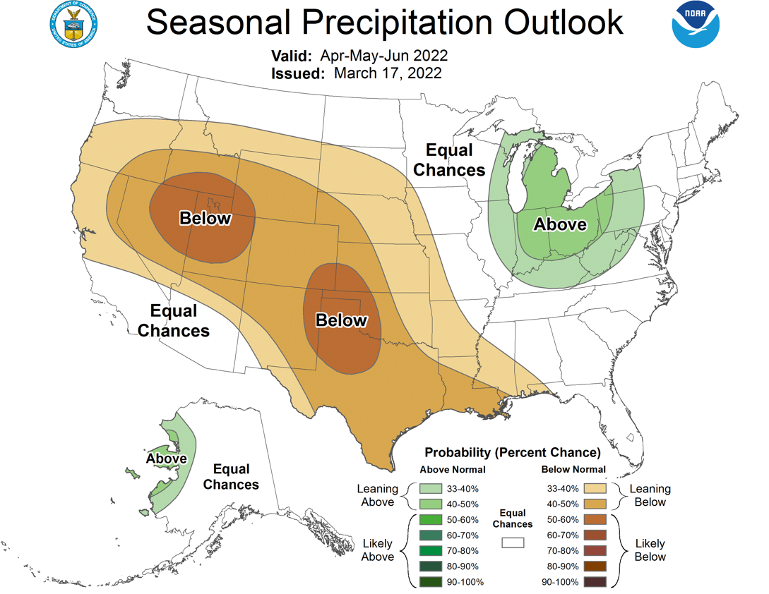
step towards drought removal. The Climate Prediction Center is less optimistic
than I am, which means they're downright cataclysmic because I'm usually a
drought half-full kind of guy. This combination of their temperature and
precipitation outlooks would NOT be good news for Oklahoma and its drought
predicament for the April through June period...the bulk of our so-called
"rainy season."
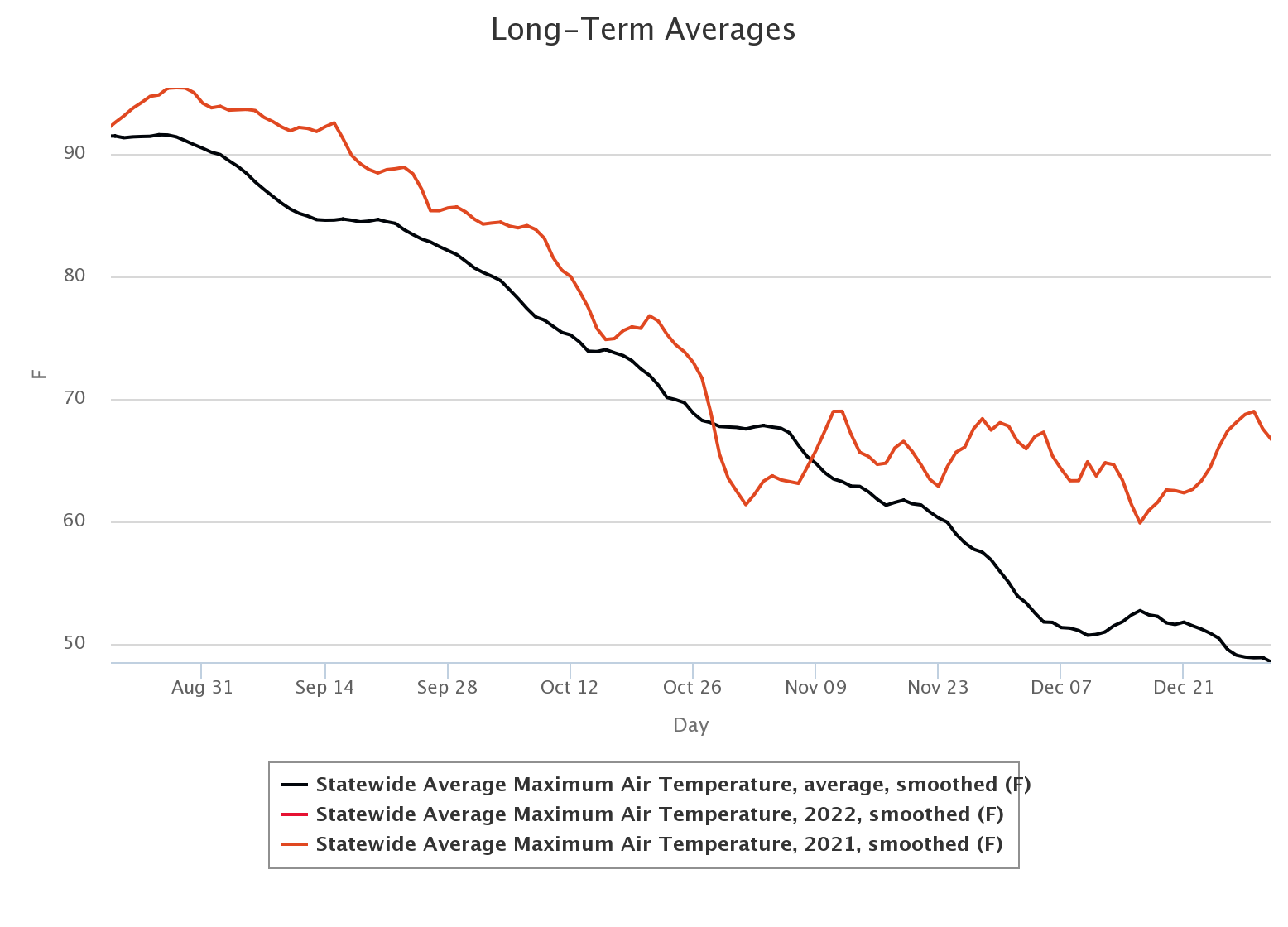
We've actually been lucky on the temperature side of things since the beginning
of the year--really right down to the first day of 2022. Such a vast difference
exists between the "ridiculous warmth" that we saw to end 2021 that led to
uncharacteristically rapid drought development during winter, and that which
we've seen in 2022. Remember (English to Okie translation: "Amember"), December
was more than 10 degrees above normal! And the warmth actually started in
mid-August. These here are the statewide average highs across the Mesonet, for
periods in 2021 (red) and 2022 (red) vs. the long-term Mesonet average (black).
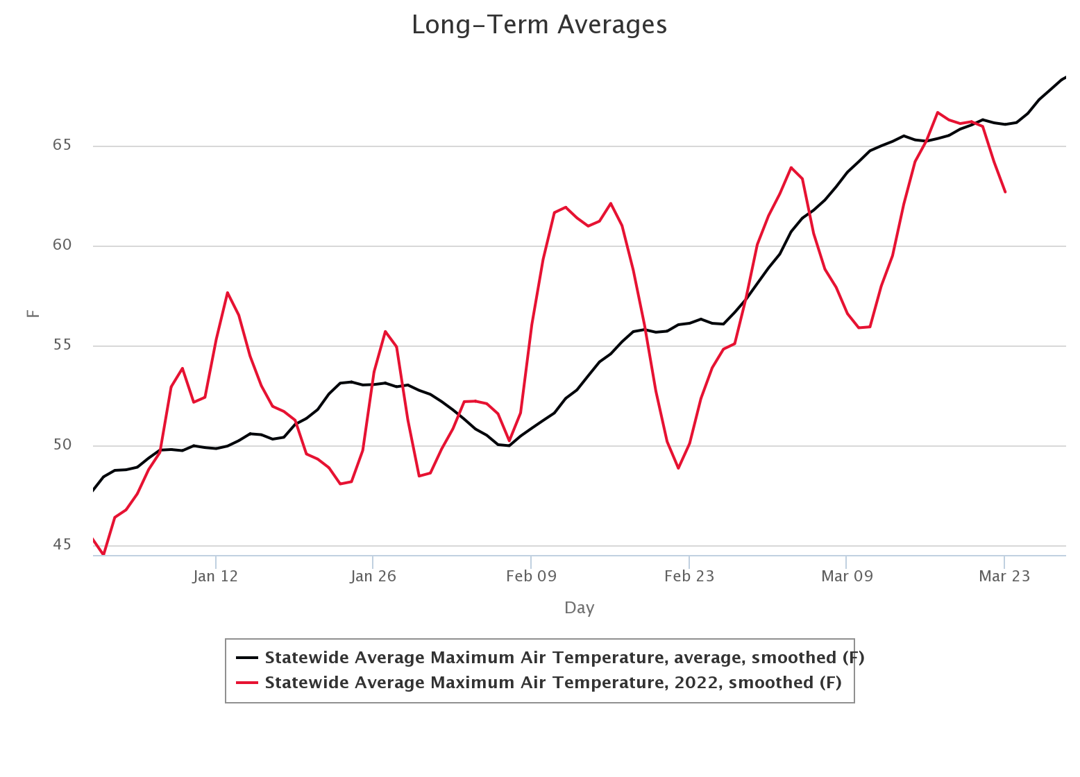
The difference is striking: we've had a few periods of prolonged warm weather
in January and February, but most of the area between the red and black come
in the near- or below-normal category. And it's been that way pretty steady
since mid-February.
We really need rain, though...summer days or not.
Gary McManus
State Climatologist
Oklahoma Mesonet
Oklahoma Climatological Survey
gmcmanus@mesonet.org
March 24 in Mesonet History
| Record | Value | Station | Year |
|---|---|---|---|
| Maximum Temperature | 88°F | ALTU | 2003 |
| Minimum Temperature | 12°F | KENT | 2013 |
| Maximum Rainfall | 5.00 inches | CLAY | 2023 |
Mesonet records begin in 1994.
Search by Date
If you're a bit off, don't worry, because just like horseshoes, “almost” counts on the Ticker website!