Ticker for February 28, 2022
MESONET TICKER ... MESONET TICKER ... MESONET TICKER ... MESONET TICKER ...
February 28, 2022 February 28, 2022 February 28, 2022 February 28, 2022
Spring glorious spring
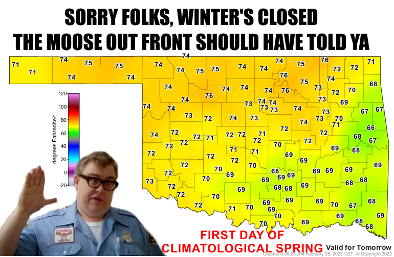
Yep, we're calling it. Winter is over. First day of climatological spring is
tomorrow, and so winter is officially closed until next December!
Wow, such derisive laughter. You realize I can hear you, right?
Okay, so we can declare whatever we want, but when Mother Nature sends us a
winter blast in a couple of weeks and a blizzard somewhere up north, I guess
we can call the moose out front a liar. But hey, after a decidedly cold February
complete with three major winter storms, we (at least the sane ones) can at
least hope, right?
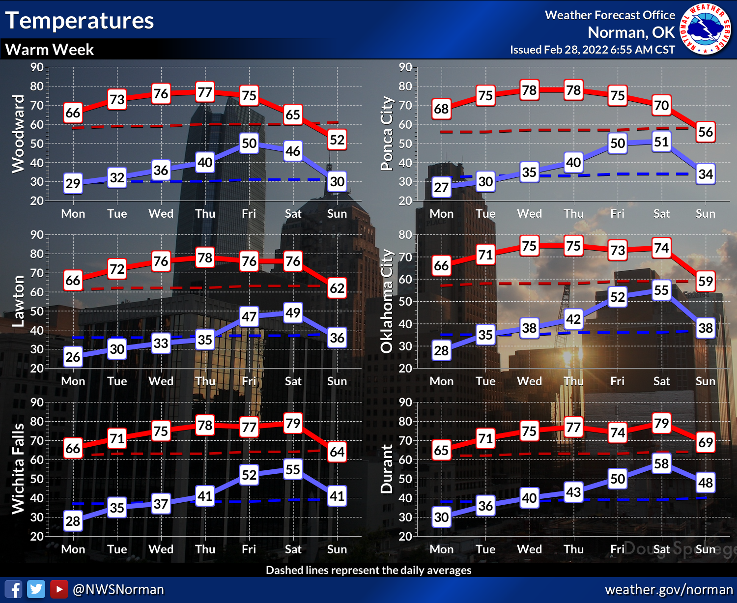
So while we're not quite sure what the weather holds for a couple of weeks down
the road (heck, NEXT week!), we at least know that this week looks pretty darned
fitting for the first week of spring. SAY WEEK ONE MORE TIME!
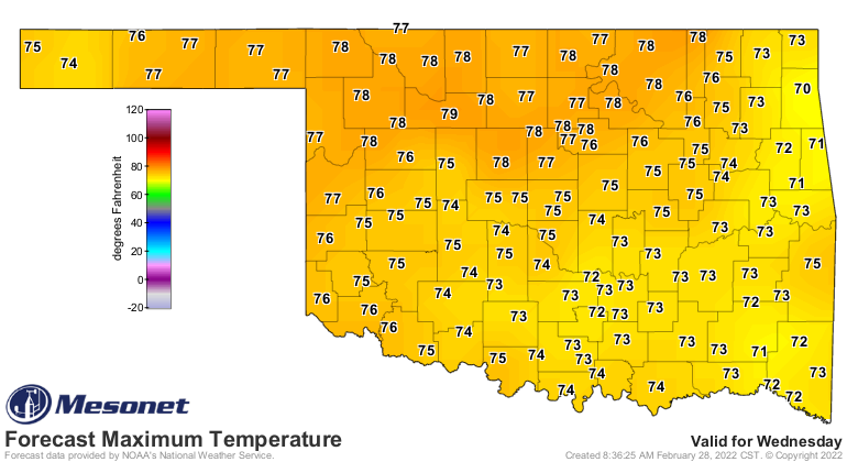
Look at Wednesday!
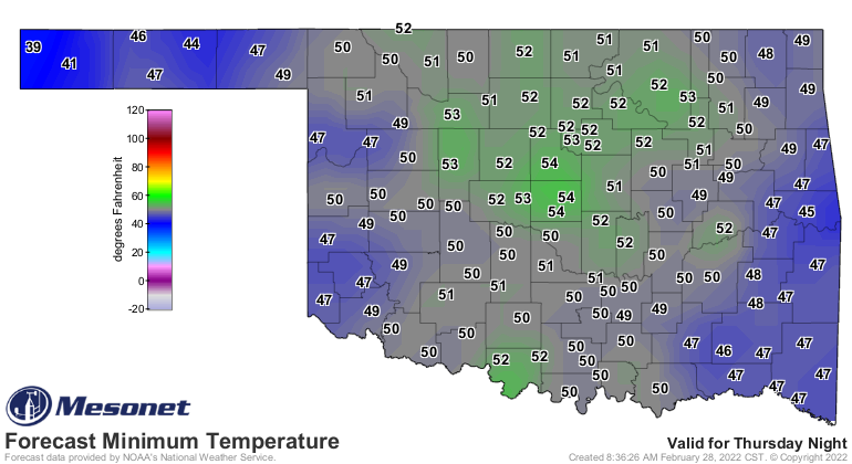
And you know it's starting to get springy when forecast lows are in the upper
40s and 50s, like this Friday. Now that's more a consequence of an approaching
front and storm system for the weekend, but it is still a preview of coming
attractions.
So a front this weekend, but different from what we've seen lately, it's not an
arctic front...more like what we saw in December. It will cool us down, but
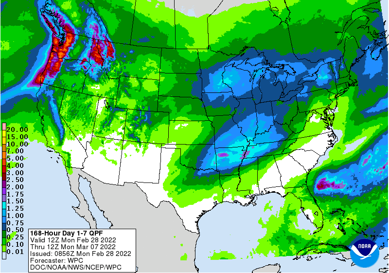
not a blast back to January. There will be a chance for moisture with that
front, but definitely not a big deluge needed by western Oklahoma.
Speaking of lows, isn't it getting close to time for us to stop seeing freezes?
Well, not just yet. Maybe on the fringe of our earliest POSSIBLE freeze, but
we're still a good month away from our average first freeze date. Here's what
that looks like on maps. Fresh from the new 1991-2020 normals as provided by
the National Centers for Environmental Information, we present our drafts of
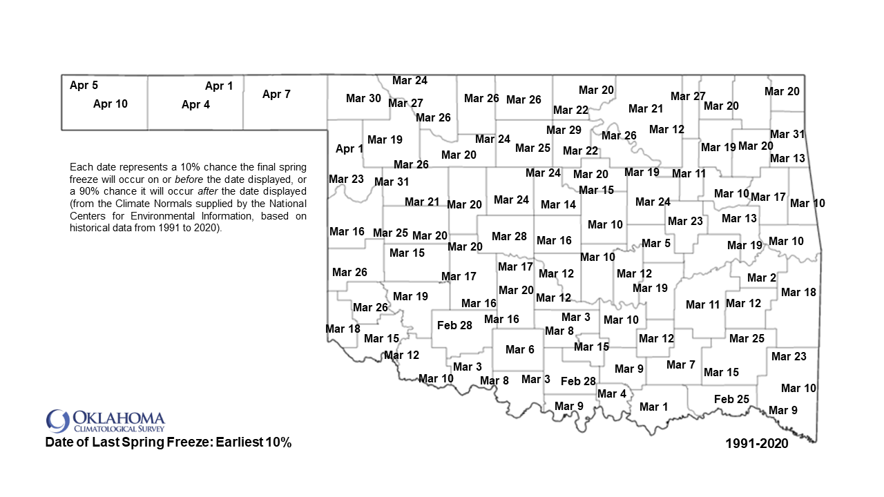
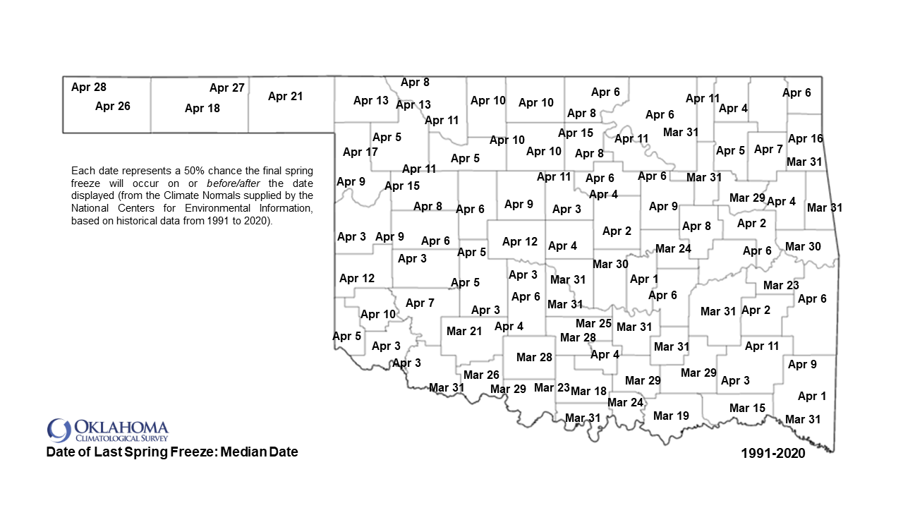
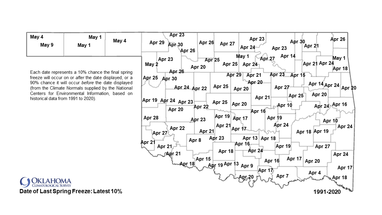
the last spring freeze dates for Oklahoma at the 10th, 50th (median date), and
90th percentile. As described on the maps, these are the dates at which you
would expect the final spring freeze to have occurred at the expressed
percentage chance. For example, the "Date of Last Spring Freeze: Earliest 10%",
the dates represent a 10% chance the final spring freeze will have occurred on
or BEFORE that date, but that also implies there is a 90% chance the last
freeze will occur AFTER that date. In other words, if you look at this map and
decide to plant some tender plants of vegetables, you're taking a BIG risk. Now
of course as we get closer to the dates, climatology becomes less important and
our ability to forecast about a week or two in advance takes over, but they
are still pretty good for planning purposes taking the risk into account.
Here be the maps:
Ugh, come on earliest 10%!
Gary McManus
State Climatologist
Oklahoma Mesonet
Oklahoma Climatological Survey
gmcmanus@mesonet.org
February 28 in Mesonet History
| Record | Value | Station | Year |
|---|---|---|---|
| Maximum Temperature | 90°F | HOLL | 2006 |
| Minimum Temperature | 7°F | BEAV | 2019 |
| Maximum Rainfall | 3.70″ | BROK | 2018 |
Mesonet records begin in 1994.
Search by Date
If you're a bit off, don't worry, because just like horseshoes, “almost” counts on the Ticker website!