Ticker for February 24, 2022
MESONET TICKER ... MESONET TICKER ... MESONET TICKER ... MESONET TICKER ...
February 24, 2022 February 24, 2022 February 24, 2022 February 24, 2022
THWAP!
I barely have a chance to Tick this morning, but we do have something important
to Tock about. Oh, I could come on here (wherever "here" is, because you realize
that "here" for you is "there," and "there" for me is...ummmm, what were we
Tocking about?) and lament the ice-covered State of the State (we see you,
northwestern Oklahoma), and the dangerous cold that remains, but let's focus on
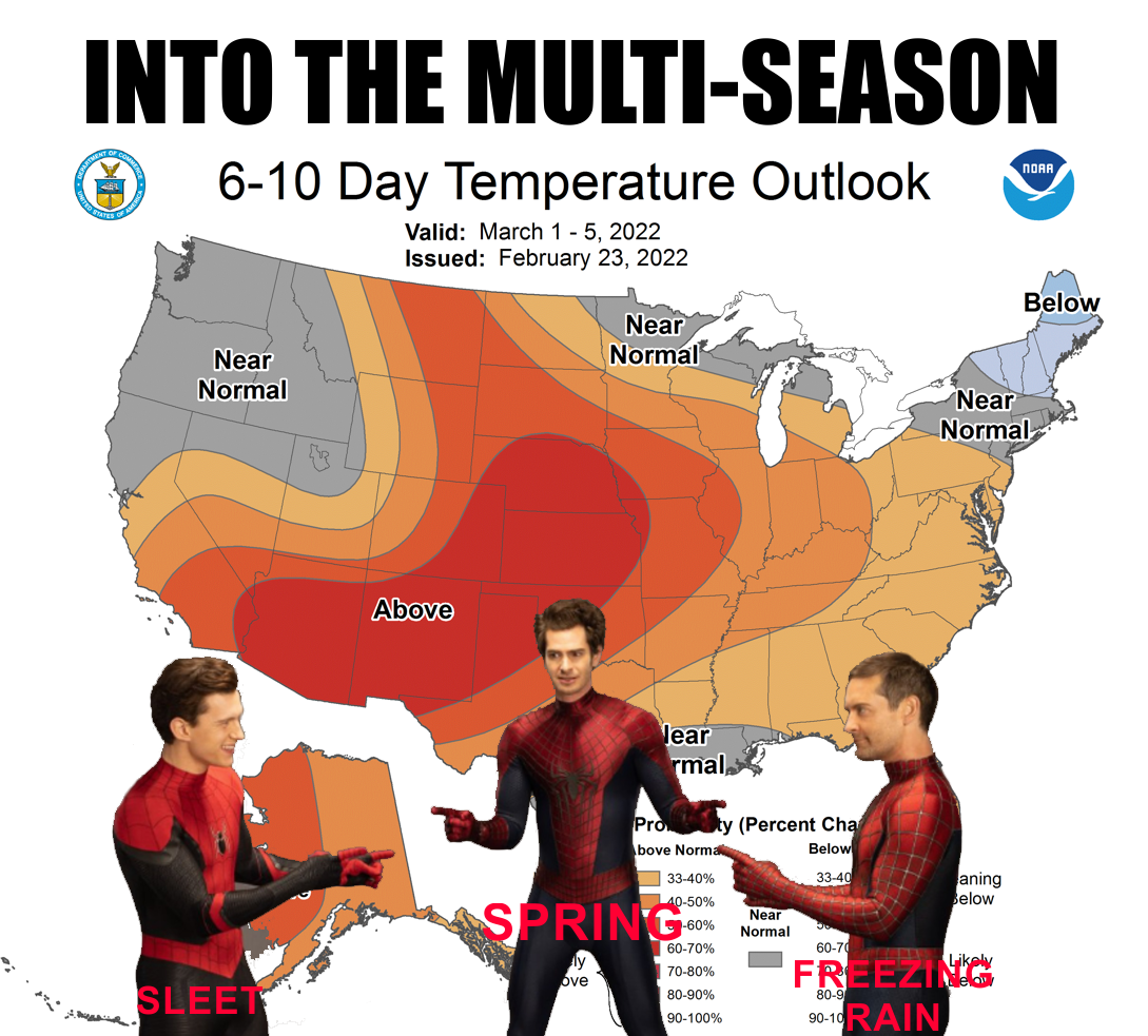
something better: spring is in the air. No, not TODAY'S air, nor tomorrow's. Nor
Saturday's. How many nors is a guy allowed? Okay, how about early next week and
then throughout, we transition to 60s and 70s?
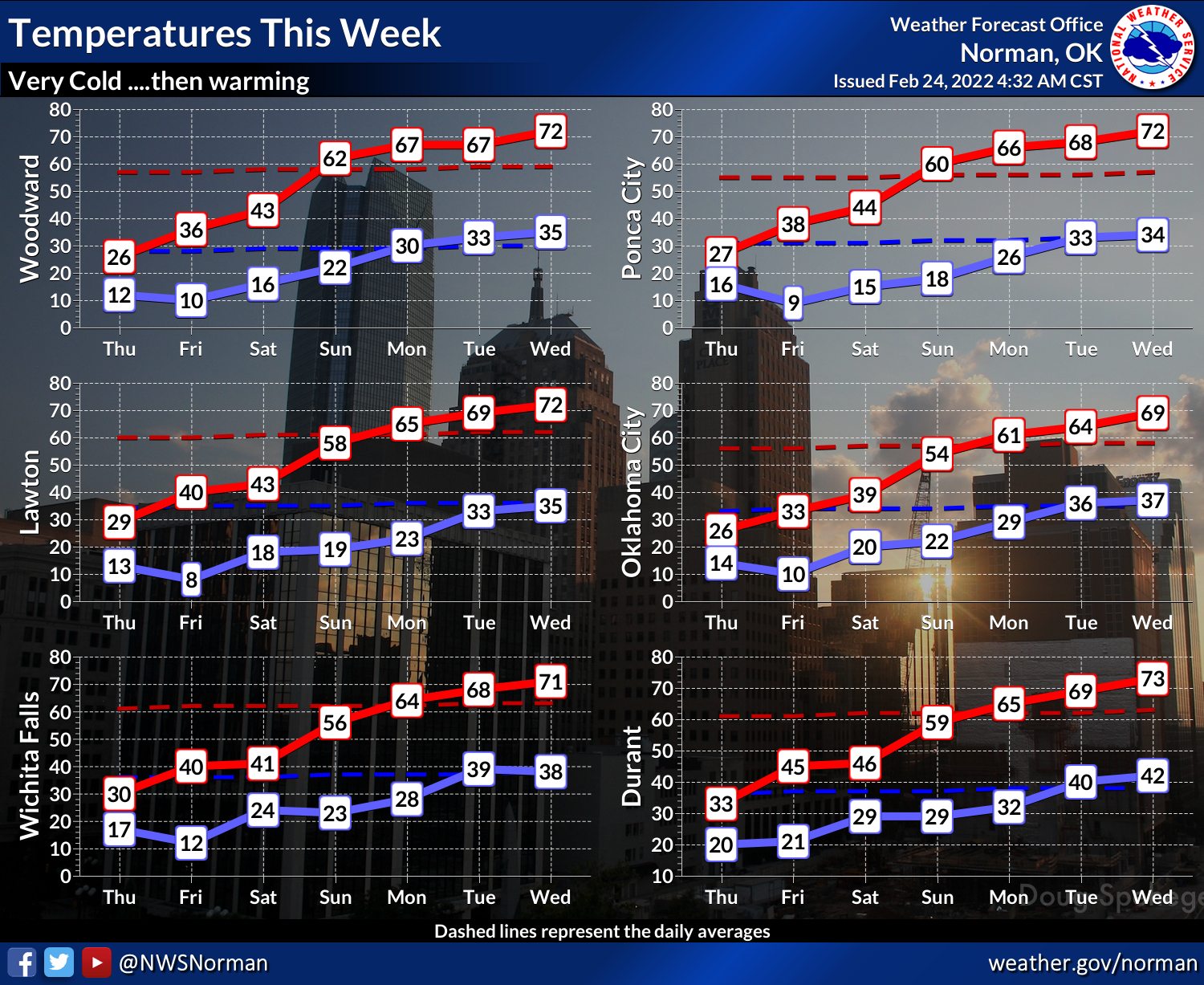
It's not 80s and 90s, which are preferred by every single State Climatologist for
Oklahoma (yeah, there's only one), but 60s are the new 80s when you've been stuck
in the teens for a few days.
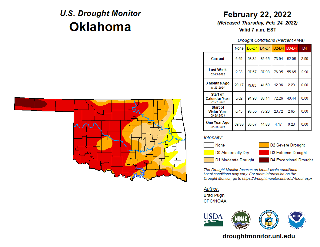
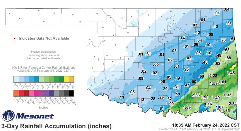
We still have significant drought across the state. We won't know how much
improving we can do until it all melts, but it's a heck of a start. We've
already seen big changes to the east.
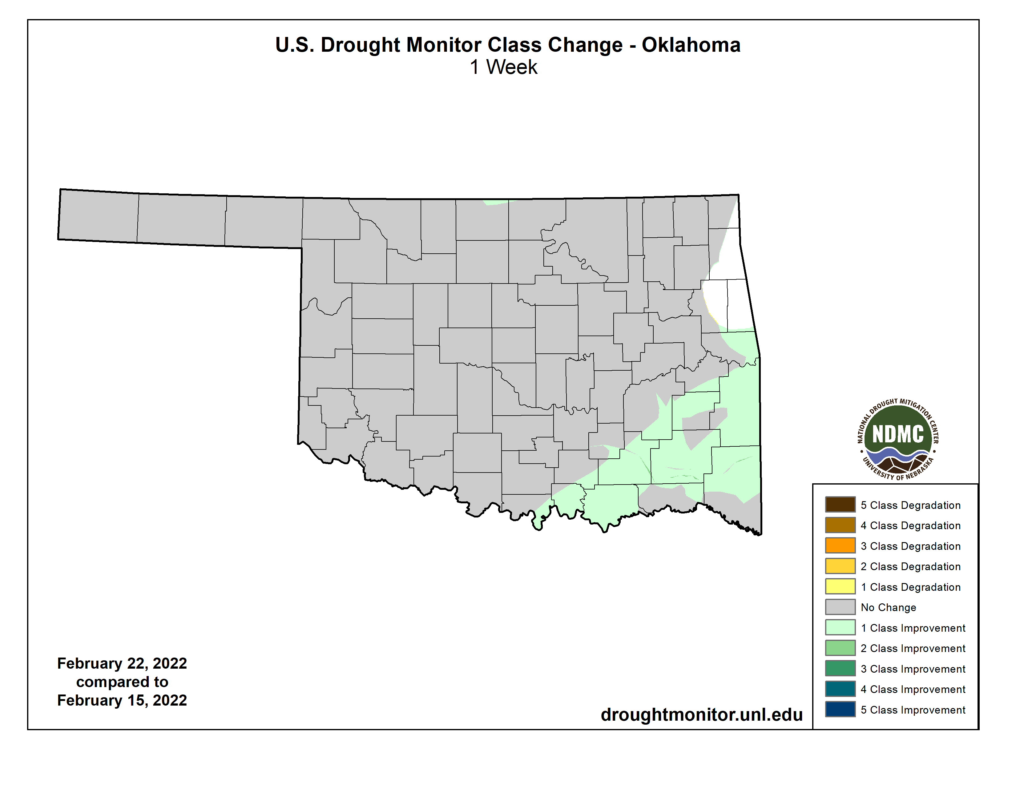
We need a LOT more than this, however, to impact the drought across western
OK.
Unfortunately, it gets really slow after this for awhile.
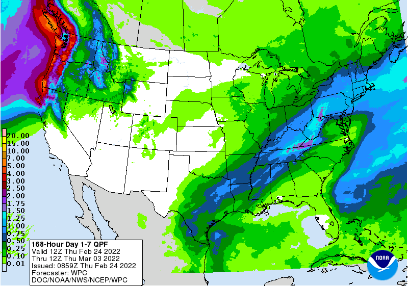
The pattern has certainly been more active over the last month, so there is
hope that it will continue. Best we can do for now while we await the big
thaw.
Gary McManus
State Climatologist
Oklahoma Mesonet
Oklahoma Climatological Survey
gmcmanus@mesonet.org
February 24 in Mesonet History
| Record | Value | Station | Year |
|---|---|---|---|
| Maximum Temperature | 82°F | HOLL | 2002 |
| Minimum Temperature | -3°F | EVAX | 2022 |
| Maximum Rainfall | 2.61″ | MTHE | 2018 |
Mesonet records begin in 1994.
Search by Date
If you're a bit off, don't worry, because just like horseshoes, “almost” counts on the Ticker website!