Ticker for February 22, 2022
MESONET TICKER ... MESONET TICKER ... MESONET TICKER ... MESONET TICKER ...
February 22, 2022 February 22, 2022 February 22, 2022 February 22, 2022
ICEMAGEDDON!
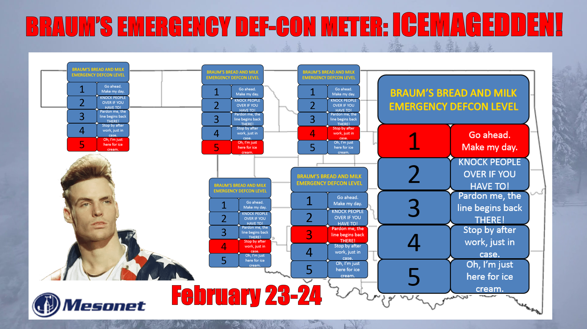
Sleet. Probably the least respected of all winter weather precip types. Think
Dennis Quaid's Doc Holliday as opposed to Val Kilmer's (or even Victor Mature's
or Kirk Douglas' for you oldies out there). It's not as fearsome as freezing
rain, the villain of winter weather, nor as sexy as snow. It's the result of that
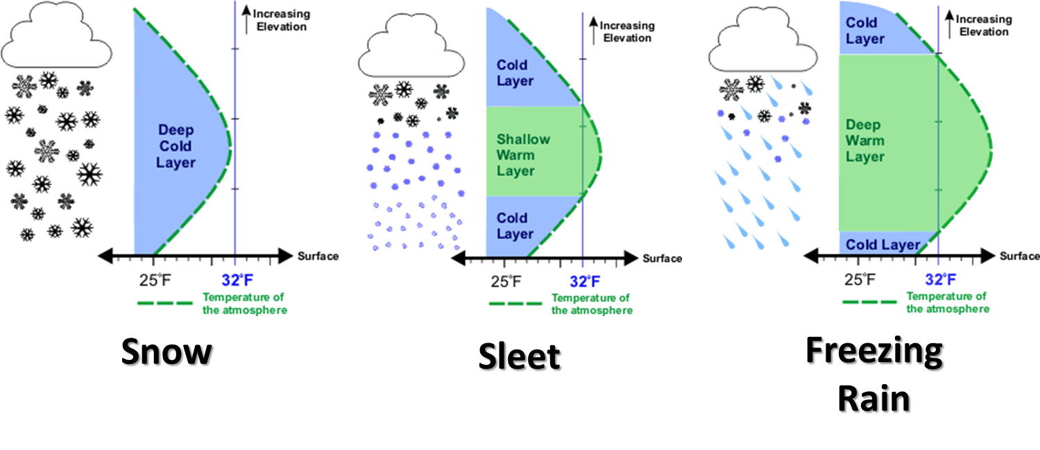
warm tongue (if your tongue is cold, seek help immediately!) of air above the
surface to be just thick enough to melt the snow as it falls through the
atmosphere, but just thin enough for that melted snow to freeze once again. You
can see that on the oft-used graphic here on the Ticker that shows the vertical
profile that produces each winter precip type.
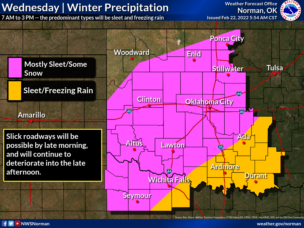
So with this storm system, sleet seems to be the main precip type for most of us,
with freezing rain also being a possibility farther to the south and east of
the I-44 corridor. And throw a bit of snow in here and there as well, probably
on Thursday as that cold air deepens and the warm tongue disappears. Here are all
the pertinent graphics from our local NWS offices.
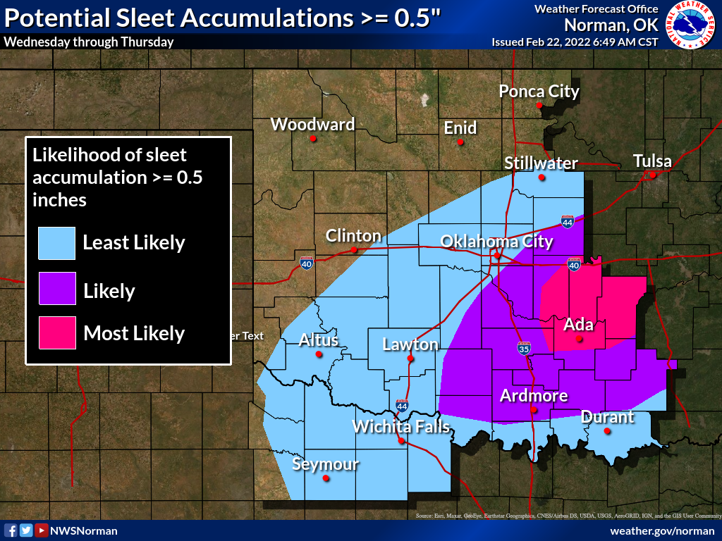
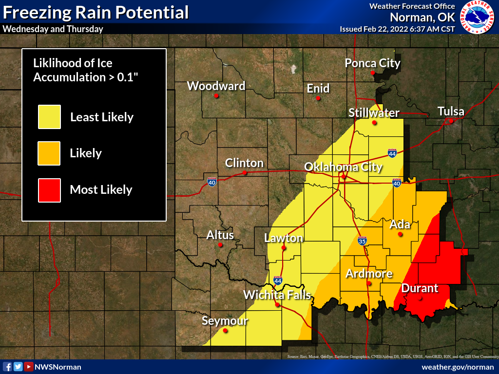
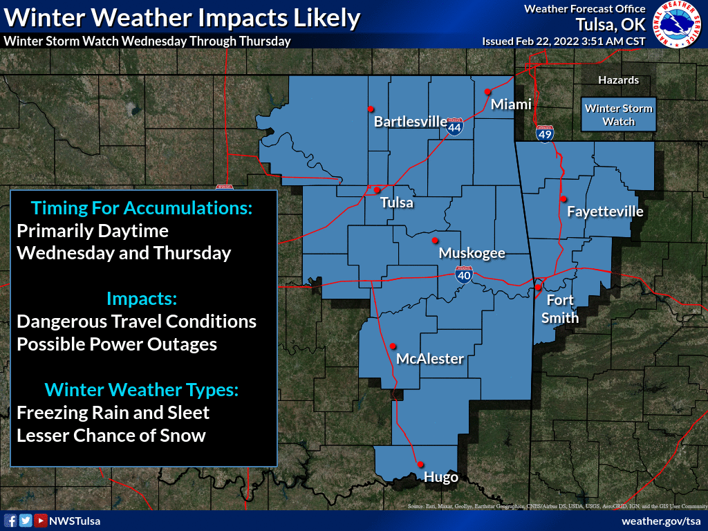
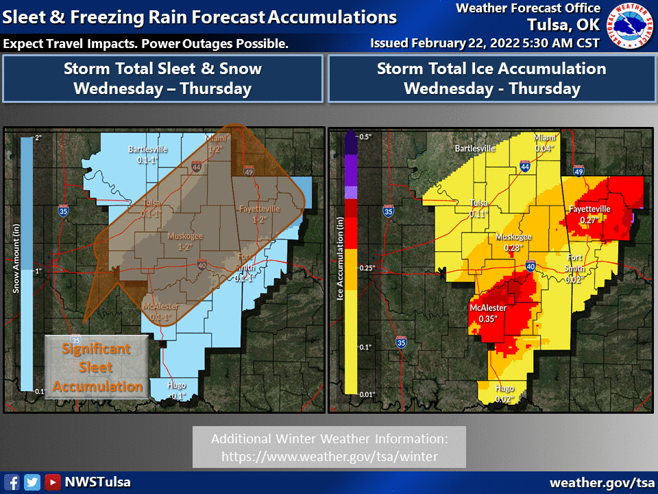
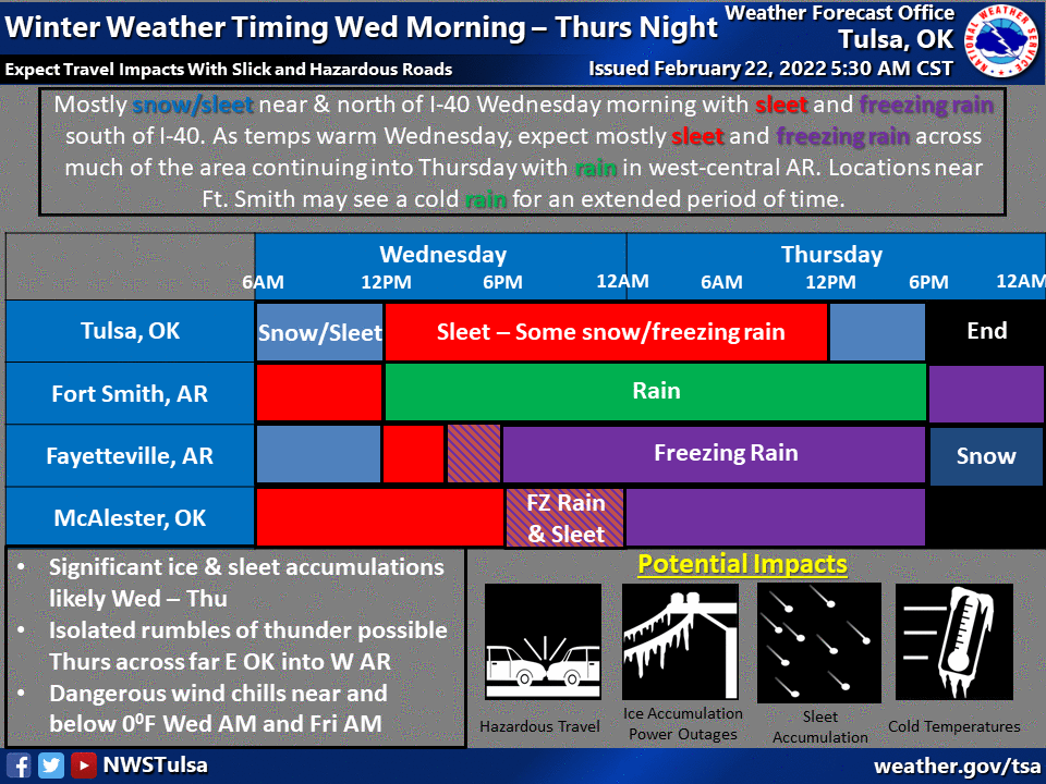
There appears to be enough ice forecast to fall to give us a winter weather
advisory of much of central OK, and a winter storm watch for much of eastern
OK.
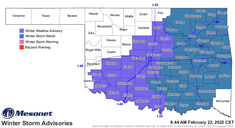
In the winter storm watch areas, expect as much as an inch of sleet and snow,
and up to a half-inch of freezing rain. For the winter wx advisory, up to an
inch of sleet/snow and maybe a tenth of an inch of freezing rain accumulation.
This is a two-part storm, with some accumulations throughout the day on
Wednesday, a lull, and then the main blast on Thursday.
So we probably could have gone with "ICEPOCALYPSE" too, but we just wanted to
give sleet its due. And we're hoping for sleet as opposed to freezing rain,
simply from an impacts standpoint. You can at least drive on sleet to some
degree (-10 degrees, but that's beside the point). It has that *CRUNCH* too it
at first. Trouble is, once it gets packed down, it's just a solid sheet of ice
and the roads and sidewalks become a skating rink. And the freezing rain added
to it means this is especially a "STAY AT HOME" situation.
Also not that the NWS advises power outages and tree damage are LIKELY in the
winter storm watch areas, and of course travel is the main impact in the
winter wx advisory area.
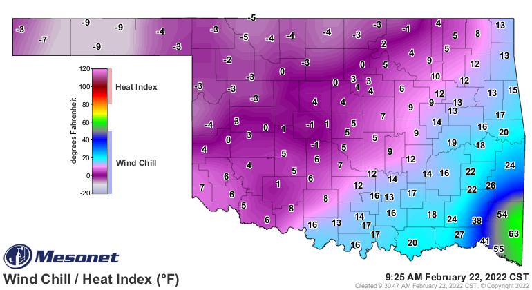
THEN comes another underrated but just as deadly hazard, the cold. Once we
get into tonight and the next couple of mornings, wind chills will be down into
the below zero territory, and that's when it gets dangerous. We do have a
wind chill for tomorrow as wind chills are expected to get down to -5 to -20
degrees.
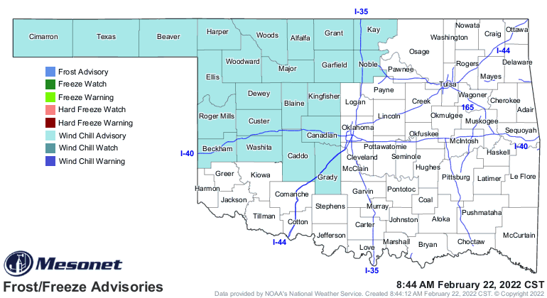
That's for tonight through tomorrow, but come on, we're already there.
This could be a real doozy of a storm, though. I'm even seeing lots of mentions
of thundersleet and thunder freezing rain.
Dirty deeds...THUNDERSLEET!
Dirty deeds...THUNDERSLEET!
Come on, you KNOW it says "THUNDERCHIEF!" I heard it myself listening on my
AM transistor radio back in Buffalo as a kid.
Gary McManus
State Climatologist
Oklahoma Mesonet
Oklahoma Climatological Survey
gmcmanus@mesonet.org
February 22 in Mesonet History
| Record | Value | Station | Year |
|---|---|---|---|
| Maximum Temperature | 86°F | HOLL | 2017 |
| Minimum Temperature | -2°F | HOOK | 2013 |
| Maximum Rainfall | 2.74 inches | BROK | 2018 |
Mesonet records begin in 1994.
Search by Date
If you're a bit off, don't worry, because just like horseshoes, “almost” counts on the Ticker website!