Ticker for February 21, 2022
MESONET TICKER ... MESONET TICKER ... MESONET TICKER ... MESONET TICKER ...
February 21, 2022 February 21, 2022 February 21, 2022 February 21, 2022
Second verse
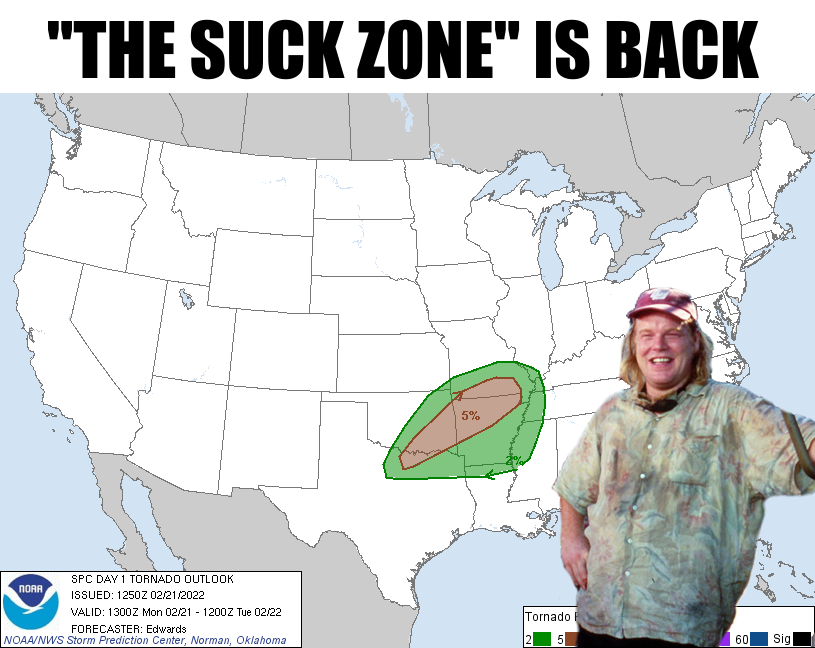
Didn't we just do all this last week? You know, fire, severe weather, possibility
of tornadoes, freezing rain, sleet, snow, etc.? And it's usually the etc. that
hurts, if you know what I mean.
Okay, let's get into it. Once again we have an arctic air mass plunging south
and a storm system (or 2...or 3) headed in from the West Coast. And just like last
week, although a bit more spread out, that gives us a chance for darned near every
hazard Mother Nature has to offer us. None of them look *TOO* bad, although with
each, there is still time for the forecast to intensify those hazards.
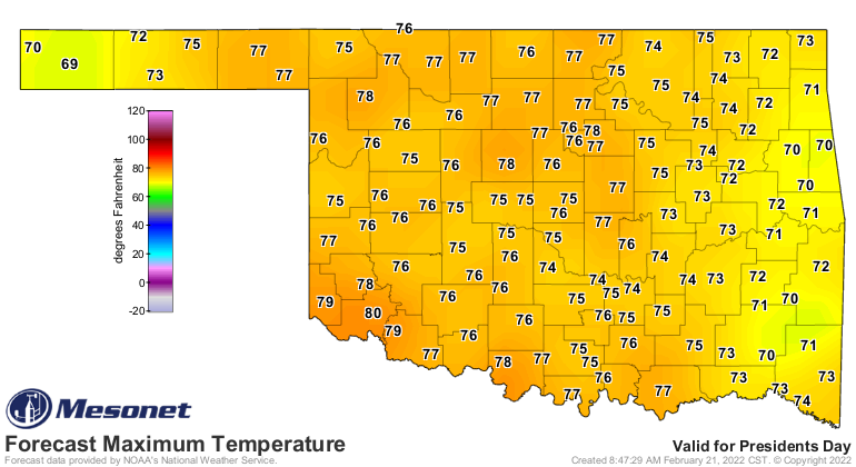
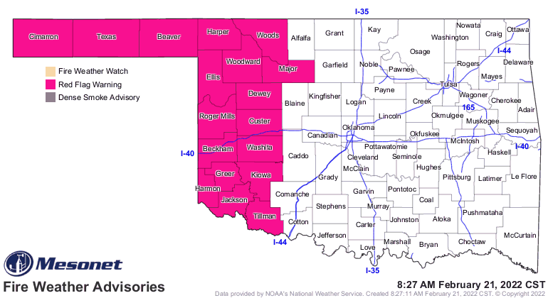
Today, we have some lovely warm weather accompanied by 30-40 mph winds and high
fire danger out west (although just about everywhere is in some sort of fire
danger today).
Tonight and overnight, we get ye olde severe weather threat with a chance of
severe winds (I JUST SAID "SEVERE THREAT!"), large hail, and maybe a few
tornadoes. And just like last week, this isn't looking like a high-end svr
setup, and it looks to happen late at night into the wee hours of the morning.
Not much happened last week, thank goodness, but there is the possibility things
could get more interesting tonight, just have to wait and see how the event
unfolds, so don't get complacent due to last week.
Okay, then tomorrow we have the big frontal passage that will bring another
arctic air mass plunging down into the state. The real cold air waits for
Wednesday and Thursday, but tomorrow will be cold enough.
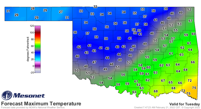
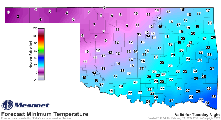
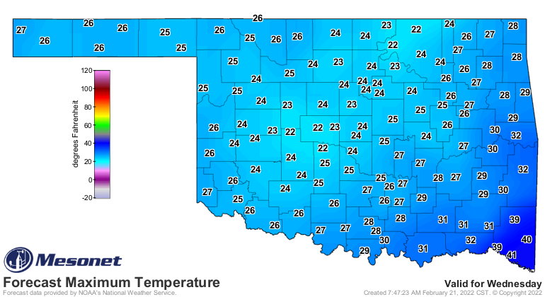
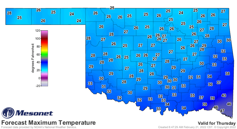
Any chance this one doesn't happen? Nope, it's coming. Spot the arctic front
if you can!
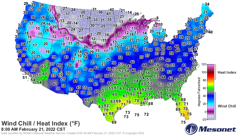
Wednesday morning through Thursday will once again have life-threatening cold
weather in the form of wind chills a bit above and below the ZERO mark.
Okay, just like last week, add moisture and GO! Except this time, it looks
like we'll have enough warm air above the surface overlaying this arctic air
to give us a mixture of sleet and freezing rain instead of snow. Maybe a bit of
snow to finish off the event on Thursday, but this is what it looks like now
3-4 days out in the forecast models. This can definitely change. It doesn't
look like a major ice storm as of now, but THIS CAN DEFINITELY CHANGE. So start
making all your preparations for some wintry weather last this week, and be
prepared to be stuck in your house for a day or two, unless you think YOU'RE
that person who can drive on ice-covered roads.
Here's a hint: you probably aren't.
Let it out.
OH YEAH? WELL COME DOWN HERE AND SAY THAT TO MY FACE! Just don't do it on
Thursday because you can't drive on the ice.
The Wednesday and Thursday ice action appears to be an I-44 and to the south
and east event, mostly. No blizzards up north this time. Sorry.
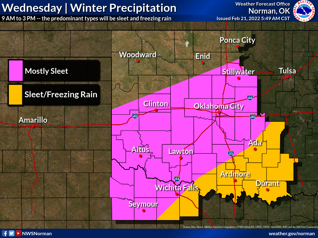
For the winter weather stuff, it's still 3-4 days out. Still too early to know
for sure what the precise impacts and locations will be.
Here we go! Enjoy the warmth today at least, even though it's gonna be windy.
Windy. That's intense.
Gary McManus
State Climatologist
Oklahoma Mesonet
Oklahoma Climatological Survey
gmcmanus@mesonet.org
February 21 in Mesonet History
| Record | Value | Station | Year |
|---|---|---|---|
| Maximum Temperature | 87°F | BURN | 2023 |
| Minimum Temperature | 2°F | HOOK | 2013 |
| Maximum Rainfall | 2.90″ | BROK | 2018 |
Mesonet records begin in 1994.
Search by Date
If you're a bit off, don't worry, because just like horseshoes, “almost” counts on the Ticker website!