Ticker for February 16, 2022
MESONET TICKER ... MESONET TICKER ... MESONET TICKER ... MESONET TICKER ...
February 16, 2022 February 16, 2022 February 16, 2022 February 16, 2022
Main Course
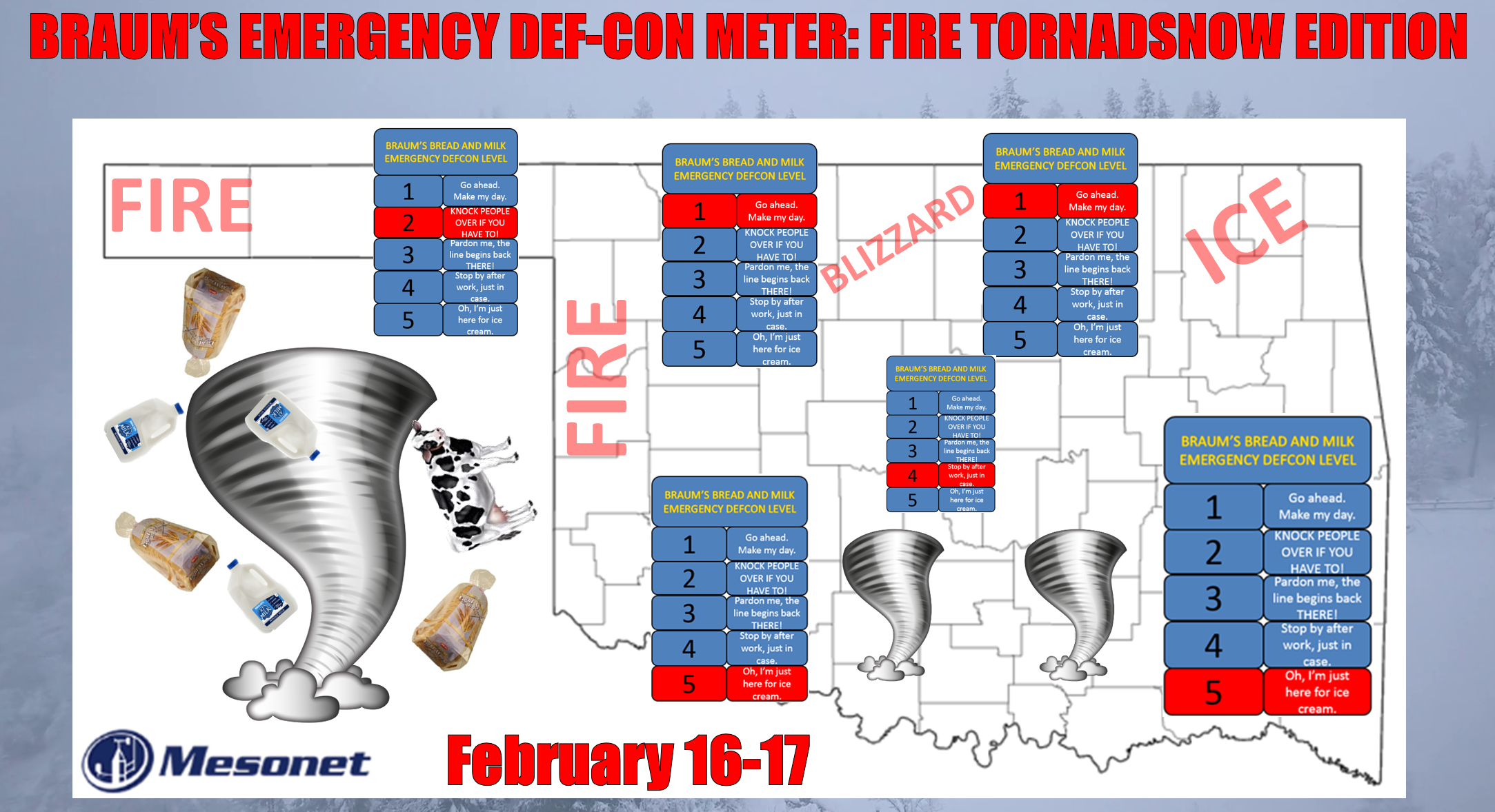
Well you wanted excitement so here you go.
ARE YOU NOT ENTERTAINED?!?
Wait, I think that was me. Okay,now is not the time to play the blame game.
SOMEBODY (I think me) called for some exciting weather and today just about takes
the cake. Now remember while we are having some fun with all the threats today,
our satirical look at the setup is meant to convey a sense of urgency to become
and REMAIN weather aware from this morning through tomorrow, because this storm
system approaching from the west is going to be giving us all sorts of fun right
through the overnight hours. And what I'm describing in the following is what it
looks like RIGHT NOW. Any shift in the track of the storm or change in the
environment could move things around a bit. It happens. Right now the storm
system is over SoCal. Sometimes weird things happen when these systems move
over the Rockies and organize once again on the other side, and that's the reason
to remain weather aware. The snow/ice/tornado threat could move over your area.
Here's a brief look at each threat.
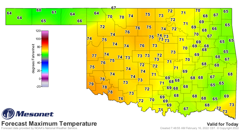
First threat: Fire. We'll have some winds gusting to 40 mph and highs approaching
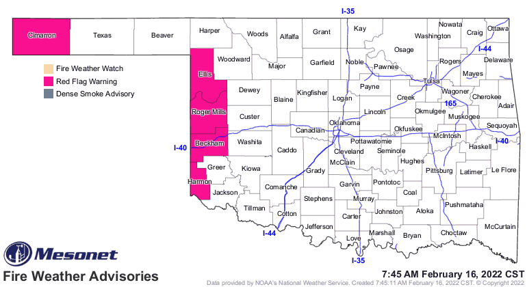
80 out west, along with very low relative humidity. That means a Red Flag Fire
warning across our far western counties in the main body of the state AND the
Panhandle.
Second threat: Severe WX. This isn't a high-end severe weather outbreak kind of
day, but there is a chance of some large hail, severe winds, and a few brief
tornado spin-ups (those QLCS kind you get at the leading edge of storms that
give you very little notice at times). And this will occur in the overnight
hours, unfortunately, mainly across south central Oklahoma. Storms should fire
up late in the evening out west and move to the NE, increasing in coverage.
Somebody is liable to get a tornado warning about 3am, so put on a pot of coffee.
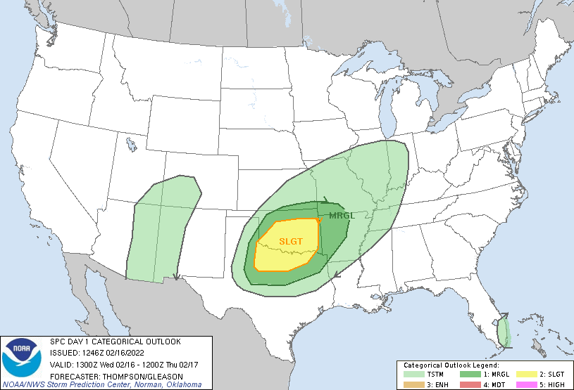
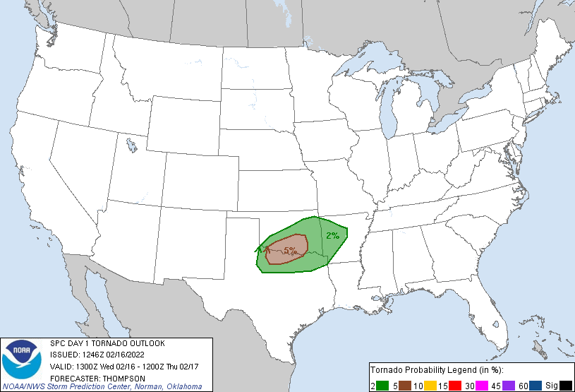
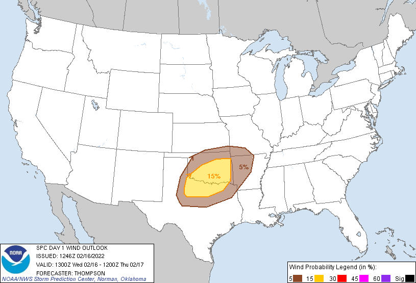
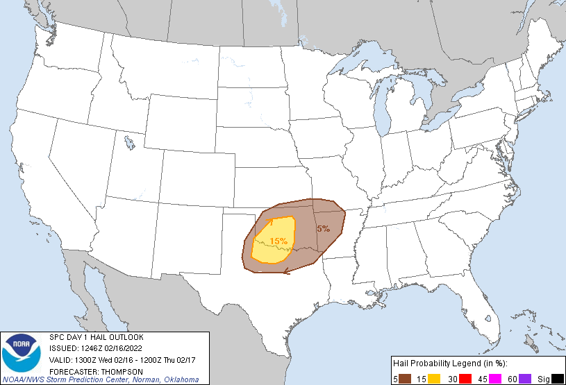
Our friends at NWS Norman give you a bleary-eyed timetable for the festivities
tonight.
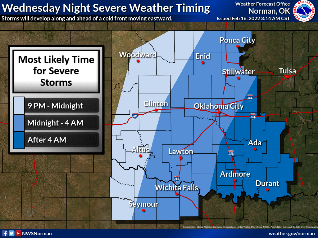
These maps have shifted since yesterday (haven't we all?), so don't be shocked
if things move around a bit more in the next 12 hours. You shouldn't be if you
STAY WEATHER AWARE!
Third Threat: Gary Busey. Just what we needed, but we'll just leave that one
alone.
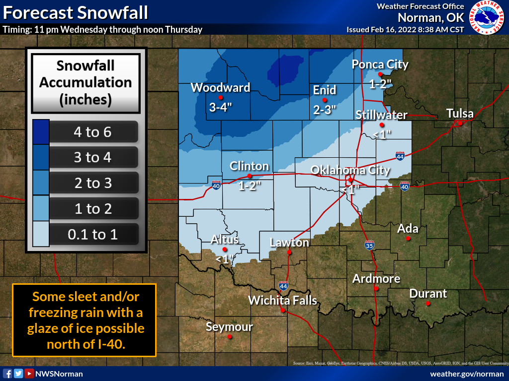
REAL Third Threat: Snow and Ice. With that arctic air plunging to the south,
we should see some rain across northern OK transition to freezing rain and
sleet, then some snow. The key here is how soon does the precip change to snow.
Don't make us show the vertical temperature profile graphic again to explain
how this works. We'll do it! We will turn this Ticker right around, mister and
misses! Okay, you asked for it.
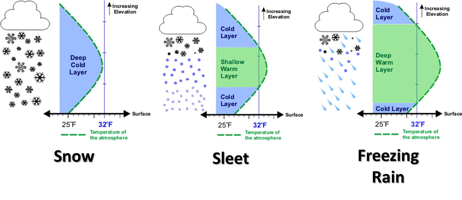
So how long until that warm tongue of air above the surface that is being
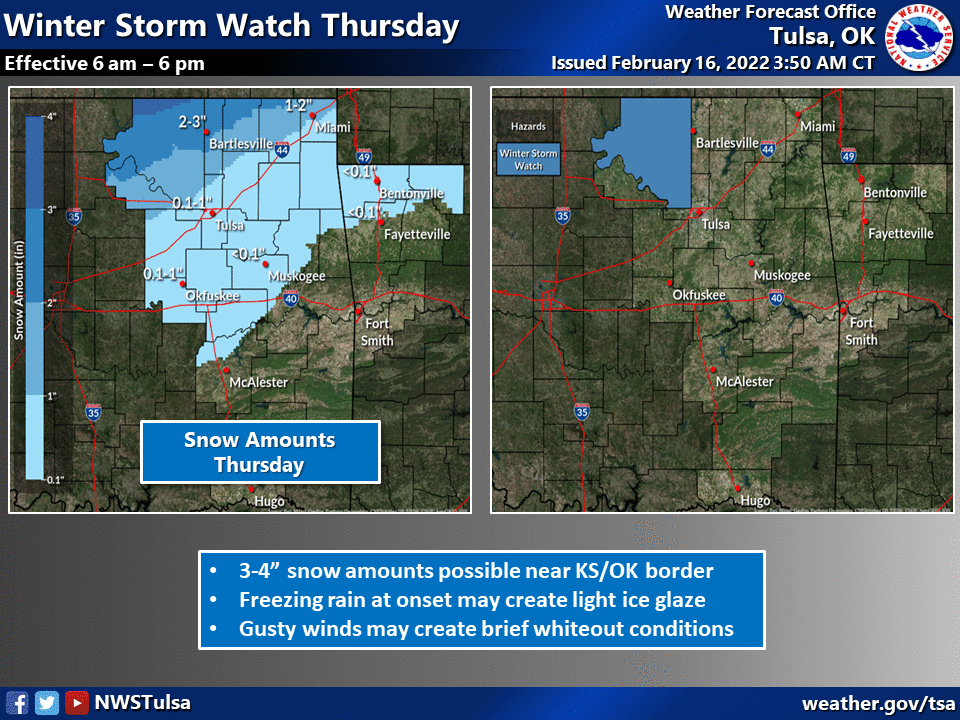
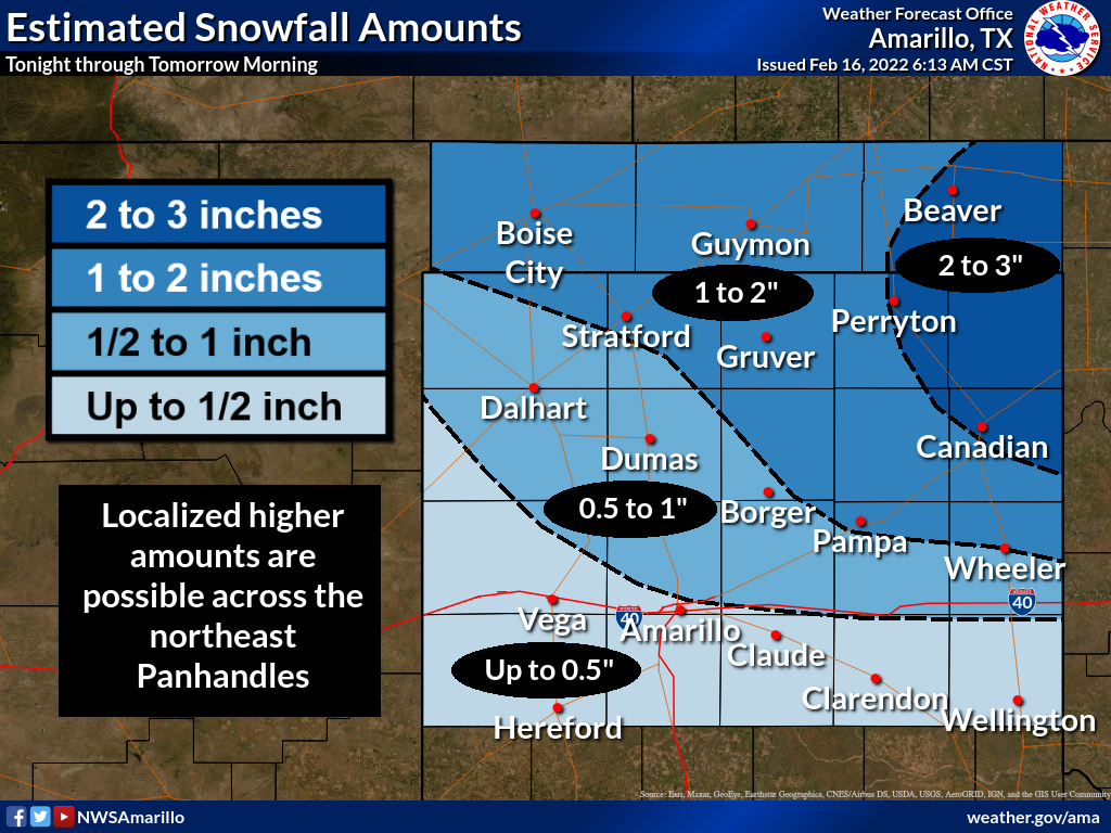
forecast will be replaced by freezing temps is the key. A good 2-4 inches is
being forecast across much of northern OK, but don't be shocked if somebody
gets upwards of 6+ inches somewhere in there with some convective banding of
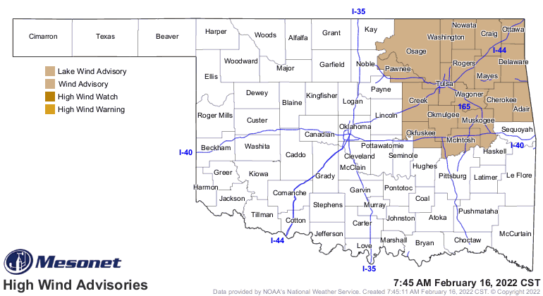
heavy snow. And with winds gusting to over 40 mph at times, we could see
blizzard-like if not downright blizzard conditions at times. There is enough
confidence at this time to warrant a Winter Storm Watch for northern OK.
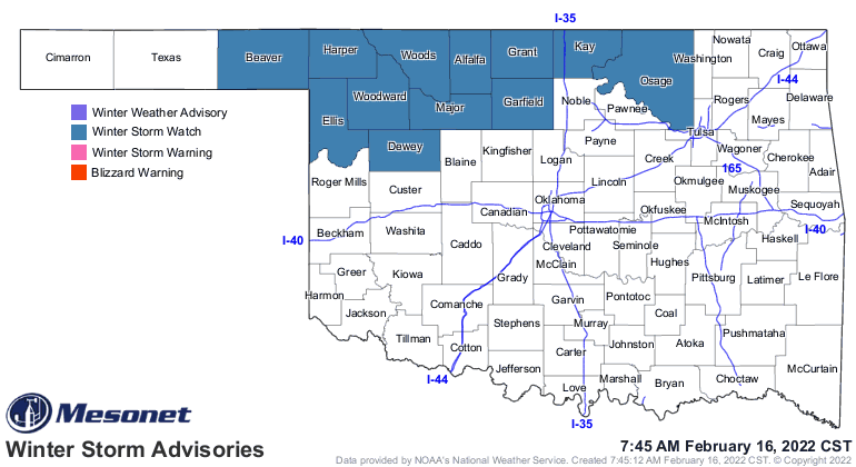
Blowing and drifting snow will be a problem if this forecast holds true, and I
haven't seen anything yet convincing me otherwise.
Fourth Threat: Cold. The arctic air will overspread the area overnight and
through the next couple of days. Nothing like we saw last year at this time,
thankfully!
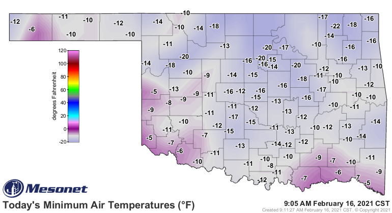
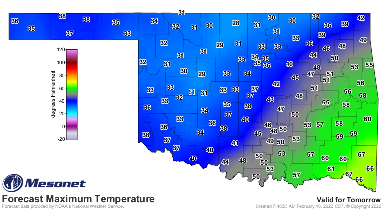
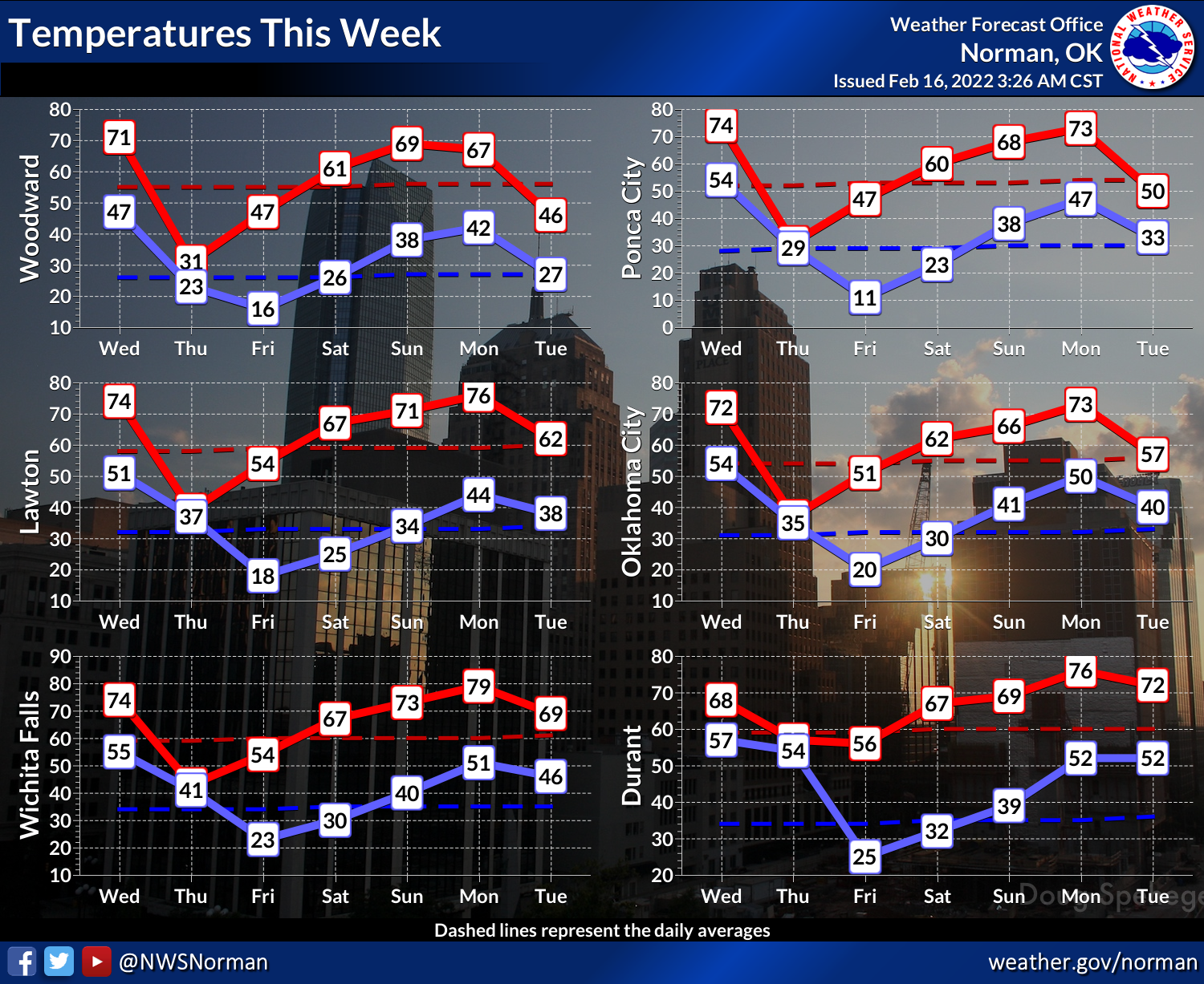
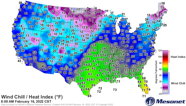
Yeah, for real. Mother Nature can be really dumb. Look for wind chills into the
single digits and teens across the state, and actual air temps not even getting
above freezing for many of us tomorrow. Many of these numbers are what you'll
see right after midnight before the front moves through, so don't be deceived
here.
But we do get a quick warm up before our next brush with "excitement" mid-week
next week as it looks like another big winter storm is possible.
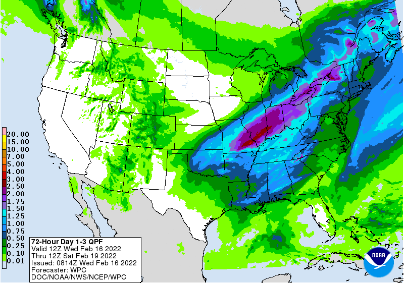
The good news is that it looks like most of the state should get a good drink
of water. As per usual for Oklahoma, it's HOW that moisture arrives that's not
quite so fun at times.
The cold front is just to our northwest, about to enter the state.
Time to hunker down until Friday.
Gary McManus
State Climatologist
Oklahoma Mesonet
Oklahoma Climatological Survey
gmcmanus@mesonet.org
February 16 in Mesonet History
| Record | Value | Station | Year |
|---|---|---|---|
| Maximum Temperature | 85°F | HOLL | 2011 |
| Minimum Temperature | -22°F | NOWA | 2021 |
| Maximum Rainfall | 3.37″ | TALI | 2008 |
Mesonet records begin in 1994.
Search by Date
If you're a bit off, don't worry, because just like horseshoes, “almost” counts on the Ticker website!