Ticker for February 15, 2022
MESONET TICKER ... MESONET TICKER ... MESONET TICKER ... MESONET TICKER ...
February 15, 2022 February 15, 2022 February 15, 2022 February 15, 2022
Course #1
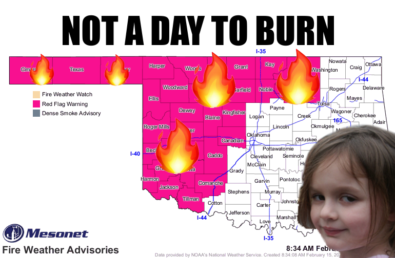
So this is day #1 of what some dolt, whose title rhymes with "Slate
Slimatologist," termed our "Smorgasbord of exciting weather." Well, maybe exciting
weather was the wrong way to put it. How about "Cornucopia of Weather Hazards?"
Remember, fire today, storms tomorrow, winter on Thursday. That's a bit too
simplified and there are fuzzy boundaries around each hazard, but close enough
for governmental weather. As per usual, here are the fire danger messages from
our NWS friends.
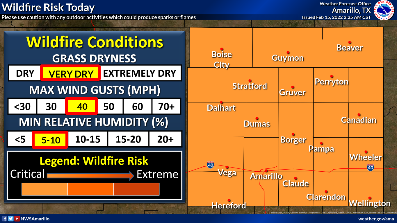
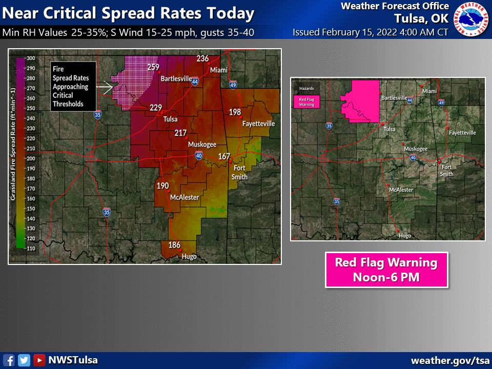
And some discussion from the fine folks at the Oklahoma Forestry Services:
"Red Flag Warning in effect today across western and northern Oklahoma
today midday into the evening. Very strong frying conditions in
previous days has enhanced composite fuel dryness resulting in
very receptive fuels overall. A strong weather system with stout south
winds will drive potential for very rapid rated of fire spread today
given the state of the fire environment. The highest fire danger
will be in the Warned Area. However, elevated fire danger will be
present across the state and given the amount of fire activity on
the landscape resource availability may be limited. Precipitation
chances build in from east to west on Wednesday limiting fire
danger in the east while another day of elevated fire danger concern
continues west."
I don't know if "Very strong frying conditions..." was a typo, but regardless,
that's some verbiage worthy of a Ticker! But there you have it...while the
highest fire danger exists in the Red Flag Warning area, THE ENTIRE STATE HAS
ELEVATED FIRE DANGER, not just the NW half of the state.
Part of the problem, as is often the case this time of year as we transition
into prime wildfire season, is the wind ahead of this approaching storm system.
We do have a wind advisory across western OK for wind gusts of 30-45 mph.
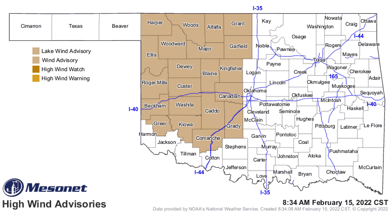
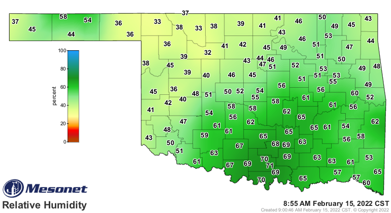
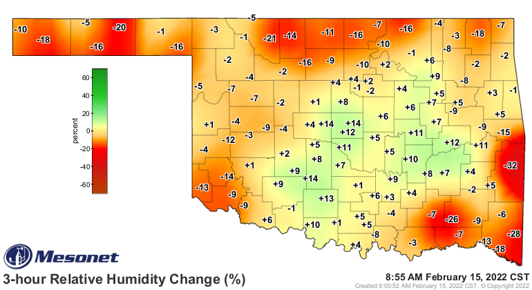
The relative humidity has already started to drop, as it normally does when
the sun comes up and we start to warm the air. It's expected to drop into the
teens and even single digits (that's "even" single digits, meaning both odds
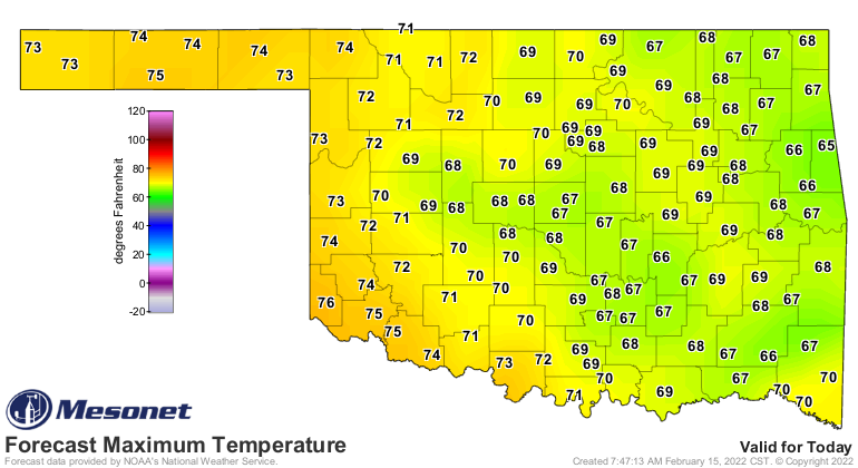
AND evens) out across western OK in the heat of the day. Highs are forecast into
the 70s in that area, and I wouldn't be shocked to see some 80s. I'd be shocked
if *I* see 80, but that's a different story.
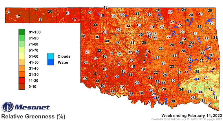
So all of that, in addition to the abundance of dry fuels across the state,
adds up to a powderkeg waiting for a spark.
Much of the western half of the state is in a burn ban. Oh, woe be unto those
that accidentally or intentionally start a wildfire in a county with a burn ban.
Bad. Very bad.
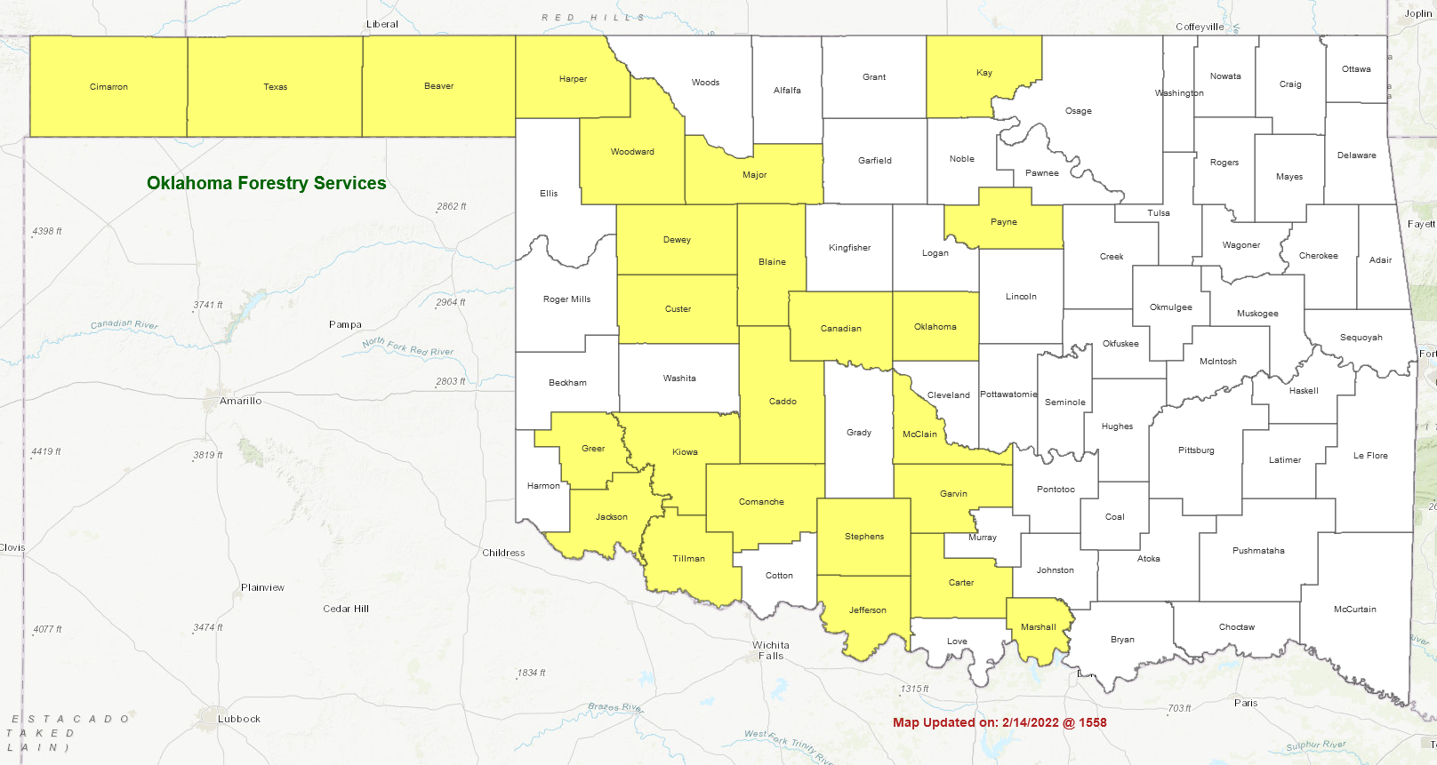
So that's the "Gary's Anatomy" of our first weather hazard, high fire danger.
Sorry, no hot doctors in this show...no McDreamy, only McDroughty.
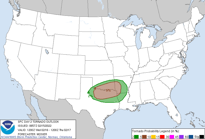
REMEMBER! Our hazard #2 is another pretty familiar one coming tomorrow and
overnight into Thursday with a chance of severe storms. Tornado chances are low
(BUT NOT ZERO) across much of the southeastern third of the state, and there
could be some big hail and high winds. The time to prepare for THAT contingency
is now. Might be a good time to clean out that storm cellar where all the creepy
crawlies (I HEARD THAT!) tried to hide over the winter. This is not a high
end severe weather threat, but high enough.
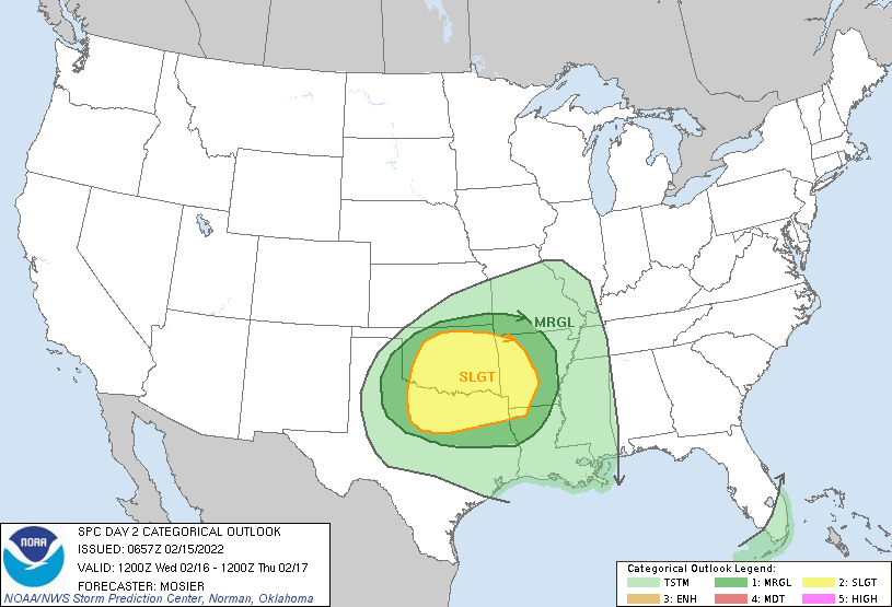
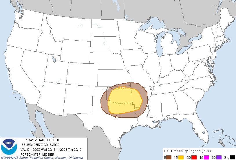
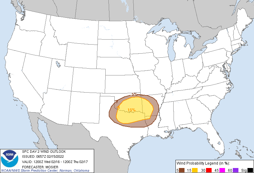
After that, ice and snow threaten the northern half of the state late Wednesday
night into Thursday. The models have started to consistently bring snow amounts
of 4-6 inches (and more) down into north central OK, with diminishing amounts
down to about I40. And also some ice accumulations of a quarter inch or so
across far northern OK are possible if the transition to snow is slow enough.
Probably good enough for a Braum's alert for tomorrow, if needed.
Gary McManus
Slate Slimatologist
Oklahoma Mesonet
Oklahoma Climatological Survey
gmcmanus@mesonet.org
February 15 in Mesonet History
| Record | Value | Station | Year |
|---|---|---|---|
| Maximum Temperature | 86°F | BURN | 2000 |
| Minimum Temperature | -22°F | KENT | 2021 |
| Maximum Rainfall | 2.12″ | CLOU | 2001 |
Mesonet records begin in 1994.
Search by Date
If you're a bit off, don't worry, because just like horseshoes, “almost” counts on the Ticker website!