Ticker for February 10, 2022
MESONET TICKER ... MESONET TICKER ... MESONET TICKER ... MESONET TICKER ...
February 10, 2022 February 10, 2022 February 10, 2022 February 10, 2022
Same as it ever was
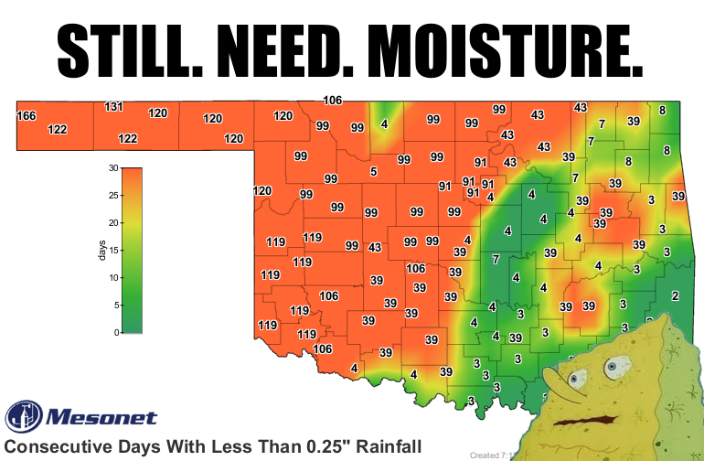
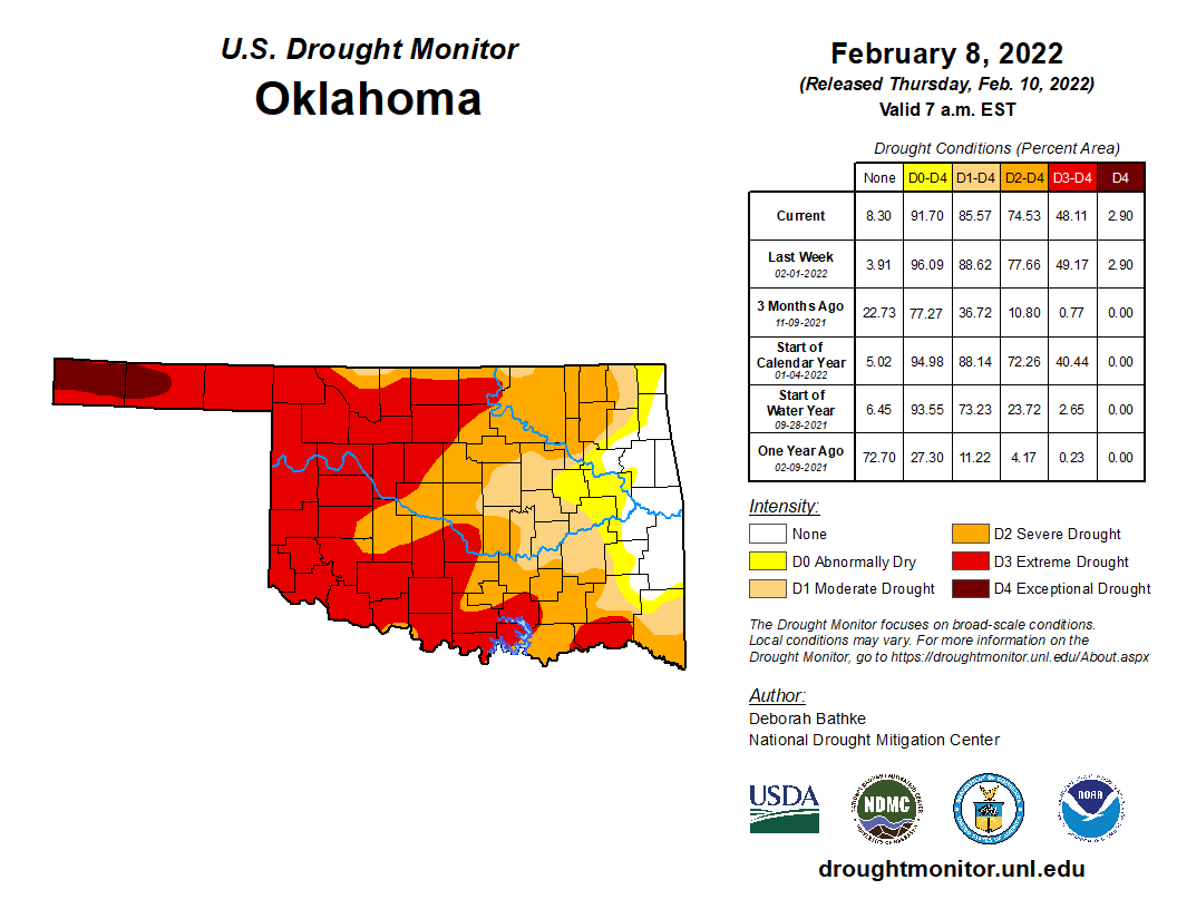
We get to talk drought today because YOU people did not do your job and hype up
the snowstorm for next week. So instead, we'll get some rain, possibly some
storms, and MAYBE the dreaded "winter mix." Or it could all change between now
and then. Now you may wonder why we're talking drought after such a lovely
blanket of snow covered the state just last week at this time? And you may find
yourself living in a shotgun shack. And you may find yourself in another part of
the world!
Pardon me for a minute.
"Letting the days go by, let the water hold me down.
Letting the days go by, water flowing underground.
Into the blue again after the money's gone.
Once in a lifetime, water flowing underground.
Same as it ever was, same as it ever was."
(This Talking Heads moment brought to you by our rain-making law firm "Dewey,
Screwem, and Howe).
Okay, back to drought. Well, for one it was a dry snow, and for deux, there
wasn't enough of it. Check out the 30-day rainfall maps from the Oklahoma
Mesonet and you can see that moisture gets quickly watered down (BA DUM BUM!).
And the stats show we are still mired in drought across the western 5/6ths of
the state.
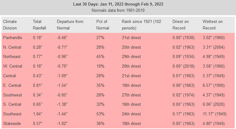
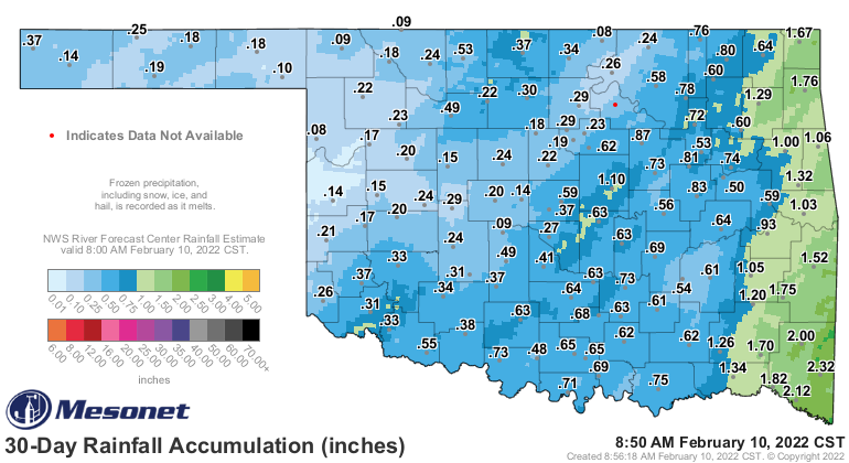
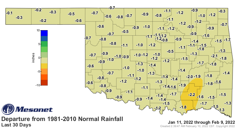
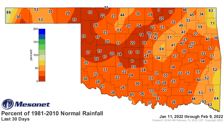
In fact, in some areas, we could have gone with drought intensification, arguably.
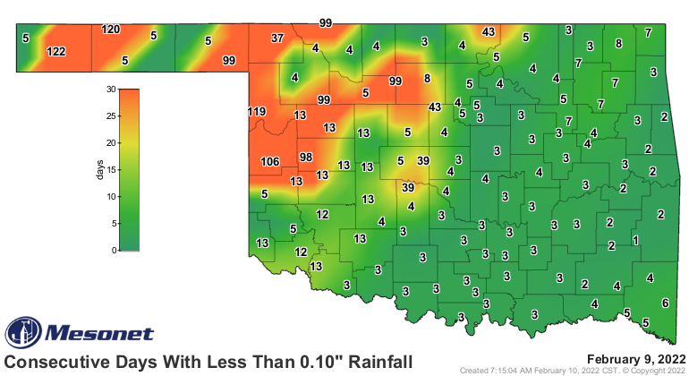
Now the good part about snowfall and drought is that the snow tends to lay in
one place and melt, which allows it to more readily soak into the ground.
However, this snow was again more of a powdery dry type, and it got blown into
piles, which diminishes the impacts on soil just a bit. What it didn't do is
recharge some of those stock ponds and farm ponds, however. For that, we need
more runoff, and that means rain. Convective rain helps even more. Thunderstorms.
That's where we might be next week, at least in the early stages of the storm.
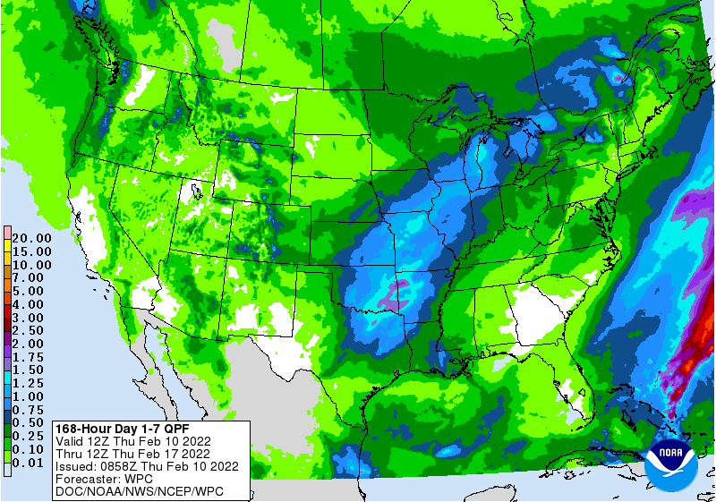
We're starting to see some of that convective type rain show up on the 7-day
rain forecast, too. You can almost imagine the line of storms marching across
the state on Wednesday.
That's okay. Storms are good. Shouldn't be too bad, and we had a good snow,
at least most of us did. AND there will still be a chance of snow across
the Panhandle. Well, the entire state, really, but that's just if the pattern
shifts south considerably between now and next Wednesday.
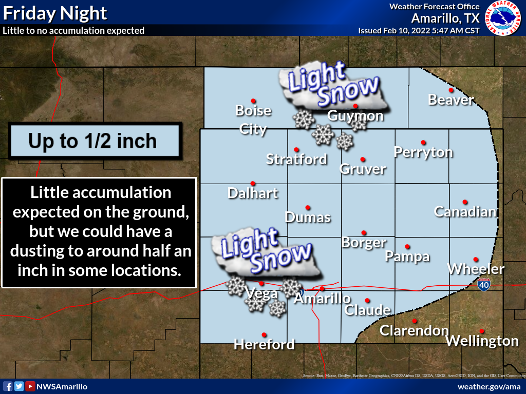
Still not enough big rains showing up across western OK, where it's needed the
most. But, you know how that is.
Same as it ever was, same as it ever was.
https://www.youtube.com/watch?v=5IsSpAOD6K8
Gary McManus
State Climatologist
Oklahoma Mesonet
Oklahoma Climatological Survey
gmcmanus@mesonet.org
February 10 in Mesonet History
| Record | Value | Station | Year |
|---|---|---|---|
| Maximum Temperature | 94°F | BEAV | 2017 |
| Minimum Temperature | -31°F | NOWA | 2011 |
| Maximum Rainfall | 2.81″ | IDAB | 1998 |
Mesonet records begin in 1994.
Search by Date
If you're a bit off, don't worry, because just like horseshoes, “almost” counts on the Ticker website!