Ticker for February 9, 2022
MESONET TICKER ... MESONET TICKER ... MESONET TICKER ... MESONET TICKER ...
February 9, 2022 February 9, 2022 February 9, 2022 February 9, 2022
Ye olde fantasy-cast
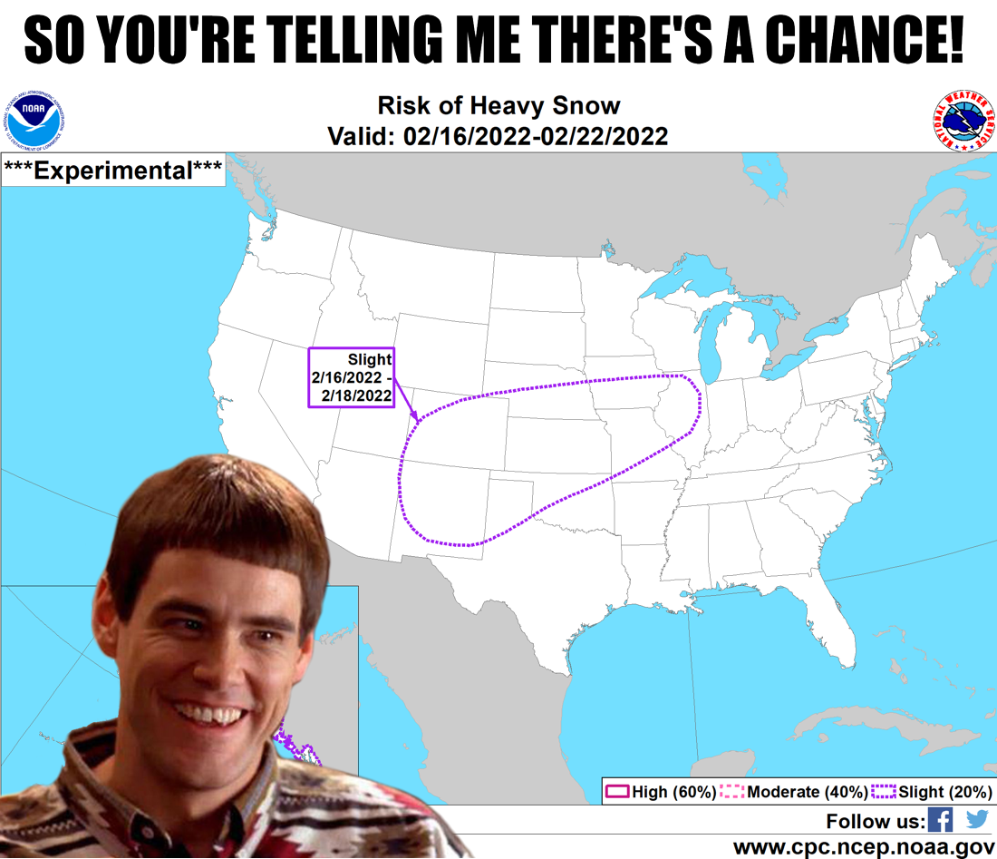
Remember what Mercutio said to Romeo after he was stabbed by Tybalt's sword? What?
Philistines!
"Ask for me tomorrow, and you shall find me a grave man." The same goes for our
fleeting snow forecast for next week...check the same graphic above tomorrow and
even the "SLIGHT" chance might be one in a million. Unfortunately, no, we wouldn't
be telling you there's a chance. What we have is a possible storm system digging
to the south just like last week's, and some cold air will probably be drawn down
by it from the north if the storm actually materializes, and there will probably
be some Gulf moisture return ahead of the system. So you put all that together and
what do you get?
Well, either a lot of something or a whole lot of nothing. You see, that's how
fantasy-casts work. BUT (and that's a big but...GASP! Shame on you!), next week's
possible storm is now just about within that 7-day realm of forecast model
possibility. There will probably be a storm system...ahhh, I've already done the
uncertainty thing. As with going to the bathroom, it's all in the timing. Some
models are saying storms, then cold air, then some wintry precip. Some are saying
some storms with a cold rain to finish us off. All of this will become more
clear when the days draw near. Last week's storm wasn't looking like the
doozy it ended up as for most folks this far out, so this one could go the same
way...or just the opposite. We ARE starting to see it on the 7-day rain
forecast. Just a hint.
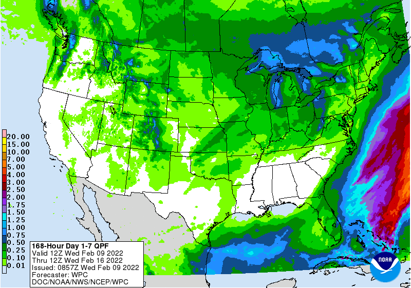
So stay tuned. Until then. we have some warm weather, then a cold front for
the weekend, then another warm up ahead of our fantasy storm next week. BLAH!
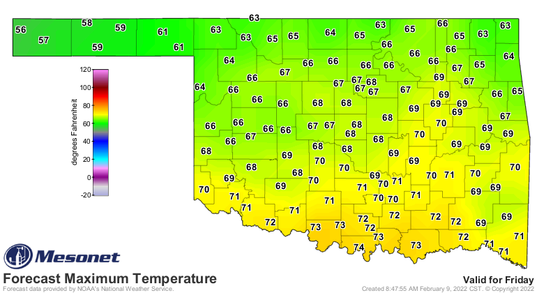
YAY!
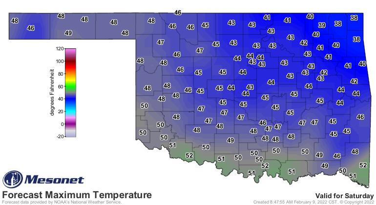
BOO!
Now what goes along with the weather this week is lots of fire danger.
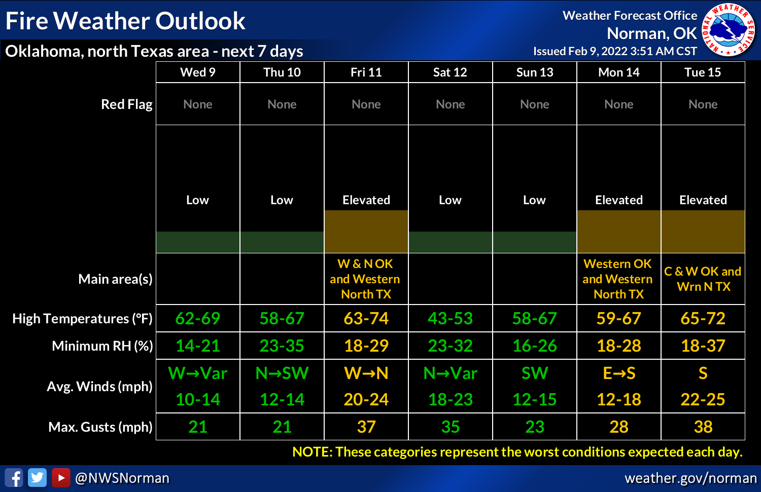
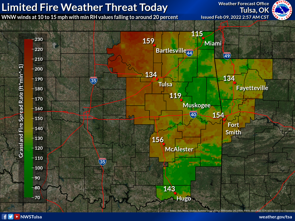
Here's what we can expect from the fine folks at the Oklahoma Forestry Services:
Statewide Discussion: With temperatures nearing fifteen degrees above
normal and low dew point temperature, afternoon relative humidity values
are expected to dip below 25% statewide resulting in very receptive
fine fuels prompting high fire danger indices. Wind speeds will remain
below critical value holding fire spread potential in the moderate
range. Dry conditions hang on through the weekend although a slight
chance of snow comes into play for parts of the Panhandle Friday night.
Taking a quick glance ahead, elevated fire danger is expected Friday
ahead of another cold front and then again early next week in advance
of weather system that is gaining some prospect of moisture. The current
Quantitative Precipitation Forecast indicates only a ‘speed bump’ for
building fire danger into the latter half of the month."
Rain? Snow? A wintry mix? Whatever that speed bump is, it's certainly better
than clear sailing during drought conditions.
Gary McManus
State Climatologist
Oklahoma Mesonet
Oklahoma Climatological Survey
gmcmanus@mesonet.org
February 9 in Mesonet History
| Record | Value | Station | Year |
|---|---|---|---|
| Maximum Temperature | 82°F | GRA2 | 2000 |
| Minimum Temperature | -18°F | MEDF | 2011 |
| Maximum Rainfall | 1.02″ | VINI | 2001 |
Mesonet records begin in 1994.
Search by Date
If you're a bit off, don't worry, because just like horseshoes, “almost” counts on the Ticker website!