Ticker for February 1, 2022
MESONET TICKER ... MESONET TICKER ... MESONET TICKER ... MESONET TICKER ...
February 1, 2022 February 1, 2022 February 1, 2022 February 1, 2022
ICE CREAMAGEDDON
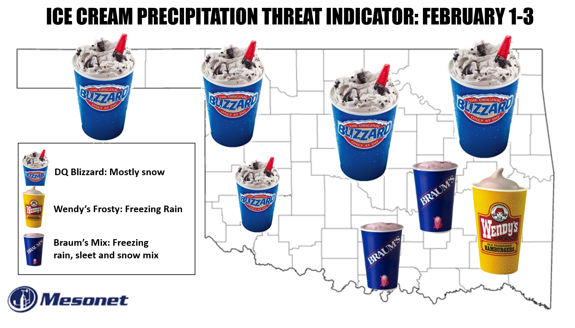
Someday, I will get free ice cream. Oh, it might be on the coldest day in
Oklahoma history...you know, when hell hath frozen over, but I'll get it one
way or another. Now that I think of it, wouldn't the Okie Prime Rib Precipitation
Threat Indicator sound better? At any rate, just another humorous (humerus for
you orthos out there) attempt to convey what is really difficult to convey, and
really a call for you to get prepared AND start tuning into your favorite
media/governmental weather source for up to the minute weather information. At
least the picture is starting to become a bit more clear. The cold front has
entered the NW part of the state, as expected.
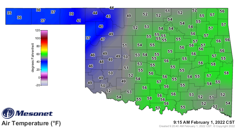
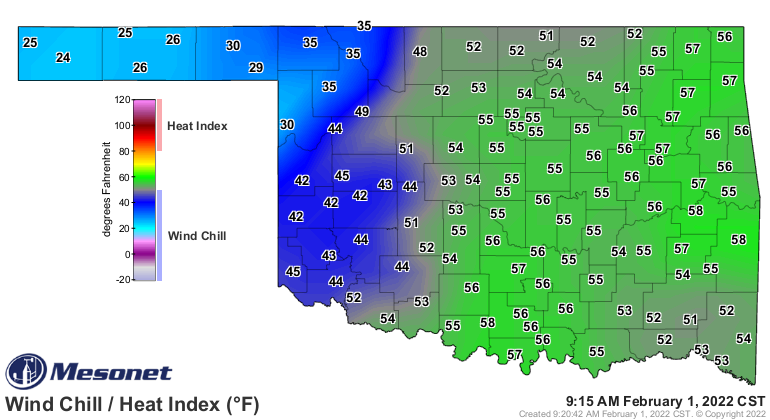
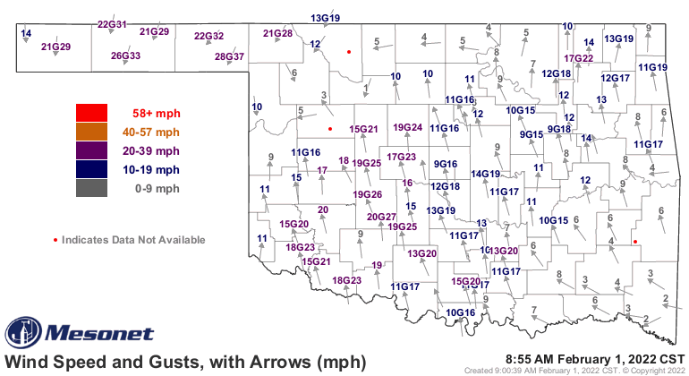
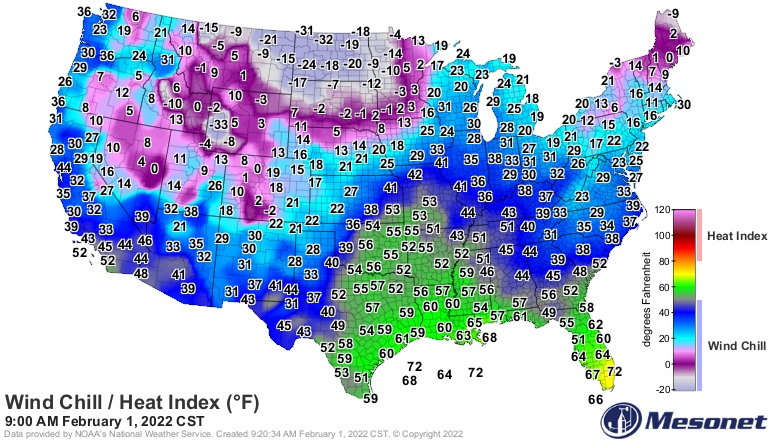
Don't be fooled by those rather ordinary temps, however. The really cold air
is lying in wait up North and will begin spilling down into Oklahoma tomorrow
on the Chapped Red Rump Express through the night and into tomorrow.
Now the good news is it looks like the forecast models have shifted much of the
expected heavy freezing rain to the southeast. Well, not shifted, more like
reduced it to mainly be in the southeast. I know that is not good for the
southeast, but for the I-44 corridor, it means less chances of power disruptions.
The southeast remains in that threat, unfortunately. That hasn't changed. However,
there is still ample time to see that shift even farther SE, or shrink even
more. We should see some light precip start to fall this evening that will
start to transition to snow in the NW and a wintry mix in central OK overnight.
Everything gets heavier tomorrow (remember the ice cream?? Lay off!) and the
impacts start to multiply. By Wednesday night heavy snows are falling and
some heavy freezing rain down in the southeast. At this point, you should be
in a Rocky Road stupor, unless you prefer chocolate chip. Also by this time,
if you go outside you'll freeze faster than your snot can run down your nose,
so not a good idea to be outdoors. Same thing on Thursday as the snow spreads
over the entire state before tapering off later that night.
Main threats
------------
NW OK: Heavy snow
NE OK: Heavy snow
NC OK: Heavy snow
WC OK: Moderate snow
C OK: Heavy snow and some sleet/freezing rain
EC OK: Heavy snow and some sleet/freezing rain, possibly heavy
SW OK: Moderate-to-heavy snow, some sleet/freezing rain
SC OK: Sleet/freezing rain, snow on top
SE OK: Heavy freezing rain, power disruptions possible
------------
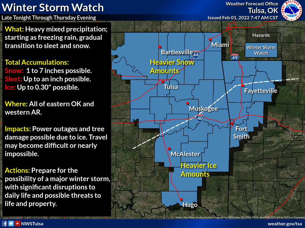
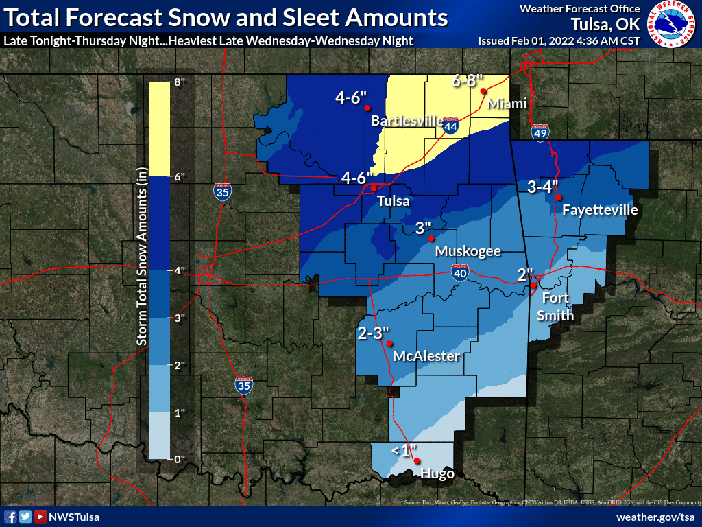
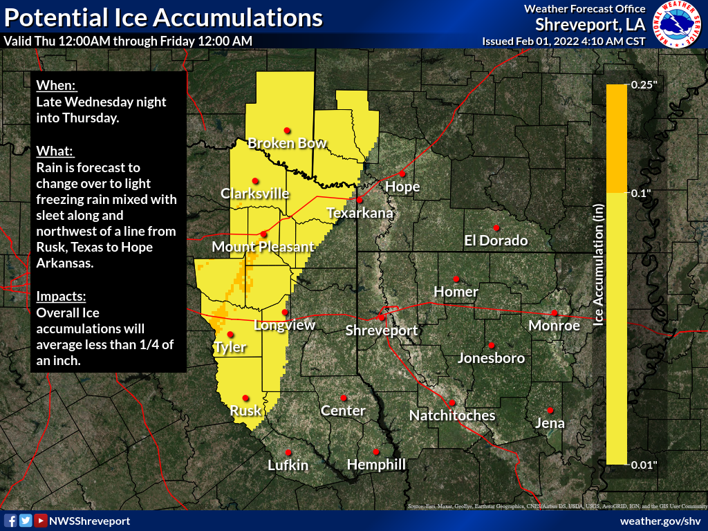
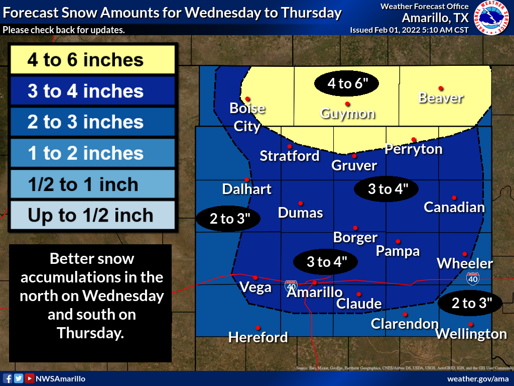
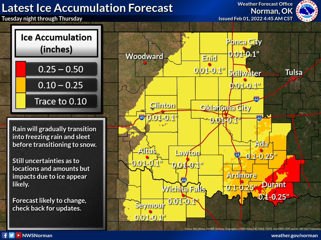
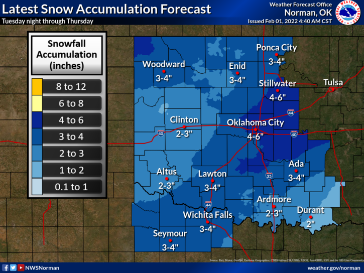
All of that can change, can shift, can get better or worse. I think somebody
gets screwed over by some dry-slotting as the storm wraps up, and other folks
see snow totals approaching double-digits. Here are what our friends at the
local NWS offices are *CURRENTLY* thinking. Keep checking back with them and
your favorite media source, however, for any changes.
Despite any changes to the precipitation forecast, the one overriding factor
from Wednesday morning through Saturday morning will be life-threatening, bone-
chilling, teeth-rattling COLD! Maybe not the coldest air of the season, but
very similar to what we had on New Year's Day. At any rate, it's time to get
ready.
ICE CREAM-AGEDDON IS AT HAND!
Now ready about January. Please?
---------------------------------------------------------------------------------
Winter Returns in January
Feb. 1, 2022
Winter arrived with conviction at the dawn of the new year in Oklahoma and
delivered a startling counterpunch to the record-shattering heat of December. At
least five strong cold fronts traversed the state during January, each one
drawing Oklahoma back into a more familiar winter mindset as memories of
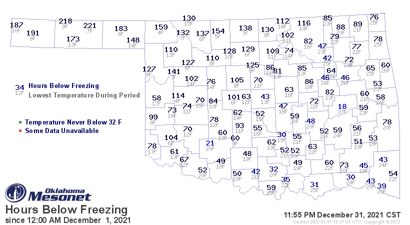
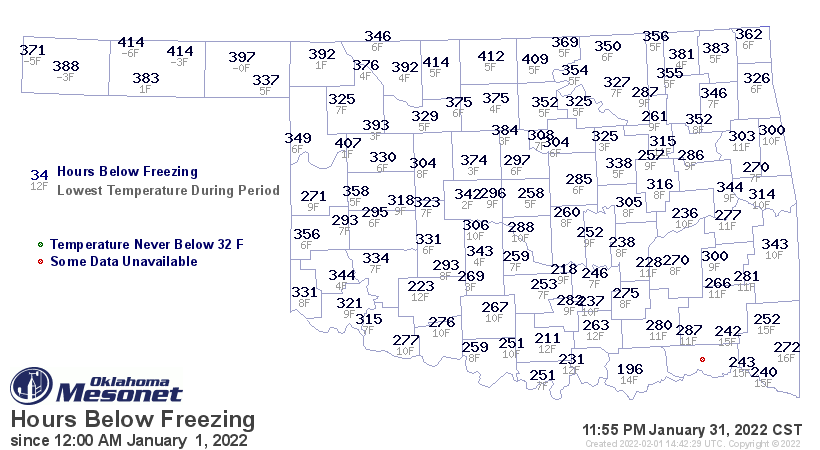
December’s warmth faded. The disparity in the hours below freezing as measured
by the Oklahoma Mesonet was demonstrative of the difference between the two
winter months. During December, most of the state spent between 50 and 150
hours below freezing. Eufaula had the fewest freezing hours with only 18. In
January, those times were more than tripled to between 250 and 400 hours, and
Durant’s 196 hours was a far greater lowest total.
One aspect of the weather that both months shared was the lack of moisture and
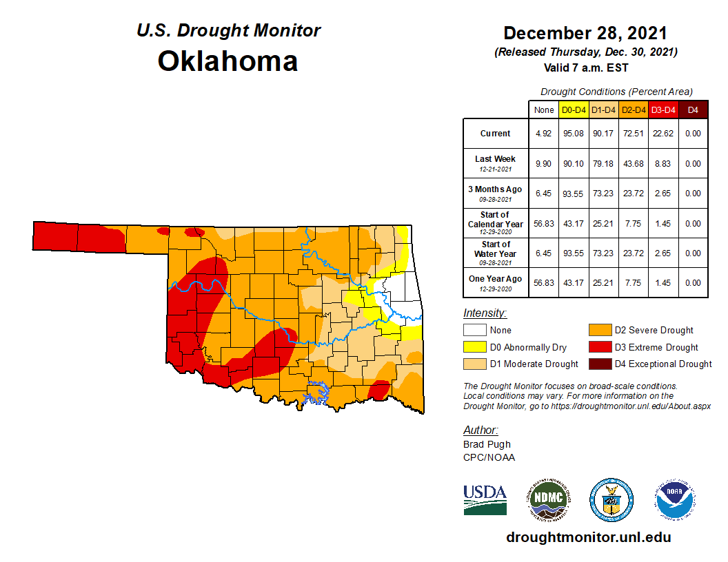
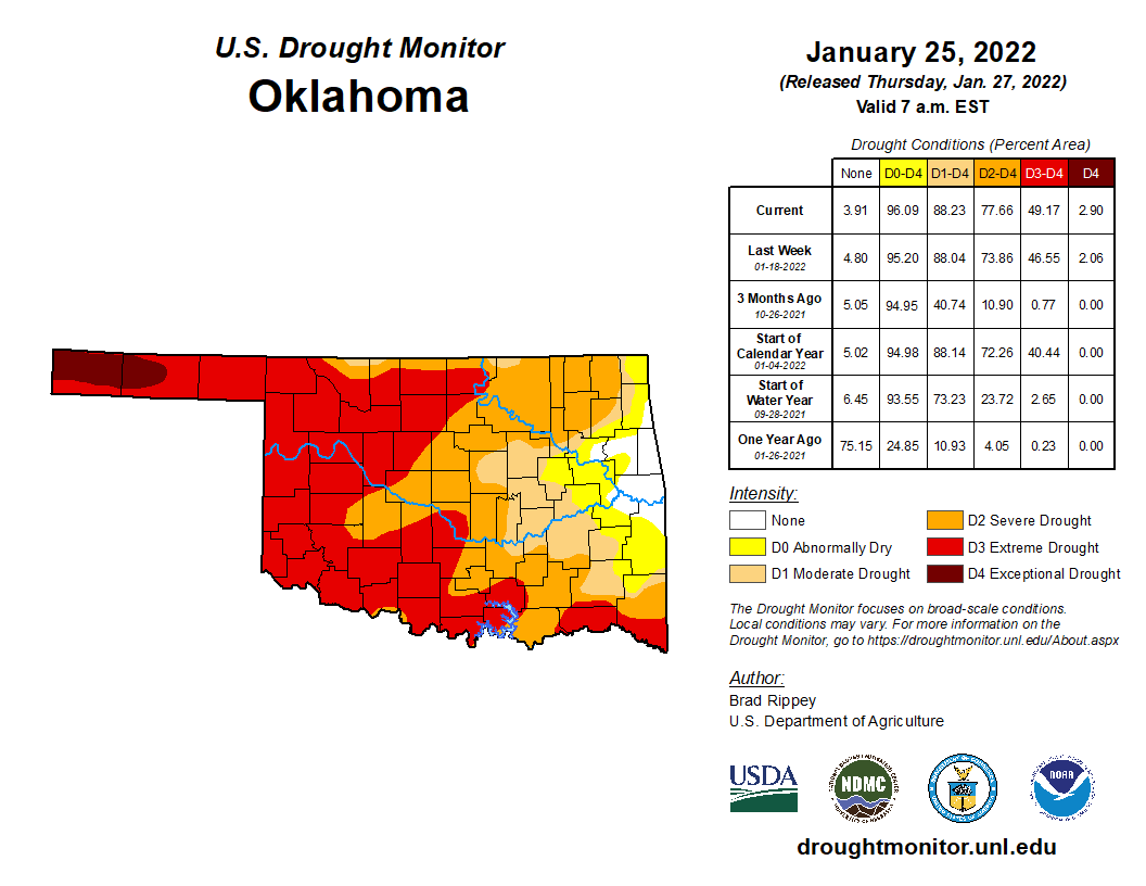
resulting drought intensification. Drought coverage actually decreased by 2%
across the state from 90% at the end of December to 88% at the end of January
according to the U.S. Drought Monitor. The amount of extreme and exceptional
drought, the two worst categories used by the Monitor, had more than doubled
from 23% to 49% over that period. Only 4% had satisfactory moisture
conditions at month’s end, contained within a small area of far east central
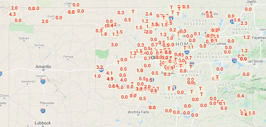
Oklahoma. Significant snowfall remained scarce, although patches of the
southwest, northeast, and western Panhandle reported 2 to 5 inches for the
month.
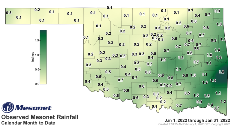
According to preliminary data from the Oklahoma Mesonet, the statewide average
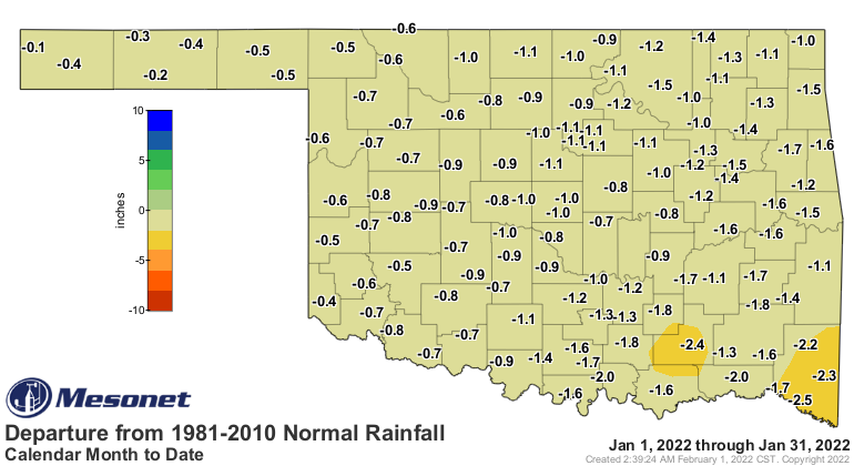
precipitation total was 0.52 inches to rank as the 20th driest January on
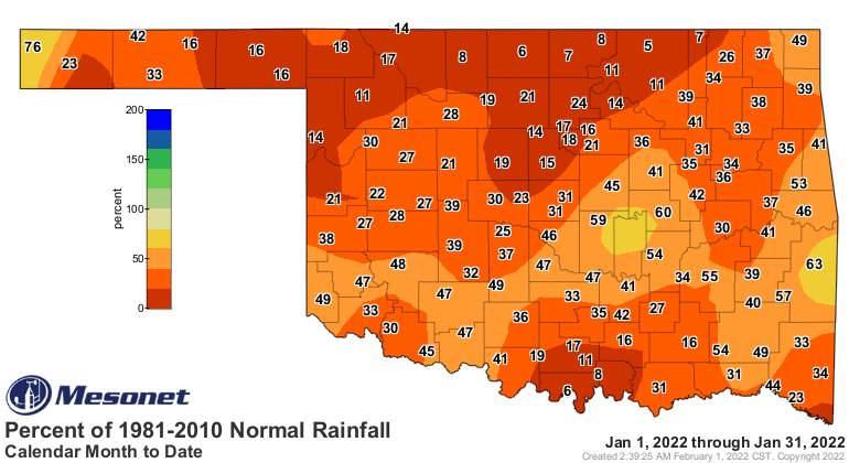
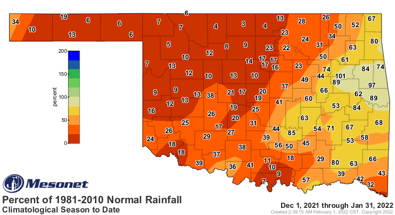
record dating back to 1895, 1.05 inches below normal. No part of Oklahoma
experienced a surplus during January, with most of the state falling below 25%
of normal. Talihina led the Mesonet totals at 1.86 inches, while Foraker had
the least with a meager 0.06 inches. Twelve other Mesonet sites failed to
eclipse a tenth of an inch during the month, while another 24 sites fell below
a quarter-inch of precipitation. Only 17 sites managed to reach above an inch,
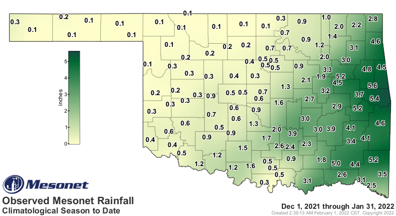
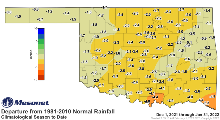
all across the eastern half of the state. Combine January with the dreadfully
dry December and the first two months of climatological winter falls to the
12th driest on record with a statewide average of 1.4 inches, 2.28 inches below
normal. For the Panhandle and north central Oklahoma, it was the third and
second driest such periods, respectively. Nearly all areas of the state fell 1
to 3 inches below normal during the first two months of winter.
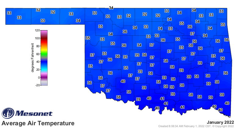
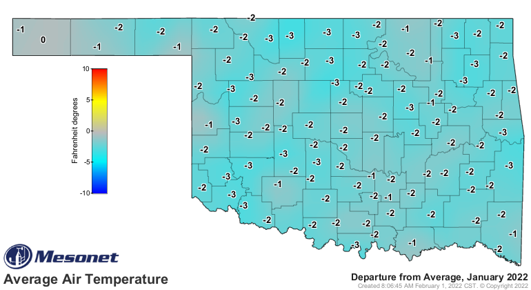
The statewide average temperature finished at 37 degrees, 1.3 degrees below
normal and ranked as the 59th coldest January since records began in 1895.
That’s a remarkable departure from December 2021’s statewide average of 50.4
degrees, a difference of 13.4 degrees between the two winter months. January's
highest reading of 78 degrees came at Waurika on the 18th. Eva recorded the
lowest temperature of the season thus far with minus 6 degrees on Jan. 2. The
wind chill at Eva reached as low as minus 22 degrees to lead the Mesonet in
that January category as well. There were 43 wind chill values of less than
minus 10 degrees across the 120 Mesonet sites during the month. Combined, the
first two months of climatological winter finished at 43.7 degrees statewide,
the second warmest such period since records began in 1895 and 4.5 degrees
above normal. Only the December 1922-January 1923 mark of 44.1 degrees was
higher.
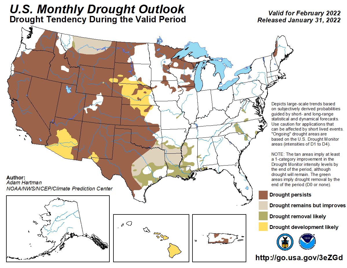
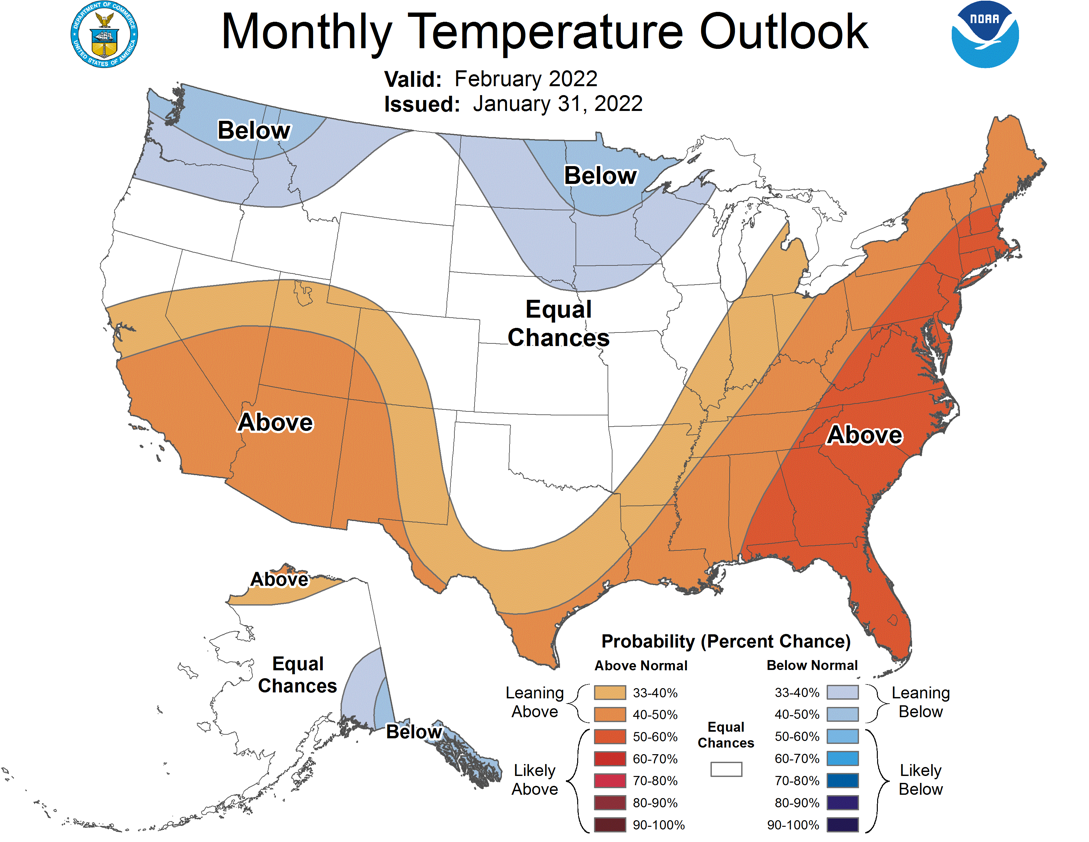
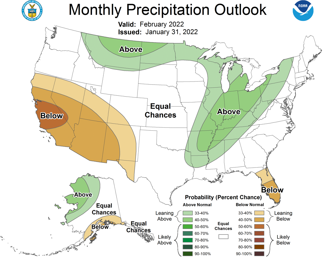
The February drought outlook from the Climate Prediction Center does not hold
much hope for improvement, save for far southeastern Oklahoma where some relief
is noted. Persistence is indicated elsewhere. The temperature outlook maintains
equal chances of above-, below-, and near-normal temperatures, and there is
only a small sliver of southeastern Oklahoma with increased odds of above
normal precipitation according to the precipitation outlook. February is the
second driest calendar month for Oklahoma, therefore above normal precipitation
would be necessary to impact drought conditions.
Gary McManus
State Climatologist
Oklahoma Mesonet
Oklahoma Climatological Survey
gmcmanus@mesonet.org
February 1 in Mesonet History
| Record | Value | Station | Year |
|---|---|---|---|
| Maximum Temperature | 81°F | SLAP | 2003 |
| Minimum Temperature | -7°F | BOIS | 2011 |
| Maximum Rainfall | 1.61″ | MTHE | 2011 |
Mesonet records begin in 1994.
Search by Date
If you're a bit off, don't worry, because just like horseshoes, “almost” counts on the Ticker website!