Ticker for January 31, 2022
MESONET TICKER ... MESONET TICKER ... MESONET TICKER ... MESONET TICKER ...
January 31, 2022 January 31, 2022 January 31, 2022 January 31, 2022
Ice Ice Maybe
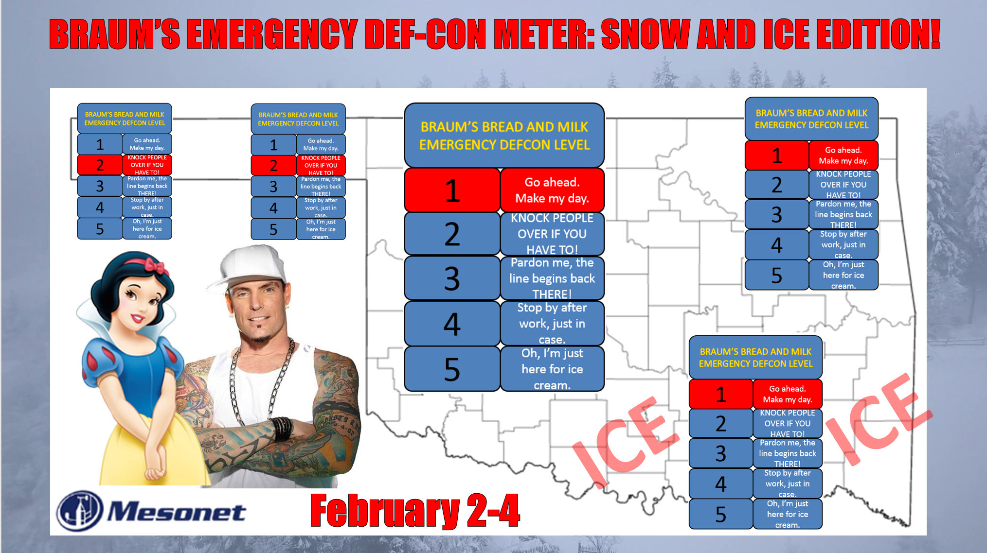
Well, we asked for something exciting, right?
Right?
Well, we got it, and my guess is the excitement is going to quickly turn to dread
once it's over. Sounds a lot like that hair-growing paste I bought online from
China. While the Braum's DEF-CON Meter is a somewhat humorous (AHEM!) look at a
real weather hazard, its real intent is to get you to sit up and take notice. So
notice (and represent...word to your muthah!).
We have a 3-4 day blast of winter right out of last February, complete with a
POSSIBLE crippling ice storm, a PROBABLE snowstorm, and DEFINITE life-threatening
cold air. Let's start with the cold air. Sometime early Tuesday morning, a front
will begin to make its way through the state, bringing some of the coldest air
of the season. Ever hear of October, November, December? Moron months. That blast
of cold to begin 2022 was plenty cold, thank you very much, but this one will rival
it in both the sheer frigidity of the air, and the threat of dangerous wind chills.
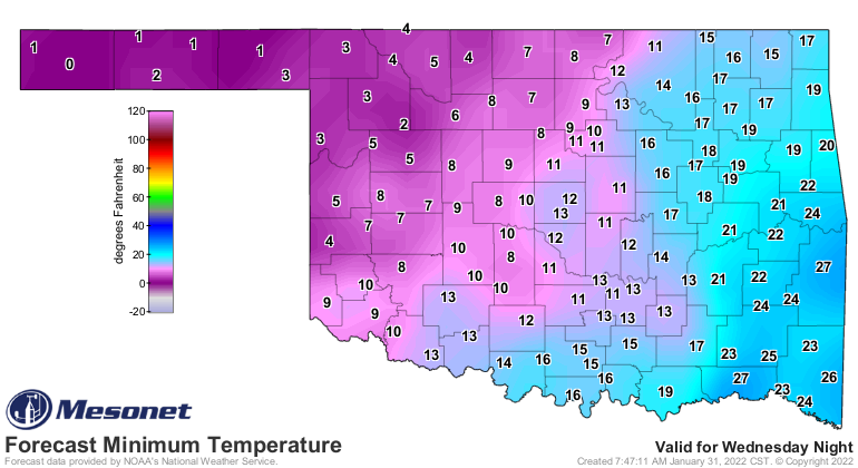
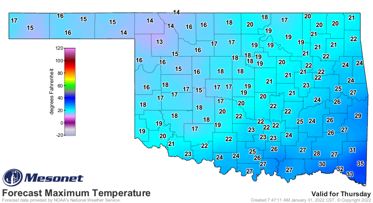
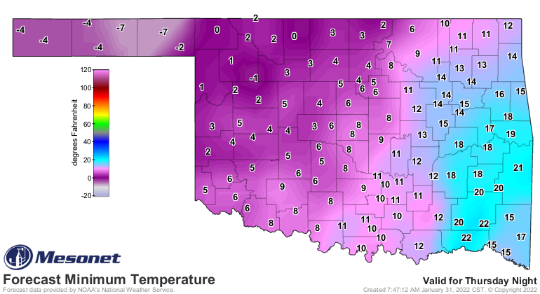
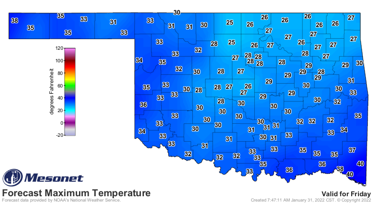
The cold air will bottom out on Friday morning with lows in the single digits
to below zero across the northwestern two-thirds of the state, and in the teens
across the far SE. Wind chills Thur/Fri will be hovering around zero to
minus 20 degrees for much of the time. Those are State Climatologist-bursting
temperatures.
Also on Tuesday, a powerful upper-level storm will swing down to our west
and we'll see return moisture from the Gulf of Mexico. As that upper low takes
its time pivoting through the state, we'll see lots of precipitation...like we
have seen in months. Check out this 5-day liquid-precip forecast for an idea of
amounts we're working with. Some of this will of course be frozen precip.
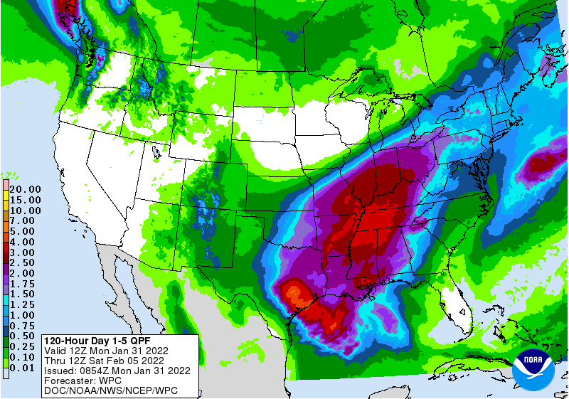
So 1-3 inches in the SE to about a quarter-to-half inch in the Panhandle, if
we're lucky. That moisture is sorely needed! However, the possible damage and
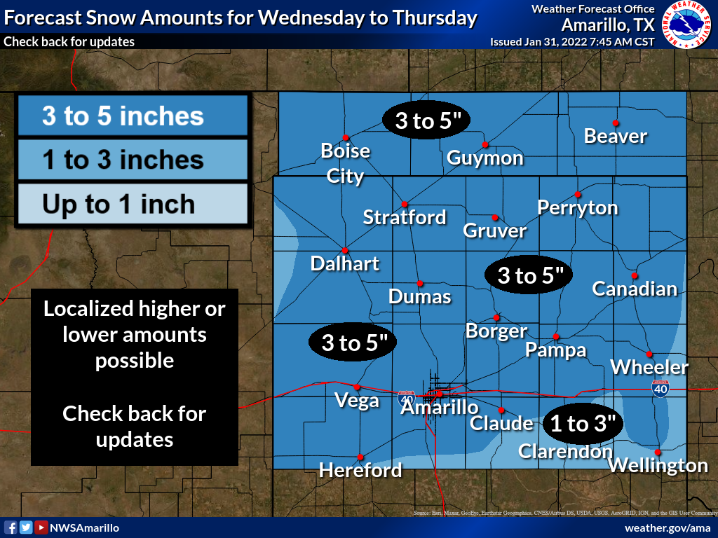
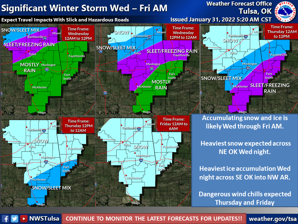
impacts are a poor tradeoff. Here is what the local NWS offices are thinking
right now. MOSTLY what they're thinking is just get the general idea out there,
and keep up to date as much as possible with each forecast period, because these
forecasts WILL be changing, possibly significantly.
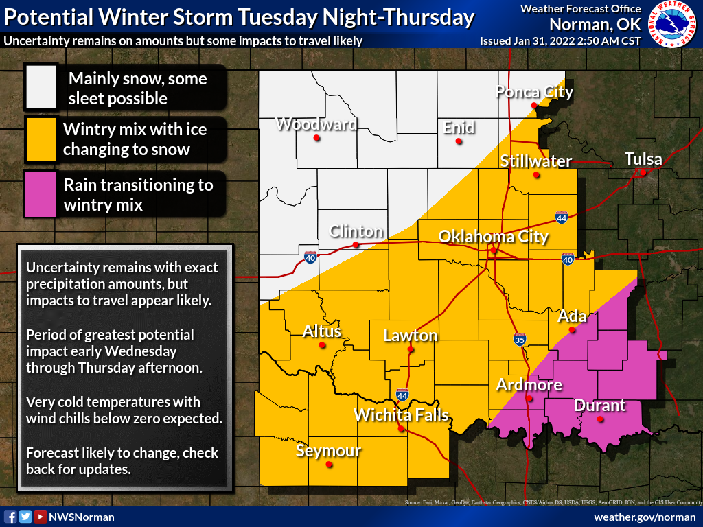
So lots of uncertainty still. Why is that? I mean, we're a day away from the
front, right? Well, we alluded to that last week when the storm system was first
showing signs of dipping south and impacting Oklahoma.
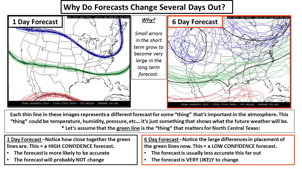
First off, the storm is still off the West Coast over the ocean, so it isn't
well-sampled by our somewhat-dense network of observing sites on land. What our
forecast models are using now to show the initial observations are satellites,
ship, and buoy measurements. And any sort of "misread" of that initial condition
of the storm will multiply into greater uncertainty the farther out you go in
the forecast. Think CHAOS.
And then you're trying to forecast the vertical temperature structure of the
atmosphere 50-100 hours out, which is the main determinant in what TYPE of
frozen precipitation falls. Right now, in the latest data, it appears there will
be a layer of warm air above the surface of enough thickness to produce either
a blanket of sleet (which sucks for driving) or freezing rain (which just plain
sucks) across the southeastern half of the state, south and east of the I-44
corridor.
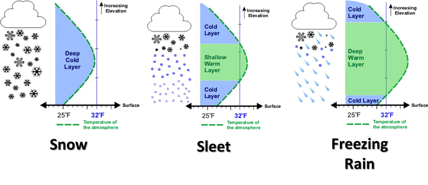
Now later on, when the actual upper-low itself moves over the state and the cold
air deepens through the entire atmosphere, we should see all snow. But the big
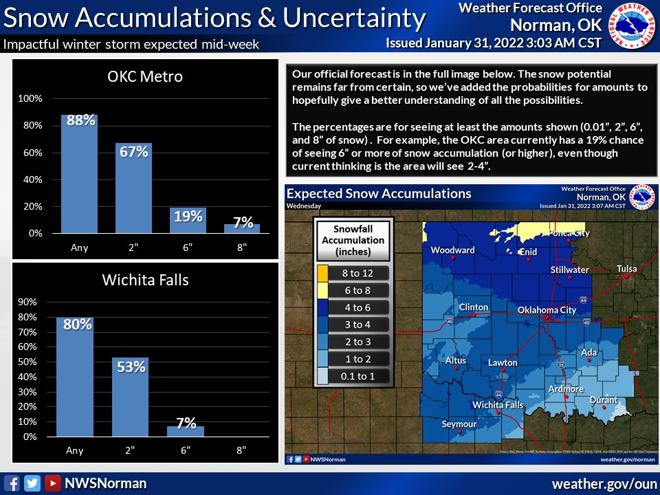
limiting factor on forecasting snow amounts is, just how much of the precip
between late Tuesday night through Thursday morning will be sleet or freezing
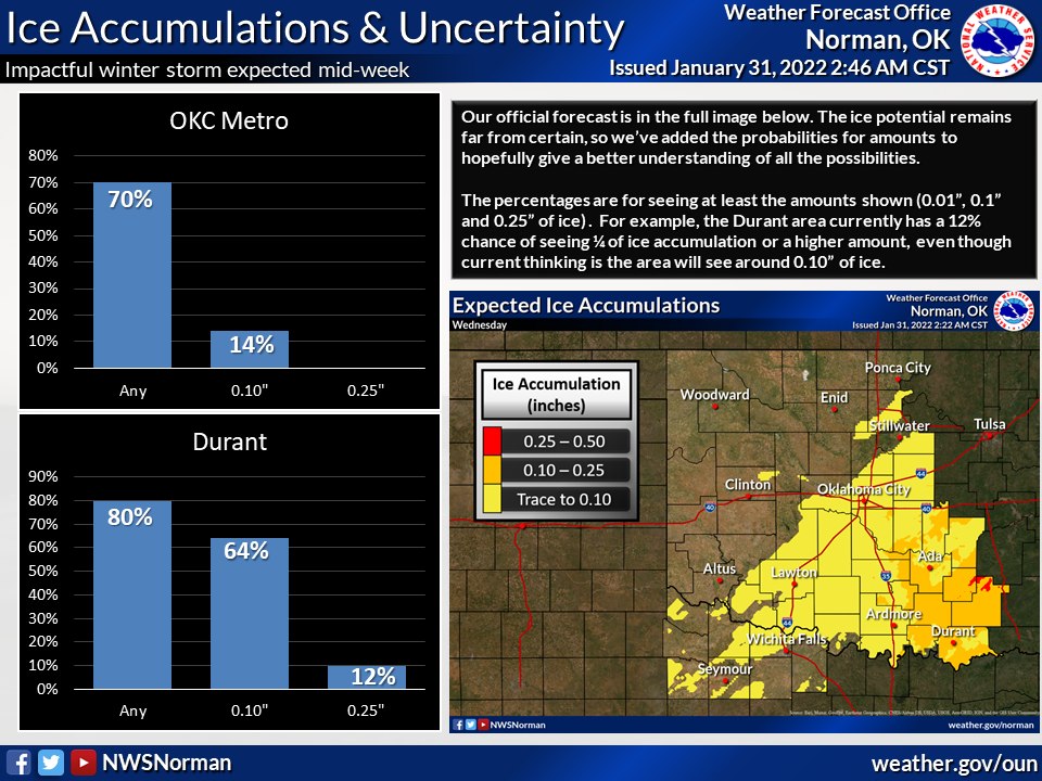
rain. Our good friends at the Norman NWS office have demonstrated these
difficult and differing probabilities in a couple of nice graphics, just as an
example.
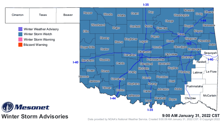
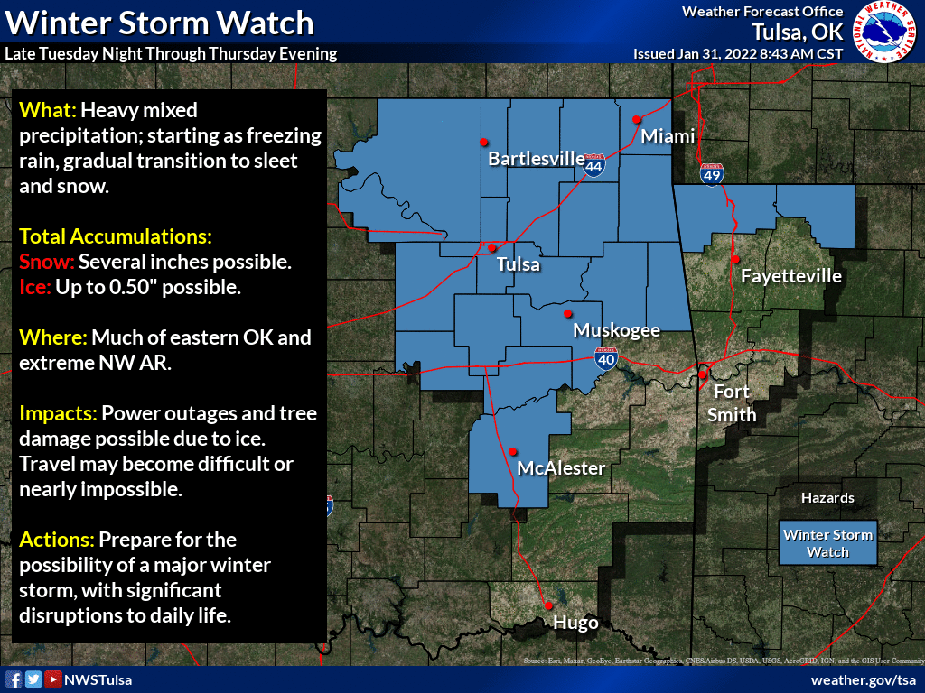
We now have a winter storm watch over much of the state for the period. These
will possibly be updated to winter storm warnings, and spread farther out into
the Panhandle. Now the southeast is a bit trickier. There is a possibility we
could see some sort of ice storm warning later on. There is a much smaller
chance these advisories could be lessened as we go through the next few forecast
periods.
So what can you do right now, with all that uncertainty facing you in the
forecast?
FLEE! SAVE YOURSELVES!

NO NO NO! No need to panic. You have 2+ days to prepare. What will you do if'n
you lose power? What do you need to have in case you can't get out and about?
Do you have enough water if your pipes freeze? Do you have enough food in the
house (HELLO!)? Do you have enough TP, for crying out loud!
So there you have it, lots of uncertainty was both offered AND intended. We will
all know much more tomorrow, and even more on Wednesday. Heck, we probably know
more than since I started typing at 6am this morning.
Gary McManus
State Climatologist
Oklahoma Mesonet
Oklahoma Climatological Survey
gmcmanus@mesonet.org
January 31 in Mesonet History
| Record | Value | Station | Year |
|---|---|---|---|
| Maximum Temperature | 80°F | WAUR | 2018 |
| Minimum Temperature | 2°F | EVAX | 2023 |
| Maximum Rainfall | 3.45″ | CLOU | 2002 |
Mesonet records begin in 1994.
Search by Date
If you're a bit off, don't worry, because just like horseshoes, “almost” counts on the Ticker website!