Ticker for January 27, 2022
MESONET TICKER ... MESONET TICKER ... MESONET TICKER ... MESONET TICKER ...
January 27, 2022 January 27, 2022 January 27, 2022 January 27, 2022
Here we go!
Yesterday was *kind of* exciting for me...I got 0.001 inches of snow at my house.
But hey, I'll take it over the endless dry and frigid/cold/warm/hot days that
we've been having. Folks across western OK got quite a bit more. I've seen reports
of 4.5 inches from Jackson County around Altus and lots of other reports from
1-3 inches. Hey, pales in comparison to last year, but ANY moisture we can get
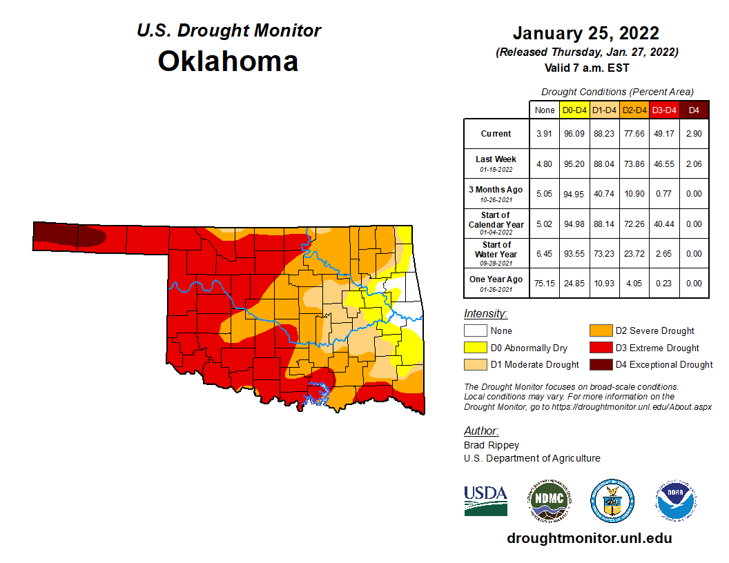
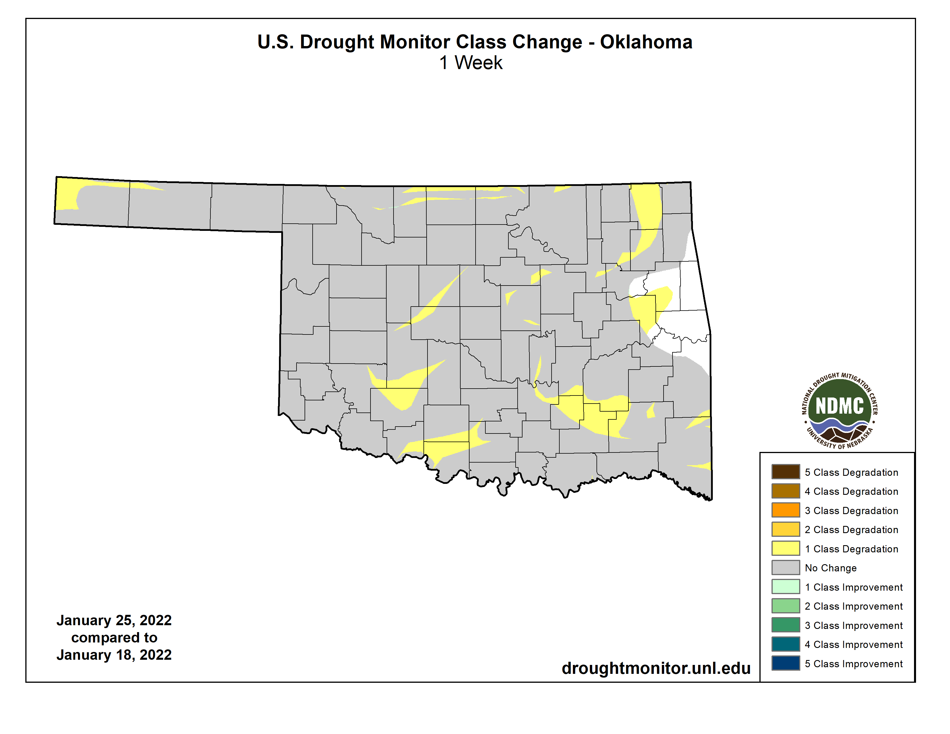
at this point is mucho welcome because Oklahoma remains in drought; drought that
continues to intensify and spread.
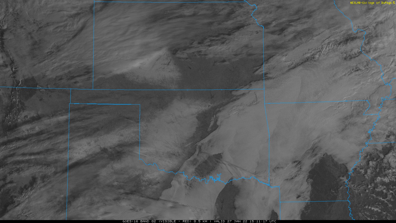
You can *sorta* see where the best snow was laid down yesterday on this visible
satellite image. A little tricky because there has been fog out across western
Oklahoma, but a bunch of that is snow of some measurable depth.
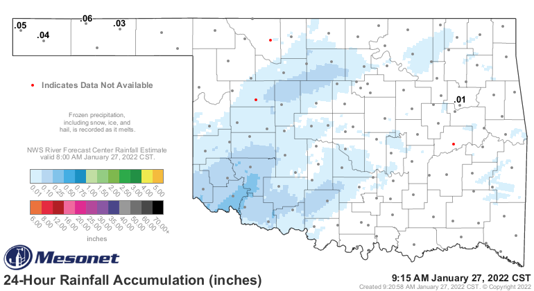
We won't know true estimates of how much liquid moisture that snowfall equates
to until the snow melts in the Mesonet gauges (still below freezing out that
way, which makes that fog FREEZING FOG), but it looks like there was a good
tenth to quarter-inch in some areas.
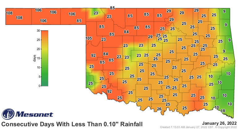
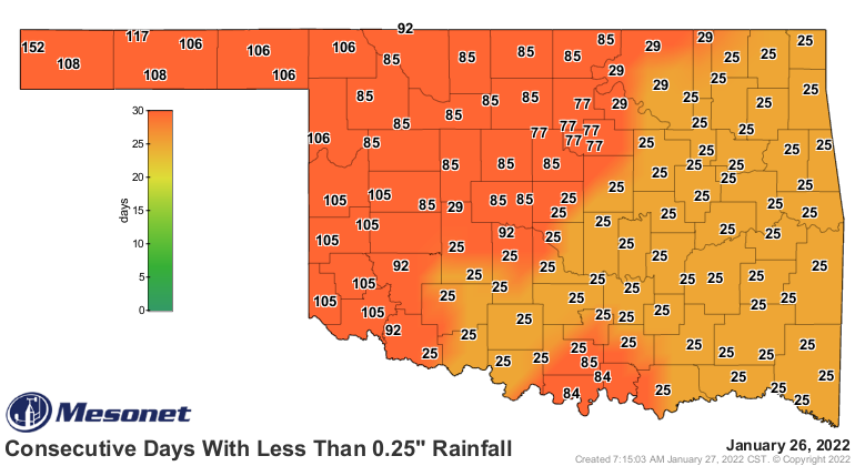
That would help reset these maps in a few locations, which does almost nothing
for the drought but get a good start for what we hope is more substantial
moisture next week.
From our NWS COOP observers, I see 0.3 inches from Roosevelt leading the way,
and Hobart and Chattanooga had 0.22 and 0.2 inches, respectively. The CoCoRaHS
observer at Blair had 0.2 inches as well. All those reports are of liquid
equivalent precipitation (the observer takes the gauge and melts the snow to
get the liquid equivalent). So not much, but better than nothing.
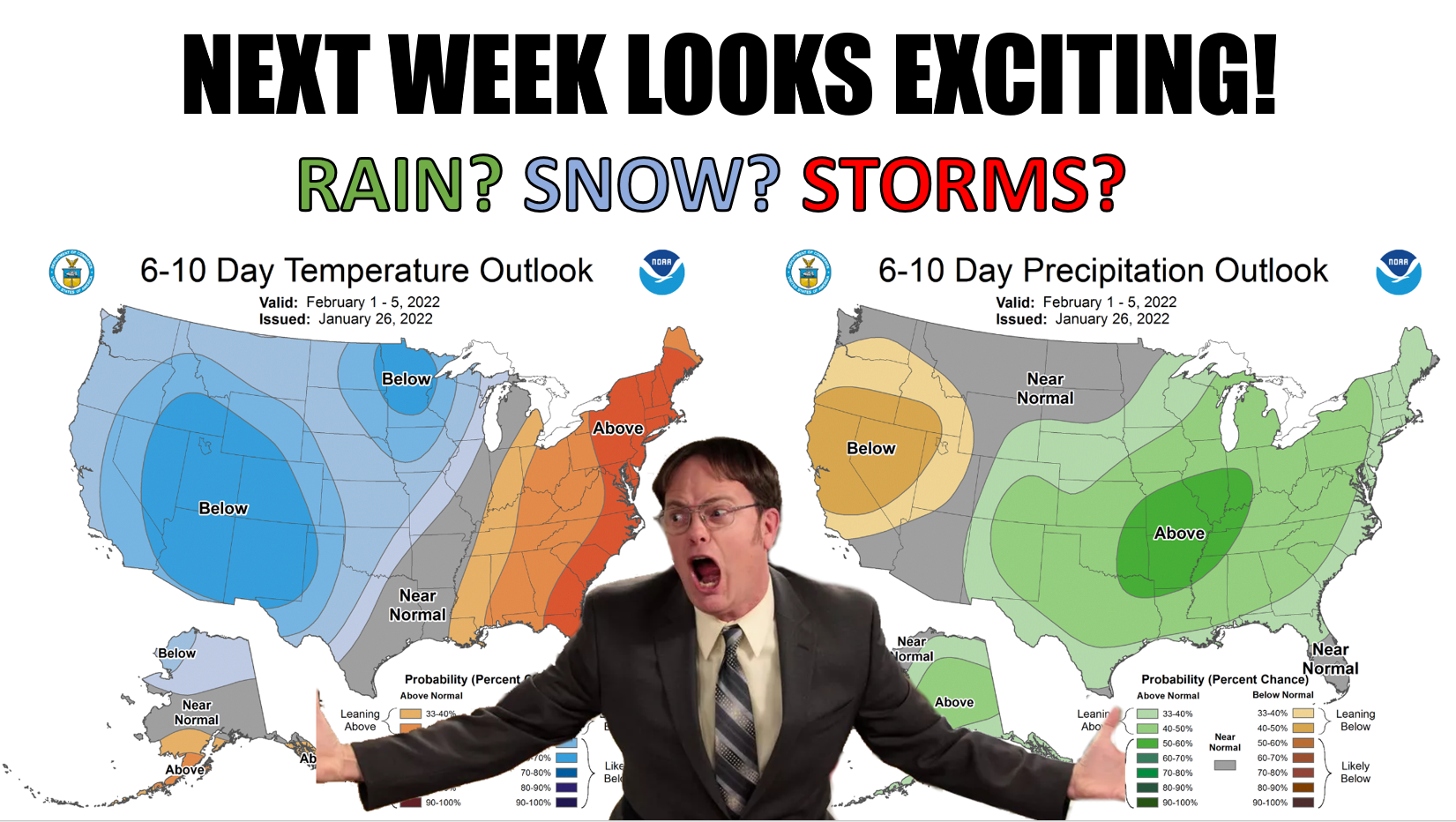
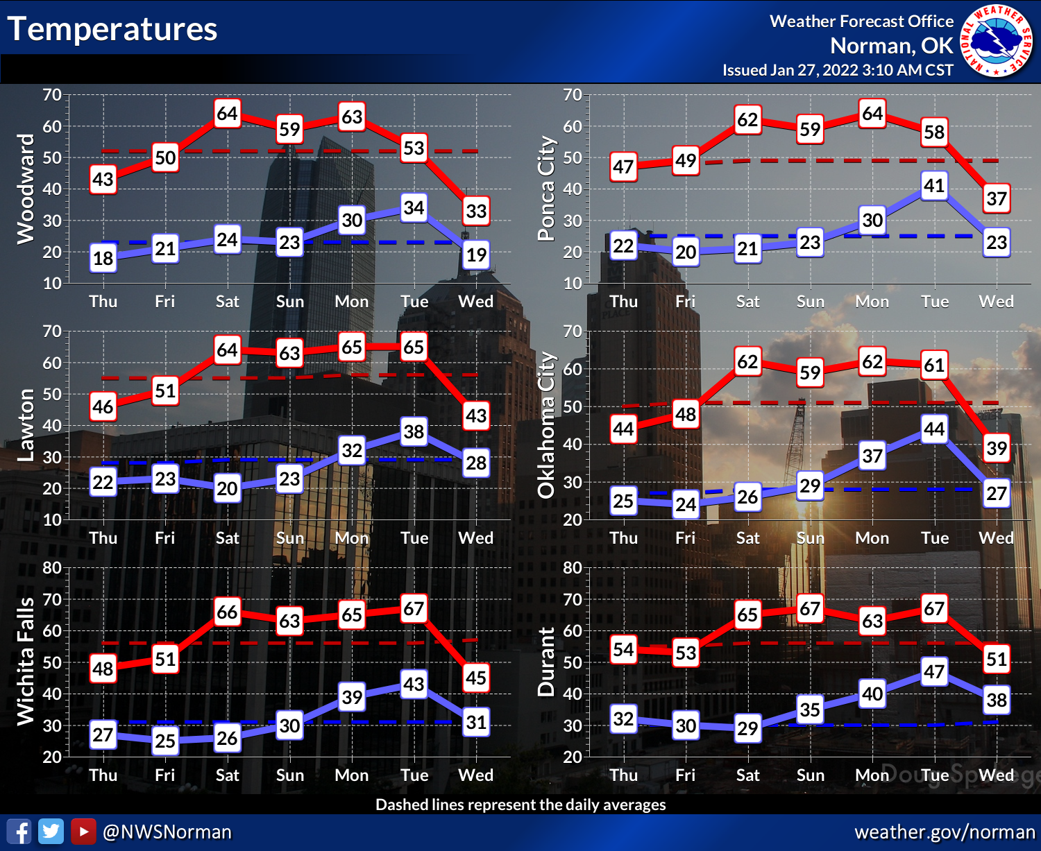
Now let's talk about next week. First, we'll slowly warm up into the 60s again
by the weekend into next week.
And THAT'S when things start to get interesting with an air pattern we haven't
seen for awhile. First we get an upper-low move through on Monday it looks like
which should give us some moisture return. Then we get another upper-level
system sometime around the Tuesday/Wednesday time frame just as another big
cold front arrives with arctic air.
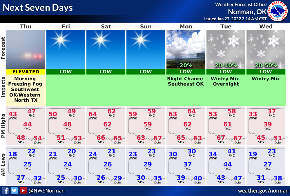
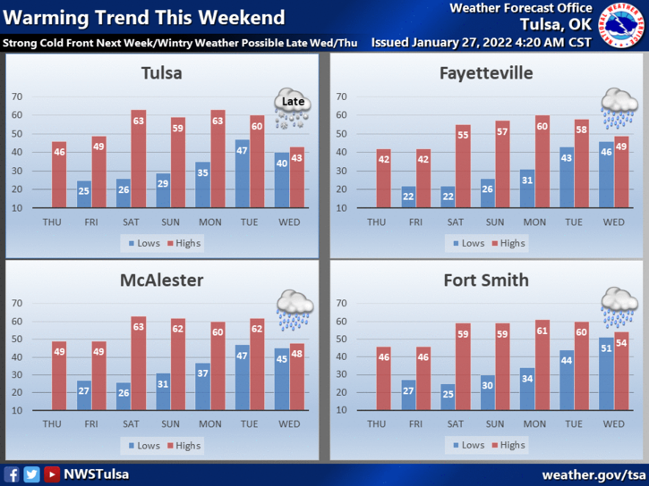
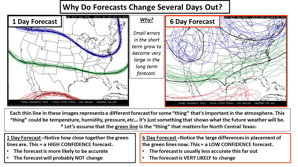
It's just too early to tell exactly what's going to happen. Heck, we may not
know what's EXACTLY going to happen WHEN it's happening. It's not quite in
FANTASY-CAST territory, but there just isn't enough consistency between all
the forecast models, both between them and from run-to-run. Remember the warning
about how chaos invades the forecast models as you go out in time. The storm
system is still out somewhere over the Pacific somewhere, if not even farther
away at this point.
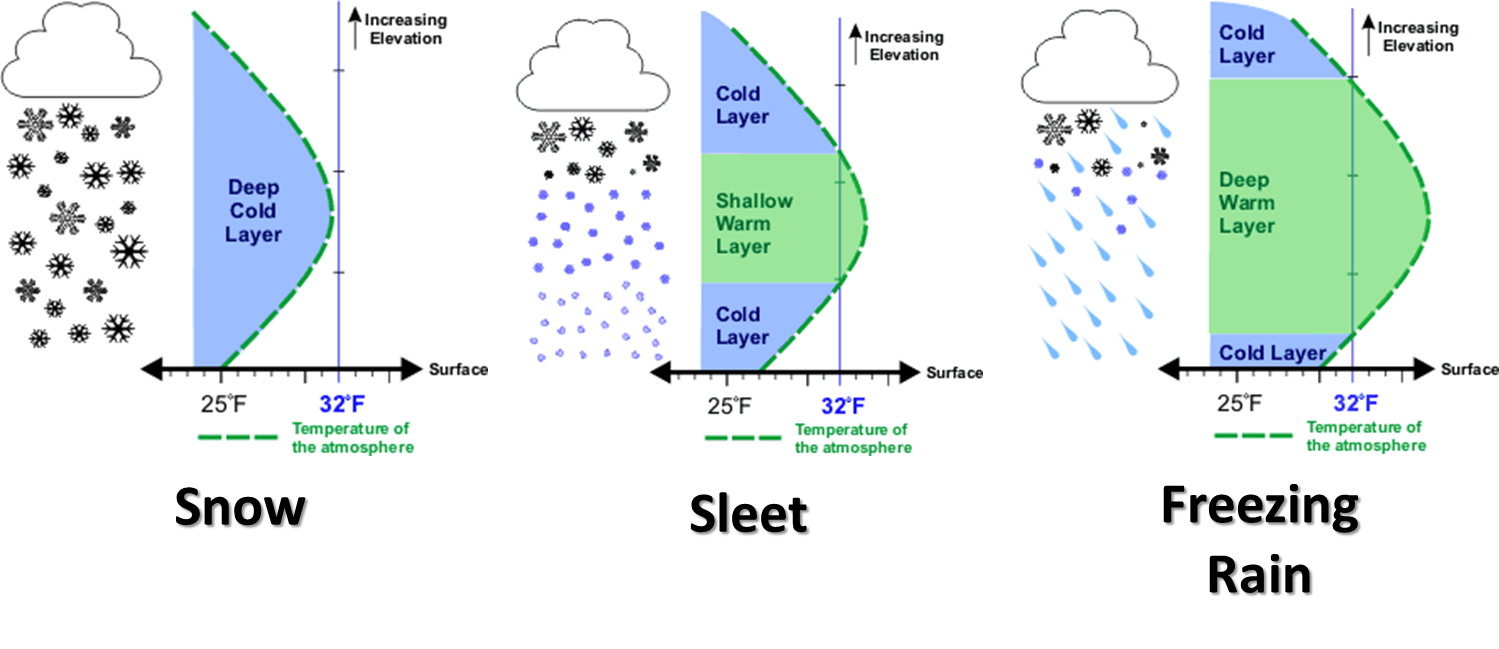
And then you're trying to ascertain whether you have all the 3-D elements
properly represented to get rain/snow/ice/freezing rain? Don't think so, not
at this point!
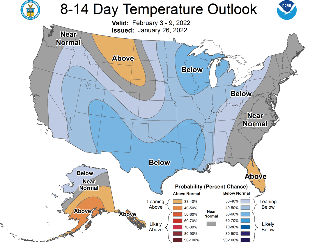
It does look pretty well certain that some cold air is headed this way. And
the moisture is less certain, but better than even odds, probably.
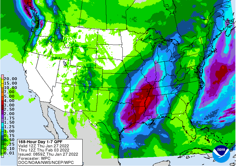
Oh, I'm being vague? You're darned right I am, for all the reasons I just
listed. And it looks like it could remain cold for the first week and a bit
longer of February.
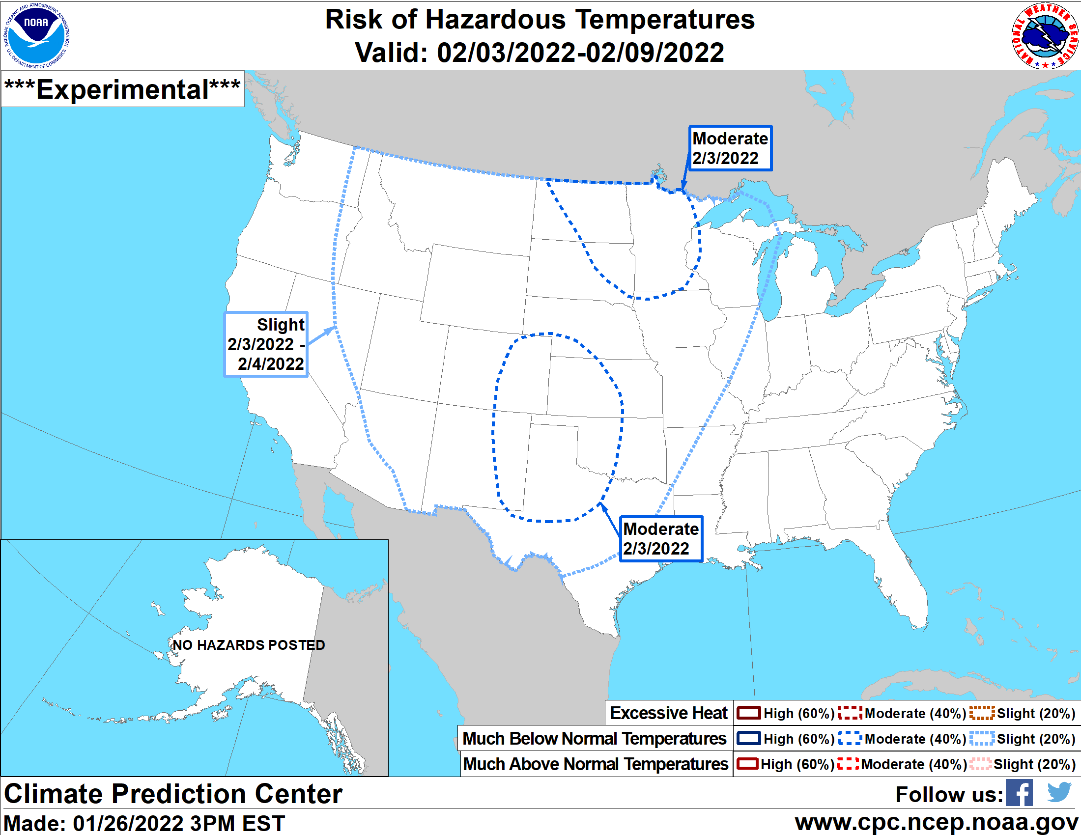
Nothing like last year showing up. It was right around this time in 2021 that
we started to get hints of cross-polar flow and displacement of the polar
air that camped over the Southern Plains for 2 weeks.
Now wouldn't that be exciting? NO!!!
Gary McManus
State Climatologist
Oklahoma Mesonet
Oklahoma Climatological Survey
gmcmanus@mesonet.org
January 27 in Mesonet History
| Record | Value | Station | Year |
|---|---|---|---|
| Maximum Temperature | 84°F | ALV2 | 2015 |
| Minimum Temperature | 0°F | KENT | 2009 |
| Maximum Rainfall | 3.39″ | SALL | 2009 |
Mesonet records begin in 1994.
Search by Date
If you're a bit off, don't worry, because just like horseshoes, “almost” counts on the Ticker website!