Ticker for December 16, 2021
MESONET TICKER ... MESONET TICKER ... MESONET TICKER ... MESONET TICKER ...
December 16, 2021 December 16, 2021 December 16, 2021 December 16, 2021
La Nina NO
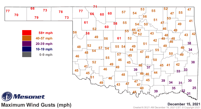
That'll about cover the wind, right? 935 wind gusts of 50 mph or greater, and
227 that were 58 mph or greater, which would classify as severe thunderstorm
winds, were there thunderstorms. Topped out by Goodwell's 79 mph gusts yesterday
at 12:20 and 12:25 pm, which basically means that for about 10 minutes, their
winds were probably in the 60-80 mph range without much letup. Remember, these are
the maximum gusts we're counting for each 5-minute period. How many gusts can you
fit in 5 minutes? Where is that wise old Owl when you need him?
So now we're back to un-reality for awhile with more seasonable weather for the
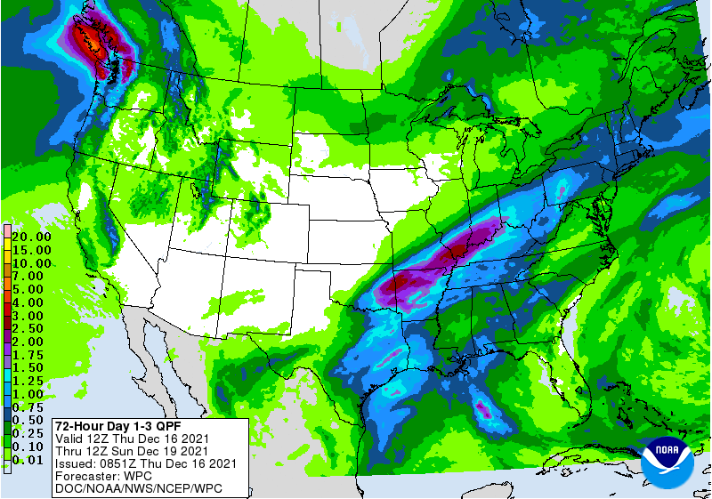
next few days, complete with a cold front tomorrow which should bring the SE
half of the state some storms. Maybe a few strong ones. Also expect one of our
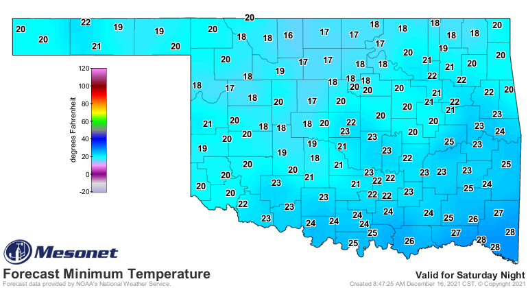
coldest mornings of the season thus far on Sunday. Pretty wimpy though. Teens
and 20s. Ooooh, so scared and cold! PFFFTTTT!!! I lived through February 2021,
pal!
Let's just skip ahead while I empty my ears from the dust yesterday, okay? By
the way, didn't you feel like you had just been through about 20 hours of
shuffling your feet on carpet and touching something metal yesterday? Or you
spent most of the day anticipating touching your tongue with a 9-volt battery
(come on, you know you've done it!)? Next week we'll start another warm up just
in time for a probable BAH HUMBUG Christmas Day with highs in the 60s. Wouldn't
shock me if we had some 70s again, but there is still the outside chance of
a cold front slipping in here. Nice try. DRY cold front. Still, looks warm for
the most part.
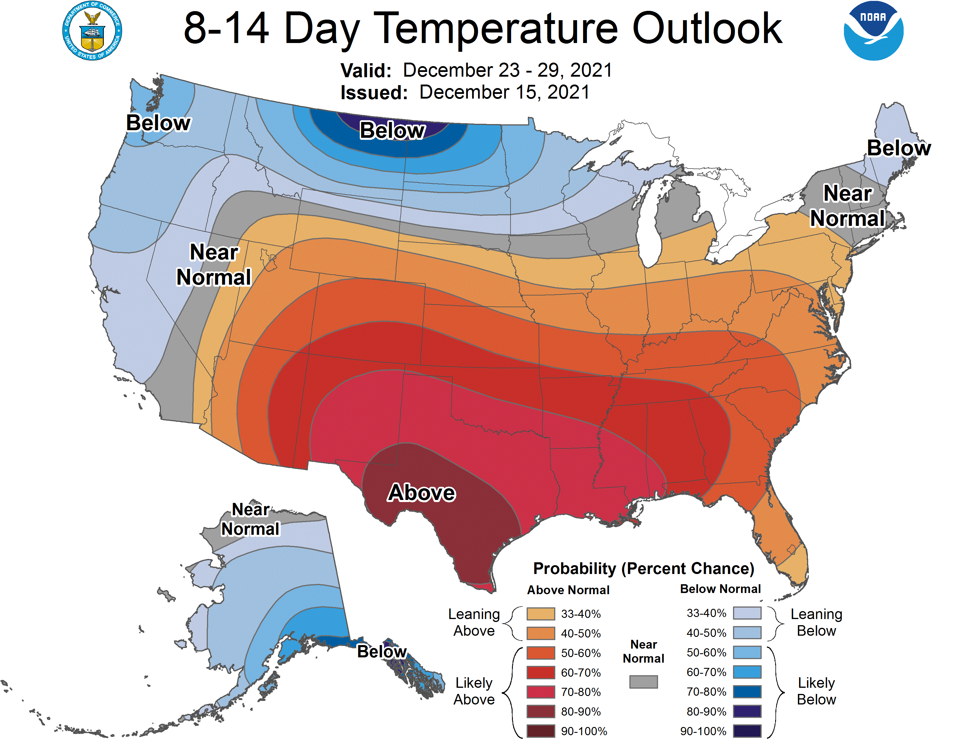
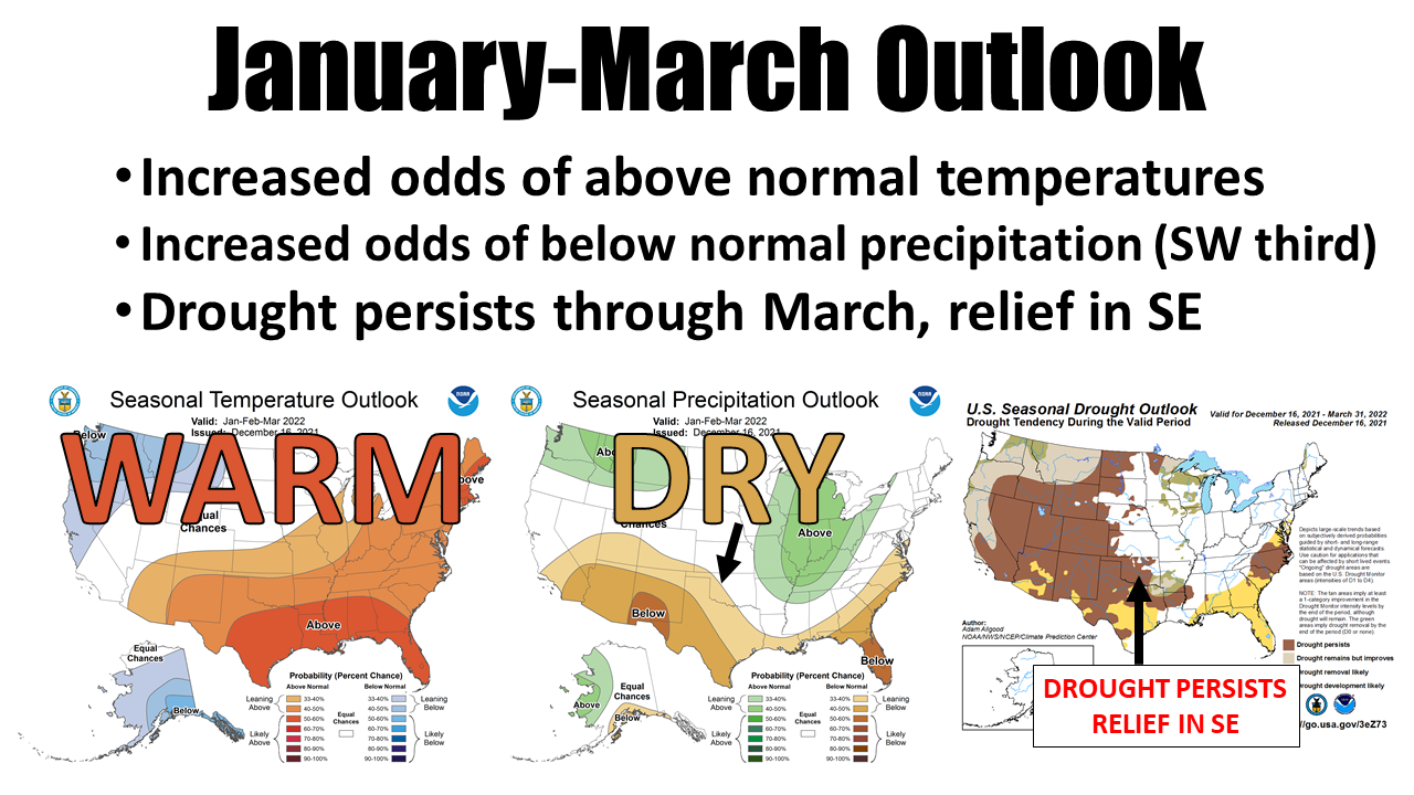
This is not good news for much of central and western OK which are doomed to
miss out once again on this weekend's probable rain. And if we go even beyond
that, we can see the CPC puts us smack dab in a classic/typical La Nina
temperature and precipitation regime. Unfortunately for us, we have drought
already in place as we enter the driest month of the year. Above normal
temperatures will act to enhance drought, uhhhhh, enhancement, in the absence
of any significant moisture.
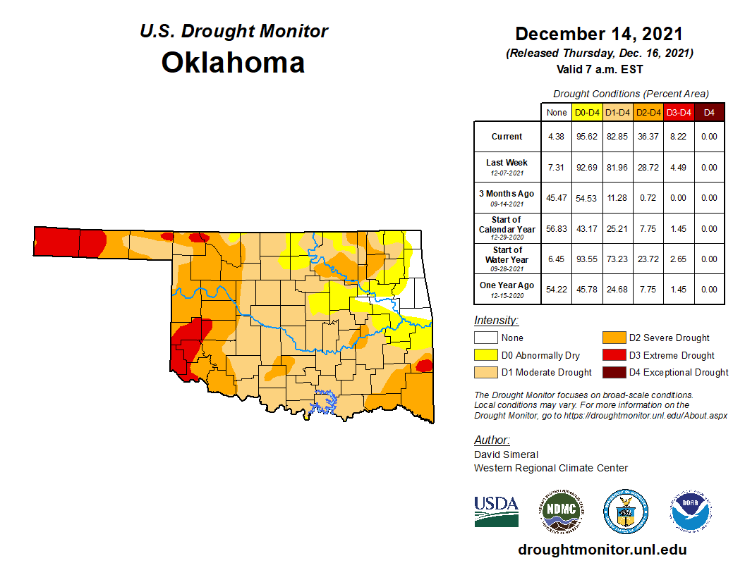
Drought is getting worse, folks. Days like yesterday are few and far between, but
they do damage to the soils and vegetation (and our sanity). There is winter
wheat out there needing moisture, and farm ponds needing filled. We're seeing
this start to advance more rapidly than we'd normally expect. Again, because of
the unusually warm stretches we keep seeing.
I will continue to compare this weather pattern to the last double-dip La Nina
we experienced back in the cool season of 2017-18. That spring did not end up
pretty to say the least. We need some sort of big switchover of the upper-air
patterns to allow more of those storms to dive down the West Coast and approach
us slowly from the west, which would allow for more moisture return and smaller
systems to eject over our area, bringing moisture. We haven't seen that much
in the last few months.
As I keep saying, HOPEFULLY the next big pattern switch is just around the
corner.
Gary McManus
State Climatologist
Oklahoma Mesonet
Oklahoma Climatological Survey
gmcmanus@mesonet.org
December 16 in Mesonet History
| Record | Value | Station | Year |
|---|---|---|---|
| Maximum Temperature | 81°F | HOLL | 2016 |
| Minimum Temperature | 2°F | BEAV | 2020 |
| Maximum Rainfall | 6.23 inches | MTHE | 2001 |
Mesonet records begin in 1994.
Search by Date
If you're a bit off, don't worry, because just like horseshoes, “almost” counts on the Ticker website!