Ticker for December 15, 2021
MESONET TICKER ... MESONET TICKER ... MESONET TICKER ... MESONET TICKER ...
December 15, 2021 December 15, 2021 December 15, 2021 December 15, 2021
WHOOSH!
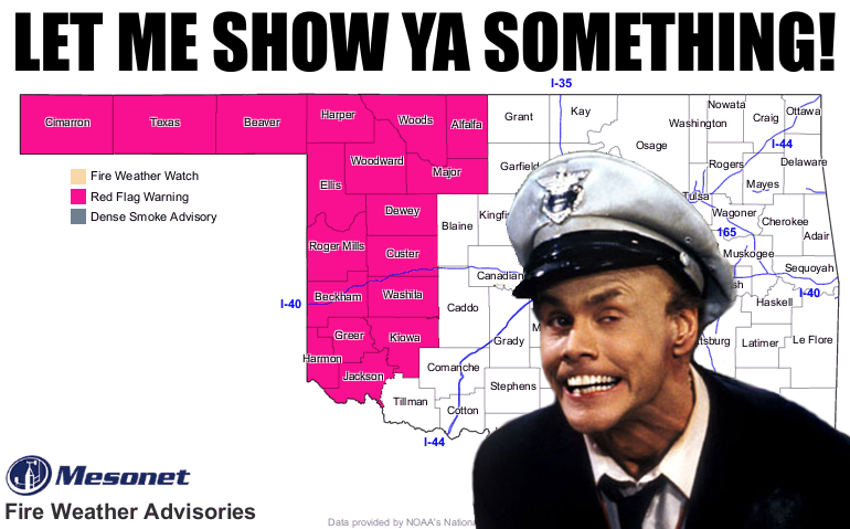
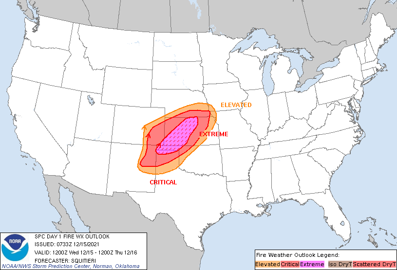
Hair can be highly combustible in today's weather setup, so I'm safe, but are you?
What are you gonna do today on accident that could set a fire that gets quickly
out of control? Are you gonna throw a butt out the window, which causes the driver
next to you to swerve out of control and wreck, causing sparks that ignites a
wildfire? Or what if it's a cigarette butt? All these scenarios and more could
easily spell disaster for much of the NW half of the state. Now I can sit here and
try and scare you with all these other disastrous wildfire scenarios, but how
about we quote the experts? From the Oklahoma Forestry Services Fire Situation
Report for today:
"The Fire Weather Forecast for today will pose very challenging
conditions across much of Oklahoma. There is potential for
damaging, life-threatening fire behavior including very-rapid to
extreme rates of fire spread, erratic fire behavior and a shift
in head fire spread direction with a cold front passage. Very dry
fuels across western Oklahoma and in the Oklahoma
Panhandle will result in increased probability of fire occurrence
and potential for large/significant fires to develop. Very dry
atmospheric conditions and strong/gusty southwest winds with a
dryline shifting east will support very receptive fine-fuels.
Wind speeds will challenge the integrity of power lines resulting
in both a potential ignition source an a hazard on the fire
line. Blowing dust and/or ash will reduce visibility resulting in
driving hazards in the vicinity of fireline operations."
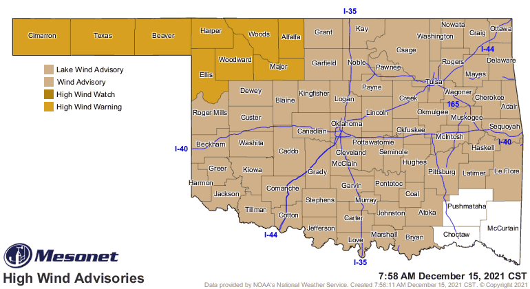
Not much we can do about the power lines sparking with winds gusting from 60-75
mph across NW OK. And luckily this isn't going to be a statewide fire threat
since there will be some Gulf Moisture out ahead of the front that will work
to kick off some storms across the SE half of the state later on.
Let's talk about those winds...they're gonna be fierce to say the least. Nobody
is safe from getting sandblasted today, but particularly up there across the
NW half of the state, prepare for eye socket-gouging winds. You know...cheek-
puffing gusts that will make you look like Dizzy Gillespie playing the trumpet
(young folks and philistines...google).
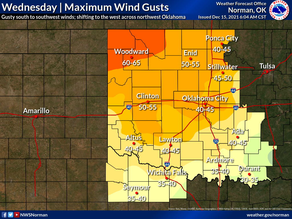
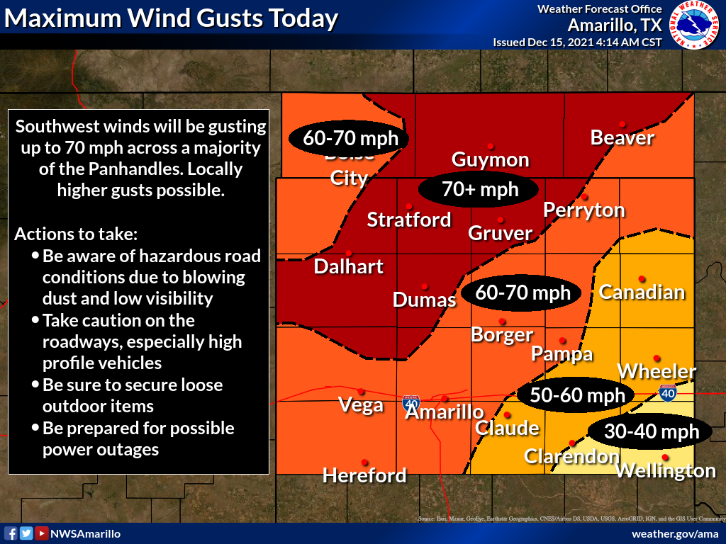
These winds are coming from above, so to speak, in a process called momentum
transfer. You may asking yourself "But Gary, what's momentum transfer?" Well,
first off if your name isn't Gary, you might need some help, but in simplest
terms those higher wind speeds above the surface are transferred down to the
surface due to the mixing of the atmosphere from surface heating by the sun.
Say what? Well, it's gonna be windy. Already is, but it's just getting started.
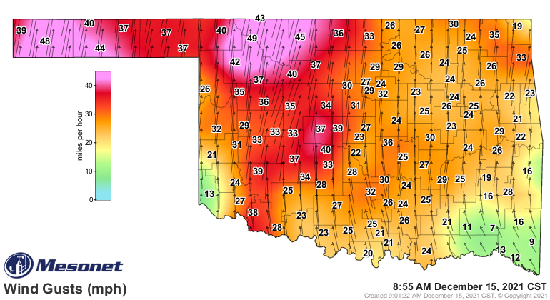
You've also probably noticed it's pretty humid outside. Well, that's gonna be
changing as well across the NW half of the state coming up later this afternoon.
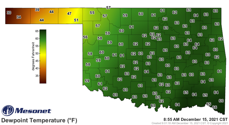
Those high dewpoints allowed us to stay exceptionally warm this morning. In fact,
we shattered the records for highest minimum temperatures for this date--in
some cases by more than 10 degrees! Heck, those lows are 10+ degrees warmer than
our normal highs for the day.
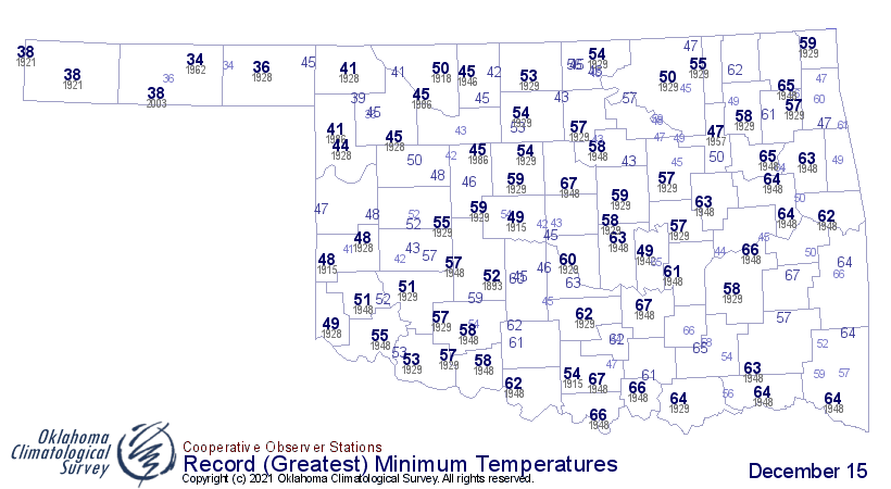
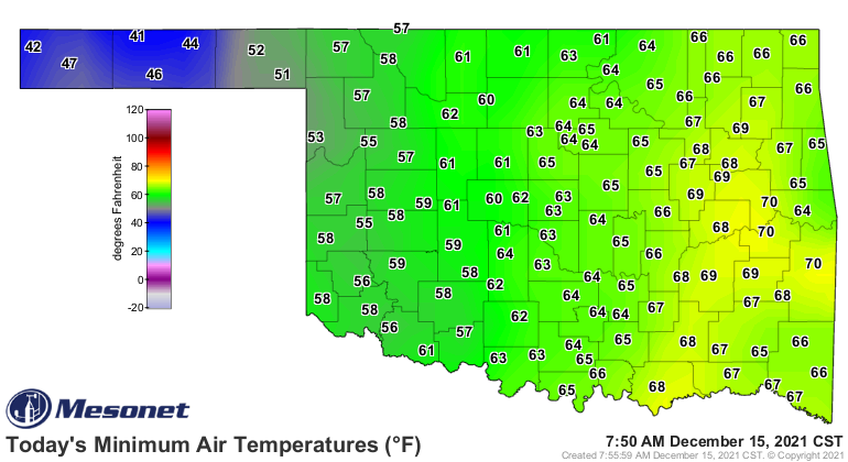
When that front comes through, we could drop down below those values pretty
quickly, so that might mess up any record-breaking temps, technically. But come
on, it was ridiculously warm this morning for a Dec. 15! And we're probably
going to see plenty of record highs fall as well.
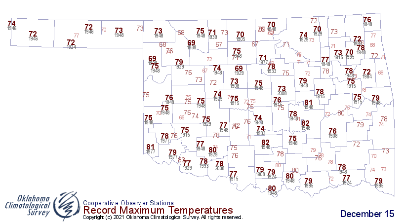
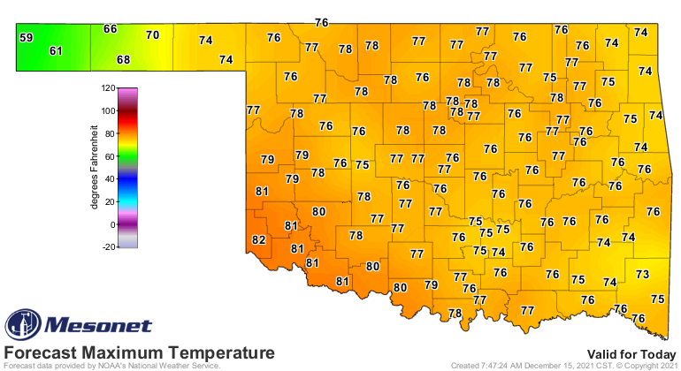
When that front hits the deeper moisture along the I-44 corridor, it should
(could) generate some showers and storms, and those storms have a chance to
go severe. Nothing bigtime for Oklahoma, maybe some wind in NE OK, but I'm
betting the non-thunderstorm winds in the Panhandle will be even greater than
those due to any storms in the NE.
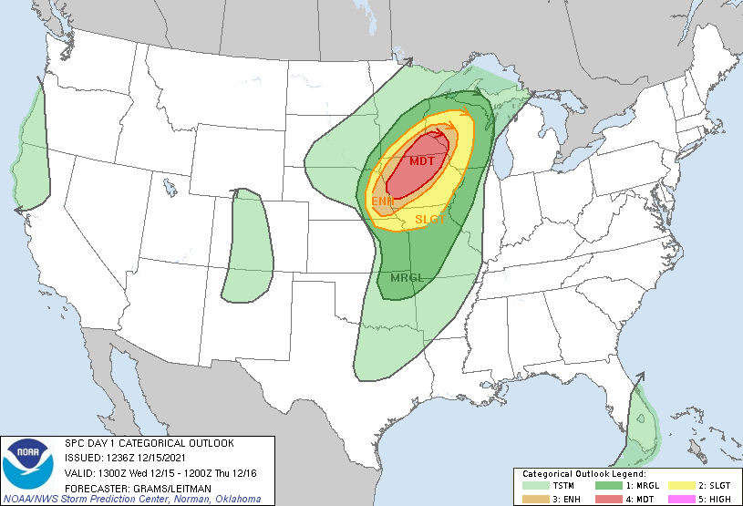
If you have friends and family up in the Iowa/Minnesota region, watch out
because they could be in for some snownadoes (there is currently snow on the
ground in some of the higher risk areas of Minnesota).
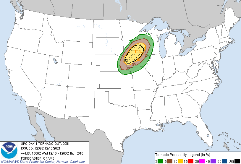
Yeah, Mother Nature gone wacky!
After today we see a cool down to more seasonable weather, then another cold
front on Friday which could give us a chilly Saturday and possibly our coldest
morning of the season thus far on Sunday. Dry though. Of course, dry.
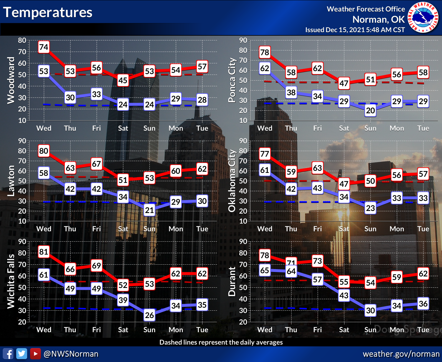
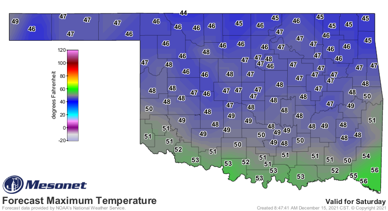
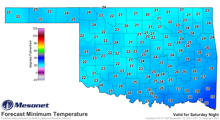
We're still looking at good rains possibly across SE OK, but completely dry
across the NW half.
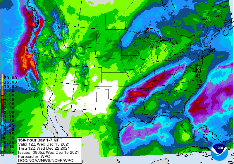
Another warm up for next week with maybe (MAYBE) a cold front around the area
on Christmas Eve and Christmas Day? A dry cold front. Of course dry. Always dry.
At this point, however, don't be shocked if it's either 63 or 36 degrees on
Christmas Day.
Gary McManus
State Climatologist
Oklahoma Mesonet
Oklahoma Climatological Survey
gmcmanus@mesonet.org
December 15 in Mesonet History
| Record | Value | Station | Year |
|---|---|---|---|
| Maximum Temperature | 83°F | SEIL | 2021 |
| Minimum Temperature | 2°F | KENT | 2008 |
| Maximum Rainfall | 1.99″ | BBOW | 2001 |
Mesonet records begin in 1994.
Search by Date
If you're a bit off, don't worry, because just like horseshoes, “almost” counts on the Ticker website!