Ticker for December 6, 2021
MESONET TICKER ... MESONET TICKER ... MESONET TICKER ... MESONET TICKER ...
December 6, 2021 December 6, 2021 December 6, 2021 December 6, 2021
Wait awhile
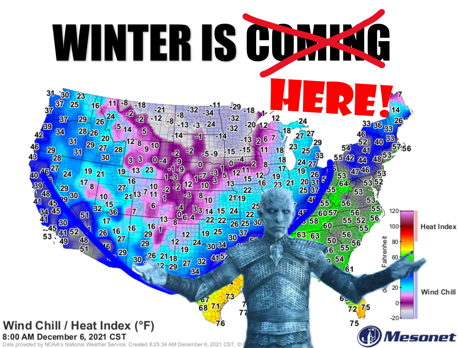
Well, it was good/bad while it lasted. After another few days of record high
temperatures, back to reality (although this is a reality we haven't seen much
since mid-August...below normal temperatures). Actually we're more close to normal
than not for early December. But still, a vast difference than what we've seen
for awhile on the back end of this cold front with winds HOWLING from the north
at 25-45 mph.
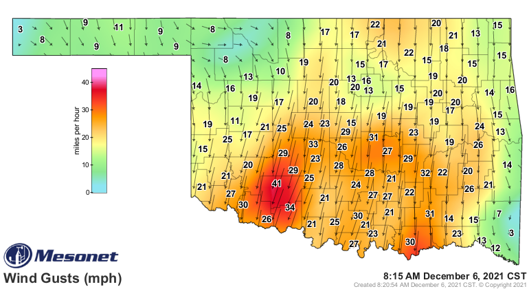
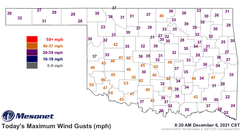
These wind chills are now a shock to the system, and if you're like me (seek help
as soon as you can), your system don't need more shocking! ("doesn't need more
shocking!" for you non-Okies).
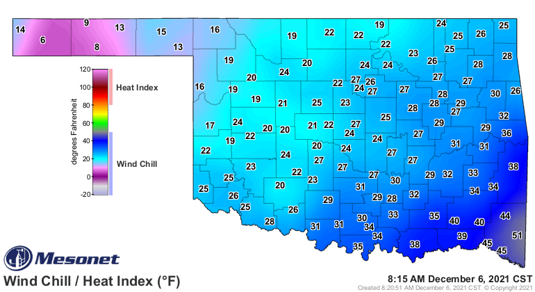
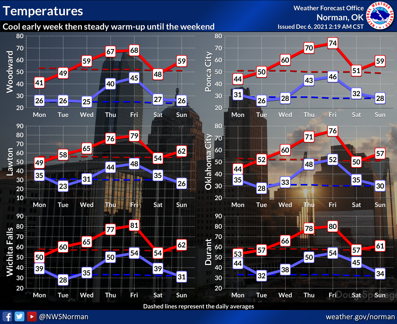
But that's okay. We'll have like 2 days of winter, tops (and bottoms), then
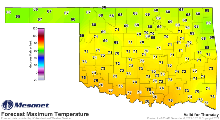
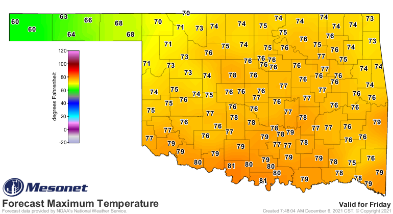
back to our 2021 post-mid-August reality later in the week with more 60s and
70s on tap.
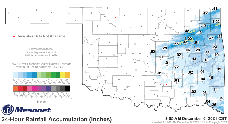
At least this front wasn't entirely dry, like the last few. Storms did fire up
across NE OK and spread some rain across the eastern section of the state last
night.
Now for the bad.
First, we need that rain. And the heat just exacerbates drought impacts and
spread/intensification. We don't see much change coming in that department just
yet.
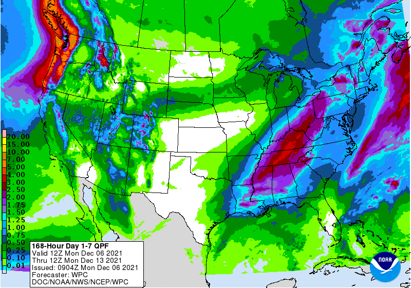
B. There really isn't any big pattern change showing up in the medium-term
either.
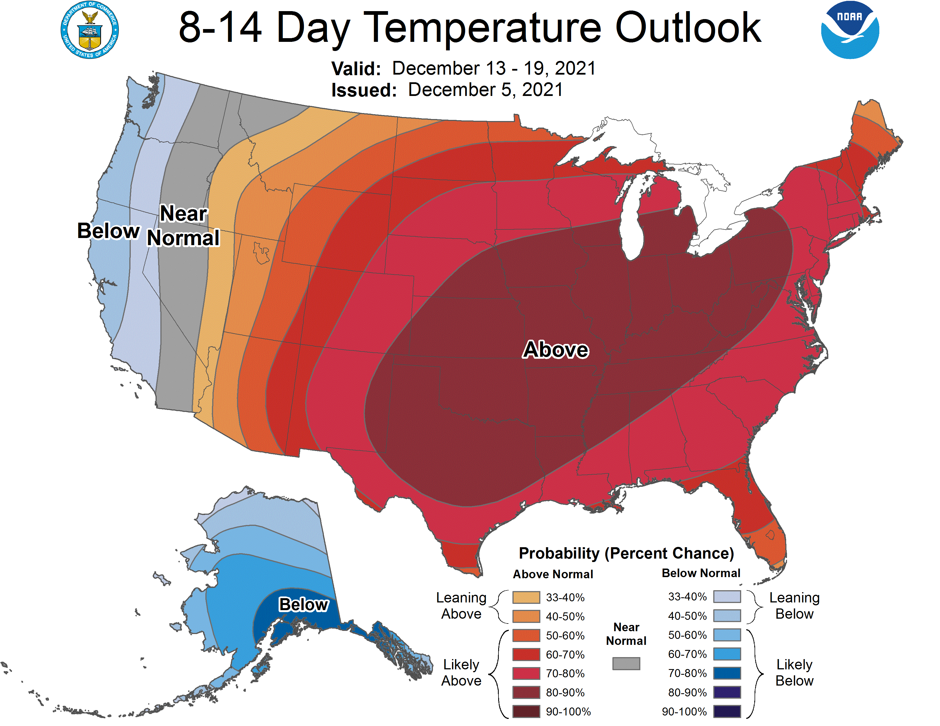
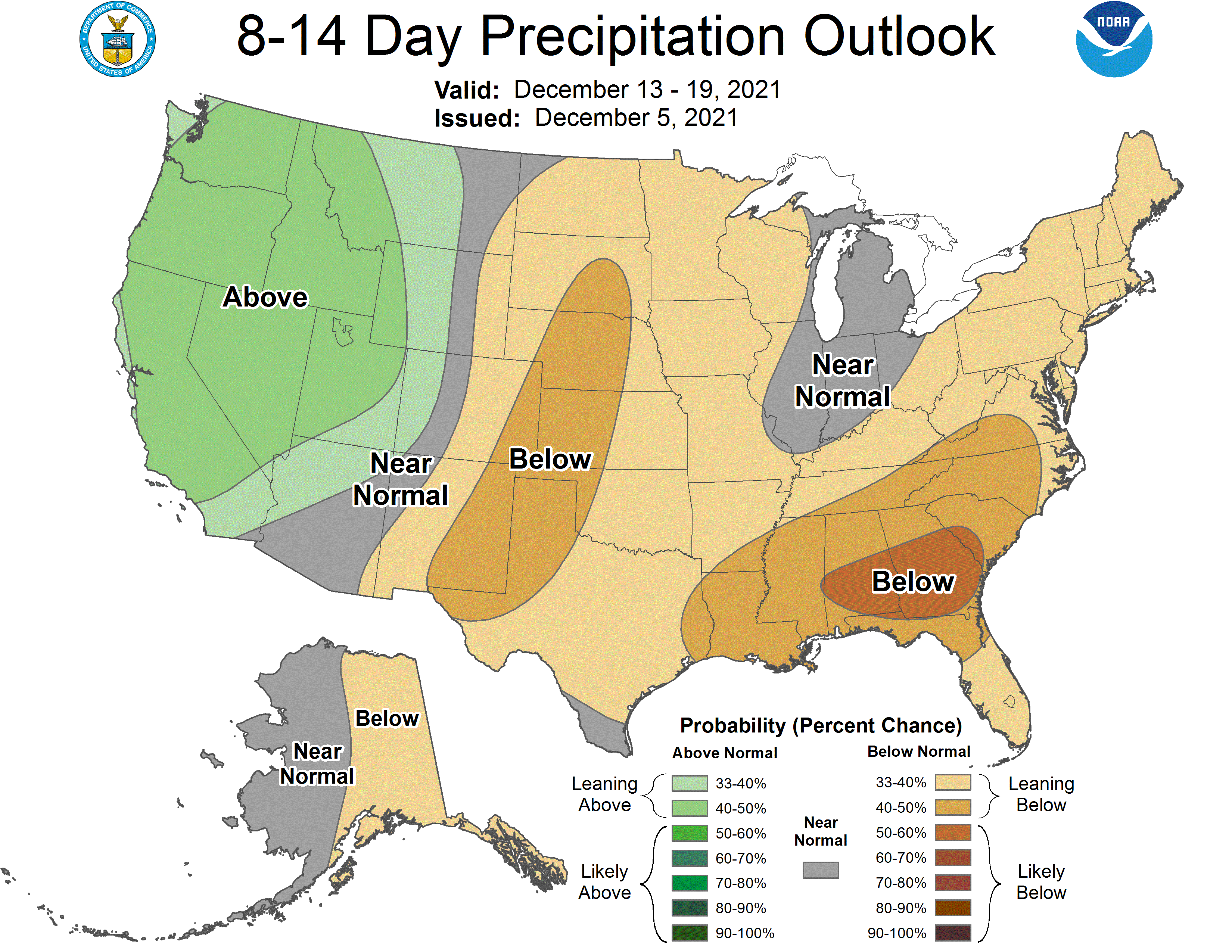
Not to alarm you (translation: I'm TRYING TO ALARM YOU!), but this type of
weather is looking to continue to dominate through much of the Holiday Season.
Look, I'm no troglodyte, Scrooge, or Grinch (spoilsport, killjoy, drag, wet
blanket, party pooper, grouch, sourpuss, stick in the mud, buzzkill,
malcontent...OKAY, WE GET IT! Okay, maybe malcontent), I'd love to see some
winter weather in here before Christmas to help with that Holiday spirit.
Best we can hope for is some sort of big upper-level low to approach from the
west and hang out awhile, drawing up some actual moisture to work with from
the Gulf while at the same time bringing down some true arctic air to give
us some snow. Sorry, freezing rain is forbidden...sleet if we must.
Still time, we'll continue watching those long-range models for the next
Fantasycast.
Gary McManus
State Climatologist
Oklahoma Mesonet
Oklahoma Climatological Survey
gmcmanus@mesonet.org
December 6 in Mesonet History
| Record | Value | Station | Year |
|---|---|---|---|
| Maximum Temperature | 77°F | ANTL | 2001 |
| Minimum Temperature | -6°F | KENT | 2011 |
| Maximum Rainfall | 1.31″ | OKEM | 2004 |
Mesonet records begin in 1994.
Search by Date
If you're a bit off, don't worry, because just like horseshoes, “almost” counts on the Ticker website!