Ticker for December 1, 2021
MESONET TICKER ... MESONET TICKER ... MESONET TICKER ... MESONET TICKER ...
December 1, 2021 December 1, 2021 December 1, 2021 December 1, 2021
Boughs of tumbleweeds
Hey, you think December looks fun, wait until January when the bottom drops out
(and we all know just how painful that can be) and we're stuck with -11 degrees
under crystal blue skies and NO snow. Now I can't know that for sure, but being
my nightmare (right below unfettered drought), I'm betting Mother Nature gives
us all that out of spite.
As you'll read below, November did not help the drought situation at all, In
fact, it set us up to fail in December pretty significantly if we don't receive
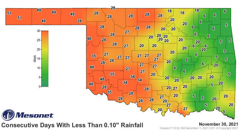
some beneficial moisture soon across the western two-thirds of the state. The
days without at least a tenth of an inch of rainfall map is a sad one, but not
as sad as that 7-day precip forecast map for western OK.
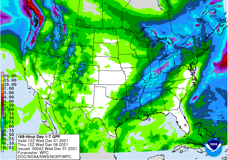
We'll stop there before you get REALLY depressed. Snow would help. However,
the forecast models are showing me 70s in the state on Dec. 16, so we can't
even get help in the Fantasy-cast department.
Now, take a little bit of November with ya.
----------------------------------------------------------------------------------
November Caps Off Warm, Dry Fall
Dec. 1, 2021
An extended pattern of warm, dry weather exacerbated drought conditions during
November. Drought impacts, including fire danger and soil moisture depletion,
increased throughout the month under the pressure from unusually high
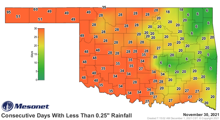
temperatures and strong winds. At the end of November, much of the area west of
Interstate 35 had gone from 20 to 60 days without at least a quarter-inch of
rain in a single day. For Boise City, that streak had extended to 95 days.
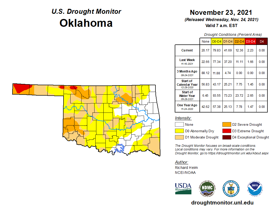
Nearly 42% of the state was in drought by the end of the month according to the
U.S. Drought Monitor, but another 38% was considered abnormally dry and in
danger of slipping into drought without beneficial moisture soon. There was one
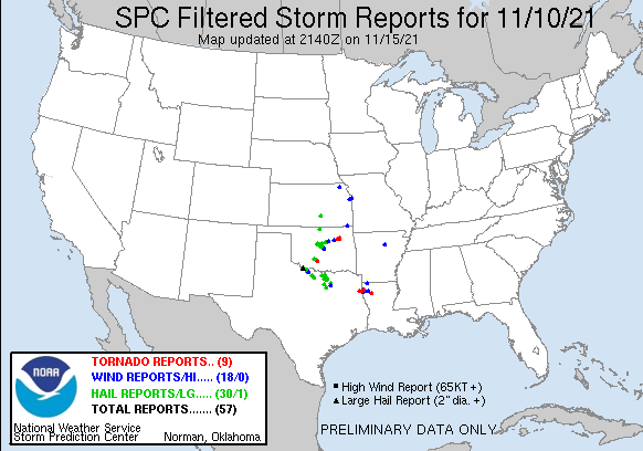
burst of excitement from severe weather. An outbreak of severe storms struck
central and northeastern Oklahoma the evening of Nov. 10, bringing large hail
and damaging winds to those areas of the state. Four tornadoes touched down in
northeastern Oklahoma that night, raising 2021’s preliminary total to 60. The
annual average tornado total for Oklahoma is 57.2, based on data from 1950 to
2020.
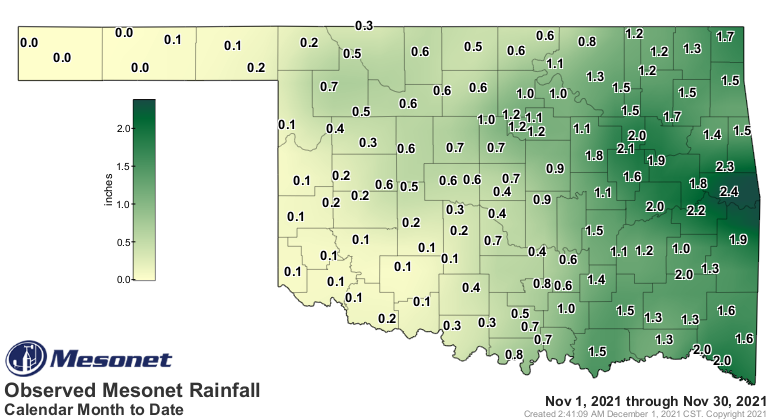
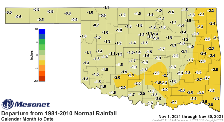
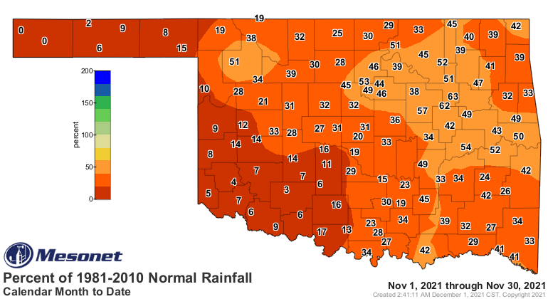
The statewide average precipitation total for the month finished at 0.82
inches, 1.5 inches below normal and ranked as the 29th driest November since
records began in 1895. Sallisaw led the month at 2.38 inches. Only five Oklahoma
Mesonet sites reached the 2-inch mark. Sixty-eight sites fell below an inch,
and two sites—Boise City and Kenton—failed to register any precipitation at all.
November rainfall deficits ranged from over 3 inches in far southeastern
Oklahoma to about half an inch across the western Panhandle. There were no
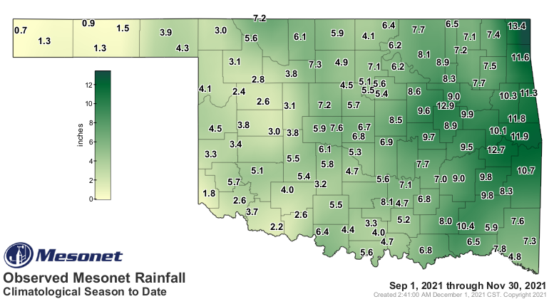
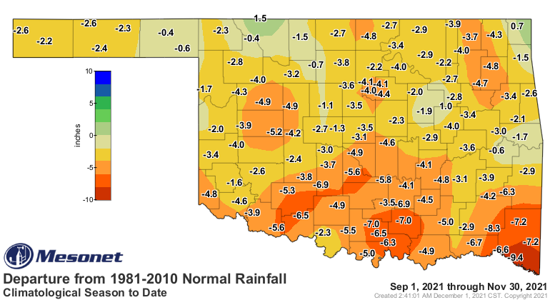
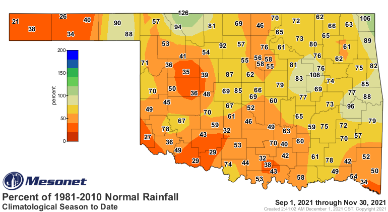
areas with a moisture surplus. The parched month capped off an exceedingly dry
climatological fall, which runs from Sept. 1 through Nov. 30. The statewide
average total was 5.81 inches, 3.19 inches below normal, to rank as the 27th
driest autumn on record. Miami’s 13.4 inches led the seasonal totals while
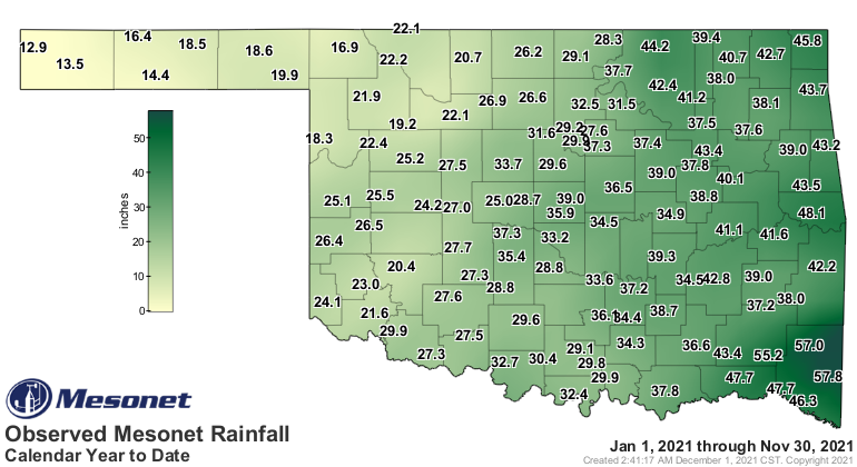
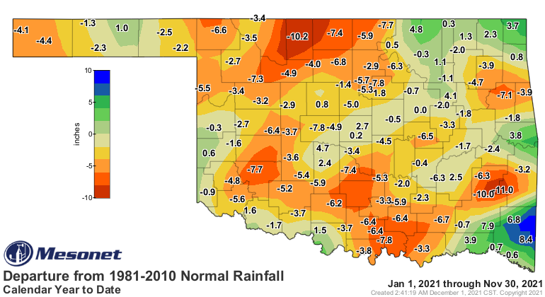
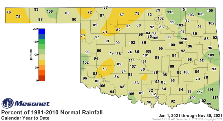
Kenton’s 0.7 inches captured the low mark. The first 11 months of 2021 had a
statewide average of 32.34 inches to finish 1.91 inches below normal, the 61st
wettest January – November on record.
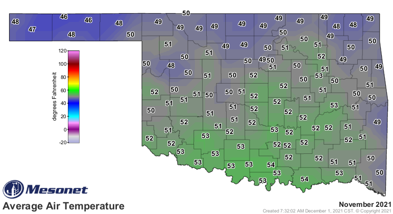
The statewide average temperature was 51 degrees, 1.6 degrees above normal and
ranked as the 29th warmest November on record. The unusually warm weather was
sustained throughout the month with just a few transitory reminders of the
actual season. The Mesonet recorded temperatures of at least 80 degrees nine
days out of the month, including the final two. Beaver managed 90 degrees on
Nov. 7, and Mangum also reached that mark on the 16th, to tie for the highest
reading of the month. It did get cold at times, especially in the dry air of
the Oklahoma Panhandle. Boise City reached a low of 15 degrees on the 18th for
the lowest temperature of the month. The climatological fall ended as the 8th
warmest on record with a statewide average of 64 degrees, 2.8 degrees above
normal. The January-November period was 0.4 degrees below normal at 61.9
degrees, the 55th warmest such period on record.
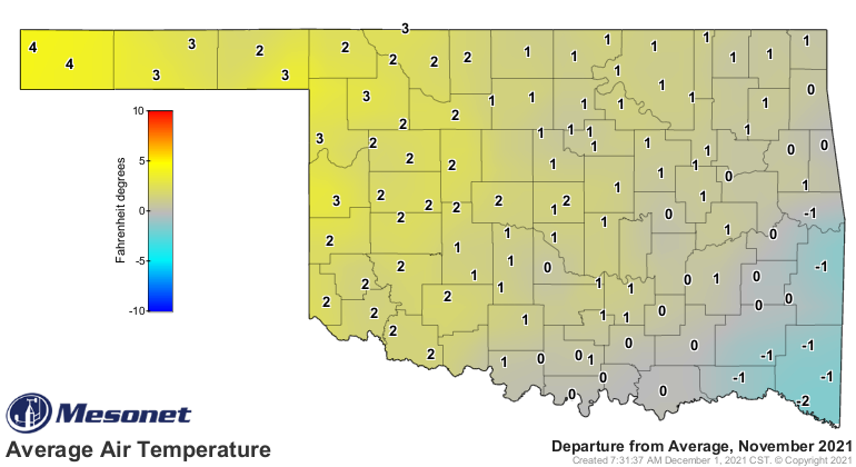
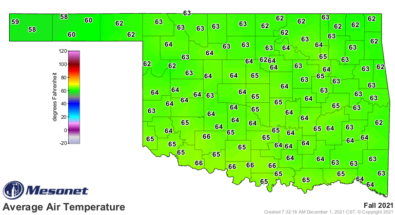
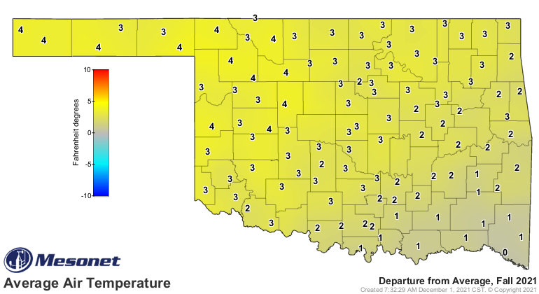
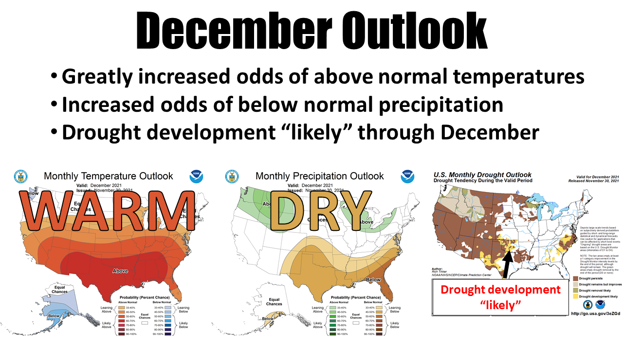
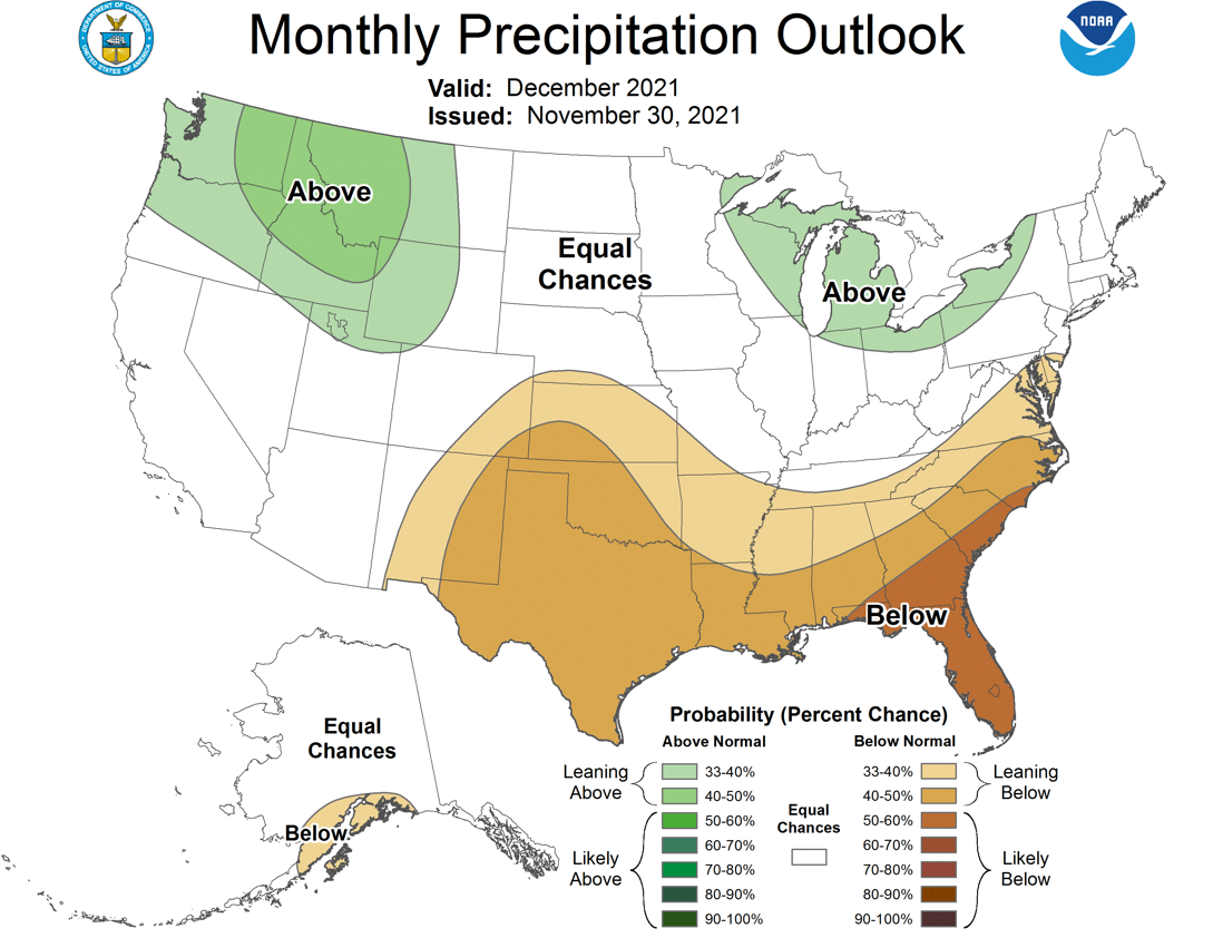
With drought beginning to flourish once again, all eyes turn towards December
for hopes of relief. The December precipitation outlook from the Climate
Prediction Center is not high on optimism, however, with increased odds of
below normal precipitation indicated for the entire state. Those odds are even
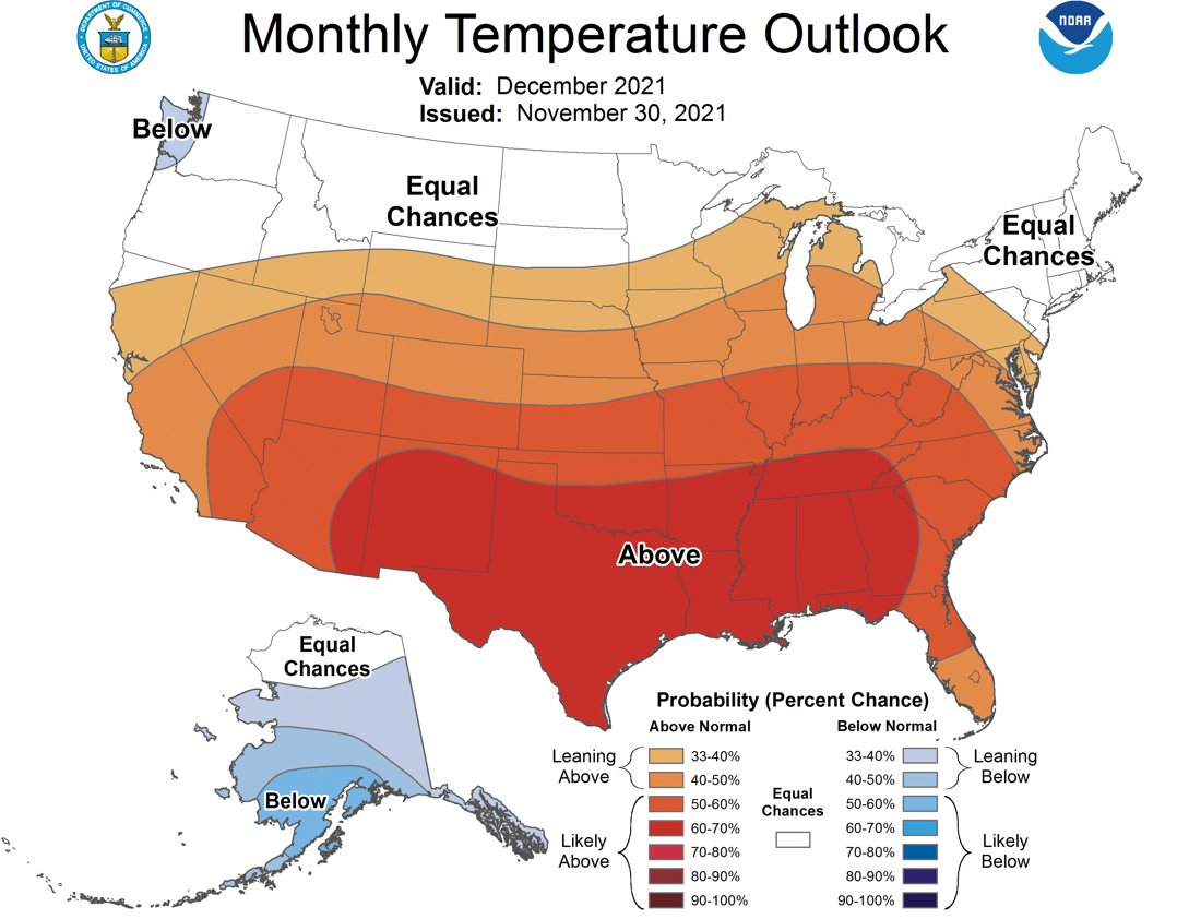
more enhanced across most of western and southern Oklahoma. Warm weather can
increase drought impacts, and CPC’s December temperature outlook shows odds
tilted strongly towards warmer than normal conditions across the state,
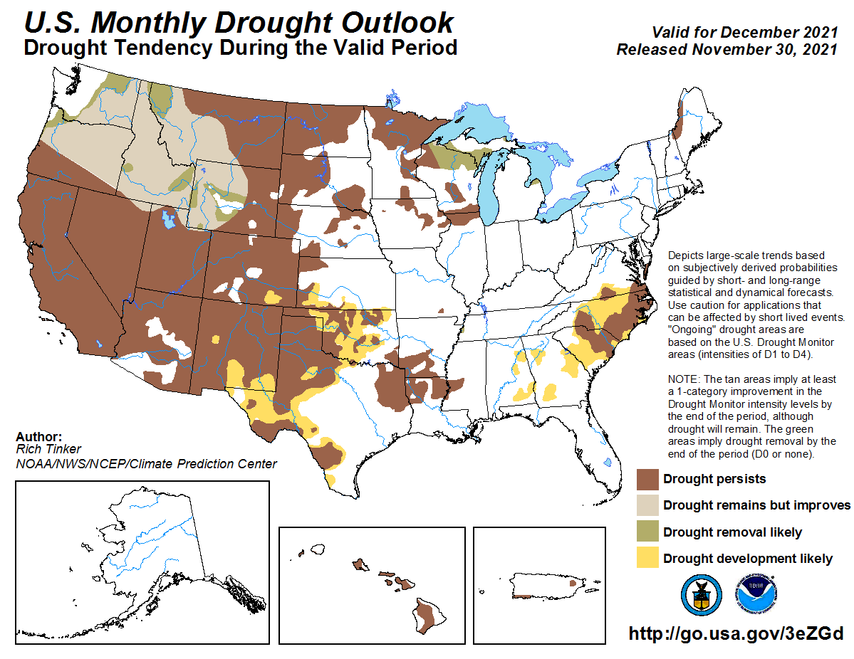
especially the southern half of Oklahoma. With those considerations in place,
CPC’s December drought outlook calls for persistence and also intensification
of drought across the western two-thirds of the state, but also bleeding into
far northeastern Oklahoma. CPC lists their forecast confidence as “high” for
the Oklahoma region in December’s drought outlook.
###
Gary McManus
State Climatologist
Oklahoma Mesonet
Oklahoma Climatological Survey
gmcmanus@mesonet.org
December 1 in Mesonet History
| Record | Value | Station | Year |
|---|---|---|---|
| Maximum Temperature | 86°F | HOLL | 2012 |
| Minimum Temperature | 0°F | SEIL | 2006 |
| Maximum Rainfall | 0.75″ | WATO | 2015 |
Mesonet records begin in 1994.
Search by Date
If you're a bit off, don't worry, because just like horseshoes, “almost” counts on the Ticker website!