Ticker for December 8, 2021
MESONET TICKER ... MESONET TICKER ... MESONET TICKER ... MESONET TICKER ...
December 8, 2021 December 8, 2021 December 8, 2021 December 8, 2021
BLEEP
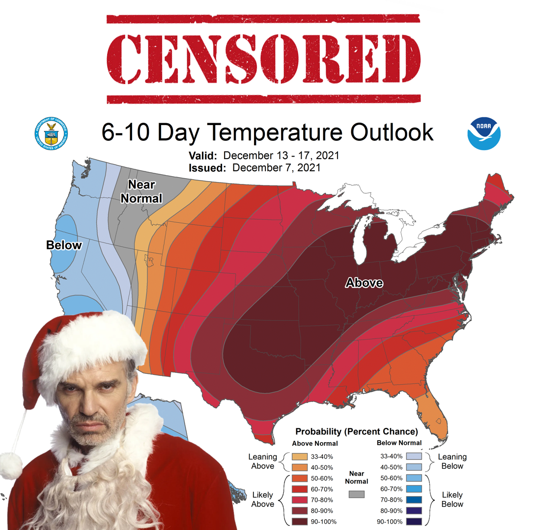
It's beginning to look a lot like...March? Late February? Well it ain't looking
like Christmas, for crying out loud (and I remember a lot of Christmases where I
was crying out loud, what with the Feats of Strength and whatnot...oh wait, that
was Festivus). At any rate, this is more of a typical La Nina year for us where
we see lots of drying conditions across western Oklahoma, with warm days more
often than not and the rest of us are just along for the ride. Very reminiscent
of the last double-dip La Nina cool season (double-dip as in this is the second
cool season in a row where La Nina rules the roost) back in the fall and winter
of 2017-2018. That's not a fall through spring to emulate, either, because
conditions got really nasty by the time spring rolled around. I remember it like
it was 4 years ago (start dream sequence in your mind).
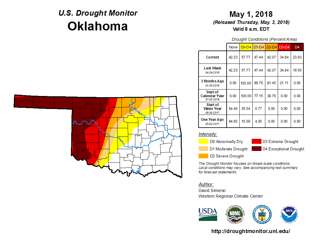
GULP!
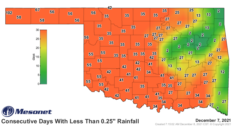
And the drought wasn't nearly as advanced as it now at this point back in 2017.
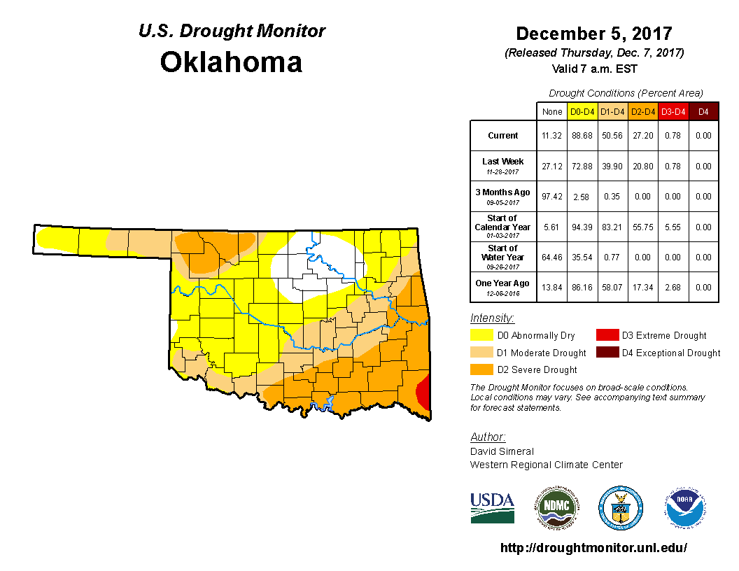
It was actually worse down in SE OK, but the rainless streak (my last rainless
streak resulted in charges, but that's a story for another day) was just getting
started out west where parts of the Panhandle went 200 consecutive days without
at least a quarter-inch of rain.
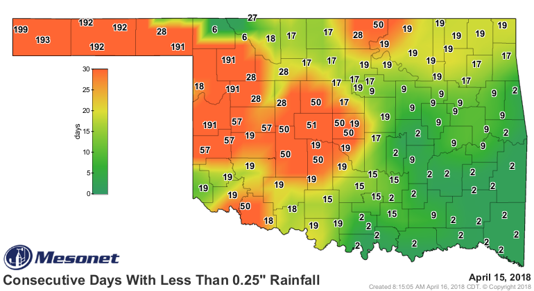
Nope, not saying that's gonna happen this go-round. Just something to keep in
mind, with this La Nina firmly in moderate strength mode. There doesn't appear
to be any help coming just yet, at least for another week (or two?). But our
current dry spell is getting similarly long in the tooth.
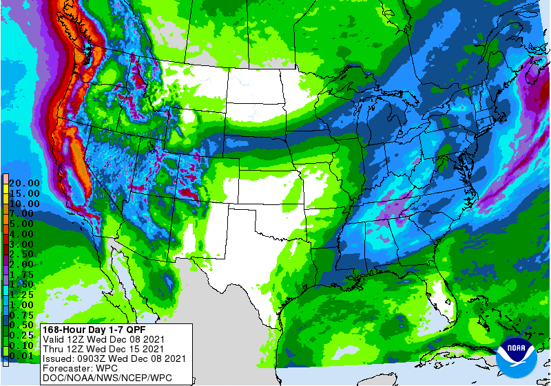
However, and this is a big however (well, that's actually the same size however,
but this is a big HOWEVER), there does appear to be some sign of a big upper-
level low pressure system moving into the Southwest US as we get closer to
Christmas week that COULD (see, that's a big could) start to switch our weather
pattern over for more favorable moisture. Not gonna say snow, but hey...
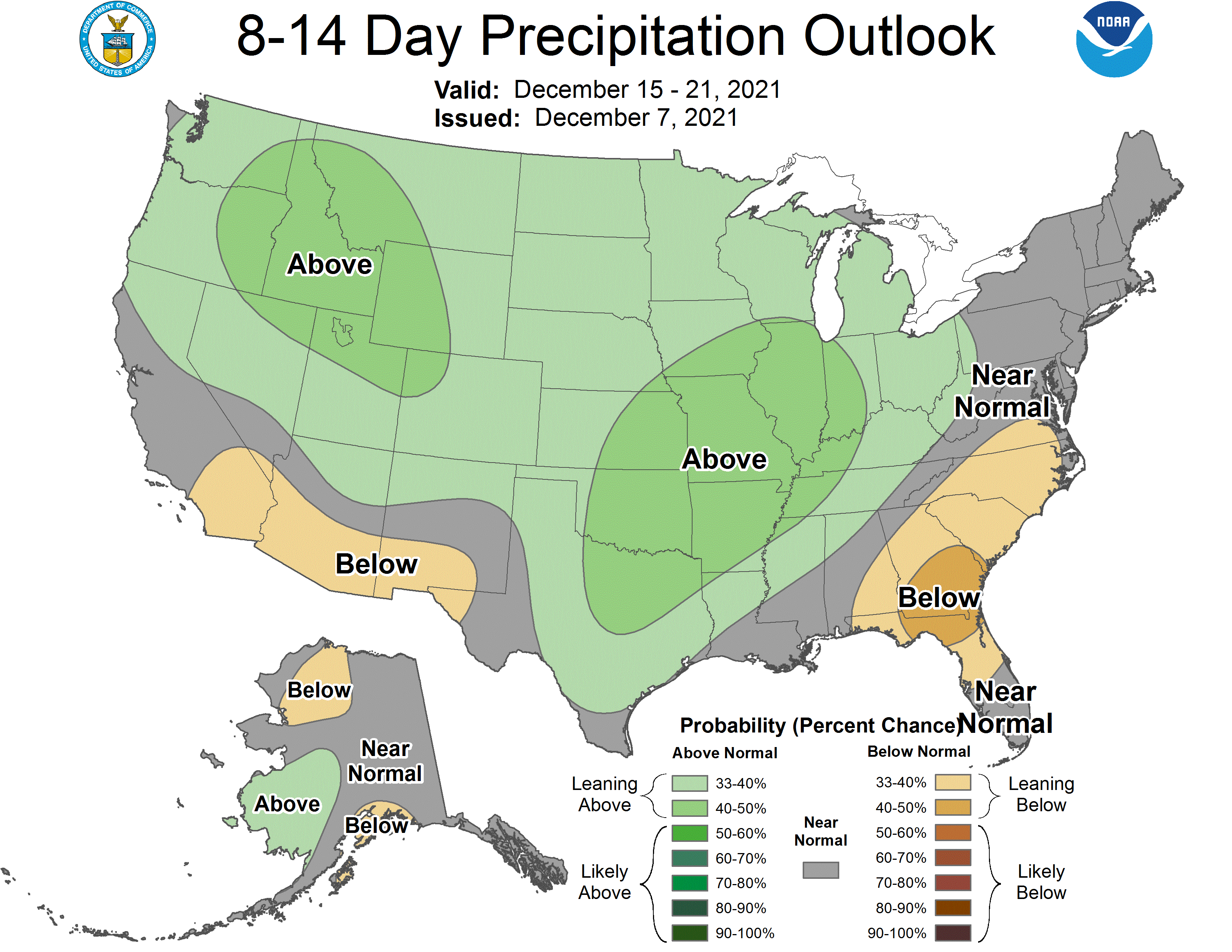
Keep in mind that "above normal" precipitation this time of year isn't exactly
a gullywasher necessarily, since December-February is the driest time of year
in Oklahoma. But if it's wet, we'll take it. Now onto our record temperatures
later this week, another dip down into winter, and right back to record
territory after that.
Gary McManus
State Climatologist
Oklahoma Mesonet
Oklahoma Climatological Survey
gmcmanus@mesonet.org
December 8 in Mesonet History
| Record | Value | Station | Year |
|---|---|---|---|
| Maximum Temperature | 80°F | BURN | 2023 |
| Minimum Temperature | -15°F | KENT | 2005 |
| Maximum Rainfall | 2.35″ | MTHE | 1994 |
Mesonet records begin in 1994.
Search by Date
If you're a bit off, don't worry, because just like horseshoes, “almost” counts on the Ticker website!