Ticker for November 30, 2021
MESONET TICKER ... MESONET TICKER ... MESONET TICKER ... MESONET TICKER ...
November 30, 2021 November 30, 2021 November 30, 2021 November 30, 2021
Maximum Meltage
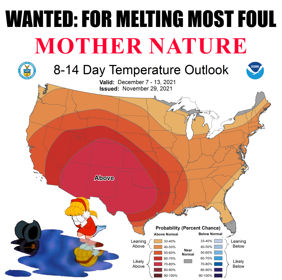
Well I guess this is us now! That about covers the first half of December. This
stupid (not to be confused with dumb, but if you're confused you could probably
go with dumb, and if you're still confused then you can join me in joyously
accepting all three adjectives) weather pattern we are in gives us momentary
glimpses of winter, which climatologically begins tomorrow (meteorologically too,
but climate always rules over weather! {spits on ground}) and runs through
February. Although in reality it probably starts somewhere around January 4 and
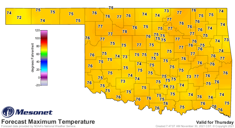
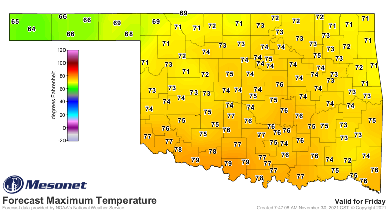
runs through January 9? So we will continue to see temperatures run 15-20 degrees
above normal at times, like Thursday and Friday.
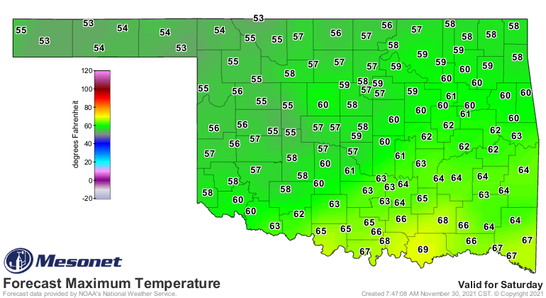
And then we'll get a mostly dry cold front through and drop the temperatures
back down to merely seasonable, but not usually too far BELOW normal. Like
Saturday.
There are always hints at bigtime cold air masses headed this way out past 10
days in the forecast model runs, but as I've told you many times, that's
fantasy-cast territory. What we're seeing hold much more sway in the atmosphere
the last half of 2021 is persistence. Since mid-August or so, temperatures
across much of the Southern Plains have remained above normal for the most
part as shown in this graph of statewide average high temperatures since Aug.
1 through yesterday.
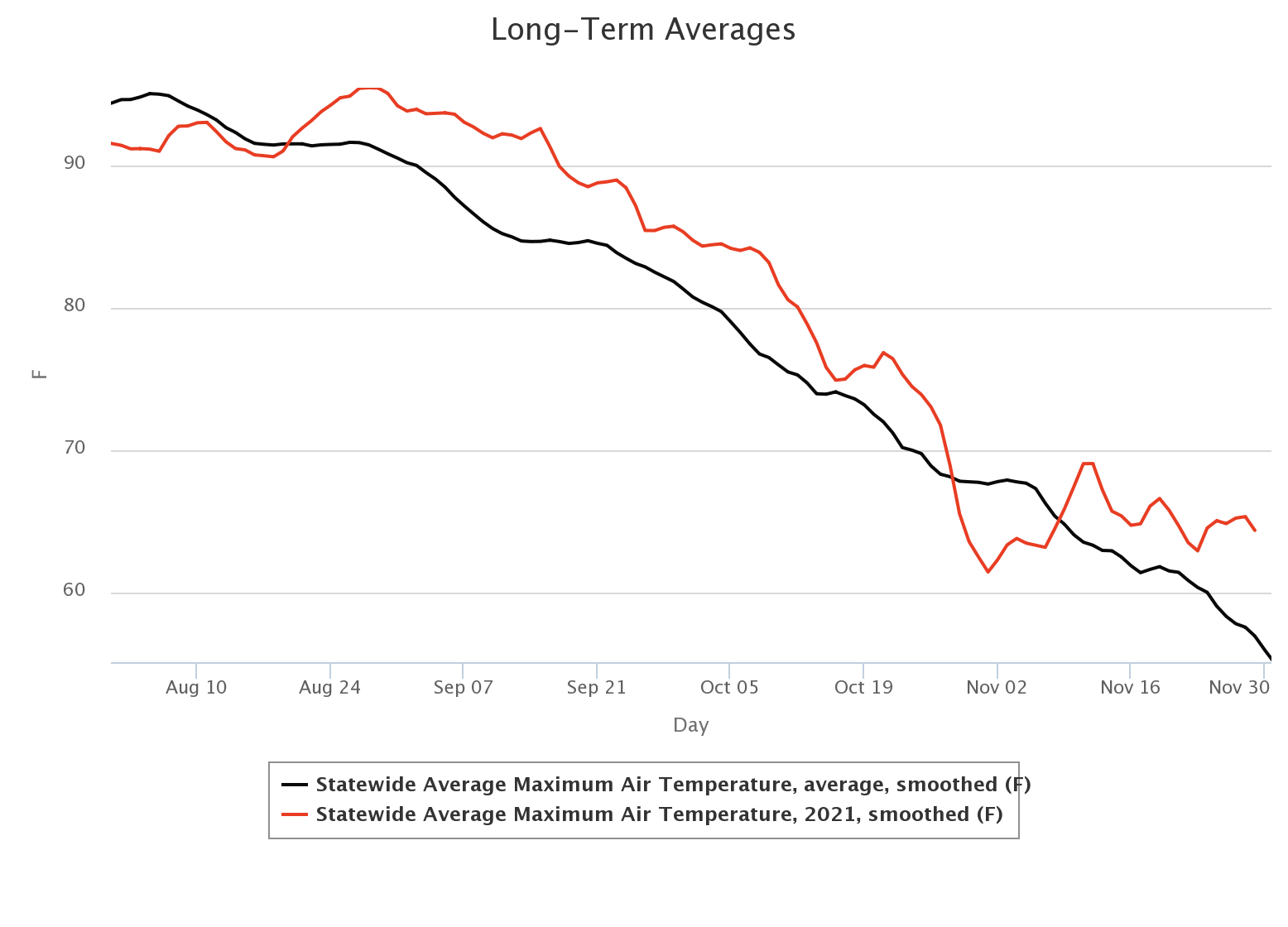
I don't really remember it getting too cold there at the end of October, but
that's really the only time in the last four months that we've had an
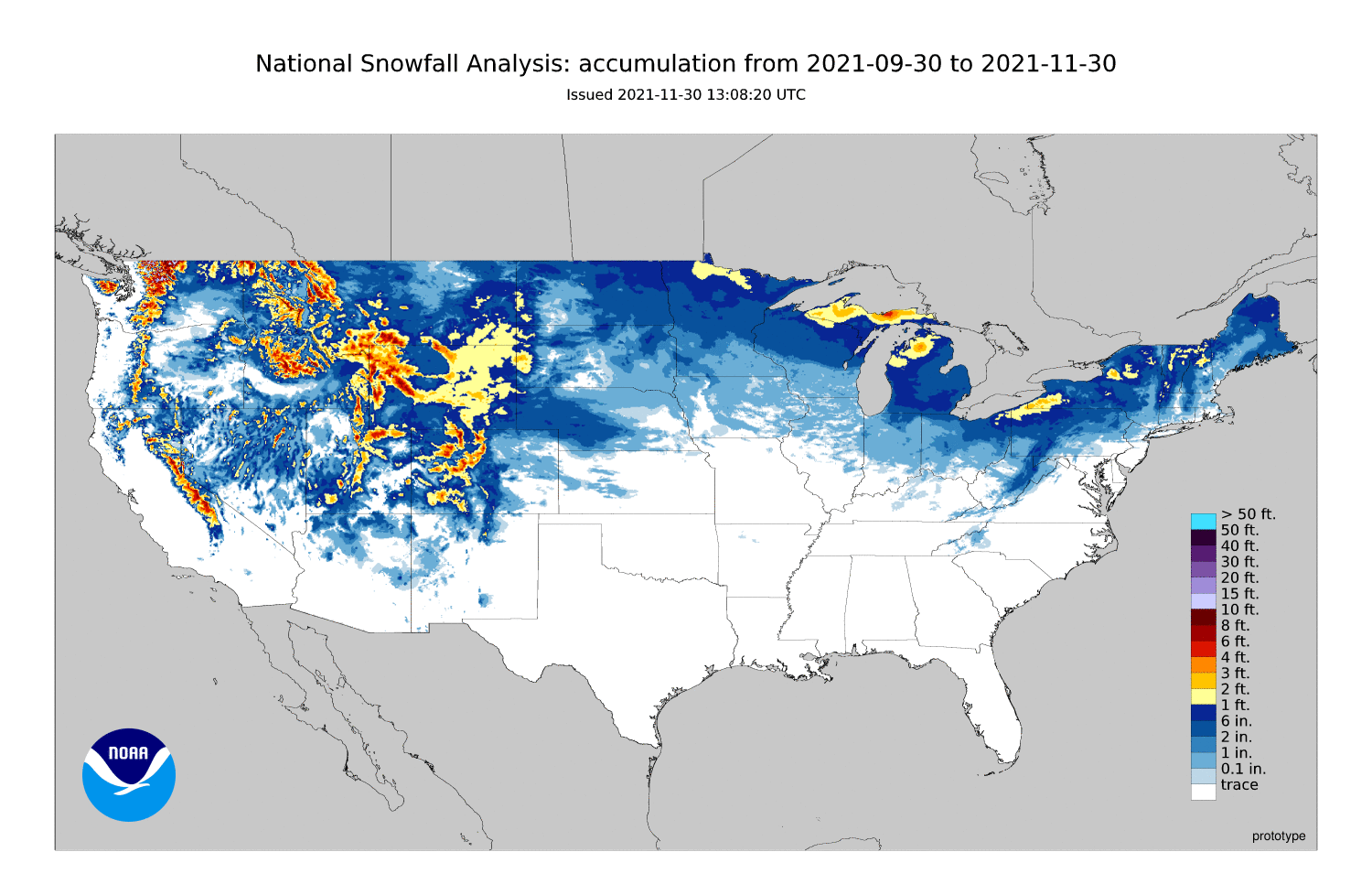
extended period of below normal temperatures. This also means that much of the
U.S. continues in a snow drought, with vast differences between the seasonal
snowfall so far this year vs. last year's deluges through this period.
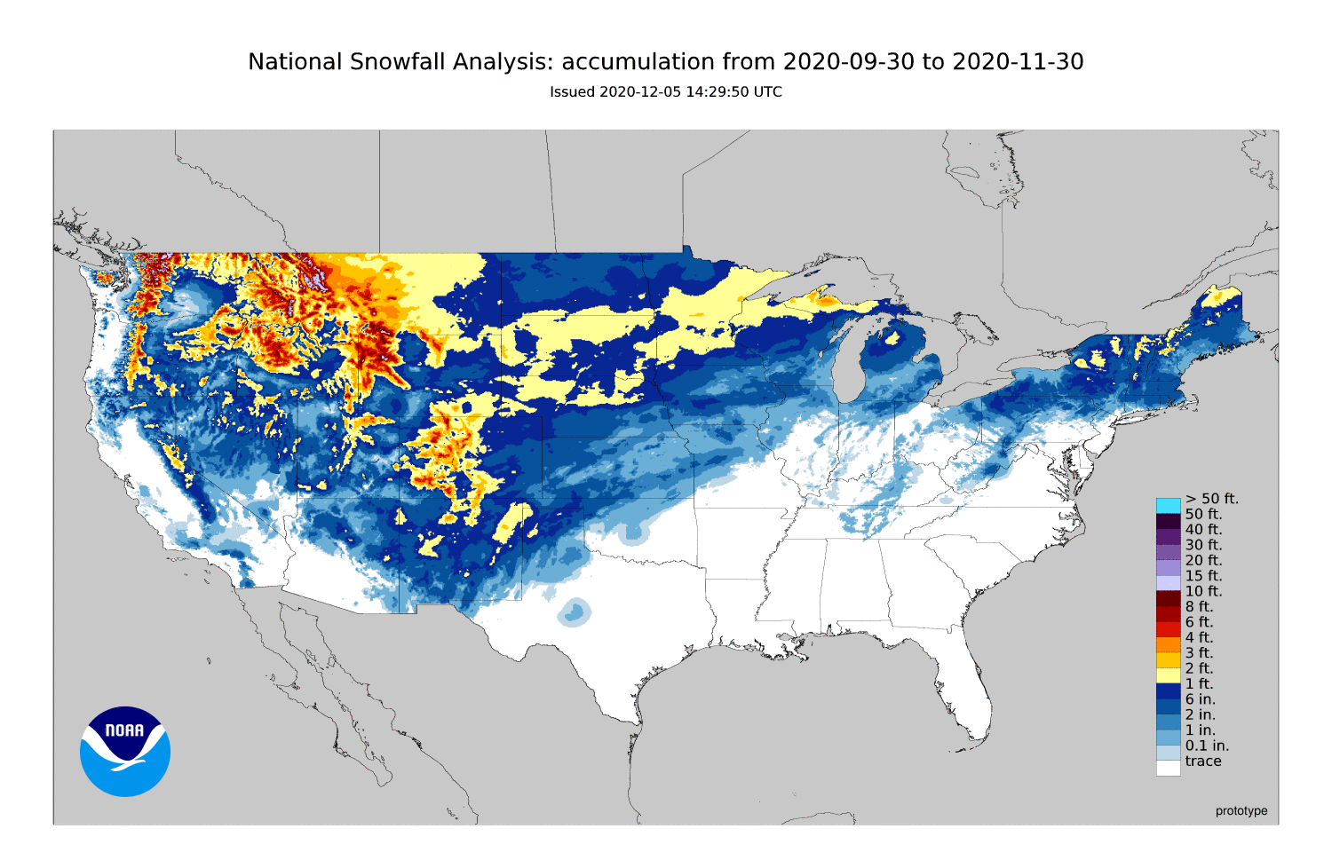
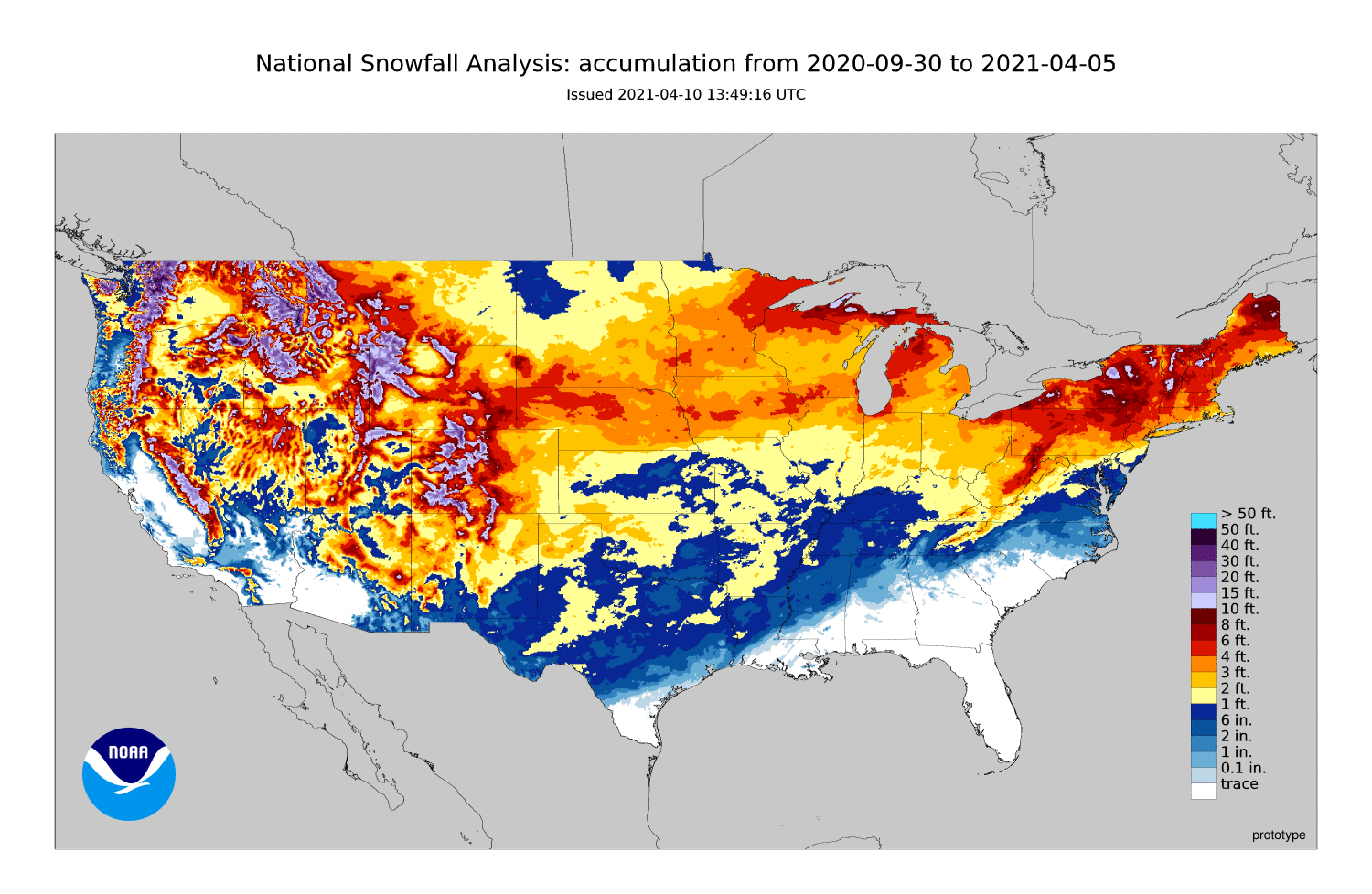
And remember last year at this time (if you must...UGH!), the snow was just
getting started.
So as we watch these small bursts of winter (late fall, really) approach and
pass, we can only dream along with those fantasy-casts of true winter sitting
tantalizingly 10-14 days out in the computer models. That's where your snow is
this winter.
My fantasy-casts are all about a full head of hair, so I guess now you know how
I feel. With winter or coifs, however, be careful what you wish for.
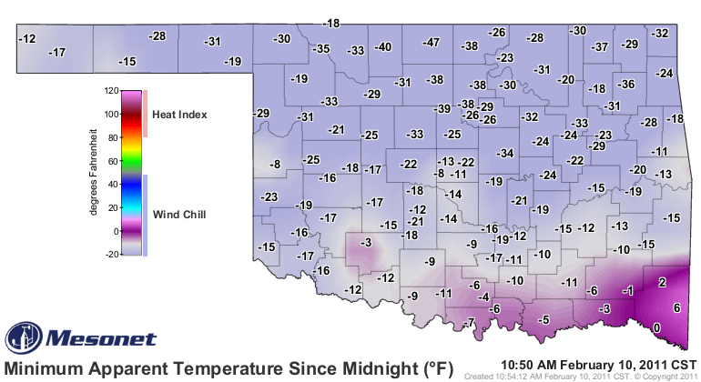

Oh well. Soon, it's gonna be May!
Gary McManus
State Climatologist
Oklahoma Mesonet
Oklahoma Climatological Survey
gmcmanus@mesonet.org
November 30 in Mesonet History
| Record | Value | Station | Year |
|---|---|---|---|
| Maximum Temperature | 80°F | ALTU | 2021 |
| Minimum Temperature | 4°F | BOIS | 2004 |
| Maximum Rainfall | 3.13″ | IDAB | 2023 |
Mesonet records begin in 1994.
Search by Date
If you're a bit off, don't worry, because just like horseshoes, “almost” counts on the Ticker website!