Ticker for November 11, 2021
MESONET TICKER ... MESONET TICKER ... MESONET TICKER ... MESONET TICKER ...
November 11, 2021 November 11, 2021 November 11, 2021 November 11, 2021
GONK
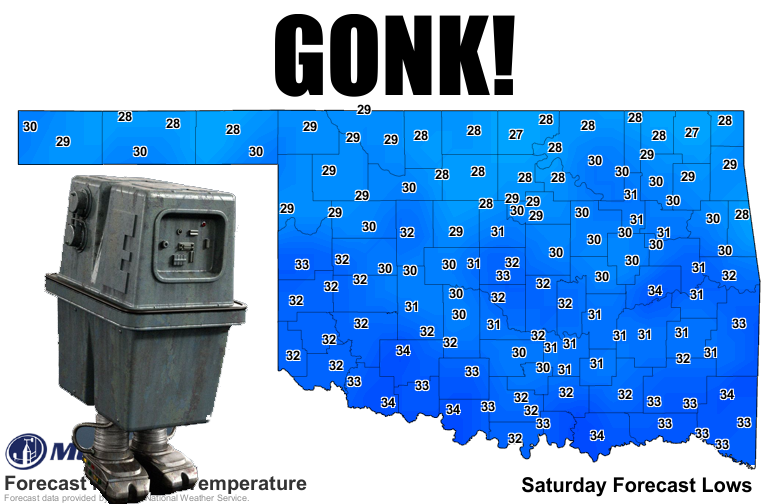
Right, how boring is the forecast when the most exciting thing on the horizon is
a near statewide freeze Saturday morning? That's excluding the precast(??) of
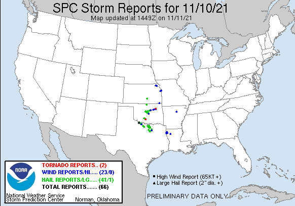
what happened last night, with another couple of possible tornadoes added to
our tally for 2021. First possible twister was near Bray in Stephens County, then
another up near Catoosa. There were also plenty of large hail and severe wind
reports to keep a November night hopping.
Some decent rains across the eastern half of the state as well.
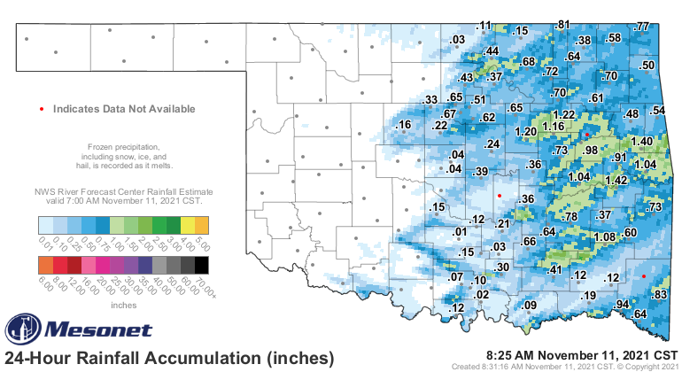
Unfortunately, much of western OK was left wanting last night. And all of us are
left with the realization that it's once again fall as we see that warm, humid air
ahead of yesterday's cold front replaced with much drier and cooler air.
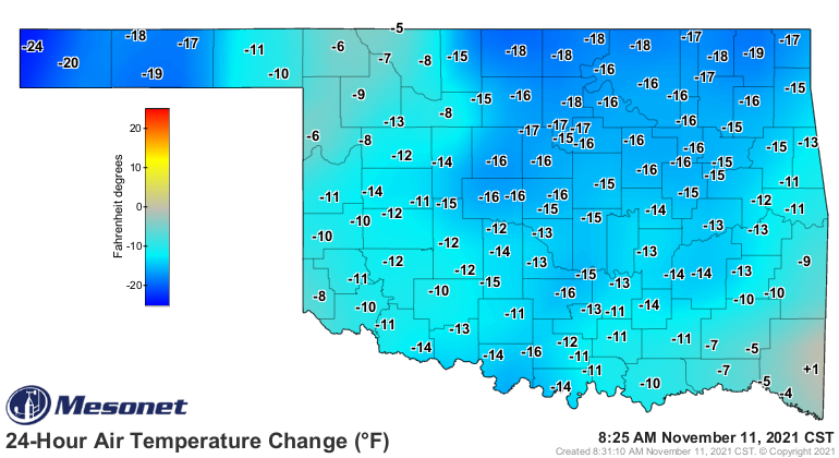
Now we go into the doldrums again with another cold front Friday that will drop
those temps down close to freezing statewide...next chance of rain looks to be
next Wednesday, but it's not like we're talking about a huge storm system by
any means. Western Oklahoma really needs some moisture to kick back those nasty
colors on the latest U.S. Drought Monitor.
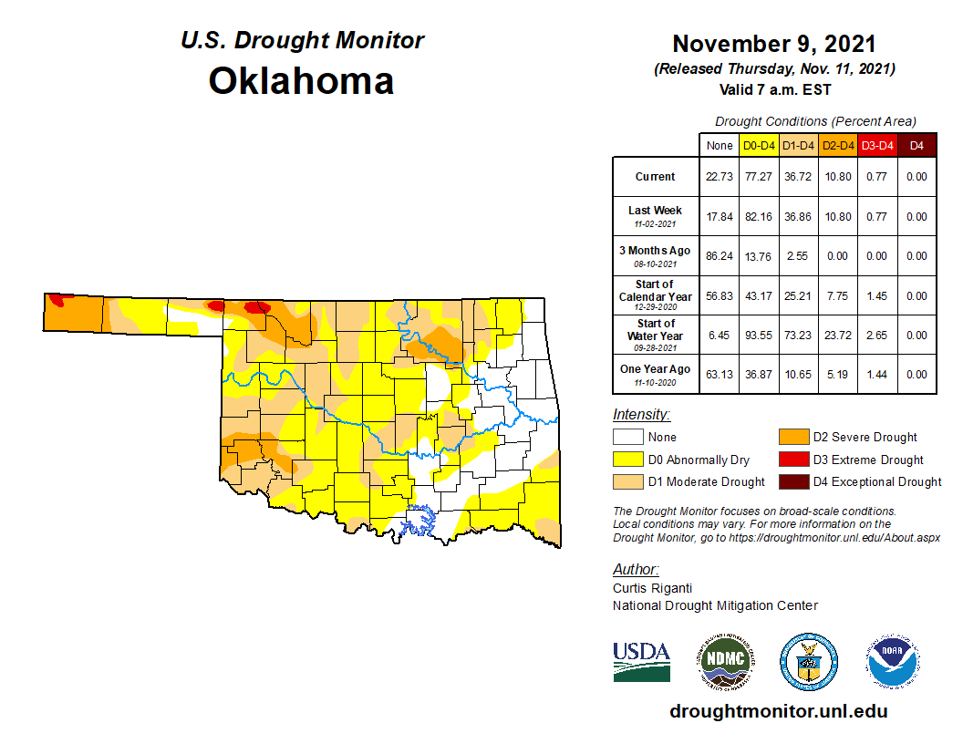
This appears to be our weather pattern for awhile...brief warmups (I prefer
boxers) with occasional mostly-dry cold fronts shooting through the state every
few days.
Boring. Some like boring. I was boring enough before this current state of
boring, so the redundancy of the boring is even more boring.
yawn.
Gary McManus
State Climatologist
Oklahoma Mesonet
Oklahoma Climatological Survey
gmcmanus@Mesonet.org
November 11 in Mesonet History
| Record | Value | Station | Year |
|---|---|---|---|
| Maximum Temperature | 86°F | SLAP | 2005 |
| Minimum Temperature | 1°F | EVAX | 2019 |
| Maximum Rainfall | 1.24″ | COPA | 2012 |
Mesonet records begin in 1994.
Search by Date
If you're a bit off, don't worry, because just like horseshoes, “almost” counts on the Ticker website!