Ticker for November 15, 2021
MESONET TICKER ... MESONET TICKER ... MESONET TICKER ... MESONET TICKER ...
November 15, 2021 November 15, 2021 November 15, 2021 November 15, 2021
An orange on a toothpick
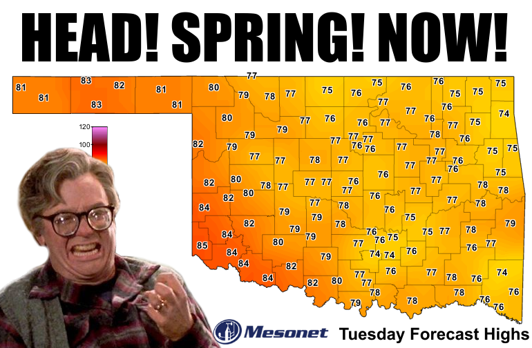
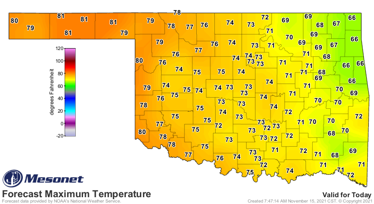
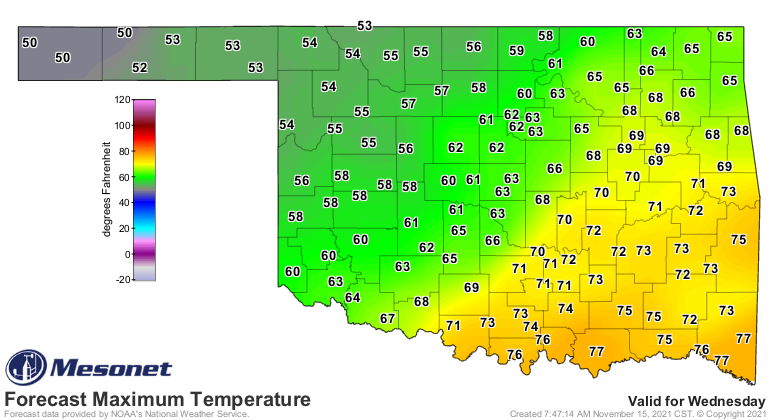
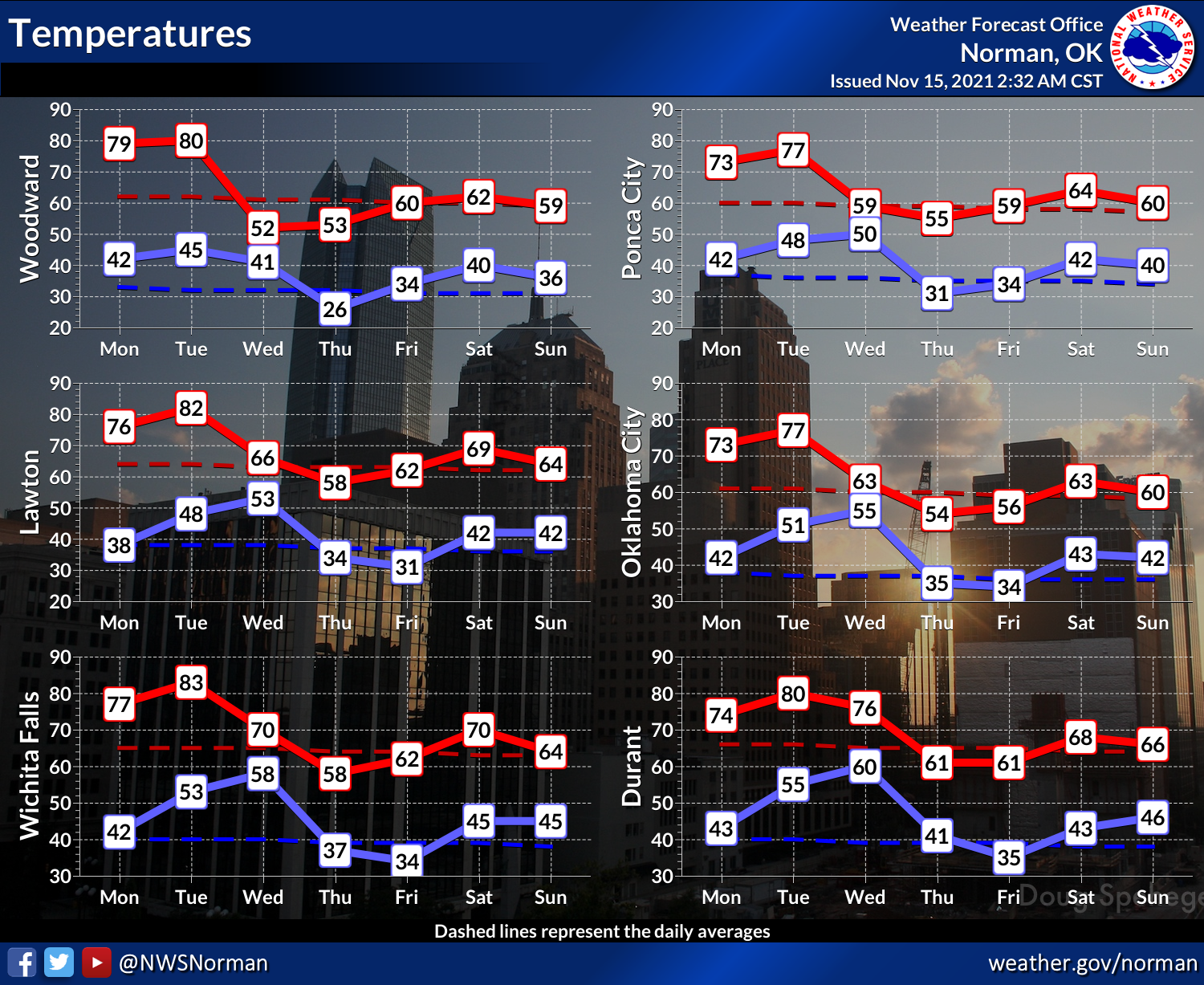
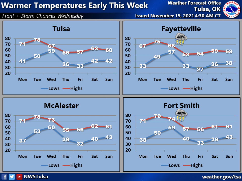
Ah, Old Man Winter will be crying himself to sleep tonight on his huge frozen
pillow. Fresh off the coldest morning of the season thus far on Saturday, which
saw most of the state get a freeze, we are now going to see a quick warm up to
spring territory (again, I don't want to say autumn since we've already had
winter...always look forward!) for the next couple of days before we see another
cold front and more seasonable temps. And another warm up after that!
Speaking of that last big freeze on Saturday, that finished off most of the
Mesonet sites' first freeze dates. There are 3 sites still awaiting their wintry
joy...Cheyenne, Grandfield, and Medicine Park.
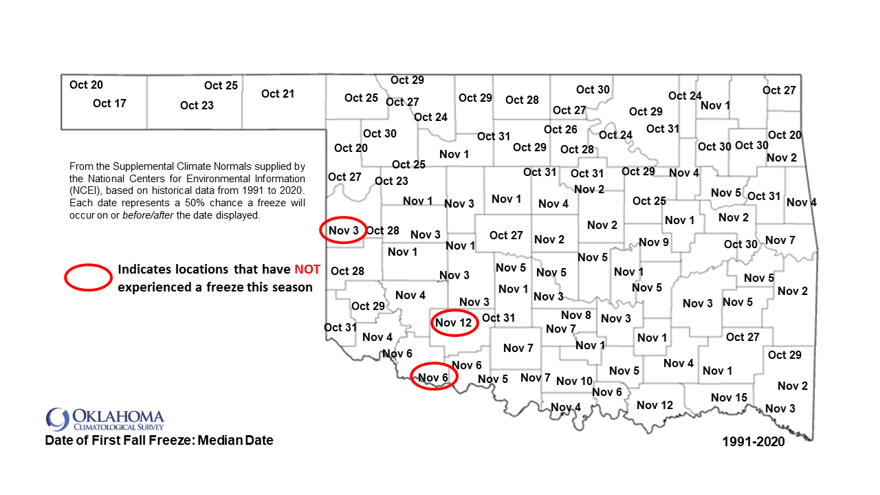
I can't really speak for Grandfield's lack of a freeze, other than they're
wayyy down south, but Cheyenne and Medicine park are notorious "inversion
pokers." No, that's not a crime like it sounds, it means that those sites are
of high enough elevation (relatively) that they often remain above that shallow
later of cold air near the ground where freezes occur. This was explained many
many years ago (WHEEZE!) in an old Ticker with the following graphic.
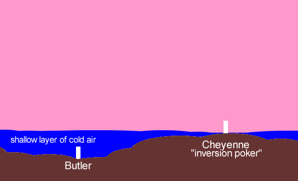
That also helps explain how low-lying areas can often have a freeze while
surrounding areas remain above freezing. The El Reno site, for instance, is
an infamous inversion non-poker(??). But as you can see by the average first
fall freeze dates, Cheyenne and Grandfield are getting a bit long in the
non-frozen tooth.
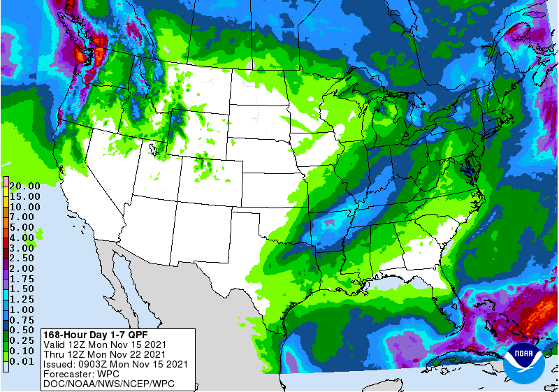
There will be minor chances of rain here and there for the next week, but mostly
across southeastern Oklahoma. Nothing showing up for awhile on the precip front.
For those wanting to walk in a winter wonderland, you're out of luck for the
time being. There really isn't much of a sign of really COLD air coming down
this way, nor of any frozen precip. This is a look at the total accumulated
snowfall totals from one extended range forecast model for now through Dec. 1.
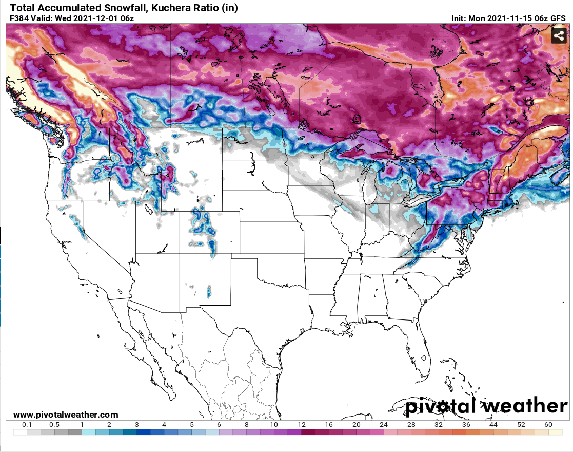
That can all change in a hurry, of course, but even the ski slopes of the
Rockies are shut out through the rest of November in that forecast. With a
ridge of high pressure to our west and trough of low pressure to our east, we
will likely be stuck in northwesterly flow, meaning we'll see quick warm ups
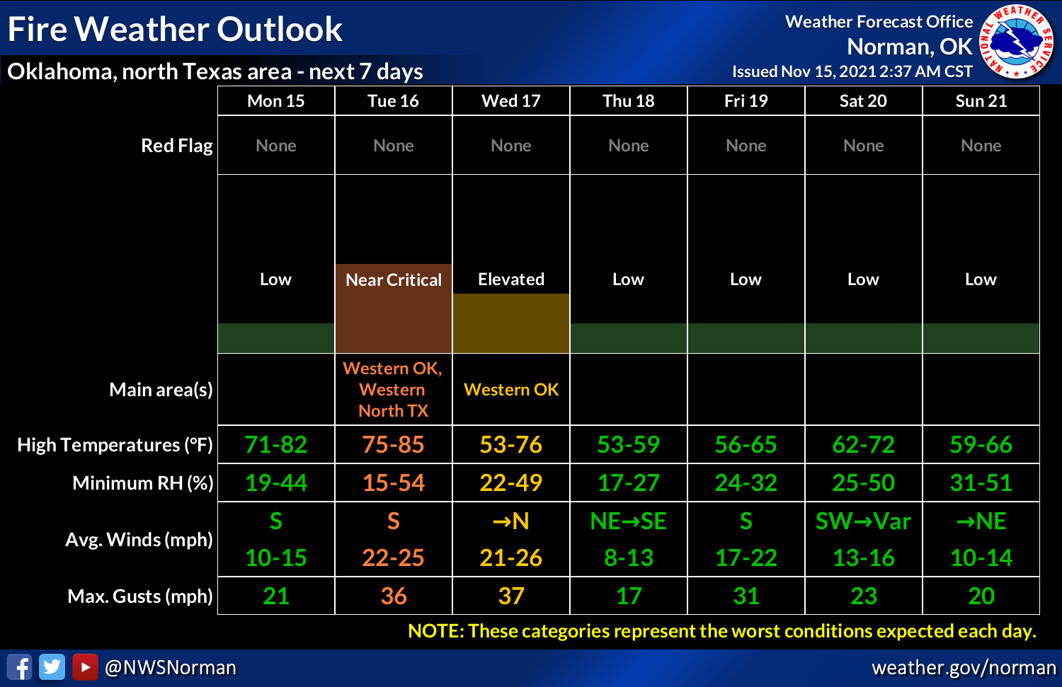
(like now) and frequent DRY cold fronts. That's not gonna help much on the
drought with these warm, windy, and exceedingly dry days exacerbating the problem,
as well as increasing the fire danger at times with all this dead and/or
dormant vegetation.
In other words, the weather is looking mighty boring for the next couple of
weeks. And who better to cover really boring weather than a climatologist!
Hey, I heard that. Now *I* will be crying myself to sleep tonight on my
normal-sized boring pillow.
Gary McManus
State Climatologist
Oklahoma Mesonet
Oklahoma Climatological Survey
gmcmanus@mesonet.org
November 15 in Mesonet History
| Record | Value | Station | Year |
|---|---|---|---|
| Maximum Temperature | 94°F | TIPT | 2025 |
| Minimum Temperature | 8°F | KENT | 1997 |
| Maximum Rainfall | 2.71″ | BROK | 2011 |
Mesonet records begin in 1994.
Search by Date
If you're a bit off, don't worry, because just like horseshoes, “almost” counts on the Ticker website!