Ticker for November 10, 2021
MESONET TICKER ... MESONET TICKER ... MESONET TICKER ... MESONET TICKER ...
November 10, 2021 November 10, 2021 November 10, 2021 November 10, 2021
Here we go again
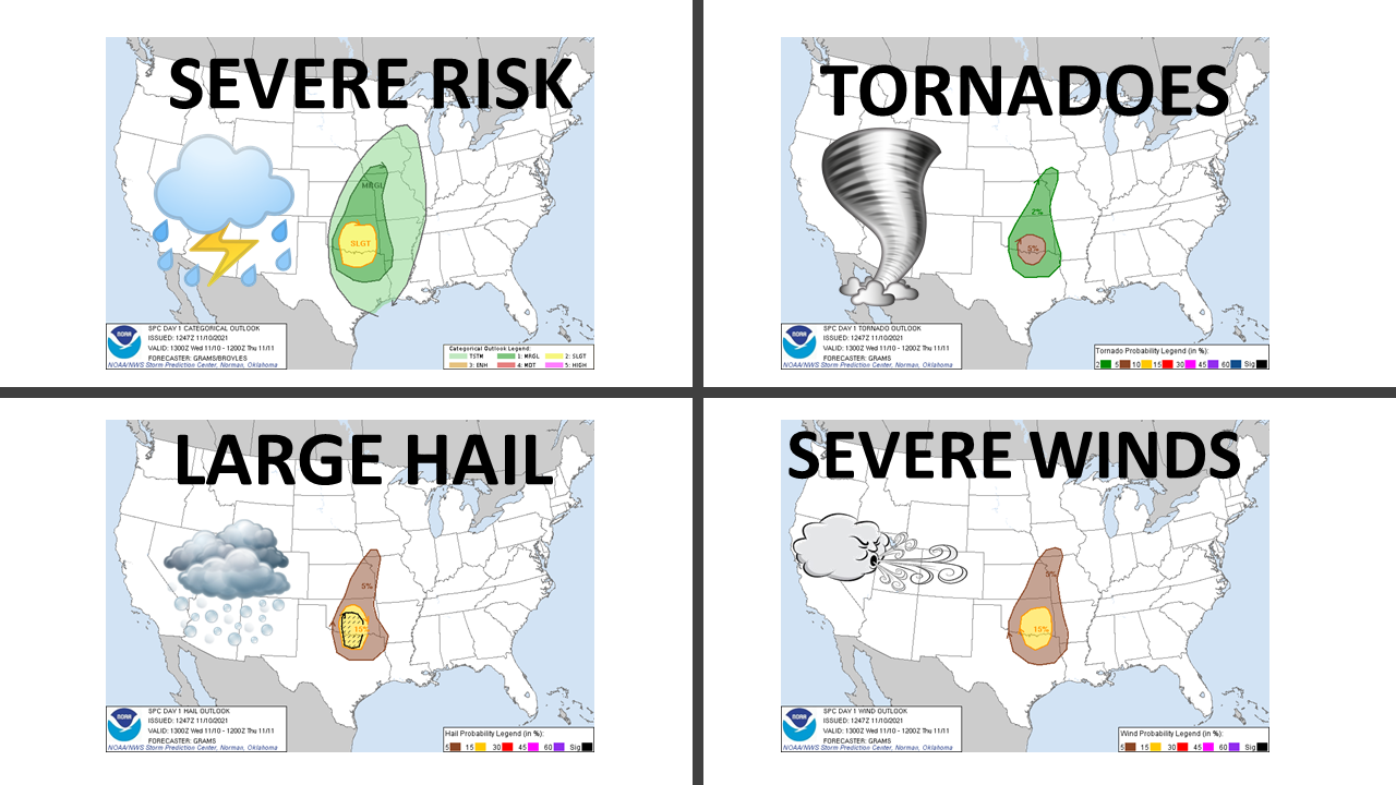
Are you kidding me? Weren't 31 tornadoes in October enough to satisfy Mother
Nature's thirst for vengeance against us for our relatively mild benign spring
weather season? I guess not because she's once again giving us one of THOSE
days in Oklahoma...in November! Not much we can do but prepare and then repair, if
needed.
Same old setup, front coming through the state currently will later set off a
round of storms that will quickly become severe. Initially they will possibly
stay discrete (can't stand a thunderstorm that blabs your business all over town!)
and begin rotating as supercells. At that point, they will be at their most
dangerous with a large hail and tornado threat,more so down in south central
Oklahoma. After that, it should start to line out then you worry for those quick
spin-ups along the leading edge of the line, those QLCS tornadoes...usually
very brief and quick evolving twisters that can be damaging nonetheless.
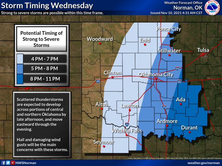
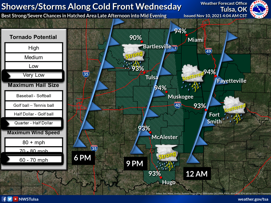
Watch for those storms to go up across western OK sometime late afternoon, and
since we've hit daylight savings time, late afternoon is basically evening, so
let's go ahead and say early evening, unless you like late afternoon better
but if you do let's get rid of daylight savings time. How was that? Then the
storms march across the state, dumping a bit of rain, a bit of hail, a bit
of high winds, and maybe a bit of tornado.
Here are a couple of pictures to replace those 2,000 words.
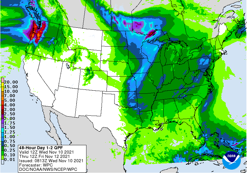
Not a lot of rain, especially across western Oklahoma.
After that, we go into a more benign pattern of northwesterly flow aloft, which
means we should see dry cold fronts periodically for the next week or so. First
one after today is on Friday, which could give us another freeze chance across
a wider area of the state Saturday morning.
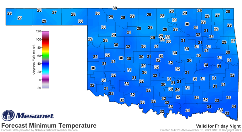
A slow warm up through next week, maybe a front mid- to late-week next week
that could really knock our temps into the dirt, but that's still iffy. Still
no bigtime arctic air outbreaks on the horizon just yet, outside of fantasyland
forecasting. My fantasyland forecasting shows 70s and 80s through spring,
then 80s and 90s through November 2022. Sorry, no snow showing up yet, a far cry
from last year at this point.
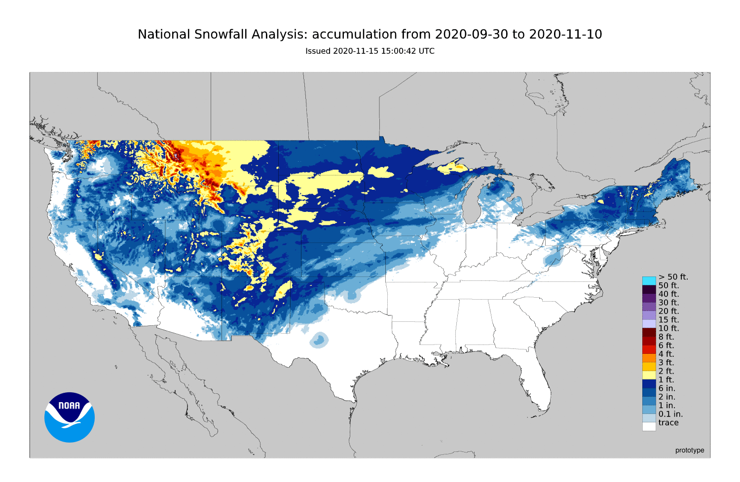
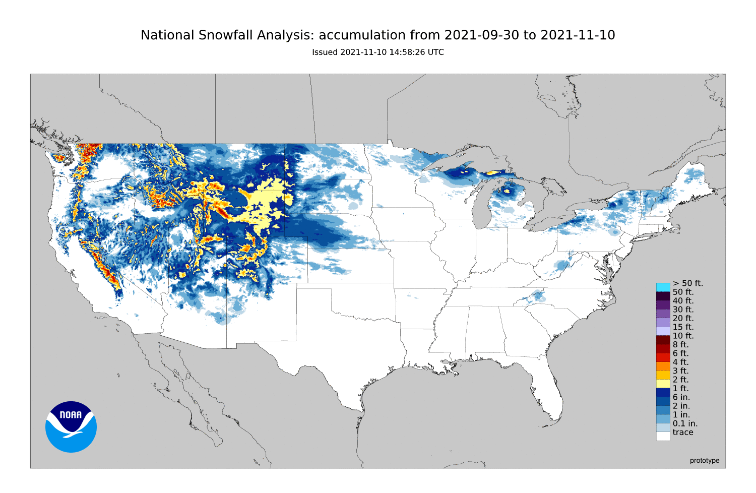
HA! Unfortunately, he who laughs first often doesn't laugh best. It'll be here
sooner or later.
Gary McManus
State Climatologist
Oklahoma Climatological Survey
Oklahoma Mesonet
gmcmanus@mesonet.org
November 10 in Mesonet History
| Record | Value | Station | Year |
|---|---|---|---|
| Maximum Temperature | 88°F | MANG | 2014 |
| Minimum Temperature | 13°F | VINI | 2018 |
| Maximum Rainfall | 2.98″ | WIST | 2008 |
Mesonet records begin in 1994.
Search by Date
If you're a bit off, don't worry, because just like horseshoes, “almost” counts on the Ticker website!