Ticker for November 3, 2021
MESONET TICKER ... MESONET TICKER ... MESONET TICKER ... MESONET TICKER ...
November 3, 2021 November 3, 2021 November 3, 2021 November 3, 2021
Fall back
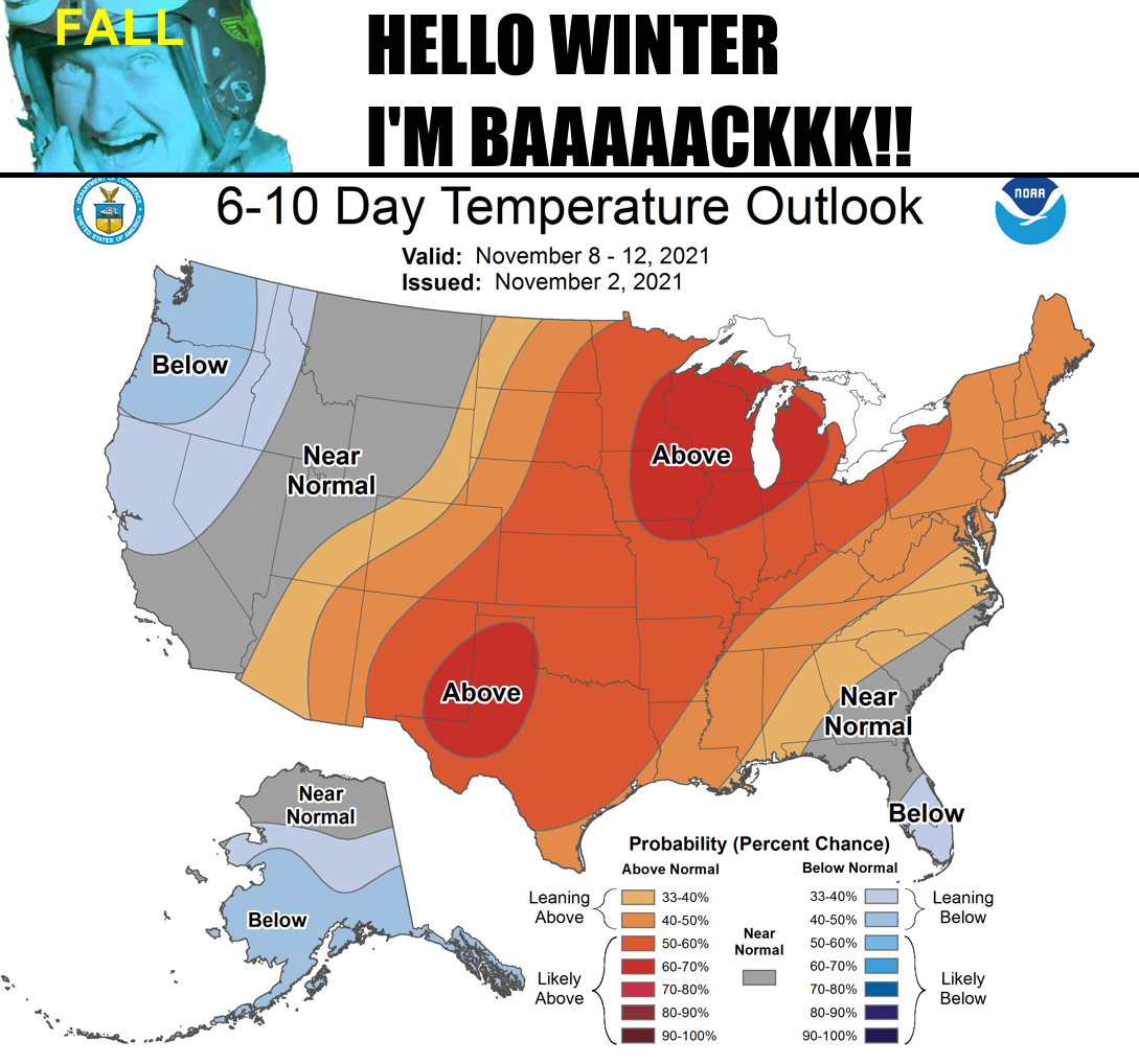
Tired of mornings like THIS, are ya?
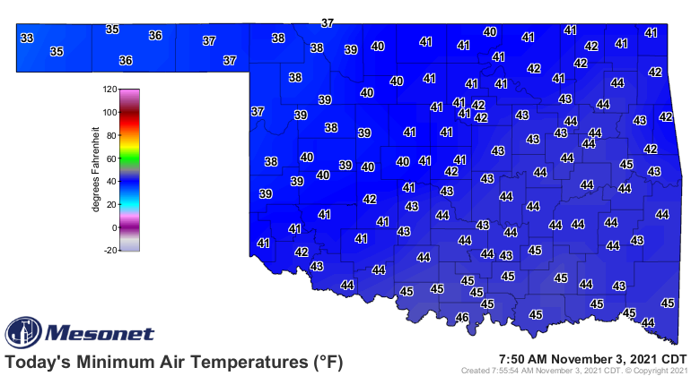
And afternoons like this?
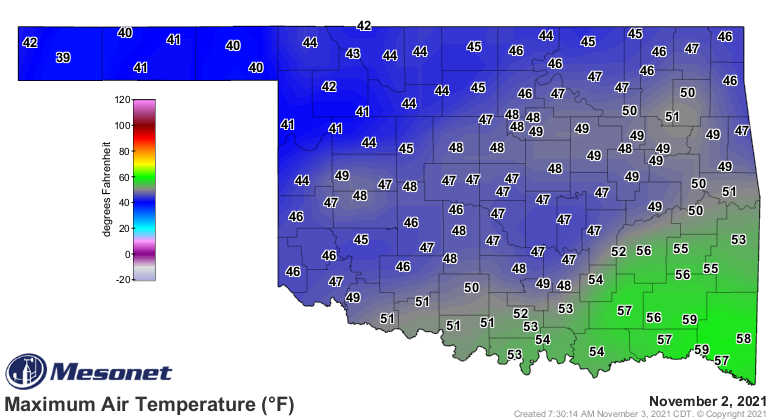
Did ya already put up all those short sleeve shirts and get down the sweaters
and hoodies? Well, it might have been a bit premature. We have a couple more
days of winter-ish temperatures, then we go right back to full-fledged fall by
the weekend.
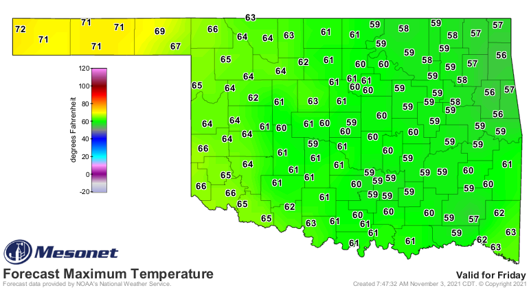
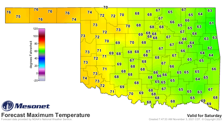
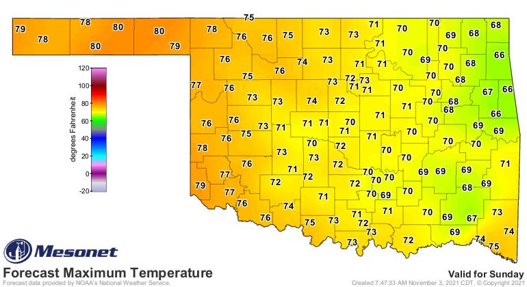
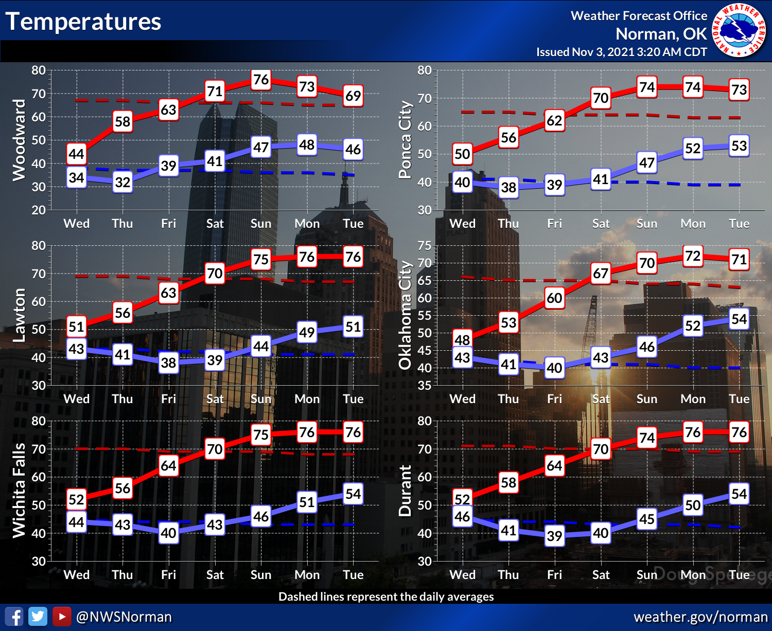
And then that warmth extends on into next week, as shown by our good friends
at the Norman NWS office, and crazy Cousin Eddie in the graphic above (sorry,
don't know his name in "Independence Day," other than "Dad").
Now there is some indication in the long-range models of a big cold blast
coming our way in week #2, but we've just had a nice cold blast so we should
be ready. Heck, we've already made chili AND switched our closets out from
fall (summer, really) to winter.
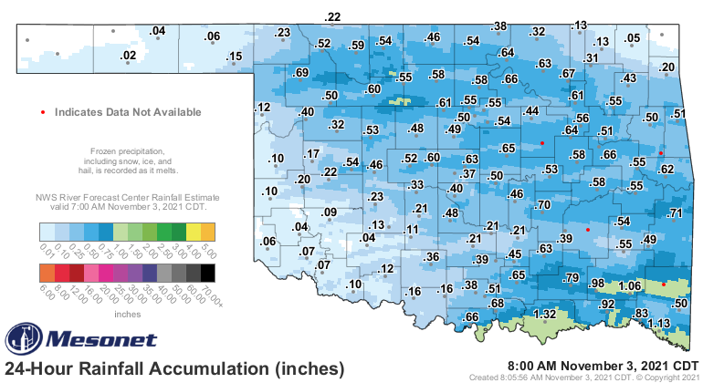
In addition to the cold, we did get a nice chilly rain (which is much better
than "chili rain"...or is it?) over most of the state. The Panhandle really
needs it, but they missed out.
Wait! We're not out of the woods yet. We still have another gray day today,
then a possible freeze tonight across northern OK.
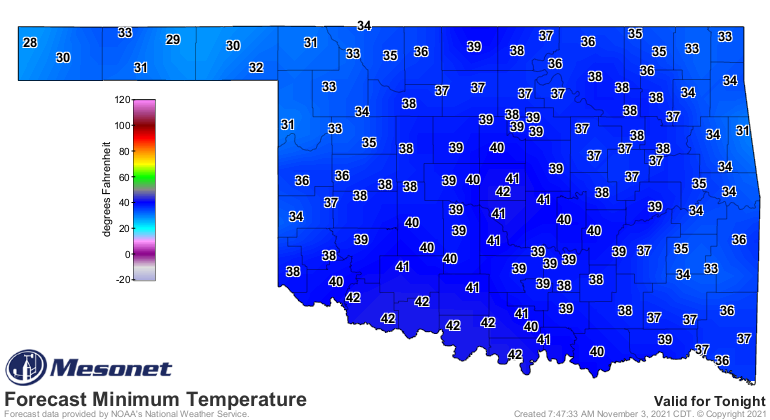
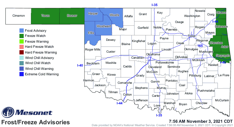
So get ready to change this map.
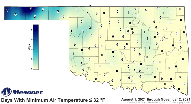
It will be okay. We just have to bide our time until this cold weather craze
blows over. Speaking of blowing over, that's coming soon, too.
Gary McManus
State Climatologist
Oklahoma Mesonet
Oklahoma Climatological Survey
gmcmanus@mesonet.org
November 3 in Mesonet History
| Record | Value | Station | Year |
|---|---|---|---|
| Maximum Temperature | 93°F | MANG | 2005 |
| Minimum Temperature | 10°F | KENT | 2004 |
| Maximum Rainfall | 6.69″ | TISH | 2024 |
Mesonet records begin in 1994.
Search by Date
If you're a bit off, don't worry, because just like horseshoes, “almost” counts on the Ticker website!