Ticker for November 1, 2021
MESONET TICKER ... MESONET TICKER ... MESONET TICKER ... MESONET TICKER ...
November 1, 2021 November 1, 2021 November 1, 2021 November 1, 2021
Those terrible twisters
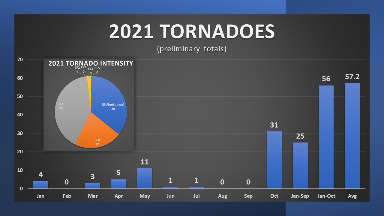
Okay, so PRELIMINARILY, we had 31 tornadoes in October (that number could go
up but not down as NWS personnel continue to investigate possible touch downs)
which is more than we had Jan-Sept (25) which gives us 56 for the year (56, I just
said that!) which is 1.2 tornadoes below the 1950-2020 annual average of 57.2.
Oh, and of those 56 tornadoes, most have been categorized thus far as EF0 or EF1
(WEAK) tornadoes, and only one has been labeled as STRONG thus far, the EF2
that hit Anadarko on Oct. 10. Now there are still 20 EFU tornadoes, meaning
their intensity is still unknown (I'll let you make your own EFU tornado jokes).
So remember after about June 10 when folks say "wow, that was a pretty tame
tornado season" and then that old-timer says "Tornado season in Oklahoma is
all year, whippersnapper," tell them to "get your chocolate out of my peanut
butter, you better leggo my Eggo, don't squeeze the Charmin," and then finish
it off with a "KISS MY GRITS!" But also believe them. If you're younger than
30, just say "bruh." If you're under 30 and also English, you can sub in "bruv"
I reckon.
Okay, enough about twisters, at least until the next one hits on Nov. 13. What?
Bruh!
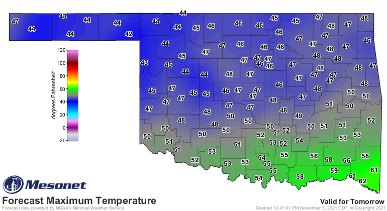
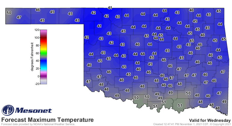
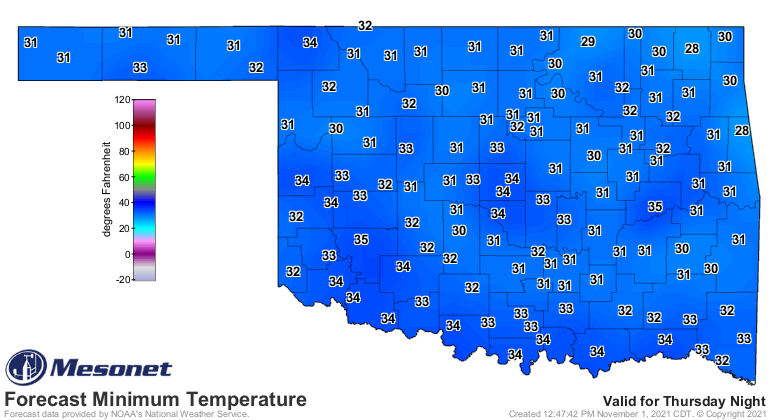
Next in line is bona fide winter coming to a sky near you. Most of you will
feel it tomorrow, and if not tomorrow then Wednesday, and if not either of
those two days, Friday morning will nip the bud off your bonnet.
Expect lots of gray skies for the next few days as well, complete with the
obligatory drizzle and occasional heavier shower and storm before clearing off
for the chilly-enough-for-chili weekend.
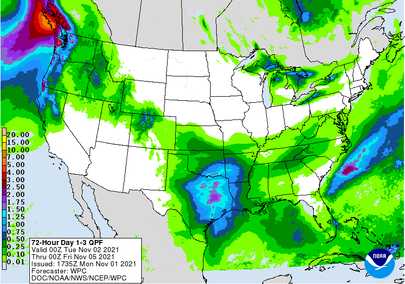
Don't be shocked if you see a few flakes around, either. Around here, they
hang out at the 7-11, leaning on the counter and calling people "guy." Also,
you might see a snowflakes as well.
So with winter (fall is over, guy) in full bloom, might as well take a look
back at October and those record tornado totals. Also, those triple-digit
temperatures.
----------------------------------------------------------------------------------
October Sets Tornado Record
Nov. 1, 2021
Oklahomans are growing accustomed to Mother Nature’s October weather
shenanigans following a snowstorm of up to 13 inches in 2019 and a crippling ice
storm in 2020. A spring severe weather motif was chosen for October 2021 with at
least 31 tornadoes touching down during the month, besting the previous October
record total of 27 set back in 1998. That preliminary total also surpasses the
25 twisters tallied during the first nine months of the year. While most of the
tornadoes were considered weak—rated EF0 or EF1 on the Enhanced Fujita Scale—
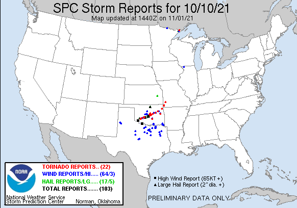
they were damaging, nonetheless. Oct. 10 was the most active day with 17
confirmed tornadoes along the Interstate 44 corridor. The most intense twister,
rated an EF2, touched down near Anadarko and created “substantial” damage
throughout the town according to Anadarko city officials. Two EF1 twisters
struck Coweta and Webbers Falls later that night and damaged numerous homes and
businesses, as well as Coweta High School. Severe winds and large hail were
also quite fierce that evening. Norman was hit with hail up to the size of
baseballs that caused significant damage to a large swath of the city—Norman’s
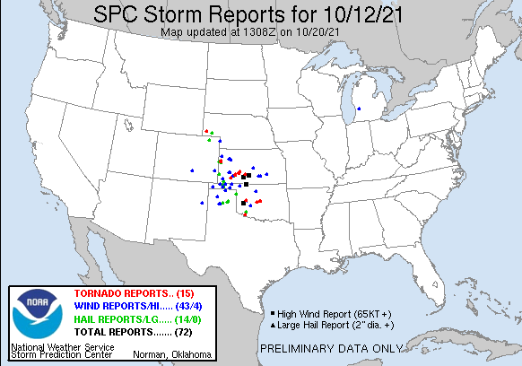
second disastrous hailstorm in 6 months. Another severe weather outbreak
struck the evening of the 12th overnight into the 13th, producing another 13
tornadoes which were also accompanied by large hail and severe winds. These
tornadoes traversed southwest through central Oklahoma, damaging houses and
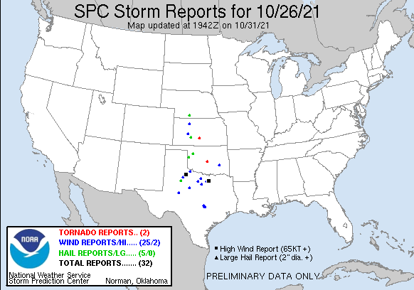
businesses along the way. The month’s final tornado struck northeast Norman
just after midnight on Oct. 27, damaging trees, fences and homes. The
preliminary total for the year now stands at 56. The annual average for
Oklahoma is 57.2 tornadoes based off of 1951-2020 data. Non-thunderstorm
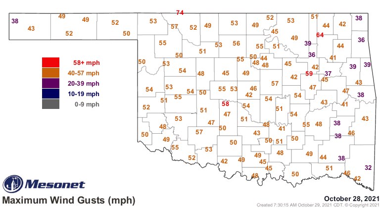
related winds buffeted the state on Oct. 28. Fifty-seven of the Mesonet’s 120
sites recorded wind gusts of at least 50 mph. The site at May Ranch in northern
Woods County reported a gust of 74 mph that afternoon.
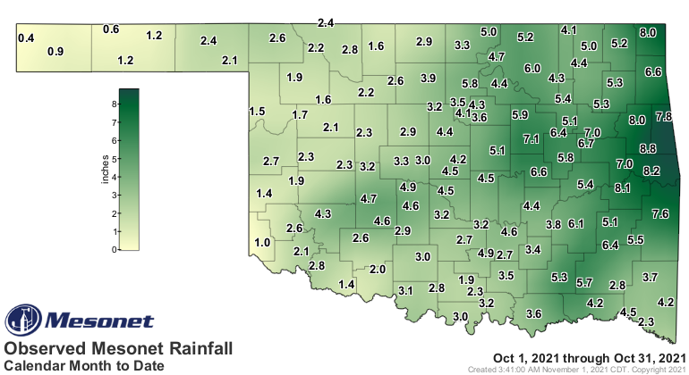
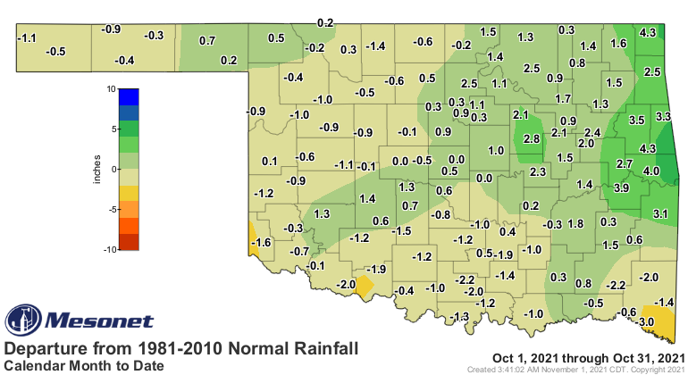
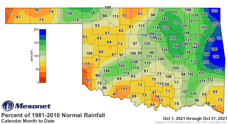
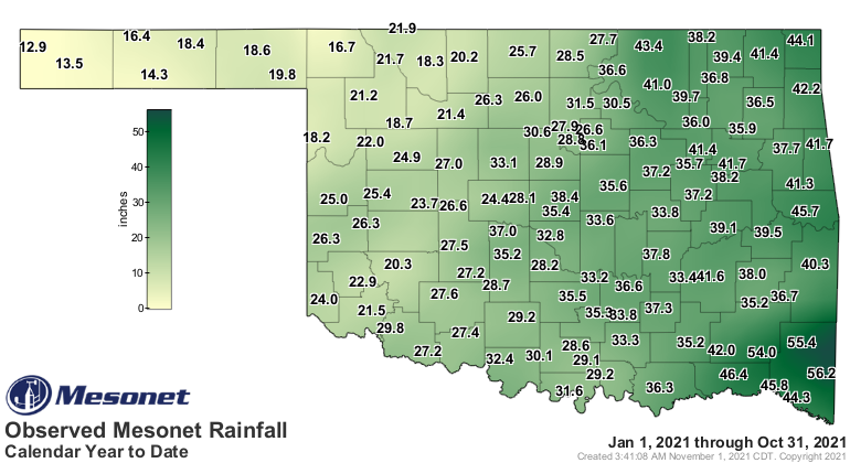
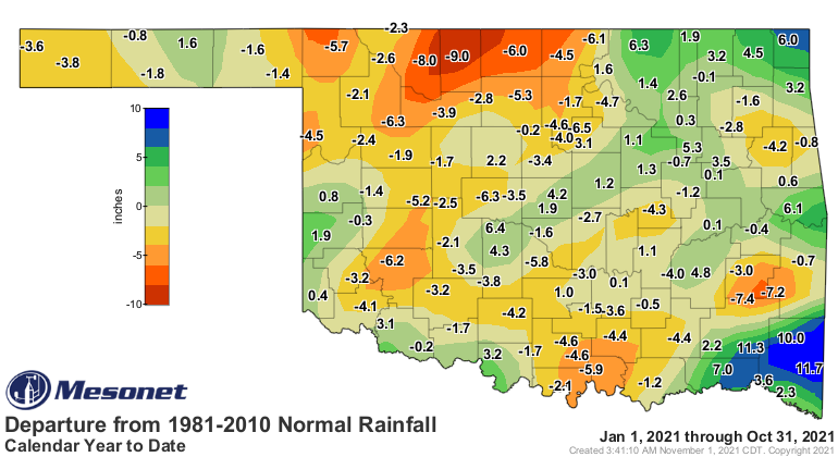
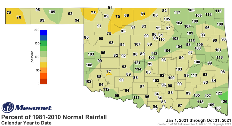
The statewide average rainfall total of 3.76 inches was 0.4 inches above normal
and ranked as the 37th wettest October since records began in 1895. Totals of
4-8 inches were common across central and eastern Oklahoma, as well as parts of
the southwestern corner to the state. Several areas across western Oklahoma
failed to eclipse the 2-inch mark, however. The Mesonet site at Cookson led the
state with 8.82 inches while the site at Kenton had the low end of the sites at
0.36 inches. Fifty-eight Mesonet sites recorded at least 4 inches for the
month, and another 18 reported at least 3 inches. The statewide average for the
first 10 months of the year was 31.51 inches, 0.42 inches below normal and
ranked as the 47th wettest January-October on record.
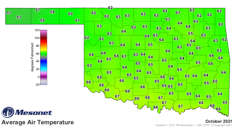
Summer seemed reluctant to give way to fall during October. Triple-digit
temperatures occurred as late as October 9, and Hollis reached 92 degrees on
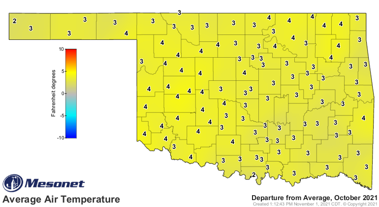
the 26th. The statewide average temperature finished at 64 degrees, 2.7 degrees
above normal and ranked as the 22nd warmest October on record. The highest
temperature of the month, 102 degrees, was recorded at Freedom on Oct. 9, one
of five sites to reach at least 100 degrees on that date. The first freeze of
the fall season occurred at Eva on Oct. 14 with a low of 32 degrees. The lowest
temperature of the month was 26 degrees at Eva on the 16th. The first 10 months
of the year ranked as the 61st coolest on record at 63 degrees, 0.6 degrees
below normal.
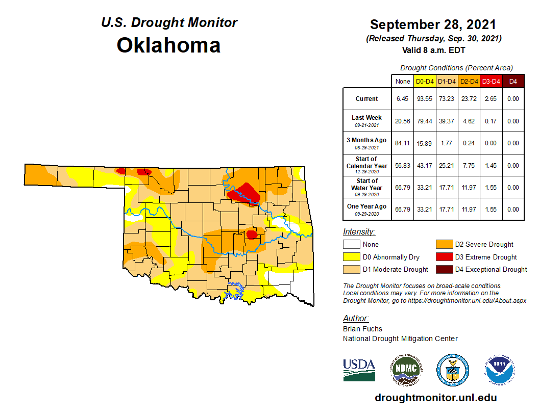
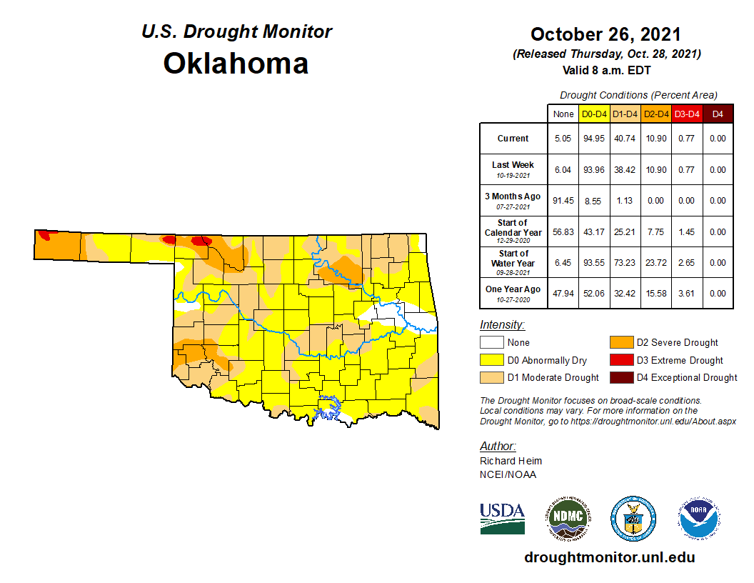
The flash drought that had surged across the state during September was greatly
diminished during October, dropping from 73% to just under 41% throughout the
month according to the U.S. Drought Monitor. However, an additional 54% of the
state remained under abnormally dry conditions according to the report. The
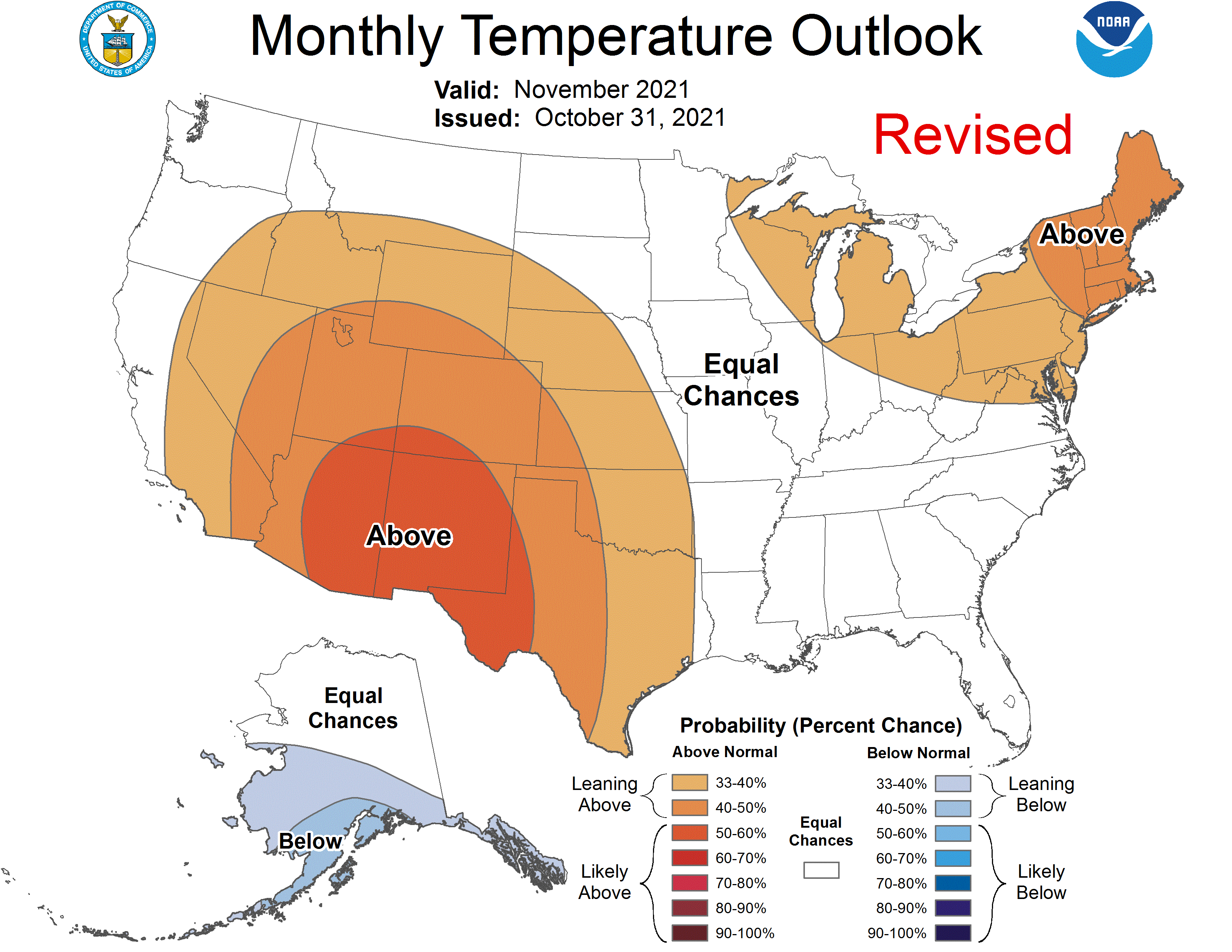
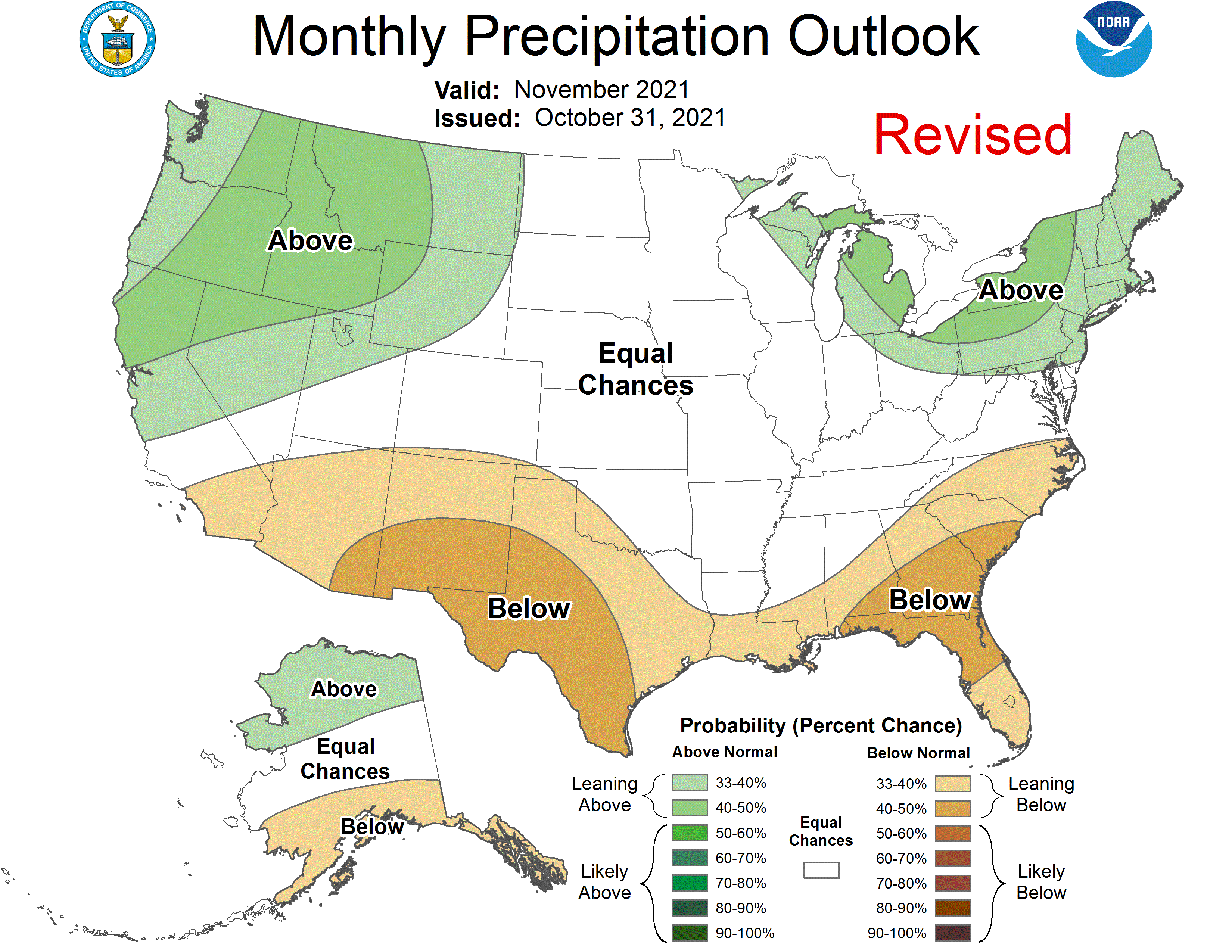
Climate Prediction Center’s November outlooks indicate increased odds for above
normal temperatures across the entire state, and below normal precipitation
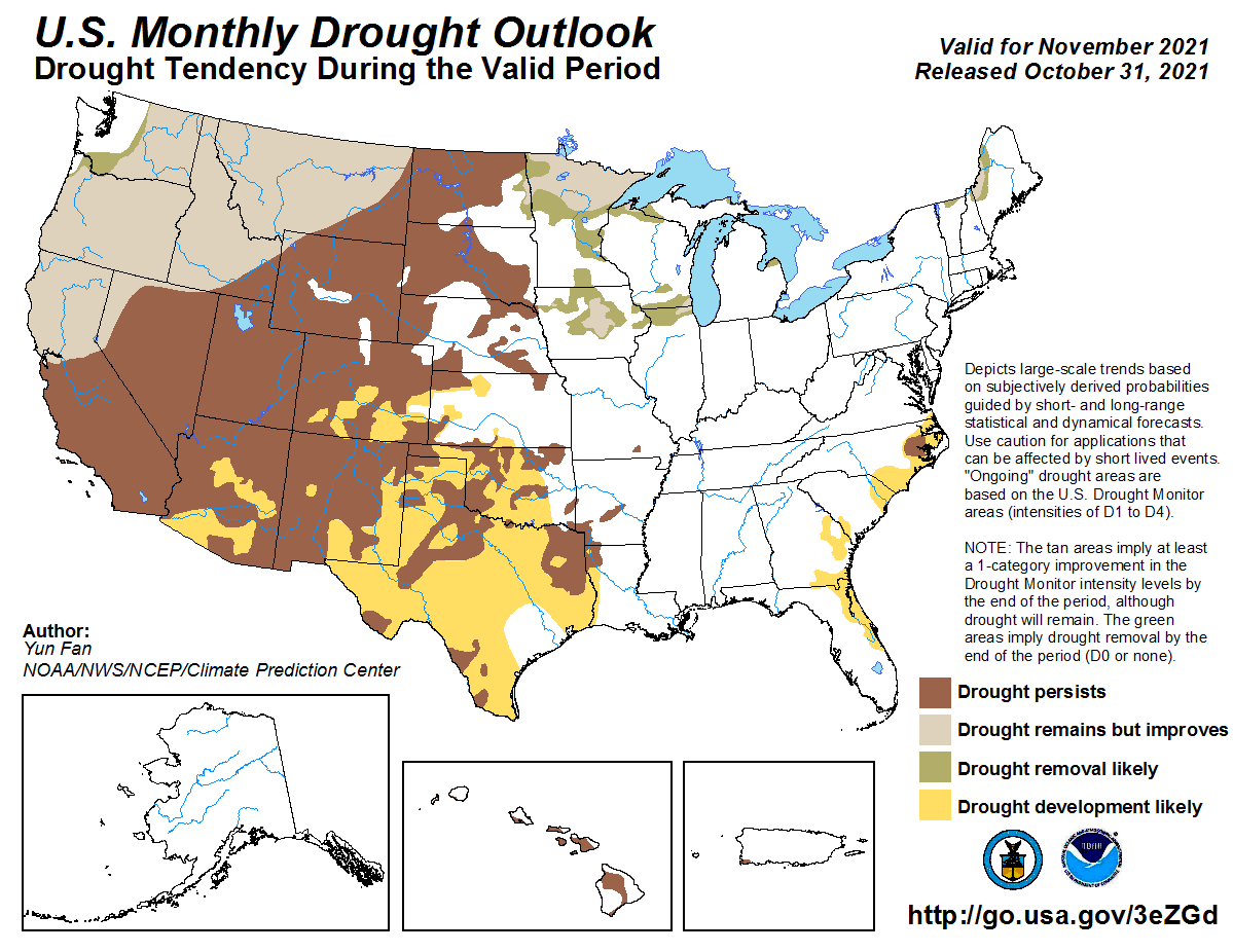
across southwestern Oklahoma and the western Panhandle. CPC’s November drought
outlook sees drought persisting through the month where it is already
established, but also developing across all the remaining western two-thirds of
the state.
Gary McManus
State Climatologist
Oklahoma Mesonet
Oklahoma Climatological Survey
gmcmanus@mesonet.org
November 1 in Mesonet History
| Record | Value | Station | Year |
|---|---|---|---|
| Maximum Temperature | 90°F | ALTU | 2001 |
| Minimum Temperature | 16°F | VINI | 2023 |
| Maximum Rainfall | 3.65″ | NEWK | 1998 |
Mesonet records begin in 1994.
Search by Date
If you're a bit off, don't worry, because just like horseshoes, “almost” counts on the Ticker website!