Ticker for October 28, 2021
MESONET TICKER ... MESONET TICKER ... MESONET TICKER ... MESONET TICKER ...
October 28, 2021 October 28, 2021 October 28, 2021 October 28, 2021
Winds Like Us
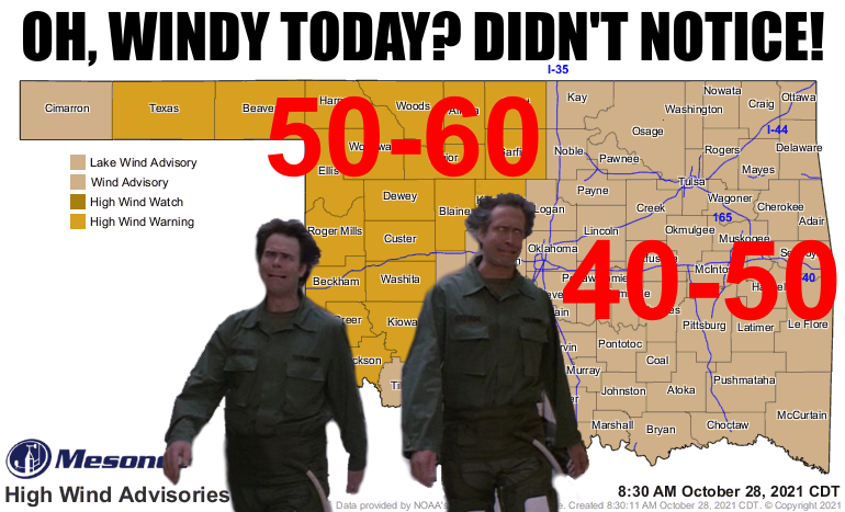
OOOOOOOOOOklahoma where the wind comes sweepin' down the plain and then blows
all your outdoor crap down the street, destroys your hair, and causes wildfires
and dust storms, and the wavin' wheat can sure smell sweet, but not today
because it isn't big enough to wave.
Oh, and the hawks were all blown out of the sky trying to make lazy circles, and
have been sent to animal rescue centers to try and help them.
Now wouldn't that make a great show? Unfortunately, we're seeing it live today
right outside our windows. And if you're outside in it, you're NOT seeing it
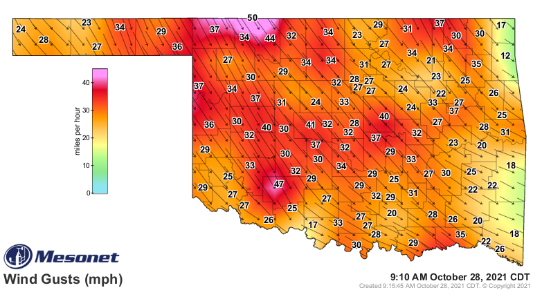
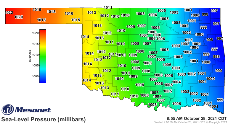
because of the grit in your eyes. A surface low pressure system to our east has
tightened the pressure gradient over the Southern Plains, which in turn turns on
the wind machine. You can see that stark difference in pressure on the Mesonet
pressure map, and also in the wind speeds as those winds circle counter-clockwise
around that low.
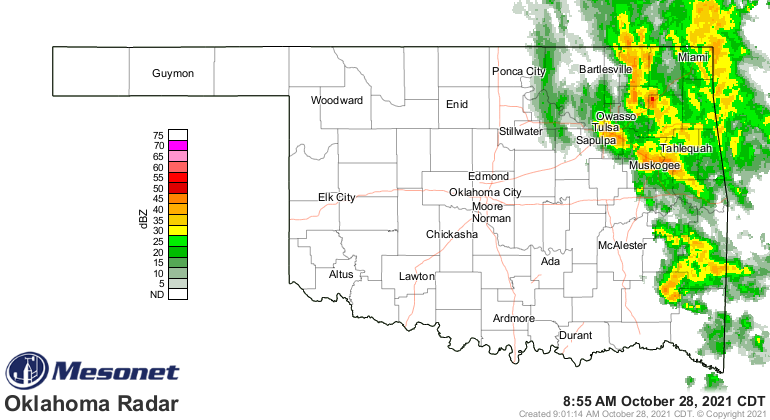
And the folks across far eastern Oklahoma are still getting some rainfall from
the storms wrapping around the backside of that low (and we all know just how
painful that can be).
We take all of this in stride, of course, since it is Oklahoma weather, after
all, AND it's still 2021. So go ahead and crazy yourself, Mother Nature. The
fire danger is obviously gonna be kicked up today and also tomorrow where those
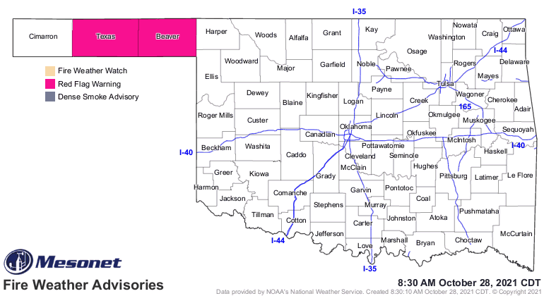
winds are fierce and the humidity is so low. We currently have Red Flag Fire
Danger in place across the Panhandle, which is the Double-Dog-Dare-Ya of
fire danger warnings, so don't take it lightly. And don't light anything taken,
either.
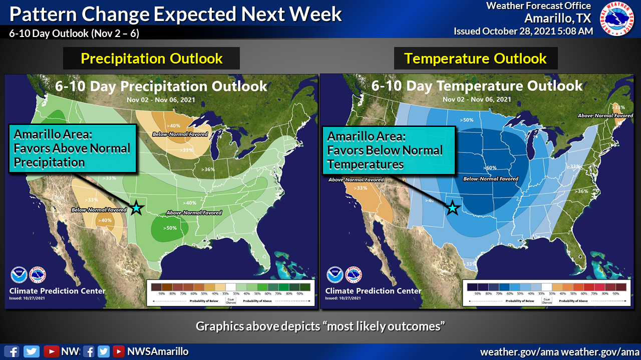
Once the low pressure moves to the east, we should calm back down over the next
couple of days, have a nice weekend, then move into an unsettled pattern next
week. Temperatures will peak on Saturday in the 60s and 70s before they start
to go downhill throughout the next week as we see more cold fronts and chances
for rain. Our friends at the Amarillo NWS office show this in a graphic of the
CPC outlooks for next week.
Don't be shocked if we start talking about wintry precip across far NW OK as
we get later into next week. Nothing too crazy showing up yet, but stay tuned
because once again, it is Oklahoma weather AND it is still 2021.
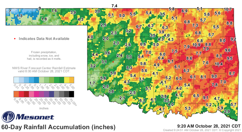
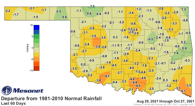
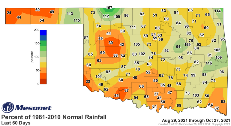
We're still dealing with drought across the state, despite all the recent
rainfall. As we look at the 60-day rain maps, we can still see pretty
significant deficits across many areas.
We're headed into wildfire season (when isn't it, right?) with drought in place,
but that day to day weather starts to take precedence over the antecedent dry
conditions.
So let's get through the wind and fire danger over today and tomorrow, then
we can deal with a trip to winter next week as we enter November, then we
can deal with the coming craziness down the road.
Oh, it's coming all right.
Gary McManus
State Climatologist
Oklahoma Mesonet
Oklahoma Climatological Survey
gmcmanus@mesonet.org
October 28 in Mesonet History
| Record | Value | Station | Year |
|---|---|---|---|
| Maximum Temperature | 97°F | FREE | 2024 |
| Minimum Temperature | 18°F | BUFF | 2019 |
| Maximum Rainfall | 3.63″ | STIG | 2025 |
Mesonet records begin in 1994.
Search by Date
If you're a bit off, don't worry, because just like horseshoes, “almost” counts on the Ticker website!