Ticker for October 26, 2021
MESONET TICKER ... MESONET TICKER ... MESONET TICKER ... MESONET TICKER ...
October 26, 2021 October 26, 2021 October 26, 2021 October 26, 2021
OCTOBERPALOOZA!
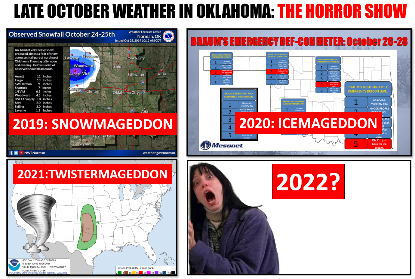
What the heck has happened to our late October weather? We're gonna try and add
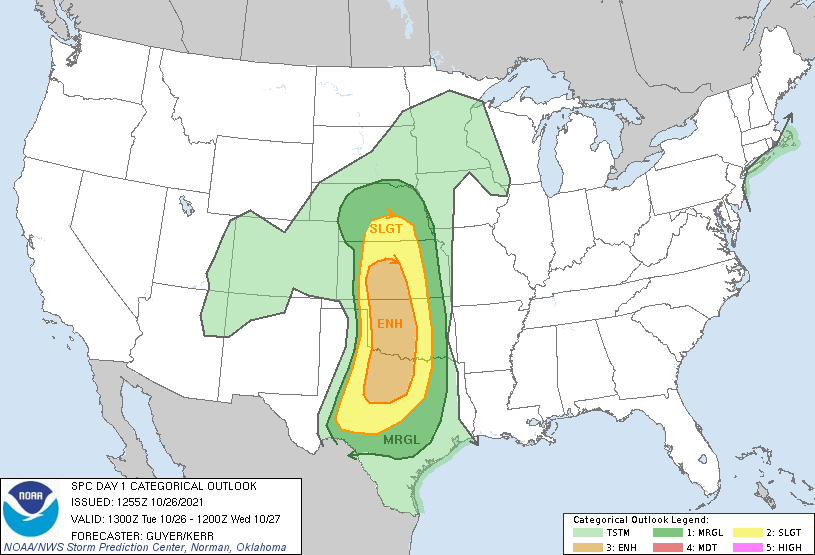
to our record number of tornadoes we've had this October already (28), and let's
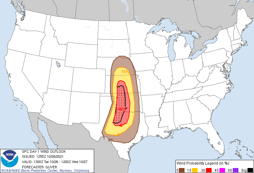
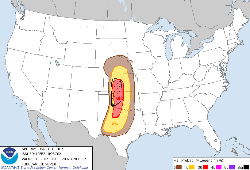
not forget about the hail and severe winds that could accompany the twisters.
Last year we had ICEMAGEDDON that left nearly 400,000 electric customers without
power.


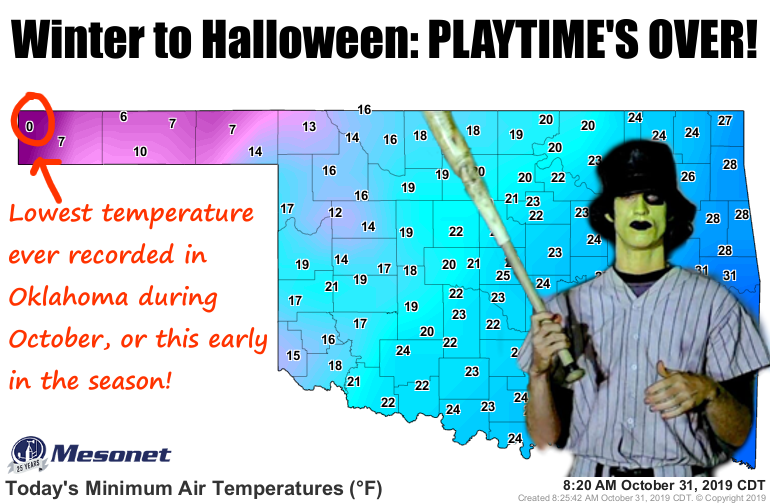
Two years ago we had SNOWMAGEDDON that dumped up to 13 inches of snow in NW OK,
and temperatures dropped to ZERO degrees in Kenton on Halloween morning, the
lowest temperature ever recorded in OK during October, or that early in the
season.
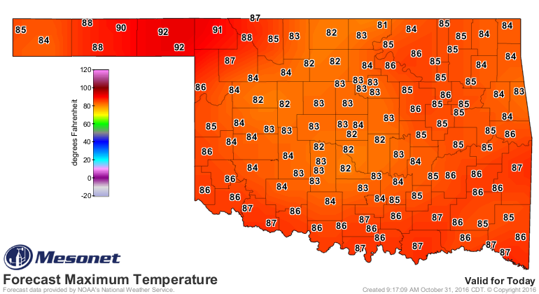
Heck, it was just back in 2016 that we were talking about one of the hottest
Halloweens ever!
So what happens in 2022? Volcanoes? Tsunamis off of Lake Hefner and Lake
Eufaula? Locust hordes?
No idea that far out, but we do see a bit of a weather change coming next week.
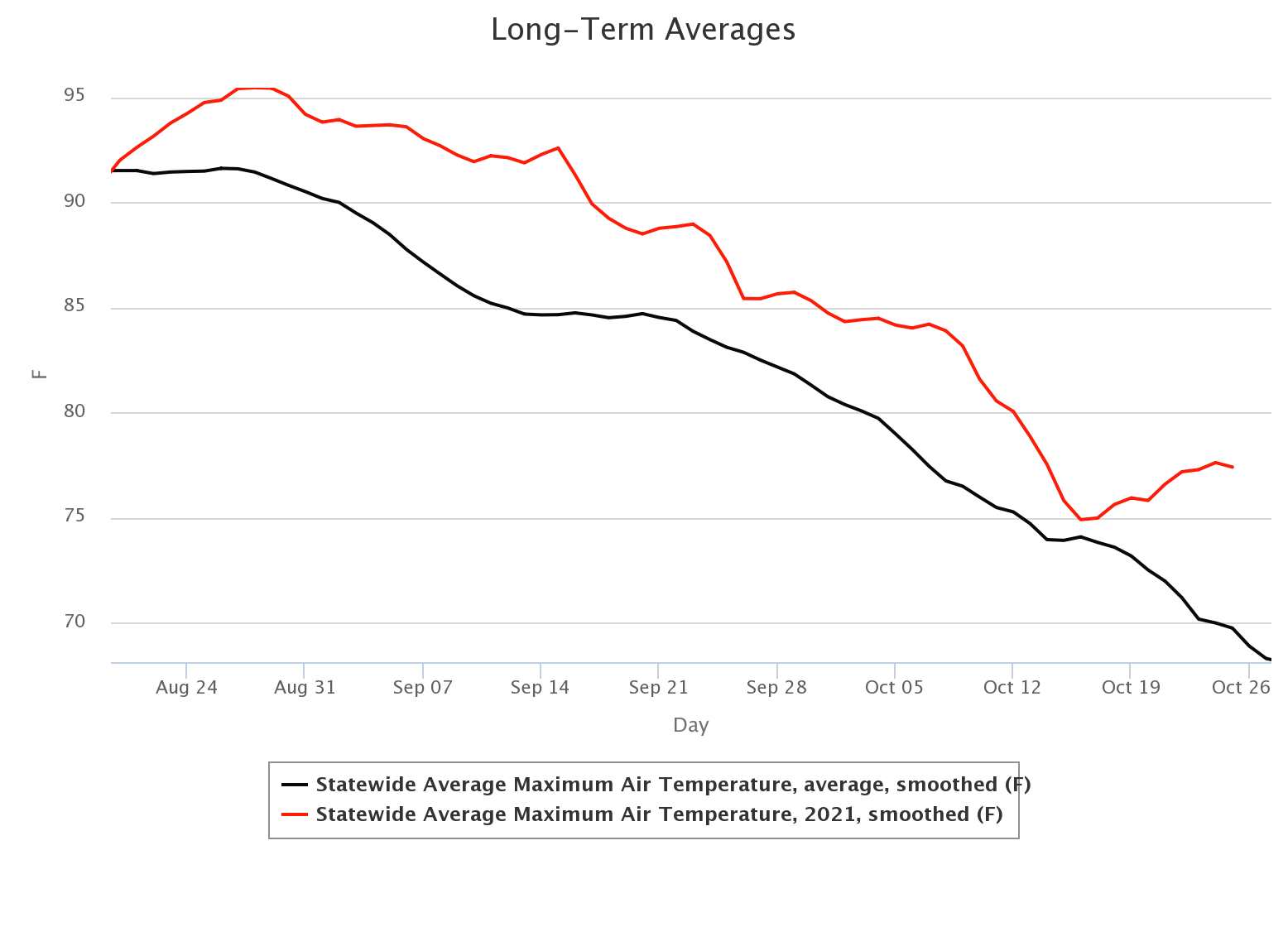
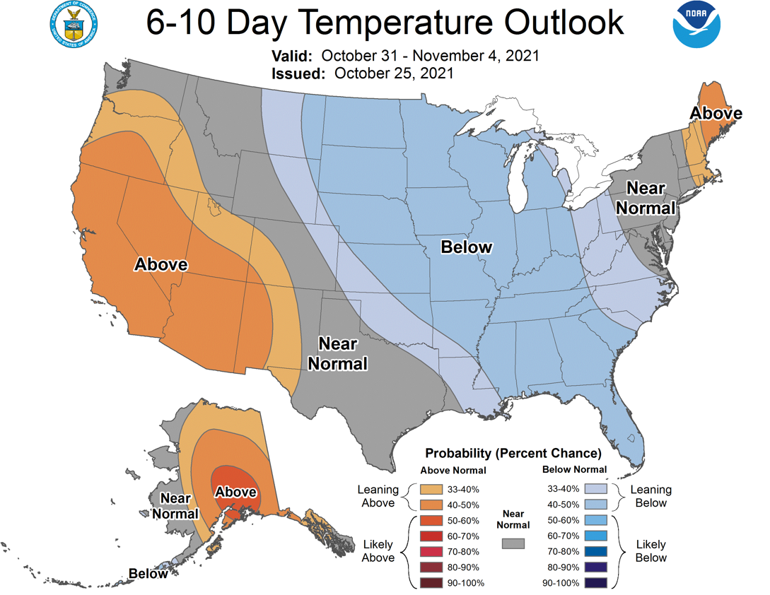
Gone will be our 2-month straight run of above normal temperatures as we plunge
headfirst into fall next week and welcome in a run of BELOW NORMAL temperatures.
No biggie there. We were due. As for next year, don't be afraid.
Be VERY afraid.
Gary McManus
State Climatologist
Oklahoma Mesonet
Oklahoma Climatological Survey
gmcmanus@mesonet.org
October 26 in Mesonet History
| Record | Value | Station | Year |
|---|---|---|---|
| Maximum Temperature | 93°F | MANG | 2014 |
| Minimum Temperature | 14°F | BOIS | 2020 |
| Maximum Rainfall | 3.78″ | TISH | 2000 |
Mesonet records begin in 1994.
Search by Date
If you're a bit off, don't worry, because just like horseshoes, “almost” counts on the Ticker website!