Ticker for October 25, 2021
MESONET TICKER ... MESONET TICKER ... MESONET TICKER ... MESONET TICKER ...
October 25, 2021 October 25, 2021 October 25, 2021 October 25, 2021
2021 again
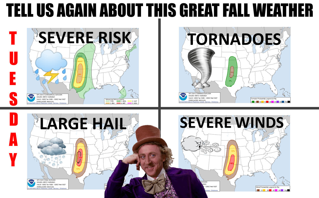
Did you know that we've ALREADY had 28 tornadoes during October, the highest total
in Oklahoma since records began in 1895? Did you know that's more tornadoes than
the rest of the year combined (Jan-Sept total, 25)? Did you know that 2021 has
two more months to go, and we should be afraid? Very afraid? Well, all we really
have to fear is fear itself, but also tornadoes, large hail and severe winds,
apparently. Here are those images a little more magnified.
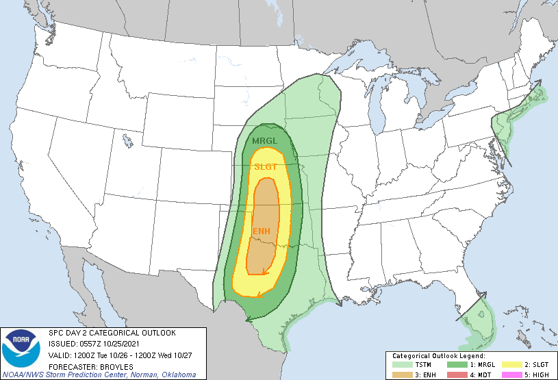
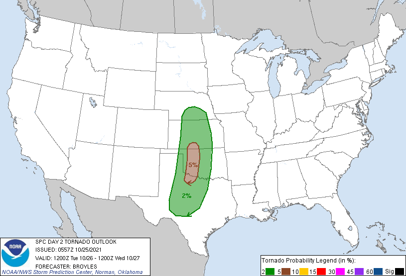
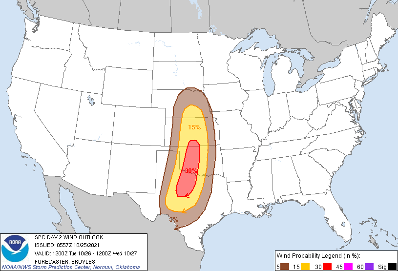
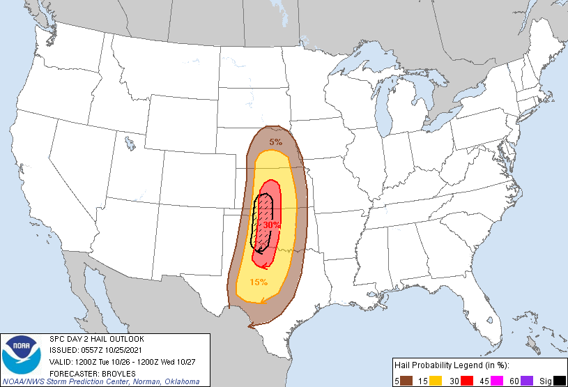
It's the "normal" October setup we've seen before with a strong upper-level system
dragging a front through the state tomorrow, with a dryline out ahead of the
front. We'll have strong southerly winds pumping warm air and Gulf moisture
ahead of the front, and storms could fire in the afternoon. As those storms
initially go up, they might stay discrete and begin rotating, which would
produce the tornado threat you see on the SPC maps...5% is pretty low, but it's
not zero, of course, so a few tornadoes possible in addition to a more robust
risk of some fairly large hail. As the front catches up to the dryline, the
storms could form into more of a squall line as they sweep east, creating more
of a straight-line wind threat. However, the tornado threat will continue, but
much lower. Those brief/small (usually) QLCS tornadoes at the front of the
line of storms are something to watch for.
We could see near-record highs tomorrow out ahead of the front, with some 70s,
mostly 80s, and possibly a few 90s.
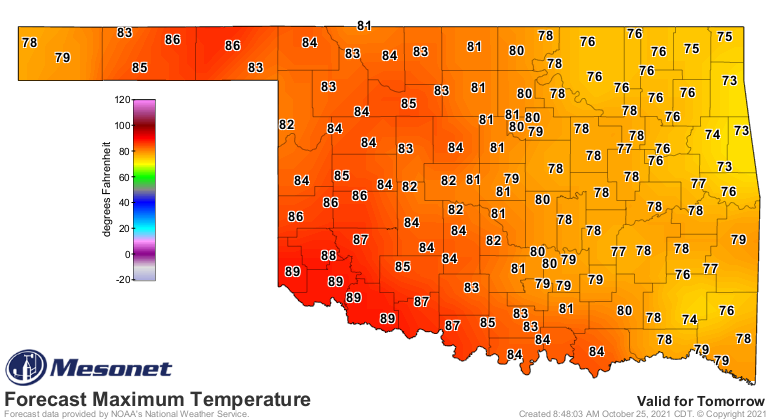
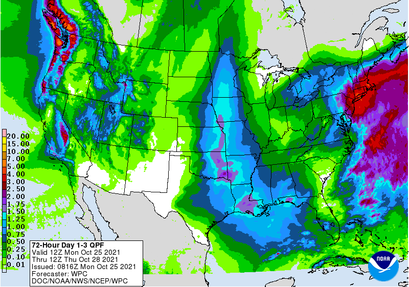
We hit 94 at Hollis on Saturday, so nothing to see here! We should see more
beneficial rains through this mess, but again more in eastern Oklahoma, probably,
as the storms tap into some deeper Gulf moisture, lasting overnight Tuesday
and lingering into Wednesday.
After all that silliness, we go back to some cool, tranquil autumnal weather
with highs in the 60s for most and lows in the 40s for many.
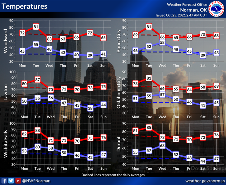
I guess we should appreciate that tranquil weather after Tuesday because Winter
is just sitting there watching, saying "Here, hold my eggnog."
Gary McManus
State Climatologist
Oklahoma Mesonet
Oklahoma Climatological Survey
gmcmanus@mesonet.org
October 25 in Mesonet History
| Record | Value | Station | Year |
|---|---|---|---|
| Maximum Temperature | 93°F | MANG | 2014 |
| Minimum Temperature | 18°F | KENT | 2019 |
| Maximum Rainfall | 3.91″ | MCAL | 2023 |
Mesonet records begin in 1994.
Search by Date
If you're a bit off, don't worry, because just like horseshoes, “almost” counts on the Ticker website!