Ticker for October 20, 2021
MESONET TICKER ... MESONET TICKER ... MESONET TICKER ... MESONET TICKER ...
October 20, 2021 October 20, 2021 October 20, 2021 October 20, 2021
When did this happen?
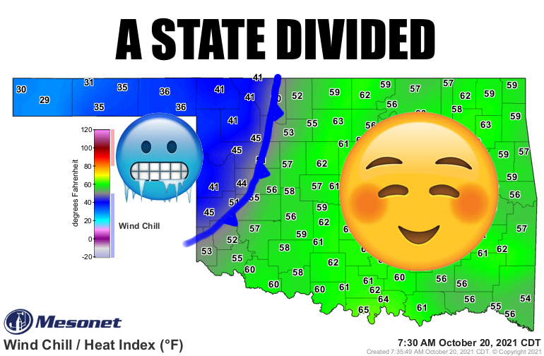
Wait, what?!? A cold front slipped into the state overnight? Why was I not
informed? Well, maybe I was and I just didn't want to believe it. It has indeed
left us with a state divided with northwestern OK facing a winter-like morning
with blustery northerly winds causing wind chills to dip down into the 30s and
40s, while the rest of the state basks in southerly winds and the moisture-rich
air those winds brought with them.
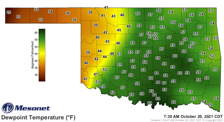
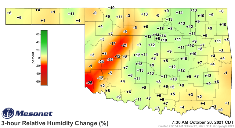
You get a picture now of the difference between the cold, dry air to the NW and
the warm, moist air to the southeast. You can also track the front by the change
in that humidity over the last 3 hours.
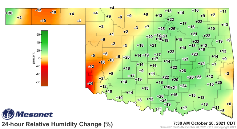
AND the impact of those southerly winds ahead of the front as they drew that
moist air northward over the last 24 hours.
Of course the moist air helps keep those temperatures up overnight as well with
the moisture helping to trap that heat down near the surface, right? And the
temperature won't drop down below the dewpoint since that would cause moisture
to condense into droplets and release heat into the air, meaning the temperature
drop would halt right there. A very simplified explanation of that process from
a very simple person.
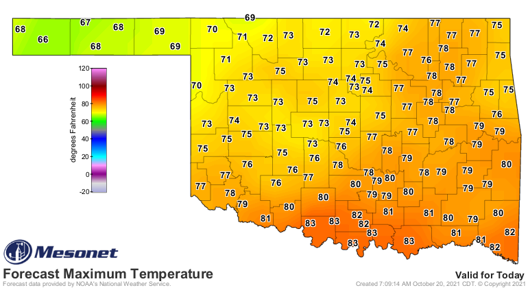
Don't worry (or worry, depending on your point of view), the return of winter
is not at hand due to this front. We should still see some nice temps in the
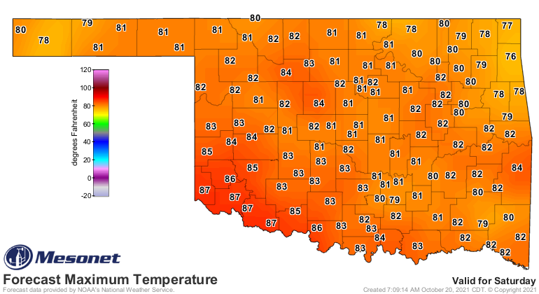
upper 60s and 70s over the next couple of days before we make a return to
late-summer weather over the weekend. Don't be shocked if you see another 90
or two Saturday or Sunday.
We have remained on the warm side of average for the most part, a condition
(WONDERFUL CONDITION!) we will probably stick to for the next couple of weeks
through the end of the month.
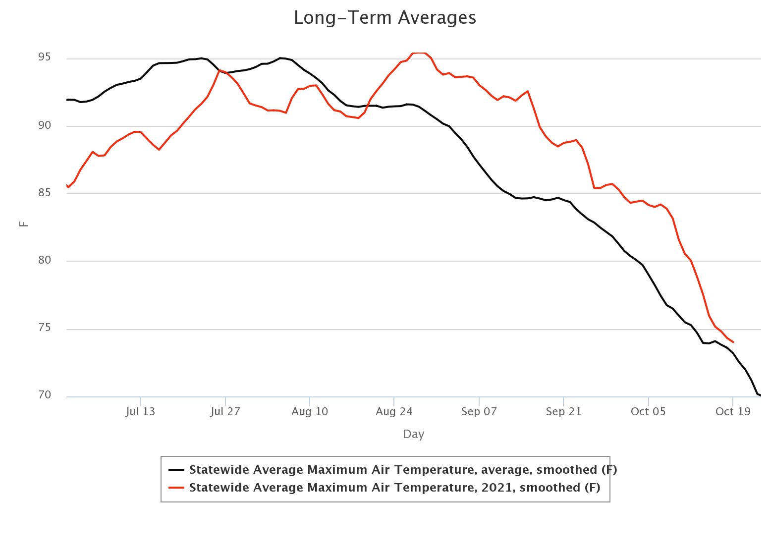
Notice how those statewide highs have continued on their downward slide like
you'd expect for this time of year, but somehow stay just above that long-term
average. It's gonna zoom up again above that average line as we go through the
next couple of weeks.
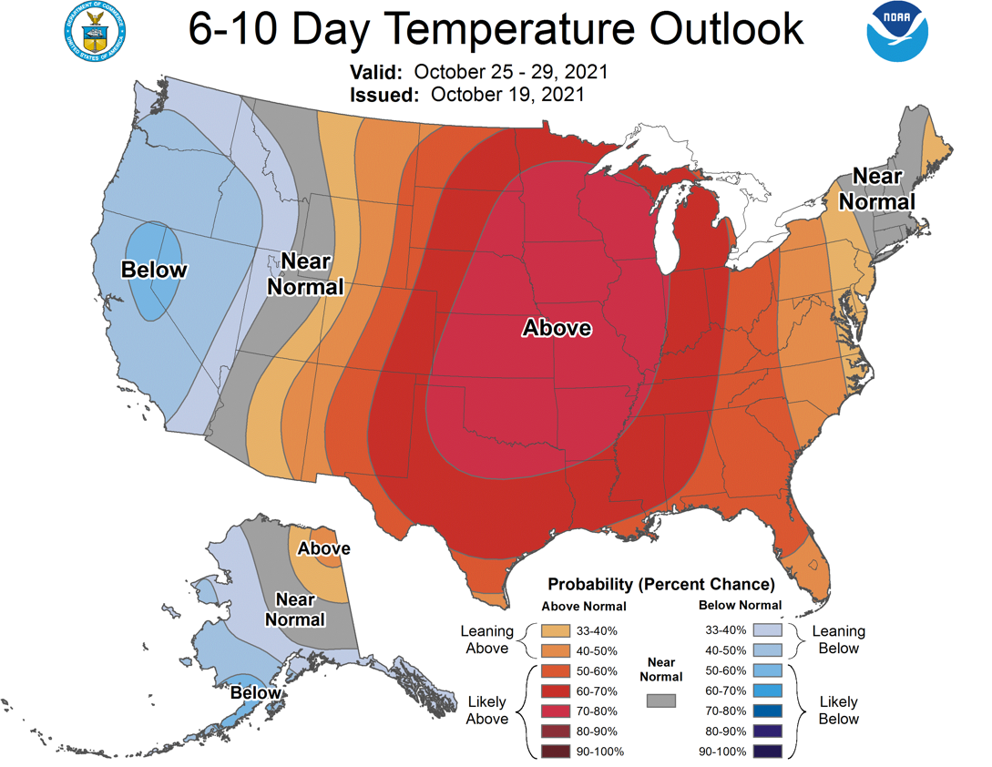
Still no winter showing up, maybe just a hint of a change in Mother Nature's
attitude in a couple of weeks. It's so far out there though that it's still in
fantasycast territory. Only a fool would make such a proclamation.
WHOO-HOOO!!! WINTER ARRIVES IN A COUPLE OF WEEKS!!
Okay, maybe not.
Gary McManus
State Climatologist
Oklahoma Mesonet
Oklahoma Climatological Survey
gmcmanus@mesonet.org
October 20 in Mesonet History
| Record | Value | Station | Year |
|---|---|---|---|
| Maximum Temperature | 96°F | CAMA | 2003 |
| Minimum Temperature | 23°F | NOWA | 2011 |
| Maximum Rainfall | 3.10 inches | LANE | 1996 |
Mesonet records begin in 1994.
Search by Date
If you're a bit off, don't worry, because just like horseshoes, “almost” counts on the Ticker website!