Ticker for October 14, 2021
MESONET TICKER ... MESONET TICKER ... MESONET TICKER ... MESONET TICKER ...
October 14, 2021 October 14, 2021 October 14, 2021 October 14, 2021
Winter preview
The Ticker is actually off today, but then again, aren't we a *little* off
everyday? That's okay, we have time for a quick Tock about everybody's favorite
subject...spaghetti sauce: with or without sugar?
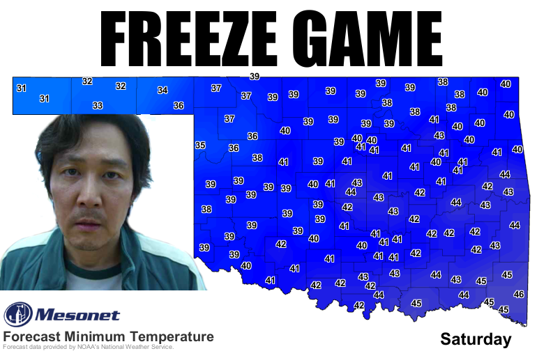
Let's not go there, let's go SOUTH! I was all prepared to tell you about
Oklahoma's first freeze being forecast for Saturday morning when darned if we
didn't look up and see the Mesonet site at Eva done beat us to the punch this
morning.
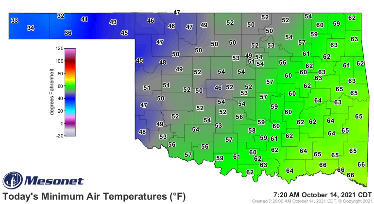
I think I told ya Tuesday that it wouldn't shock me to see a freeze before this
weekend somewhere in the Panhandle, just like I said last week don't be shocked
if we see a hunnert or two (again, two 100s, not 200) last weekend. I was
shockingly correct on both. That 32 at Eva is the first freezing weather we've
seen in the state since way back on April 24 in, you guessed it, Eva. For the
record, that's 1 freezing reading in October vs. 6 triple-digit readings.
Freedom hit 102 degrees five days ago for our probable (but not definite!) last
100 of 2021. Now we're off and running with the freezes, starting in earnest
this weekend out in the Panhandle. Again, don't be shocked if somebody else
drops to 32 for a bit either.
Lots of tornadoes the last 5 days, and we're gonna approach 1998's record
total of 27 for the month, probably, so let's go on to more pleasant things.
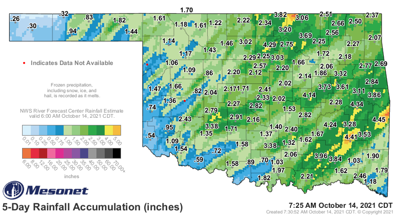
Rain. Everybody got a dose during the last 2 events, so that's a good start
to wiping a bit of drought off the map.
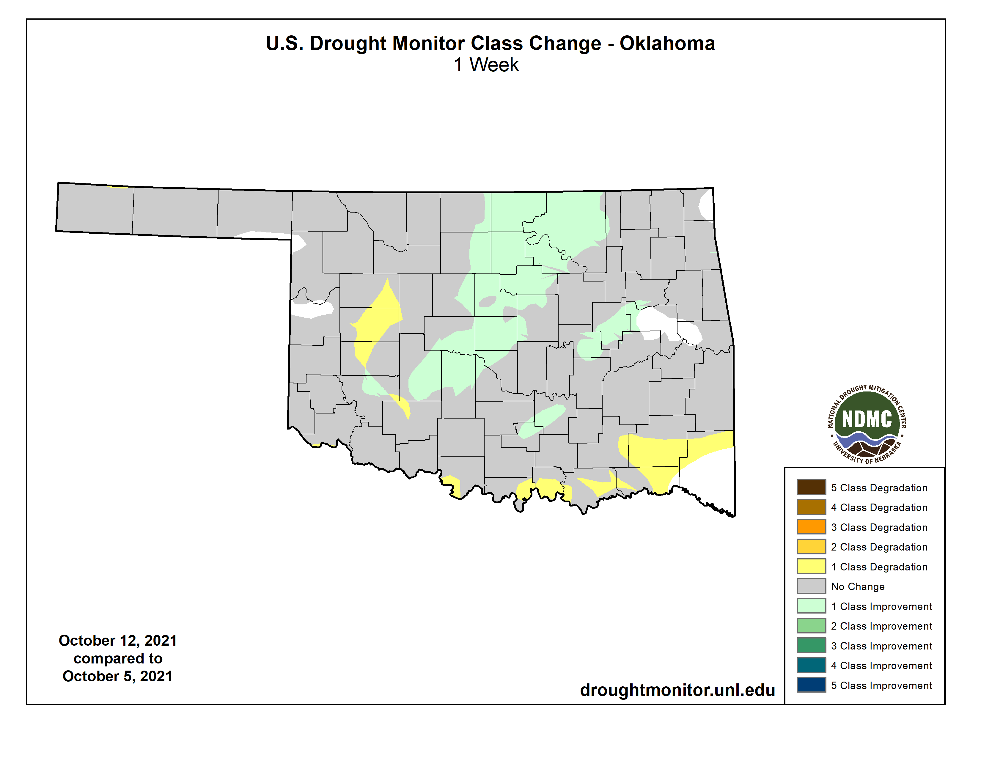
Today's Drought Monitor map had Sunday's rain included, but missed out on
Tuesday and Wednesday's rain because of the 7am cutoff to be considered by the
Drought Monitor author. So some decent changes this week, but expect more next
week.
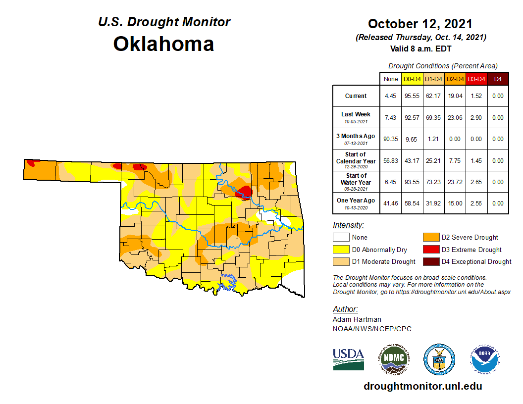
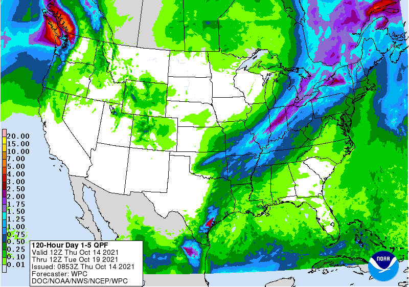
AND, more storm chances today and early tomorrow, so maybe we can add some more
relief to the maps.
Once we get by that, we go back to crystal blue skies, and a temperature
regime that's down in fall territory much more so than the half-summer/half-fall
pattern that we've been stuck in.
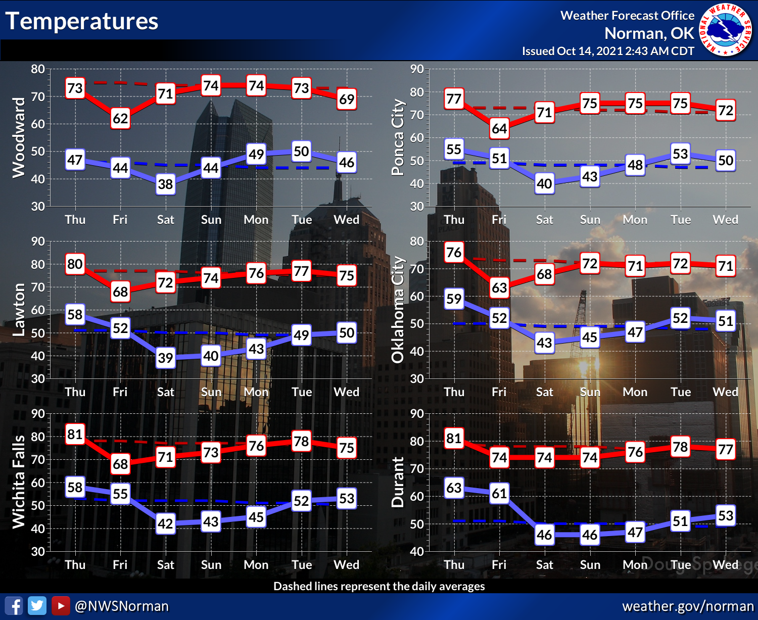
It's all downhill from here, folks.
Gary McManus
State Climatologist
Oklahoma Mesonet
Oklahoma Climatological Survey
gmcmanus@mesonet.org
October 14 in Mesonet History
| Record | Value | Station | Year |
|---|---|---|---|
| Maximum Temperature | 100°F | HOLL | 2020 |
| Minimum Temperature | 26°F | PRYO | 2002 |
| Maximum Rainfall | 2.83 inches | ARD2 | 2013 |
Mesonet records begin in 1994.
Search by Date
If you're a bit off, don't worry, because just like horseshoes, “almost” counts on the Ticker website!